New Hampshire Route 3A

Last updated

NH Route 3A.svg

New Hampshire Route 3A

New Hampshire Route 3A
Route 3A highlighted in blue
Route information
Auxiliary route of US 3
Maintained by NHDOT
Southern segment
Length39.412 mi [1]  (63.427 km)
South endMA Route 3A.svg Route 3A in Tyngsborough, MA
Major intersections
North endUS 3 square.svg US 3 in Concord
Northern segment
Length31.015 mi [1]  (49.914 km)
South endUS 3 square.svgNH Route 11.svgNH Route 127.svg US 3  / NH 11  / NH 127 in Franklin
Major intersectionsUS 3 square.svgNH Route 25.svg US 3  / NH 25 in Plymouth
North endI-93.svg I-93 in Plymouth
Location
Country United States
State New Hampshire
Counties Hillsborough, Merrimack, Grafton
Highway system
US 3 square.svg US 3 NH Route 4.svg NH 4
New England 5.svg Route 5 N.E. New England 7.svg Route 7
Old style Route 3A shield, still seen widely throughout the state NH Route 3A (variant).svg
Old style Route 3A shield, still seen widely throughout the state

New Hampshire Route 3A is a designation held by two separate state highways in New Hampshire. The two segments, although not directly connected, are linked by U.S. Route 3, from which they derive their route number.

Contents

Route description

Southern segment

The southern terminus of the 39.40-mile-long (63.41 km) southern segment is at the Massachusetts state line in Hudson, where it continues south as Massachusetts Route 3A. The northern terminus is in the city of Concord at US 3. This segment of NH 3A follows the Merrimack River for its entire length. The route begins in Hudson at the Massachusetts line and shortly intersects the eastern end of the Nashua Circumferential Highway, which provides access to US 3 and the F.E. Everett Turnpike. NH 3A passes through Hudson Village, the historic center of town, where it intersects with NH 111 just across the river from downtown Nashua. NH 102 begins at this intersection and is cosigned with NH 3A for its first mile, before 3A splits to the north west, while 102 continues on towards Londonderry. NH 3A continues along the eastern bank of the river, through Litchfield and into the city of Manchester, where it crosses under I-293/NH 101 and follows a short surface alignment in the southwest section of town. NH 3A intersects with US 3 and is actually cosigned with it (in a wrong-way concurrency) on Queen City Avenue across the river, where the two routes intersect NH 114A at its eastern terminus. At this point, NH 3A leaves US 3 and merges onto I-293 northbound (which also carries the Everett Turnpike) at exit 4. NH 3A is concurrent with I-293 for 3 miles (5 km), departing at exit 7 and crossing into Hooksett. The highway immediately interchanges with I-93 (which it parallels for the remainder of its length) near the northern terminus of I-293, and continues north (now paralleling on the west side of the river). Hackett Hill Road provides another access point to I-93, while nearby Main Street connects to US 3/NH 28 across the river. NH 3A enters Bow and meets the southern end of the I-89 freeway before crossing into the city limits of Concord. The highway interchanges with I-93 one last time before ending at US 3 just south of downtown Concord.

Northern segment

The southern terminus of the 30.93-mile-long (49.78 km) northern segment is in the city of Franklin at US 3, NH 11, and NH 127. Where US 3 takes a more easterly route from here, NH 3A continues due north, following the western bank of the Pemigewasset River along North Main Street. North of Franklin, it enters the town of Hill, continuing to follow the Pemigewasset, passing through the William H. Thomas State Forest on the way to the town of Bristol. It forms the main commercial thoroughfare through Bristol, with a brief concurrency with NH 104 in the center of town, following first South Main Street, then Pleasant Street, and finally Lake Street. At Bristol, 3A leaves the Pemigewasset, which turns east here, and continues north into Bridgewater and the southern shores of Newfound Lake. Following the Mayhew Turnpike along the eastern side of Newfound Lake through Bridgewater, 3A continues through rural areas on the eastern side of Hebron and the western side of Plymouth. In Plymouth, the route joins with NH 25 and heads due east to rejoin US 3 at an interchange with Interstate 93, US 3 and NH 25, which is the northern terminus of this segment.

History

New England 6A.svg
NH 3A in the town of Bow New Hampshire Route 3A Bow NH.jpg
NH 3A in the town of Bow

From 1922 to 1926, Route 3A was part of the New England road marking system as New England Route 6A (NE-6A). In 1926, all roads designated as NE-6A were changed to New Hampshire Route 3A and Massachusetts Route 3A to accommodate the change of New England Route 6 to U.S. Route 3.

Major intersections

Southern segment

CountyLocation [1] [2] mi [1] [2] kmDestinationsNotes
Hillsborough Hudson 0.0000.000South plate.svg
MA Route 3A.svg
Route 3A south (Frost Road) Tyngsborough
Continuation from Massachusetts
2.1703.492To plate.svg
US 3 square.svg
To plate Vermont.svg
Everett Turnpike.svg
To US 3  / Everett Turnpike  Boston, South Nashua
Access via Circumferential Highway
5.0368.105NH Route 111.svgNH Route 102.svg NH 111 (Ferry Street) / NH 102  Nashua Western terminus of NH 102; southern end of concurrency with NH 102
6.0449.727East plate.svg
NH Route 102.svg
NH 102 east (Derry Road) Derry
Northern end of concurrency with NH 102
Manchester 16.8227.07To plate.svg
US 3 square.svg
To plate Vermont.svg
Everett Turnpike.svg
Airport Sign.svg Raymond Wieczorek Drive to US 3  / Everett Turnpike  Manchester Airport, Merrimack, Bedford
Interchange; via Roundstone Drive
19.214–
19.314
30.922–
31.083
I-293.svgNH Route 101.svg I-293  / NH 101  Salem, Concord, Portsmouth, Bedford, Nashua Exit 2 on I-293
21.25734.210North plate.svg
US 3 square.svg
US 3 north (Elm Street)
Southern end of wrong-way concurrency with US 3
21.900–
21.918
35.245–
35.274
South plate.svg
US 3 square.svg
NH Route 114A.svg US 3 south (Second Street) / NH 114A
South plate blue.svg
I-293.svg
South plate Vermont.svg
Everett Turnpike.svg
I-293 south / Everett Turnpike south Boston
Northern end of wrong-way concurrency with US 3; southern end of concurrency with I-293
Exit 4 on I-293; eastern terminus of NH 114A
23.29037.482Granite Street W. Manchester Exit 5 on I-293
24.47239.384Amoskeag Street / Goffstown RoadExit 6 on I-293
24.90840.086North plate blue.svg
I-293.svg
North plate Vermont.svg
Everett Turnpike.svg
I-293 north / Everett Turnpike north
Exit 7 on I-293; northern end of concurrency with I-293; northbound exit and southbound entrance
Merrimack Hooksett 27.298–
27.673
43.932–
44.535
I-93.svg I-93  Salem, Boston, Concord, Plymouth [lower-alpha 1] Exit 10 on I-93
30.86749.676To plate blue.svg
I-93.svg
Hackett Hill Road to I-93  Concord, Manchester
Bow 37.60160.513North plate blue.svg
I-89.svg
I-89 north Bow, Lebanon
Southern terminus of I-89
Concord 38.003–
38.340
61.160–
61.702
I-93.svgTo plate blue.svg
North plate blue.svg
I-89.svg
I-93 (Everett Turnpike) to I-89 north Plymouth, Littleton, Manchester, Lebanon [lower-alpha 1]
Exit 12 on I-93
39.41263.427US 3 square.svg US 3 (Water Street / South Main Street)
1.000 mi = 1.609 km; 1.000 km = 0.621 mi
  1. 1 2 The Everett Turnpike is unsigned along I-93 from the I-293 interchange to its northern terminus in Concord at exit 14.

Northern segment

CountyLocation [1] [3] mi [1] [3] kmDestinationsNotes
Merrimack Franklin 0.0000.000North plate.svg
US 3 square.svg
East plate.svg
NH Route 127.svg
East plate.svg
NH Route 11.svg
US 3 north / NH 127 east / NH 11 east (Central Street) Downtown Franklin, Tilton, Laconia
South plate.svg
US 3 square.svg
West plate.svg
NH Route 127.svg
US 3 south (South Main Street) / NH 127 west Salisbury, Concord
Southern terminus of northern segment; southern end of concurrency with NH 11
1.0201.642West plate.svg
NH Route 11.svg
NH 11 west (Webster Lake Road) Andover
Northern end of concurrency with NH 11
Grafton Bristol 13.10921.097East plate.svg
NH Route 104.svg
To plate blue.svg
I-93.svg
NH 104 east (Summer Street) to I-93  New Hampton
Southern end of concurrency with NH 104
13.30521.412West plate.svg
NH Route 104.svg
NH 104 west (Pleasant Street) Danbury
Northern end of concurrency with NH 104
Plymouth 27.00943.467West plate.svg
NH Route 25.svg
NH 25 west Rumney, Woodsville
Southern end of concurrency with NH 25
30.54749.161US 3 square.svgEast plate.svg
NH Route 25.svg
US 3  / NH 25 east (Main Street) Plymouth, Campton
Interchange; northern end of concurrency with NH 25
31.01549.914I-93.svg I-93 (Styles Bridges Highway) Campton, Littleton, Ashland, Concord Northern terminus; Exit 26 on I-93
1.000 mi = 1.609 km; 1.000 km = 0.621 mi

See also

Related Research Articles

<span class="mw-page-title-main">Interstate 93</span> Interstate Highway in Massachusetts, New Hampshire, and Vermont in the United States

Interstate 93 (I-93) is an Interstate Highway in the New England states of Massachusetts, New Hampshire, and Vermont in the United States. Spanning approximately 190 miles (310 km) along a north–south axis, it is one of three primary Interstate Highways located entirely within New England; the other two are I-89 and I-91. The largest cities along the route are Boston, Massachusetts, and Manchester, New Hampshire; it also travels through the New Hampshire state capital of Concord.

<span class="mw-page-title-main">Interstate 89</span> Interstate in Vermont and New Hampshire

Interstate 89 (I-89) is an Interstate Highway in the New England region of the United States traveling from Bow, New Hampshire, to the Canada–United States border between Highgate Springs, Vermont, and Saint-Armand, Quebec. As with all odd-numbered primary Interstates, I-89 is signed as a north–south highway. However, it follows a primarily northwest-to-southeast path. The route forms a major part of the main connection between the cities of Montreal and Boston. In Quebec, the route continues as Route 133. The eventual completion of Autoroute 35 will lead to a nonstop limited-access highway route between Boston and Montreal, following I-93 south from I-89's terminus. The largest cities directly served by I-89 are Concord, the state capital of New Hampshire; Montpelier, the state capital of Vermont; and Burlington, Vermont. I-89 is one of three main Interstate highways whose route is located entirely within New England, along with I-91 and I-93.

<span class="mw-page-title-main">Hooksett, New Hampshire</span> Town in New Hampshire, United States

Hooksett is a town in Merrimack County, New Hampshire, United States. The population was 14,871 at the 2020 census, up from 13,451 at the 2010 census. The town is located between Manchester, the state's largest city, and Concord, the state capital. A prominent landmark is Robie's Country Store, a National Historic Landmark and a frequent stop for presidential candidates during the New Hampshire primary.

<span class="mw-page-title-main">U.S. Route 3</span> Highway in the United States

U.S. Route 3 (US 3) is a United States Numbered Highway running 277.90 miles (447.24 km) from Cambridge, Massachusetts, through New Hampshire, to the Canada–United States border near Third Connecticut Lake, where it connects to Quebec Route 257.

<span class="mw-page-title-main">Interstate 293</span> Highway in New Hampshire

Interstate 293 (I-293) is an 11-mile-long (18 km) auxiliary Interstate Highway surrounding Manchester, New Hampshire, roughly shaped like two sides of a triangle. Completing the loop in the northeast is I-93. The southern portion of the loop shares the road with New Hampshire Route 101 (NH 101) and passes near Manchester–Boston Regional Airport and The Mall of New Hampshire. The western portion of the loop shares the road with the Everett Turnpike, but there are no tolls on this portion of the turnpike.

The Frederick E. Everett Turnpike, also called the Central New Hampshire Turnpike, is a controlled-access toll road in the U.S. state of New Hampshire, running 44 miles (71 km) from the Massachusetts border at Nashua north to Concord. The Everett Turnpike is named for Frederick Elwin Everett, the first commissioner of the New Hampshire Department of Transportation.

<span class="mw-page-title-main">New Hampshire Route 111</span> State highway in southeastern New Hampshire, US

New Hampshire Route 111 is a 50.027-mile-long (80.511 km) east–west highway in Hillsborough and Rockingham counties in southeastern New Hampshire. The road runs from the Massachusetts border at Hollis to North Hampton on the Atlantic shore.

<span class="mw-page-title-main">New Hampshire Route 101</span> East-west highway in southern New Hampshire, U.S.

New Hampshire Route 101 is a state-maintained highway in southern New Hampshire extending from Keene to Hampton Beach. It is the major east–west highway in the southern portion of the state. Most of its eastern portion is a major freeway linking the greater Manchester area to the Seacoast Region. At 95.189 miles (153.192 km) in length, NH 101 nearly spans the entire width of southern New Hampshire.

<span class="mw-page-title-main">New Hampshire Route 114</span> State highway in central New Hampshire, US

New Hampshire Route 114 is a 60.433-mile-long (97.257 km) secondary north–south highway in central New Hampshire. The highway runs between Bedford in Hillsborough County and Grantham in Sullivan County.

<span class="mw-page-title-main">New Hampshire Route 25</span> State highway in New Hampshire, US

New Hampshire Route 25 is a 96.62-mile (155.49 km) long east–west state highway in New Hampshire. It runs completely across the state from Vermont to Maine.

<span class="mw-page-title-main">Interstate 393</span> Highway in New Hampshire

Interstate 393 (I-393) is a 4.6-mile (7.4 km) east–west auxiliary Interstate Highway extending from I-93 at Concord to Pembroke, New Hampshire. The primary purpose of the road is to bypass a densely built commercial strip on New Hampshire Route 9 (NH 9) in the eastern part of Concord. Several times a year, I-393 also serves traffic to events at New Hampshire Motor Speedway in Loudon. I-393 runs concurrently with US Route 4 (US 4) and US 202 for its entire length.

<span class="mw-page-title-main">New Hampshire Route 11</span> State highway in central New Hampshire, US

New Hampshire Route 11 is a 108.223-mile-long (174.168 km) east–west state highway in New Hampshire, running completely across the central part of the state. Its western terminus is at the Vermont state line in Charlestown, where it continues west as Vermont Route 11. The eastern terminus is at the Maine state line in Rochester, where it crosses the border with U.S. Route 202 and continues as Maine State Route 11.

<span class="mw-page-title-main">New Hampshire Route 13</span> North-south state highway in New Hampshire, US

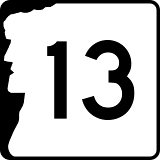
New Hampshire Route 13 is a 43.38-mile (69.81 km) long north–south state highway in the state of New Hampshire, United States. The highway runs from Brookline to Concord.

<span class="mw-page-title-main">New Hampshire Route 28</span> State highway in eastern New Hampshire, US

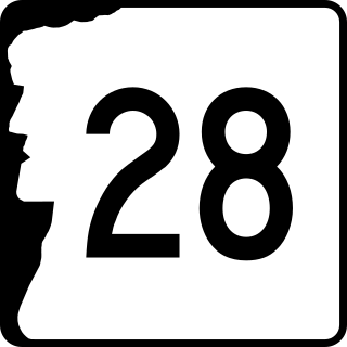
New Hampshire Route 28 is an 85.413-mile-long (137.459 km) north–south state highway in eastern New Hampshire. It connects the town of Ossipee in east-central New Hampshire with Salem on the Massachusetts border, while passing through Manchester, the largest city in the state.

<span class="mw-page-title-main">New Hampshire Route 106</span> North-south state highway in New Hampshire, US

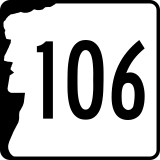
New Hampshire Route 106 is a 34.535-mile-long (55.579 km) secondary north–south highway in Merrimack and Belknap counties in central New Hampshire. It connects the town of Pembroke with Meredith in the Lakes Region.

<span class="mw-page-title-main">New Hampshire Route 107</span> State highway in eastern New Hampshire, US

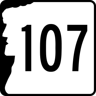
New Hampshire Route 107 is a 69.108-mile-long (111.219 km) north–south state highway in eastern New Hampshire. It connects Laconia in the Lakes Region with Seabrook on the Atlantic coast. The southern terminus of NH 107 is at U.S. Route 1 in Seabrook near the entrance to Seabrook Station Nuclear Power Plant. The northern terminus is at U.S. Route 3 on the Laconia/Gilford town line.

<span class="mw-page-title-main">New Hampshire Route 132</span> State highway in central New Hampshire, US

New Hampshire Route 132 is a 40.012-mile-long (64.393 km) north–south highway in Belknap and Merrimack counties in central New Hampshire. NH 132 runs from Concord north to Ashland in the Lakes Region, parallel to Interstate 93.

<span class="mw-page-title-main">New Hampshire Route 175</span> State highway in Grafton County, New Hampshire, US

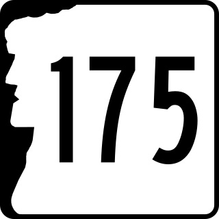
New Hampshire Route 175 is a state highway in the U.S. state of New Hampshire. The highway runs north 25.261 miles (40.654 km) from an intersection in Holderness with U.S. Route 3 and New Hampshire Route 25 to an intersection with US 3 in Woodstock.

<span class="mw-page-title-main">New Hampshire Route 9</span> State highway in New Hampshire, United States

New Hampshire Route 9 is a 109.910-mile-long (176.883 km) state highway located in southern New Hampshire. It runs across the state from west to east and is a multi-state route with Vermont and Maine, part of 1920s-era New England Interstate Route 9.

<span class="mw-page-title-main">U.S. Route 4 in New Hampshire</span> Segment of American highway

U.S. Route 4 (US 4) in the state of New Hampshire runs for 106.834 miles (171.933 km) across the central and southern part of the state, stretching from Lebanon on the Connecticut River border with Vermont southeast to Portsmouth on the eastern coast.

References

  1. 1 2 3 4 5 6 Bureau of Planning & Community Assistance (February 20, 2015). "NH Public Roads". Concord, New Hampshire: New Hampshire Department of Transportation. Archived from the original on April 15, 2015. Retrieved April 7, 2015.
  2. 1 2 Bureau of Planning & Community Assistance (April 3, 2015). "Nodal Reference 2015, State of New Hampshire". New Hampshire Department of Transportation . Retrieved April 7, 2015.[ permanent dead link ]
  3. 1 2 Bureau of Planning & Community Assistance (April 3, 2015). "Nodal Reference 2015, State of New Hampshire". New Hampshire Department of Transportation . Retrieved April 7, 2015.[ permanent dead link ]
Template:Attached KML/New Hampshire Route 3A
KML is not from Wikidata

Southern segment

Northern segment