Stow of Wedale, or more often Stow, is a village in the Scottish Borders area of Scotland, 7 miles north of Galashiels. In the 2011 Census the population was 718. It is served by Stow railway station.

Morebattle is a village in the Scottish Borders area of Scotland, on the B6401, seven miles south of Kelso, Scottish Borders, beside the Kale Water, a tributary of the River Teviot. The St. Cuthbert's Way long distance footpath passes through the village.
Falnash is a village in the Scottish Borders of Scotland. It is near Teviothead, in the former Roxburghshire, and in the parish of Teviothead.
Foulden is a civil parish and village in the Berwickshire area of Scottish Borders, Scotland, situated not far above the Whiteadder Water, and 7 miles (11 km) west of Berwick-upon-Tweed.

Oxton is a small rural village in the Scottish Borders area of Scotland, just off the A68. It is 4+1⁄2 miles north of Lauder, and 25 mi (40 km) southeast of the centre of Edinburgh, yet in a quiet rural position.

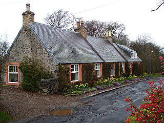
Bairnkine is a hamlet on the Jed Water in the Scottish Borders area of Scotland, on the A68, south of Jedburgh.
Polwarth is a village and parish in the Scottish Borders area of Scotland. It is located at grid reference NT745502, between Greenlaw and Duns, in the former county of Berwickshire.
Smailholm is a small village in the historic county of Roxburghshire in south-east Scotland. It is at grid reference NT648364 and straddles the B6397 Gordon to Kelso road. The village is almost equidistant from both, standing 6 miles (10 km) northwest of the abbey town of Kelso. Since local government reorganisation in Scotland in the early 1970s, Smailholm has been part of the Scottish Borders Council.
Ladykirk is a village on the B6470 in the Scottish Borders area of Scotland, and the former Berwickshire, just north of the River Tweed and the Anglo-Scottish border. The town was formerly known as Upsettlington, but King James IV of Scotland renamed the town Ladykirk; the church is also known as St Mary's Church or Kirk of Steill. Ladykirk stands directly opposite Norham Castle, Northumberland, England

Camptown is a small settlement on the A68, in the Scottish Borders area of Scotland, 5m (8 km) south of Jedburgh, and the same distance south to Carter Bar. The village lies on the course of the Jed Water, and the remains of a peel tower are close by at Edgerston.
Fogo is a village in the county of Berwickshire, in the Borders of Scotland, 3 miles south of Duns, on the Blackadder Water.
Leitholm is a village in the Scottish Borders area of Scotland, 4 miles (6.4 km) north-west of Coldstream, in the former county of Berwickshire.

Westruther is a village on the B6465, in the Scottish Borders area of Scotland, on the lower slopes of the Lammermuir Hills, in the former Berwickshire. The largest town nearby is Gordon.

Cessford is a hamlet and former barony about a mile south of the B6401 road, in the Scottish Borders area of Scotland. The placename is from Gaelic 'ceis' and means 'the wattled causeway over the ford'; spellings vary between Cesfuird, Cesford, Cessfoord, Cessfuird, and Cessfurde.

Crailing is a village on the A698, in Teviotdale, 4m east of Jedburgh in the Scottish Borders area of Scotland, in the historic county of Roxburghshire.

Crailinghall is a village near Oxnam in the Scottish Borders area of Scotland, in the former Roxburghshire.

Cranshaws is a village on the B6355 road, near Duns, in the Scottish Borders area of Scotland, in the former Berwickshire.

Ettleton is a village near Castleton, in the Scottish Borders area of Scotland, in the former Roxburghshire.
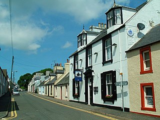
Kirkcolm is a village and civil parish on the northern tip of the Rhinns of Galloway peninsula, south-west Scotland. It is in Dumfries and Galloway, and is part of the former county of Wigtownshire. The parish is bounded on the north and west by the sea, on the east by the bay of Loch Ryan and on the south by Leswalt parish.