Related Research Articles

A postal code is a series of letters or digits or both, sometimes including spaces or punctuation, included in a postal address for the purpose of sorting mail.

Postal codes used in the United Kingdom, British Overseas Territories and Crown dependencies are known as postcodes. They are alphanumeric and were adopted nationally between 11 October 1959 and 1974, having been devised by the General Post Office. A full postcode is known as a "postcode unit" and designates an area with several addresses or a single major delivery point.

ISO 3166-1 alpha-2 codes are two-letter country codes defined in ISO 3166-1, part of the ISO 3166 standard published by the International Organization for Standardization (ISO), to represent countries, dependent territories, and special areas of geographical interest. They are the most widely used of the country codes published by ISO, and are used most prominently for the Internet's country code top-level domains. They are also used as country identifiers extending the postal code when appropriate within the international postal system for paper mail, and have replaced the previous one consisting one-letter codes. They were first included as part of the ISO 3166 standard in its first edition in 1974.
UN/LOCODE, the United Nations Code for Trade and Transport Locations, is a geographic coding scheme developed and maintained by United Nations Economic Commission for Europe (UNECE). UN/LOCODE assigns codes to locations used in trade and transport with functions such as seaports, rail and road terminals, airports, Postal Exchange Office and border crossing points. The first issue in 1981 contained codes for 8,000 locations. The version from 2011 contained codes for about 82,000 locations.

A Canadian postal code is a six-character string that forms part of a postal address in Canada. Like British, Irish and Dutch postcodes, Canada's postal codes are alphanumeric. They are in the format A1A 1A1, where A is a letter and 1 is a digit, with a space separating the third and fourth characters. As of October 2019, there were 876,445 postal codes using Forward Sortation Areas from A0A in Newfoundland to Y1A in Yukon.
A geocode is a code that represents a geographic entity. It is a unique identifier of the entity, to distinguish it from others in a finite set of geographic entities. In general the geocode is a human-readable and short identifier.
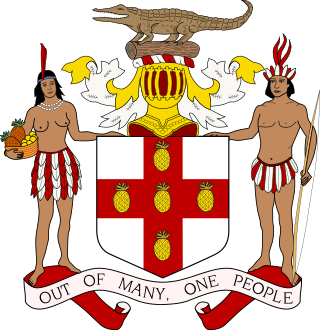
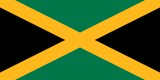
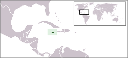
The parishes of Jamaica are the main units of local government in Jamaica. They were created following the English Invasion of Jamaica in 1655. This administrative structure for the Colony of Jamaica developed slowly. However, since 1 May 1867, Jamaica has been divided into the current fourteen parishes. These were retained after independence in 1962. They are grouped into three historic counties, which no longer have any administrative relevance. Every parish has a coast; none are landlocked.
An address is a collection of information, presented in a mostly fixed format, used to give the location of a building, apartment, or other structure or a plot of land, generally using political boundaries and street names as references, along with other identifiers such as house or apartment numbers and organization name. Some addresses also contain special codes, such as a postal code, to make identification easier and aid in the routing of mail.
Canadian provincial and territorial postal abbreviations are used by Canada Post in a code system consisting of two capital letters, to represent the 13 provinces and territories on addressed mail. These abbreviations allow automated sorting.
A postal address in Ireland is a place of delivery defined by Irish Standard (IS) EN 14142-1:2011 and serviced by the universal service provider, An Post. Its addressing guides comply with the guidelines of the Universal Postal Union (UPU), the United Nations-affiliated body responsible for promoting standards in the postal industry, across the world.
Postal codes in Argentina are called códigos postales. Argentina first implemented a four-digit postal code system in 1958, aiming to improve mail distribution efficiency. However, it wasn't until 1998 that the more detailed and comprehensive Código Postal Argentino (CPA) system was launched, significantly enhancing both accuracy and efficiency in mail delivery. Until 1998 Argentina employed a four-digit postal code for each municipality, with the first digit representing a region in the country, except in the case of the city of Buenos Aires. The unique codes became the base for the newer system, officially called CPA.
ISO 3166-2:JM is the entry for Jamaica in ISO 3166-2, part of the ISO 3166 standard published by the International Organization for Standardization (ISO), which defines codes for the names of the principal subdivisions of all countries coded in ISO 3166-1.
The following outline is provided as an overview of and topical guide to Jamaica:
The following is an alphabetical list of topics related to the nation of Jamaica.

Postal codes in the Czech Republic are called PSČ. The acronym is commonly pronounced as a word, rather than separate letters. The system was introduced in former Czechoslovakia in 1973 and has remained unchanged. The postal code consists of five digits, usually written with a space in the form XXX XX. The first digit indicates a region :
Postal codes in Hungary are four-digit numeric postcodes administered by Magyar Posta, the postal service of Hungary. The current system was introduced on 1 January 1973.
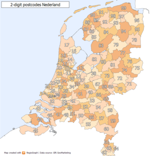
Postal codes in the Netherlands, known as postcodes, are alphanumeric, consisting of four digits followed by two uppercase letters. The letters 'F', 'I', 'O', 'Q', 'U' and 'Y' were originally not used for technical reasons, but almost all existing combinations are now used as these letters were allowed for new locations starting 2005. The letter combinations 'SS', 'SD' and 'SA' are not used because of their associations with the Nazi occupation of the Netherlands.
Postal codes in Sri Lanka are five digit numbers used by Sri Lanka Postal Service, that identifies each postal jurisdiction to sort mail more efficiently. They were first introduced in 1997.
Postal codes in Greenland consist of the two letter ISO 3166 code "GL", followed by four digits, the first two of which are "39".
References
- ↑ Jamaica, Universal Postal Union
- ↑ Post code system to be introduced in Jamaica, Postal Corporation of Jamaica, June 6, 2005
- ↑ Postal Code System Easy to use – Dr. O'Meally Nelson, Jamaica Information Service, June 21, 2005
- ↑ New postal code system before year end, Sunday Observer, April 2, 2006
- ↑ POST CODE PROJECT SUSPENDED INDEFINITELY, Postal Corporation of Jamaica, February 12, 2007
- ↑ Unlocking the Postal Code, Postal Corporation of Jamaica, 18 July 2005
- ↑ Unlocking the post code - Pt III, Postal Corporation of Jamaica, 25 July 2005
- ↑ Kgn 8 post code is JMAAW03, Postal Corporation of Jamaica, June 13, 2005
