Pyrogeography

Last updated
Spatial pattern of fire and its primary controls: vegetation type, climate, and ignitions
Global Fires - August and February 2008.jpg
Patterns of fire in the year 2008
NDVI 1998.gif
The seasonal cycle of greenness (NDVI index).
Global Lightning Frequency.png
Lightning flashes/km2/yr, April 1995 to February 2003

Pyrogeography is the study of the past, present, and projected distribution of wildfire. Wildland fire occurs under certain conditions of climate, vegetation, topography, and sources of ignition, such that it has its own biogeography, or pattern in space and time. [1] [2] The earliest published evidence of the term appears to be in the mid-1990s, and the meaning was primarily related to mapping fires [3] [4] The current understanding of pyrogeography emerged in the 2000s as a combination of biogeography and fire ecology, facilitated by the availability of global-scale datasets of fire occurrence, vegetation cover, and climate. Pyrogeography has also been placed at the juncture of biology, the geophysical environment, and society and cultural influences on fire. [5]

Contents

Pyrogeography often uses a framework of ecological niche concepts to evaluate the environmental controls on fire. By examining how environmental factors interact to facilitate fire activity, pyrogeographers can predict expected fire behavior under new conditions. Pyrogeographic research contributes to and informs land management policy in various regions across the globe.

Concepts

The pyrogeography framework

Under the framework used in pyrogeography, there are three basic categories that control fire regimes across the world: consumable resources, ignitions and atmospheric conditions. Each of the three factors varies across space and time, causing and creating different fire regime types. Fire is a result of the intersection of these three components.

By examining and quantifying this framework across time and space, pyrogeographers can examine the difference between fire regimes in different regions or time periods.

Fire variables

Large amounts of brush burned by the Tumbleweed Fire near Los Angeles, California, in July 2021 Grapevine, California July 2021.JPG
Large amounts of brush burned by the Tumbleweed Fire near Los Angeles, California, in July 2021

Several variables must be met for fire to occur, all of which are influenced by both natural and human factors. Due to the spatial and temporal characteristics of each variable, global fire behavior is a complex and fluid system to model and cannot be predicted by climate or vegetation alone.

Wind speed

Wind speed is the driving force behind rate of spread, or how quickly a fire moves through a landscape. It is influenced by the season, weather, topography, and land cover of a location. Wind speed is affected by human activity through anthropogenic climate change and land use change.[ citation needed ]

Fuel continuity

Fuel continuity is the distribution of fuel particles in a fuel bed, and affects the fire's ability to sustain combustion and spread. It is influenced by the terrain type, presence of water bodies, seasonality, and vegetation type/age. Human influences on continuity include artificial fuel breaks (roads, fire suppression tactics), habitat fragmentation, species displacement, and land management methods (patch burning, “slash and burn”, etc.).[ citation needed ]

Fuel loads

Fuel load is the amount of available fuel per unit area. Can also be defined by amount of heat energy generated per unit area upon combustion. Natural influences include vegetation type/cover, presence of natural disturbances (such as insect outbreak, wind damage), herbivory, soil fertility, and seasonality. Human influences can involve grazing, logging, suppression tactics, fuel treatments (preventative measures), and land use change such as deforestation and agricultural development.[ citation needed ]

Fuel moisture

Fuel moisture is the measure of amount of water within fuels, and is expressed as a percent of dry weight of that fuel. Fuel moisture is affected by wind activity, season, antecedent rainfall, relative humidity, air temperature, and soil moisture. Human influences include anthropogenic climate change and land management activity (logging, grazing, burning). [7]

Ignitions

Ignitions can be either natural or anthropogenic. Natural ignitions are generally limited to lightning strikes, but volcanism and other sources have been observed. Human-caused fire may be intentional (arson, fuel management methods) or unintentional. Natural factors affecting ignitions include lightning flashes, volcanoes, and seasonality. Human influences include population size, land management, road networks, and arson.[ citation needed ]

Methodology

Pyrogeographers use many different methods to study the distribution of fire. To study fire across space, pyrogeographers use spatial data of fire activity, which may come in several forms including observations, satellite imagery, and historical evidence of fire. [6] The emergence of pyrogeography as a field is closely linked to the availability of satellite imagery. Since the late 1970s when satellite data became widely-available, the seasonal and geographical patterns of fire activity have come under inquiry, leading to the development of the field.

Fire observation data

The observation of fire occurrence is an important piece of data in pyrogeography. Information on the occurrence of fire can be obtained from a variety of sources: historical and present. Historic fire observation data frequently comes from dendrochronology (tree ring records of fire) or other written historical records. Modern fire observations are often made with satellites: using aerial imagery, scientists can examine fire activity and the size of an area burned. Both forms of fire observation data are important for studying the distribution of fire.[ citation needed ]

Spatial distribution models

Spatial distribution models are used in pyrogeography to describe empirical relationships between fire and environmental factors. There are a number of statistical methods used to build and run these models. Most models consist of mapped fire observations compared against various independent variables (in this case, spatial environmental gradients such as topography or precipitation). The two of these components together produce a statistical model of fire probability that can be used to assess hypotheses or challenge assumptions. Some of the variables used include things like net primary productivity (NPP), annual precipitation, temperature or soil moisture. Models are especially important for pyrogeography since they can be used across areas where fire observation data may be incomplete or biased. Models with high reliability can be used to project or predict conditions in areas with little data or observations. [8]

Climate-wildfire relationships

Perhaps the most important and encompassing relationship in pyrogeography is that between area burnt and net primary productivity. [7] [9]

In places with low net primary productivity, the necessary fire variables do not exist to allow fires to burn. For example, deserts have very low NPP given the arid climate, and do not build up sufficient fuel loads to sustain fire.[ citation needed ]

On the other hand, areas with very high net primary productivity are generally constrained by wet tropical weather patterns. This is seen in places such as tropical rainforests, where primary productivity is extremely high but the necessary weather conditions to dry out fuels do not exist.

It is in areas with intermediate levels of net primary productivity and climates with a seasonal pattern of sustaining fuel loads where fires regularly occur. Tropical savannas are a clear example of these conditions, where hot, wet growing seasons are followed by dry periods that desiccate fuels and provide ignitions for fire. These savannas are the most widespread flammable environments on Earth.[ citation needed ]

An example of the relationship between NPP and area burnt is seen in the western U.S., where dense conifer forests with high NPP experience infrequent stand-replacing fires, drier pine forests and chaparral shrublands experience fire at decadal intervals on average, and steppe shrubland experiences fire, at least historically, on multi-decadal or longer intervals.

Human influences on expanding the extent of fire

In dense forests (e.g., tropical rainforests), land use change and deforestation sharply increase the risk of wildfire by opening the forest canopy and thus reducing humidity and fuel moisture of surface fuels, and by targeted ignitions during otherwise low-lightning dry periods. This has been clearly demonstrated in the Amazon Basin and Indonesia, where massive deforestation and changing land use has altered the vast rainforest landscape and made it vulnerable to fire. [10] The occurrence of fire has become much more frequent in tropical rainforest, as positive feedback loops between forest loss, fragmentation, and fire provide increasingly fire-conducive conditions. It is estimated that rainfall in the Amazon could fall as much as 20% due to large-scale deforestation. [11]

Invasive species also may have a dramatic effect on changing the fuel type and fuel load, thereby increasing or decreasing the amount of fire.

Applications of pyrogeography

Risk Management

Pyrogeography is also used to help inform development efforts and landscape management in regions that may be prone to fire. The expansion of suburbs and neighborhoods into regions that tend to burn frequently or intensely (such as parts of California) means that homeowners face increasing risks of wildfires spreading or starting in their area. Pyrogeography can be used to create maps of fire hazard in order to educate or inform landowners and communities. These maps may show which areas might be most prone to the most intense burning. Landowners and developers can use that information to plan either evacuation strategies or to avoid building in certain areas. There are other policies that can decrease fire risk: vegetation management and fire-resistant building materials (such as metal instead of wood) may help lower the risk of losing a home in a fire. [12]

Land Management

The modeling of fire distribution through pyrogeographic methods helps inform land management. Distribution models of fire are used to evaluate land management practices in action, and can be used to determine if a particular practice (such as fuel treatment or removal) is working effectively or as predicted. One example of this is in the northern Central Valley of California: fire has been suppressed in the area for over a century due to agriculture, but spatial distribution models show that fire may have been more frequent in the past. Knowing that fire suppression has altered the natural frequency of fire in the area (and therefore perhaps altered the landscape) allows land managers, landowners and policy makers to inform ongoing efforts of natural restoration. [8]

Relationships to other disciplines

Paleoecology

Reconstructing the fire history of an area is very helpful in determining its climatic conditions and ecology. Knowledge of past fire regimes comes from geochemistry, tree ring analysis, charcoal, written documents and archeology. [13] Each data source has advantages and disadvantages. For the purposes of paleoecology, charcoal data from lake and soil core samples provides information dating back millennia, enabling accurate climate reconstruction based on the relationship of fire regimes to vegetation and climate. [14] Charcoal must first be extracted or washed from the sediments of a core sample. It is then placed on a plate and counted under a microscope. The sediment layer charcoal counts are plotted on a graph, showing when and with what intensity fires occurred. The highest peaks, where the most charcoal is found, correspond to more intense fire. Different ecosystems are more susceptible to fire due to climatic factors and what kinds of vegetation is present. This relationship between fire and vegetation present is used to make inferences about the climate at that time, based on the amount and kinds of charcoal found. Different types of vegetation leave different charcoal. The job of the paleoecologist is to count and determine the quantity and kinds of charcoal present. [15] These counts are later studied and analyzed in conjunction with other data sources. This allows the use of fire as a proxy for the reconstruction of climates in the distant past. The effects of the fire can be seen using processes like loss on ignition. Soil chemistry is analyzed to determine changes in mineral and carbon percentages as a result of fire. Historical data may reveal the source or cause of fire. Pollen data provides information on vegetative species present before and after the fire. Fire-induced soil susceptibility to magnetism can reveal fire-regime characteristics that pre-date recorded history [16] and provide insight into fire-regimes at the time of soil formation. All of these proxies help construct the ecosystem of the studied area.

Archaeology

Fire became a regular technology for many Hominina populations between 400 thousand and 300 thousand years ago; humans have had a relationship with fire for many hundreds of thousands of years. Humans influence the pyrogeographic framework in more ways than in providing an ignition source: our actions and behaviors may also change vegetation, climate, and suppress lightning ignitions, thus significantly affecting fire regimes. [17]

See also

Related Research Articles

<span class="mw-page-title-main">Fire</span> Rapid and hot oxidation of a material

Fire is the rapid oxidation of a material in the exothermic chemical process of combustion, releasing heat, light, and various reaction products. At a certain point in the combustion reaction, called the ignition point, flames are produced. The flame is the visible portion of the fire. Flames consist primarily of carbon dioxide, water vapor, oxygen and nitrogen. If hot enough, the gases may become ionized to produce plasma. Depending on the substances alight, and any impurities outside, the color of the flame and the fire's intensity will be different.

<span class="mw-page-title-main">Wildfire</span> Uncontrolled fires in rural countryside or wilderness areas

A wildfire, forest fire, bushfire, wildland fire or rural fire is an unplanned, uncontrolled and unpredictable fire in an area of combustible vegetation. Depending on the type of vegetation present, a wildfire may be more specifically identified as a bushfire, desert fire, grass fire, hill fire, peat fire, prairie fire, vegetation fire, or veld fire. Some natural forest ecosystems depend on wildfire. Wildfires are distinct from beneficial human usage of wildland fire, called controlled or prescribed burning, although controlled burns can turn into wildfires. Modern forest management often engages in prescribed burns to mitigate risk and promote natural forest cycles.

<span class="mw-page-title-main">Grassland</span> Area with vegetation dominated by grasses

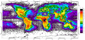
A grassland is an area where the vegetation is dominated by grasses (Poaceae). However, sedge (Cyperaceae) and rush (Juncaceae) can also be found along with variable proportions of legumes, like clover, and other herbs. Grasslands occur naturally on all continents except Antarctica and are found in most ecoregions of the Earth. Furthermore, grasslands are one of the largest biomes on Earth and dominate the landscape worldwide. There are different types of grasslands: natural grasslands, semi-natural grasslands, and agricultural grasslands. They cover 31–69% of the Earth's land area.

<span class="mw-page-title-main">Heath</span> Shrubland habitat

A heath is a shrubland habitat found mainly on free-draining infertile, acidic soils and characterised by open, low-growing woody vegetation. Moorland is generally related to high-ground heaths with—especially in Great Britain—a cooler and damper climate.

<span class="mw-page-title-main">Controlled burn</span> Technique to reduce potential fuel for wildfire through managed burning

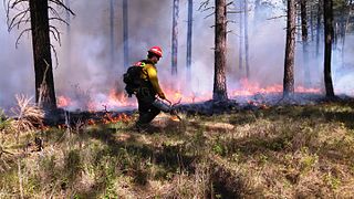
A controlled or prescribed (Rx) burn, which can include hazard reduction burning, backfire, swailing or a burn-off, is a fire set intentionally for purposes of forest management, fire suppression, farming, prairie restoration or greenhouse gas abatement. A controlled burn may also refer to the intentional burning of slash and fuels through burn piles. Fire is a natural part of both forest and grassland ecology and controlled fire can be a tool for foresters.

<span class="mw-page-title-main">Fire ecology</span> Study of fire in ecosystems

Fire ecology is a scientific discipline concerned with the effects of fire on natural ecosystems. Many ecosystems, particularly prairie, savanna, chaparral and coniferous forests, have evolved with fire as an essential contributor to habitat vitality and renewal. Many plant species in fire-affected environments use fire to germinate, establish, or to reproduce. Wildfire suppression not only endangers these species, but also the animals that depend upon them.

<span class="mw-page-title-main">Smouldering</span> Slow, flameless combustion

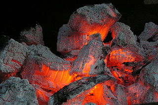
Smouldering or smoldering is the slow, flameless form of combustion, sustained by the heat evolved when oxygen directly attacks the surface of a condensed-phase fuel. Many solid materials can sustain a smouldering reaction, including coal, cellulose, wood, cotton, tobacco, cannabis, peat, plant litter, humus, synthetic foams, charring polymers including polyurethane foam and some types of dust. Common examples of smouldering phenomena are the initiation of residential fires on upholstered furniture by weak heat sources, and the persistent combustion of biomass behind the flaming front of wildfires.

<span class="mw-page-title-main">Paleolimnology</span> Scientific study of ancient lakes and streams

Paleolimnology is a scientific sub-discipline closely related to both limnology and paleoecology. Paleolimnological studies focus on reconstructing the past environments of inland waters using the geologic record, especially with regard to events such as climatic change, eutrophication, acidification, and internal ontogenic processes.

<span class="mw-page-title-main">Wildfire suppression</span> Firefighting tactics used to suppress wildfires

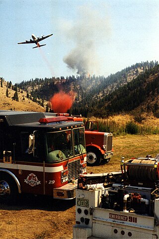
Wildfire suppression is a range of firefighting tactics used to suppress wildfires. Firefighting efforts depend on many factors such as the available fuel, the local atmospheric conditions, the features of the terrain, and the size of the wildfire. Because of this wildfire suppression in wild land areas usually requires different techniques, equipment, and training from the more familiar structure fire fighting found in populated areas. Working in conjunction with specially designed aerial firefighting aircraft, fire engines, tools, firefighting foams, fire retardants, and using various firefighting techniques, wildfire-trained crews work to suppress flames, construct fire lines, and extinguish flames and areas of heat in order to protect resources and natural wilderness. Wildfire suppression also addresses the issues of the wildland–urban interface, where populated areas border with wild land areas.

Prior to the European colonization of the Americas, indigenous peoples used fire to modify the landscape. This influence over the fire regime was part of the environmental cycles and maintenance of wildlife habitats that sustained the cultures and economies of the Indigenous peoples of the Americas. What was initially perceived by colonists as "untouched, pristine" wilderness in North America was the cumulative result of the Indigenous use of fire, creating an mosaic of grasslands and forests across North America, sustained and managed by the peoples indigenous to the landscape.

<span class="mw-page-title-main">Dry thunderstorm</span> Thunderstorm where little to no precipitation reaches the ground

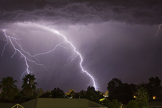
A dry thunderstorm is a thunderstorm that produces thunder and lightning, but where most of its precipitation evaporates before reaching the ground. Dry lightning refers to lightning strikes occurring in this situation. Both are so common in the American West that they are sometimes used interchangeably.

A fire regime is the pattern, frequency, and intensity of the bushfires and wildfires that prevail in an area over long periods of time. It is an integral part of fire ecology, and renewal for certain types of ecosystems. A fire regime describes the spatial and temporal patterns and ecosystem impacts of fire on the landscape, and provides an integrative approach to identifying the impacts of fire at an ecosystem or landscape level. If fires are too frequent, plants may be killed before they have matured, or before they have set sufficient seed to ensure population recovery. If fires are too infrequent, plants may mature, senesce, and die without ever releasing their seed.

The wildland–urban interface (WUI) is a zone of transition between wilderness and land developed by human activity – an area where a built environment meets or intermingles with a natural environment. Human settlements in the WUI are at a greater risk of catastrophic wildfire.

<span class="mw-page-title-main">Mediterranean forests, woodlands, and scrub</span> Habitat defined by the World Wide Fund for Nature

Mediterranean forests, woodlands and scrub is a biome defined by the World Wide Fund for Nature. The biome is generally characterized by dry summers and rainy winters, although in some areas rainfall may be uniform. Summers are typically hot in low-lying inland locations but can be cool near colder seas. Winters are typically mild to cool in low-lying locations but can be cold in inland and higher locations. All these ecoregions are highly distinctive, collectively harboring 10% of the Earth's plant species.

<span class="mw-page-title-main">Deforestation in British Columbia</span>

Deforestation in British Columbia has resulted in a net loss of 1.06 million hectares of tree cover between the years 2000 and 2020. More traditional losses have been exacerbated by increased threats from climate change driven fires, increased human activity, and invasive species. The introduction of sustainable forestry efforts such as the Zero Net Deforestation Act seeks to reduce the rate of forest cover loss. In British Columbia, forests cover over 55 million hectares, which is 57.9% of British Columbia's 95 million hectares of land. The forests are mainly composed of coniferous trees, such as pines, spruces and firs.

<span class="mw-page-title-main">Great Western Woodlands</span> Ecoregion in Western Australia

The Great Western Woodlands is located in the southwest of Australia. The woodlands cover almost 16,000,000 hectares, a region larger in size than England and Wales. The boundary of the Great Western Woodlands runs from the Nullarbor Plain in the east to the Western Australian Wheatbelt in the west; from north of Esperance through to the inland mulga country and deserts that are found north of Kalgoorlie.

<span class="mw-page-title-main">Wildfires in the United States</span> Wildfires that occur in the United States


Wildfires can happen in many places in the United States, especially during droughts, but are most common in the Western United States and Florida. They may be triggered naturally, most commonly by lightning, or by human activity like unextinguished smoking materials, faulty electrical equipment, overheating automobiles, or arson.

Fire history, the ecological science of the study of the history of wildfires, is a subdiscipline of fire ecology. Patterns of forest fires in historical and prehistorical time provide information relevant to the pattern of vegetation in modern landscapes. It provides an estimate of the historical range of variability of a natural disturbance regime, and can be used to identify the processes affecting the occurrence of fire. Fire history reconstructions are achieved by compiling atlases of past fires, using the tree ring record from fire scars and tree ages, and the charcoal record from soils and sediments.

The relationships between fire, vegetation, and climate create what is known as a fire regime. Within a fire regime, fire ecologists study the relationship between diverse ecosystems and fire; not only how fire affects vegetation, but also how vegetation affects the behavior of fire. The study of neighboring vegetation types that may be highly flammable and less flammable has provided insight into how these vegetation types can exist side by side, and are maintained by the presence or absence of fire events. Ecologists have studied these boundaries between different vegetation types, such as a closed canopy forest and a grassland, and hypothesized about how climate and soil fertility create these boundaries in vegetation types. Research in the field of pyrogeography shows how fire also plays an important role in the maintenance of dominant vegetation types, and how different vegetation types with distinct relationships to fire can exist side by side in the same climate conditions. These relationships can be described in conceptual models called fire–vegetation feedbacks, and alternative stable states.

Natural disasters in Nigeria are mainly related to the climate of Nigeria, which has been reported to cause loss of lives and properties. A natural disaster might be caused by flooding, landslides, and insect infestation, among others. To be classified as a disaster, there is needs to be a profound environmental effect or human loss which must lead to financial loss. This occurrence has become an issue of concern, threatening large populations living in diverse environments in recent years.

References

  1. Krawchuk MA, Moritz MA, Parisien MA, Van Dorn J, Hayhoe K (April 2009). "Global pyrogeography: the current and future distribution of wildfire". PLOS ONE. 4 (4): e5102. Bibcode:2009PLoSO...4.5102K. doi: 10.1371/journal.pone.0005102 . PMC   2662419 . PMID   19352494.
  2. Krawchuk MA, Moritz MA (July 2014). "Burning issues: statistical analyses of global fire data to inform assessments of environmental change". Environmetrics. 25 (6): 472–481. doi:10.1002/env.2287. ISSN   1180-4009. S2CID   117838440.
  3. Sannikov SN (1994). "Evolutionary pyroecology and pyrogeography of the natural regeneration of Scots Pine". Proceedings of Forest Fire Research: 961–968.
  4. Yool SR (June 1999). Gottfried GJ, Eskew LG, Curtin CG, Edminster CB (eds.). "Remote sensing fire studies in the Greater Borderlands" (PDF). Toward Integrated Research, Land Management, and Ecosystem Protection in the Malpai Borderlands: Conference Summary. USDA Forest Service Proceedings: 88–92. RMRS-P-10.
  5. Bowman DM, O'Brien JA, Goldammer JG (October 2013). "Pyrogeography and the Global Quest for Sustainable Fire Management". Annual Review of Environment and Resources. 38 (1): 57–80. doi: 10.1146/annurev-environ-082212-134049 . ISSN   1543-5938.
  6. 1 2 Tobin M (5 June 2013). "Wildfire ignition trends: humans versus lightning - EcoWest". EcoWest. Retrieved 1 December 2017.
  7. 1 2 Scott AC, Bowman DM, Bond WJ, Pyne SJ, Alexander ME (2014). Fire on Earth : An Introduction. Chichester, West Sussex: Wiley-Blackwell. ISBN   9781119953579. OCLC   854761793.
  8. 1 2 Moritz MA, Krawchuk MA, Parisien MA (August 2010). "Pyrogeography: Understanding the ecological niche of fire" (PDF). PAGES. 18 (2): 83–65. doi: 10.22498/pages.18.2.83 .
  9. Krawchuk MA, Moritz MA (January 2011). "Constraints on global fire activity vary across a resource gradient". Ecology. 92 (1): 121–132. doi:10.1890/09-1843.1. PMID   21560682.
  10. Laurance WF, WilliamsonGB (December 2001). "Positive Feedbacks among Forest Fragmentation, Drought, and Climate Change in the Amazon". Conservation Biology. 15 (6): 1529–1535. doi:10.1046/j.1523-1739.2001.01093.x. ISSN   1523-1739. S2CID   35177088.
  11. "Fewer trees mean less rain for the Amazon basin". Nature. 547 (7662): 142. July 2017. doi:10.1038/d41586-017-01215-3. PMID   32076244. S2CID   4382777.
  12. Parisien MA (June 2016). "Science can map a solution to a fast-burning problem". Nature. 534 (7607): 297. Bibcode:2016Natur.534..297P. doi: 10.1038/534297a . PMID   27306154.
  13. Iglesias V, Yospin GI, Whitlock C (January 2015). "Reconstruction of fire regimes through integrated paleoecological proxy data and ecological modeling". Frontiers in Plant Science. 5: 785. doi: 10.3389/fpls.2014.00785 . PMC   4302794 . PMID   25657652.
  14. Gavin DG, Hallett DJ, Hu FS, Lertzman KP, Prichard SJ, Brown KJ, et al. (2007). "Forest fire and climate change in western North America: insights from sediment charcoal records". Frontiers in Ecology and the Environment. 5 (9): 499–506. doi: 10.1890/060161 . ISSN   1540-9295. S2CID   5738427.
  15. Crawford AJ, Belcher CM (August 2014). "Charcoal morphometry for paleoecological analysis: The effects of fuel type and transportation on morphological parameters". Applications in Plant Sciences. 2 (8): 1400004. doi:10.3732/apps.1400004. PMC   4141710 . PMID   25202644.
  16. Jordanova, Neli, ed. (2017). "Chapter 8 - The discriminating power of soil magnetism for the characterization of different soil types". Soil Magnetism. Academic Press. pp. 349–365. doi:10.1016/B978-0-12-809239-2.00008-5. ISBN   978-0-12-809239-2.
  17. Roos CI, Bowman DM, Balch JK, Artaxo P, Bond WJ, Cochrane M, et al. (April 2014). "Pyrogeography, historical ecology, and the human dimensions of fire regimes". Journal of Biogeography. 41 (4): 833–836. doi: 10.1111/jbi.12285 . ISSN   1365-2699. S2CID   83822229.