Old English, or Anglo-Saxon, is the earliest recorded form of the English language, spoken in England and southern and eastern Scotland in the early Middle Ages. It developed from the languages brought to Great Britain by Anglo-Saxon settlers in the mid-5th century, and the first Old English literary works date from the mid-7th century. After the Norman conquest of 1066, English was replaced, for a time, by Anglo-Norman as the language of the upper classes. This is regarded as marking the end of the Old English era, since during this period the English language was heavily influenced by Anglo-Norman, developing into a phase known now as Middle English in England and Early Scots in Scotland.

The Saxons were a group of Germanic peoples whose name was given in the early Middle Ages to a large country near the North Sea coast of northern Germania, in what is now Germany. In the late Roman Empire, the name was used to refer to Germanic coastal raiders, and in a similar sense to the later "Viking". Their origins are believed to be in or near the German North Sea coast where they appear later, in Carolingian times. In Merovingian times, continental Saxons had been associated with the activity and settlements on the coast of what later became Normandy. Their precise origins are uncertain, and they are sometimes described as fighting inland, coming into conflict with the Franks and Thuringians. There is possibly a single classical reference to a smaller homeland of an early Saxon tribe, but its interpretation is disputed. According to this proposal, the Saxons' earliest area of settlement is believed to have been Northern Albingia. This general area is close to the probable homeland of the Angles.

Mercia was one of the three notable Anglic kingdoms founded after Sub-Roman Britain was settled by Anglo-Saxons in an era called the Heptarchy. It was centred on the River Trent and its tributaries, in a region now known as the Midlands of England.

Oxfordshire is a ceremonial county in South East England. The county is landlocked and borders Northamptonshire and Warwickshire to the north, Buckinghamshire to the east, Berkshire to the south, and Wiltshire and Gloucestershire to the west. The largest settlement is the city of Oxford.

Bucknell University is a private liberal arts college in Lewisburg, Pennsylvania. Founded in 1846 as the University at Lewisburg, it now consists of the College of Arts and Sciences, Freeman College of Management, and the College of Engineering. It offers 65 majors and over 70 minors in the humanities, arts, mathematics, natural science, social sciences, engineering, management, as well as programs and pre-professional advising that prepare students for study in law and medicine. Located just south of Lewisburg, the 445-acre (1.80 km2) campus rises above the West Branch of the Susquehanna River.

Warwick is a market town, civil parish and the county town of Warwickshire in the Warwick District in England, adjacent to the River Avon. It is 9 miles (14 km) south of Coventry, and 19 miles (31 km) south-east of Birmingham. It is adjoined with Leamington Spa and Whitnash.
Penkridge is a large village and civil parish in South Staffordshire District in Staffordshire, England. It is to the south of Stafford, north of Wolverhampton, west of Cannock and east of Telford.
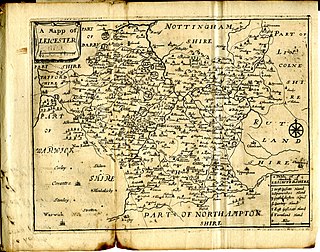
This article is intended to give an overview of the history of Leicestershire.

Doynton is a village in South Gloucestershire, England. The population of this village taken at the 2011 census was 320.
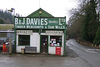
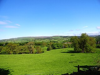
Bucknell is a village and civil parish in south Shropshire, England. The village lies on the River Redlake, within 660 yards (600 m) of the River Teme and close to the border of Wales and Herefordshire. It is about 6 miles (9.7 km) east of Knighton and is set within the Shropshire Hills Area of Outstanding Natural Beauty.

Buckton and Coxall is a civil parish in north Herefordshire, England.

Cradley is a village in the Black Country and Metropolitan Borough of Dudley near Halesowen and the banks of the River Stour. Colley Gate is the name of the short road in the centre of Cradley. It was part of the ancient parish of Halesowen, but unlike much of the rest of that parish, which was an exclave of Shropshire, Cradley was always in Worcestershire, until the creation of the West Midlands county in 1974. This meant that for civil administrative purposes, Cradley formerly had the officers which a parish would have had. The population of the appropriate Dudley Ward taken at the 2011 census was 13,340.

Caverswall is a village and parish in Staffordshire, to the south west of Staffordshire Moorlands.

Chapel Lawn is a small village in southwest Shropshire, England, located within the Redlake Valley, some three miles south of the small town of Clun.

The Kingdom of the East Angles, today known as the Kingdom of East Anglia, was a small independent kingdom of the Angles comprising what are now the English counties of Norfolk and Suffolk and perhaps the eastern part of the Fens. The kingdom formed in the 6th century in the wake of the Anglo-Saxon settlement of Britain. It was ruled by the Wuffingas dynasty in the 7th and 8th centuries, but fell to Mercia in 794, and was conquered by the Danes in 869, to form part of the Danelaw. It was conquered by Edward the Elder and incorporated into the Kingdom of England in 918.

The Cheddar Yeo is a small river in Somerset, England. Beneath the limestone of the Mendip Hills it forms the largest underground river system in Britain. After emerging into Cheddar Gorge it flows through the village of Cheddar, where it has been used in the past to power mills. From the Middle Ages until the 19th century the river had ports for seagoing vessels but is no longer navigable. Some of the water, which is of good quality, is diverted into Cheddar Reservoir to provide drinking water for Bristol.
The Battle of Buttington was fought in 893 between a Viking army and an alliance of Anglo-Saxons and Welsh.

Lancaster Roman Fort, also known as Wery Wall, Galacum or Calunium, is the modern name given to ruined former Roman fort atop Castle Hill in Lancaster in North West England. The first castra was founded c. 80 AD within the Roman province of Britannia.
The Redlake River has had different names in different places at different times. The upper reaches through Treverward and Purlogue were known as the Bradfeld or Bardfield Flud up until the early 19th century. In the 17th century, and maybe before, the middle section was called Chapel Brook after the medieval chapel that was built there in 1513. From Saxon times until the end of the 18th century, the lower reaches and maybe higher, were known as the Adlake, Adlagh and Elagh, plus many variations in spelling, so called because of a Saxon Manor called Adelactune further downstream at Bucknell. It is thought that the 'R' came from either ‘yr’ which is Welsh for ‘the’ or from ‘atter’, which is Middle English for ‘at the’. A longer explanation can be found on the Redlake Valley Artist's webpage.