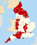
Shropshire is a ceremonial county in the West Midlands of England, on the Welsh border. It is bordered by Wrexham County Borough and Cheshire to the north, Staffordshire to the east, Worcestershire to the south-east, Herefordshire to the south and Powys to the west. The largest settlement is Telford, and Shrewsbury is the county town.

Oswestry is a market town, civil parish and historic railway town in Shropshire, England, close to the Welsh border. It is at the junction of the A5, A483 and A495 roads.

Telford and Wrekin is a borough and unitary authority in Shropshire, England. In 1974, a non-metropolitan district of Shropshire was created called The Wrekin, named after a prominent hill to the west of Telford. In 1998, the district became a unitary authority and was renamed "Telford and Wrekin", which remains part of the Shropshire ceremonial county and shares institutions such as the Fire and Rescue Service and Community Health with the rest the county.

Shrewsbury and Atcham was a local government district with borough status in Shropshire, England, between 1974 and 2009.

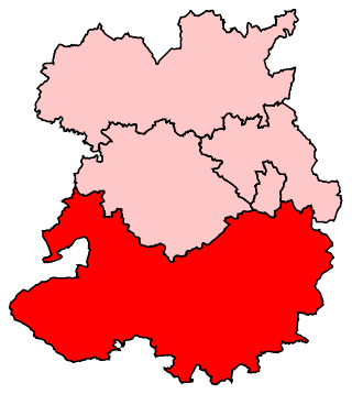
North Shropshire was a local government district in Shropshire, England from 1974 to 2009. The district council was based at Edinburgh House in Wem. Other settlements included the towns of Ellesmere, Market Drayton and Whitchurch, as well as the large villages of Shawbury and Baschurch. The district bordered onto Wales, Cheshire and Staffordshire as well as the Shropshire districts of Oswestry, Shrewsbury and Atcham and the unitary Telford and Wrekin.

Bridgnorth District was a local government district in Shropshire, England, from 1974 to 2009. Its council was based in the town of Bridgnorth. The district also included the towns of Much Wenlock, Shifnal and Broseley and the villages of Albrighton and Sheriffhales, as well as RAF Cosford.

The Borough of Oswestry was a local government district with borough status in Shropshire, England, from medieval times until its abolition in 2009. Until 1974 the borough just covered the town of Oswestry itself. The borough was enlarged in 1974 to also include the surrounding rural area.
Shropshire was established during the division of Saxon Mercia into shires in the 10th century. It is first mentioned in 1006. After the Norman Conquest it experienced significant development, following the granting of the principal estates of the county to eminent Normans, such as Roger De Montgomery and his son Robert de Bellême.

The English county of Shropshire has a fairly large railway network, with 19 National Rail stations on various national lines; there are also a small number of heritage and freight lines, including the famous heritage Severn Valley Railway running along its eastern border with Worcestershire.
Ludlow is a constituency in Shropshire represented in the House of Commons of the UK Parliament since 2005 by Philip Dunne, a member of the Conservative Party.

North Shropshire is a constituency in the county of Shropshire, represented in the House of Commons of the UK Parliament by Helen Morgan of the Liberal Democrats after a by-election on 16 December 2021. The former MP, Owen Paterson of the Conservatives, resigned his seat on 5 November 2021 when faced with suspension from the Commons for a breach of advocacy rules and the consequent possibility of a recall petition. The seat had previously been a safe seat for the Conservatives.
Local justice areas are units in England and Wales established by the Courts Act 2003, replacing and directly based on the previous petty sessional divisions. They have been in existence since 2005.
Shropshire Constabulary was the territorial police force responsible for policing rural Shropshire in central England from 1840 until 1967, when it became part of West Mercia Constabulary.

Shropshire Council, known between 1980 and 2009 as Shropshire County Council and from 1889 to 1980 as Salop County Council, is the local authority for the non-metropolitan county of Shropshire in the West Midlands of England. Since 2009 it has been a unitary authority, having taken over district-level functions when the county's districts were abolished. The non-metropolitan county of Shropshire is smaller than the ceremonial county of the same name, the latter additionally including Telford and Wrekin. The council's headquarters are at Shirehall in Shrewsbury, the largest town in the district and the county town of Shropshire.
Shropshire Council elections are held every four years, and since 2009 74 councillors have been elected from 63 electoral divisions.
The 2009 elections to Shropshire Council in England were held on 4 June 2009. These were the first elections to the new unitary body, which replaced Shropshire County Council and the district councils of Bridgnorth, North Shropshire, Oswestry, Shrewsbury and Atcham and South Shropshire on 1 April as part of the 2009 local government restructuring across England.
The town of Shrewsbury in Shropshire, England has historically been affected by flooding of the River Severn. The Frankwell area, has been particularly affected, but flood defence measures have largely been effective in the area.