Bracknell Forest

Last updated

Bracknell Forest
Downtown Bracknell - geograph.org.uk - 5342466.jpg
Wellington College East Tower, Crowthorne - geograph.org.uk - 3609278.jpg
College Road, College Town - geograph.org.uk - 4480252.jpg
Church of St Michael, Sandhurst 04.jpg
Bracknell Forest - geograph.org.uk - 3503018.jpg
Bracknell Forest UK locator map.svg
Shown within Berkshire
Coordinates: 51°25′01″N0°44′49″W / 51.417°N 0.7469°W / 51.417; -0.7469
Sovereign state United Kingdom
Constituent country England
Region South East England
Ceremonial Counties Berkshire
Status Unitary authority
Incorporated1 April 1974
Admin HQBracknell
Government
  TypeUnitary authority
  Body Bracknell Forest Borough Council
  LeadershipLeader & Cabinet (Labour)
   MPs: Adam Afriyie
James Sunderland
Area
  Total42.23 sq mi (109.38 km2)
  Rank191st (of 296)
Population
 (2021)
  Total125,174
  Rank188th (of 296)
  Density3,000/sq mi (1,100/km2)
Ethnicity (2021)
[1]
   Ethnic groups
List
Religion (2021)
[1]
   Religion
List
Time zone UTC0 (GMT)
  Summer (DST) UTC+1 (BST)
ONS code 00MA (ONS) E06000036 (GSS)
OS grid reference SU871694
Website www.bracknell-forest.gov.uk OOjs UI icon edit-ltr-progressive.svg

Bracknell Forest is a unitary authority area in Berkshire, southern England. It covers the two towns of Bracknell and Sandhurst and the village of Crowthorne and also includes the areas of North Ascot, Binfield, Warfield, and Winkfield. The borough borders Wokingham and the Royal Borough of Windsor & Maidenhead in Berkshire, and also parts of Surrey and Hampshire.

Contents

History

The district was formed as Easthampstead Rural District under the Local Government Act 1894 as a successor to the Easthampstead rural sanitary district. Originally a small rural district, its population was about 20,000 during the Second World War. Bracknell, in the district, was one of the first post-war new towns to be designated, and became a civil parish in 1955, created from parts of Binfield, Easthampstead, Warfield and Winkfield parishes. Bracknell had originally been a hamlet at the far south-west of Warfield parish.

The district's population rose rapidly, and reached 64,135 by the 1971 census. [2] In 1974 the district was reconstituted as the non-metropolitan district of Bracknell under the Local Government Act 1972. [3] [4] It changed its name in May 1988 to Bracknell Forest, at the same time as it was granted borough status.

On 1 April 1998, Berkshire County Council was abolished, as a consequence of the Banham Review, and Bracknell Forest Borough Council became a unitary authority. From 2008, references to 'borough' were phased out in favour of simply Bracknell Forest Council.

Since 1973, Bracknell Forest has been twinned with Opladen in Germany, continued by Leverkusen after Opladen's incorporation in 1975.

There are 265 Listed Buildings in the borough of which 254 are Grade II, 10 are Grade II* and 1 is Grade I.[ citation needed ]

There are five sites in the borough included on the Register of Historic Parks and Gardens: Ascot Place, Broadmoor Hospital, Newbold College, South Hill Park and Windsor Great Park. [5]

Bracknell Forest Borough Council's offices at Time Square in Market Street were featured in an episode of Road Wars on 4 February 2010 when a pursuit ended in the carpark. [6]

Geography

Two rivers run through Bracknell Forest: the River Blackwater forms the borough's southern boundary, and the Cut meanders through the northern parishes. These receive water from small streams within the borough namely the Bull Brook in the north which feeds into the Cut and the Wish stream which flows into the River Blackwater. The built and developed proportion of the Borough amounts to about 35% of the total land area. Extensive forests cover more than 20% of the total area, consisting principally of parts of Windsor Forest; predominantly conifer plantation owned and managed by the Crown Estate and Forestry Commission. Agricultural land covers 24% of the land, located mainly in the north of the borough.

More than 20% of the borough is recognised as being of a high wildlife value and protected by some form of designation. Nine sites in Bracknell Forest are designated as Site of Special Scientific Interest (SSSI), comprising 1911.5 hectares or 17.48% of the Borough's total area. The largest, Broadmoor to Bagshot Woods & Heaths SSSI was designated in 2001 to include the majority of Swinley Forest.

The Thames Basin Heaths Special Protection Area (SPA), 1356 hectares of which lie within Bracknell Forest (Sandhurst to Owlsmoor Bogs and Heaths SSSI and the Broadmoor to Bagshot Woods and Heaths SSSI), supports nationally important populations of Dartford warblers, nightjars and woodlarks, all of which are Annex I species of the Birds Directive, and a small breeding population of hobbies, an important migratory species in a European context.

Demographics

Bracknell Forest is generally affluent (ranked 291 out of 326 on the Index of Multiple Deprivation 2010, Rank of Average Score) [7] with significantly lower than average unemployment levels. Property prices and levels of car ownership are significantly higher than the national average. [8] However deprivation does exist in the borough -central Bracknell is within the 30% most deprived areas in England, with several other parts of the town also within the more deprived half of England. In contrast, almost all of Crowthorne, Sandhurst, and the borough's rural fringes fall into the 10% least deprived areas in England. [9] Household incomes are also significantly lower than other areas of similar deprivation, being close to the national average. [10]

According to the Office for National Statistics figures the borough's population is 113,696. [11] 77% of the borough's population, aged between 16 and 74 years are economically active with the service sector employing the largest proportion, 46.4% of this group. Only 11% of the population is of pensionable age, compared to a national average of 18%, with 7% being over 75 years old. [8]

There are many distinctive local geographical communities within Bracknell Forest, from Sandhurst and Crowthorne in the south, the semi-rural communities of Binfield, Winkfield and Warfield in the north and the former new town of Bracknell in the centre, which contains most of the Borough's commercial and industrial areas. [12]

With respect to ethnicity, according to the Office for National Statistics, the vast majority of the Borough's residents (89.6%) consider themselves to be 'White'. The second largest group is defined as 'Asian' at 4.34%, third as 'Black' at 2.35%, fourth as Mixed at 1.82%. [13] With regard to religious affiliation, the population is predominantly Christian (77.8%), followed by those who have no religion (19.4%), Hindus (1.1%), Muslims (0.7%), Buddhists (0.3%), other religions (0.3%), Jews (0.2%) and Sikhs (0.2%). [14]

The population is quite healthy comparing well regionally and nationally with life expectancy at 80.15 years. [15]

Industry

Bracknell Forest is a base for high-tech industries and home to companies such as Panasonic, Fujitsu (formerly ICL) and Fujitsu Siemens Computers, Dell, Hewlett-Packard, Sharp Corporation, Tracks Laser & Electronics and LSI Corporation. The software development and computer services side of the industry also thrives in Bracknell Forest and includes companies like Cable and Wireless, Honeywell, Avnet, Novell, and RSA Security. Pharmaceutical and engineering companies also draw together in Bracknell Forest, these include Boehringer Ingelheim, Syngenta, Minebea, Daler-Rowney and Hyundai Heavy Industries.

Bracknell is also home to the central Waitrose distribution centre and head office which is on a 70-acre (280,000 m2) site on the Southern Industrial Estate. Waitrose has operated from the town since the 1970s. The town is also home to the headquarters of Avis Europe.

Education

Swinley Forest

There is no forest called 'Bracknell Forest'. This name is often confused with Swinley Forest (or Woods), which is an area of the Windsor Estate between Bracknell and Bagshot. Owned and managed by the Crown Estates, it comprises 2,600 acres (11 km2) of woodland (mainly Scots pine). It is a Site of Special Scientific Interest (SSSI), and has protected areas for the birds that live there.

It also provides some of the best mountain biking in South-East England, with many off-road 'single-track' trails available as well as plenty of fire roads. In recent years, Swinley forest has also been used as a filming location for a number of films including Harry Potter and the Deathly Hallows Parts 1 & 2. [16]

Civil parishes

Related Research Articles

<span class="mw-page-title-main">Sandhurst, Berkshire</span> Human settlement in England

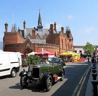
Sandhurst is a town and civil parish in the Bracknell Forest borough in Berkshire, England. It is in the south eastern corner of Berkshire, and is situated 32 miles (51 km) west-southwest of central London, 2.5 miles (4.0 km) north west of Camberley and 5 miles (8.0 km) south of Bracknell. Sandhurst is known worldwide as the location of the Royal Military Academy Sandhurst. Despite its close proximity to Camberley, Sandhurst is also home to a large and well-known out-of-town mercantile development. The site is named "The Meadows" and has a Tesco Extra hypermarket and a Marks & Spencer, two of the largest in the country. A large Next clothing and homeware store is open on the site of the old Homebase.

<span class="mw-page-title-main">Bracknell</span> Town and civil parish in England

Bracknell is a town and civil parish in Berkshire, England, the westernmost area within the Greater London Urban Area and the administrative centre of the borough of Bracknell Forest. It lies 11 miles (18 km) to the east of Reading, 9 miles (14 km) south of Maidenhead, 10 miles (16 km) southwest of Windsor and 25 miles (40 km) west of central London. Bracknell is the third largest town in Berkshire.

<span class="mw-page-title-main">Borough of Wokingham</span> Unitary authority area in Berkshire, England

The Borough of Wokingham is a local government district with borough status in Berkshire, England. It is named after its main town, Wokingham. Other places in the district include Arborfield, Barkham, Charvil, Earley, Finchampstead, Hurst, Sonning, Remenham, Ruscombe, Shinfield, Twyford, Wargrave, Three Mile Cross, Winnersh, Spencers Wood and Woodley. The population of Wokingham is 177,500 according to 2021 census.

<span class="mw-page-title-main">Crowthorne</span> Village in Berkshire, England

Crowthorne is a village and civil parish in the Bracknell Forest district of south-eastern Berkshire, England. It had a population of 7,806 at the 2021 census. Crowthorne is the venue of Wellington College, a large co-educational boarding and day independent school, which opened in 1859, and of Broadmoor Hospital, one of England's three maximum-security psychiatric hospitals, which lies on the eastern edge of the village.

<span class="mw-page-title-main">Maidenhead (UK Parliament constituency)</span> Parliamentary constituency in the United Kingdom, 1997 onwards

Maidenhead is a constituency in Berkshire represented in the House of Commons of the Parliament of the United Kingdom. Since its creation at the 1997 general election, the seat has been held by Conservative Member of Parliament Theresa May, who served as Home Secretary from 2010 to 2016 and as Prime Minister from 2016 to 2019. In March 2024, May announced she would be standing down as an MP at the next general election.

<span class="mw-page-title-main">Bracknell (UK Parliament constituency)</span> Parliament constituency in the United Kingdom since 1997

Bracknell is a constituency in Berkshire represented in the House of Commons of the UK Parliament since 2019 by James Sunderland, a Conservative. It was created for the 1997 general election, largely replacing the abolished county constituency of East Berkshire.

<span class="mw-page-title-main">Easthampstead</span> Human settlement in England

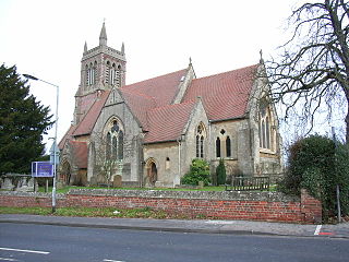
Easthampstead is a former village and now a southern suburb of the town of Bracknell, in the civil parish of Bracknell, in the Bracknell Forest district, in the ceremonial county of Berkshire, England. The old village can still be easily identified around the Church of St Michael and St Mary Magdalene. This building houses some of the finest stained glass works of Sir Edward Burne-Jones.

<span class="mw-page-title-main">Winkfield</span> Human settlement in England

Winkfield is a village and civil parish in the Bracknell Forest unitary authority of Berkshire, England.

Bracknell Forest Borough Council is the local authority for Bracknell Forest, a unitary authority in Berkshire, England. Until 1 April 1998 it was a non-metropolitan district.

<span class="mw-page-title-main">Warfield</span> Human settlement in England

Warfield is a village and civil parish in the English county of Berkshire and the borough of Bracknell Forest.

<span class="mw-page-title-main">East Berkshire (UK Parliament constituency)</span> Parliamentary constituency in the United Kingdom 1983-1997

East Berkshire was a county constituency in the county of Berkshire. It returned one Member of Parliament (MP) to the House of Commons of the Parliament of the United Kingdom, elected by the first past the post voting system.

<span class="mw-page-title-main">Swinley Forest</span> Woodland in Southern England

Swinley Forest is a large expanse of Crown Estate woodland managed by Forestry England mainly within the civil parishes of Windlesham in Surrey and Winkfield and Crowthorne in Berkshire, England.

<span class="mw-page-title-main">Broadmoor to Bagshot Woods and Heaths</span>

Broadmoor to Bagshot Woods and Heaths is a 1,696.3-hectare (4,192-acre) biological Site of Special Scientific Interest (SSSI) in Berkshire and Surrey that extend from a minority of the parish of Crowthorne including around Broadmoor Hospital in the west to Bagshot south-east, Bracknell north-east, and Sandhurst, south. It is part of the Thames Basin Heaths Special Protection Area. Two nature reserves which are managed by the Surrey Wildlife Trust are in the SSSI, Barossa nature reserve and Poors Allotment. Broadmoor Bottom, which is part of Wildmoor Heath, also falls within the SSSI; this reserve is managed by the Berkshire, Buckinghamshire and Oxfordshire Wildlife Trust.

Crown Wood is a south-eastern estate of Bracknell in the English county of Berkshire, and formerly part of the parish of Winkfield.

<span class="mw-page-title-main">Caesar's Camp, Bracknell Forest</span> Iron Age hill fort in Berkshire, England

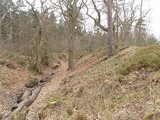
Caesar's Camp is an Iron Age hill fort around 2,400 years old. It is located just in Crowthorne civil parish to the south of Bracknell in the English county of Berkshire. It falls within the Windsor Forest and is well wooded, although parts of the fort have now been cleared of some trees. The area is managed by the Forestry Commission but owned by Crown Estate, and is open and accessible to the public. The hill fort covers an area of about 17.2 acres and is surrounded by a mile-long ditch, making it one of the largest in southern England.

<span class="mw-page-title-main">Devil's Highway (Roman Britain)</span> Roman road in England

The Devil's Highway was a Roman road in Britain connecting Londinium (London) to Calleva Atrebatum (Silchester) via Pontes (Staines). The road was the principal route to the west of Britain during the Roman period but, whilst maintained for its easternmost section, was replaced by other routes after the demise of Roman Britain.

<span class="mw-page-title-main">2023 Bracknell Forest Borough Council election</span> 2023 election in England

The 2023 Bracknell Forest Borough Council election took place on 4 May 2023, to elect all 41 members in 15 wards for Bracknell Forest Borough Council in England. The election took place on the same day as other local elections in England as part of the 2023 United Kingdom local elections. Due to a boundary review there had been a change in ward boundaries, along with a reduction in size from 42 members elected in 2019. This is the first election since 1971 where a majority of seats are outside Bracknell. The election was held alongside concurrent town and parish council elections in Binfield, Bracknell, Crowthorne, Sandhurst, Warfield, and Winkfield.

References

  1. 1 2 UK Census (2021). "2021 Census Area Profile – Bracknell Forest Local Authority (E06000036)". Nomis. Office for National Statistics . Retrieved 5 January 2024.
  2. "Easthampstead RD through time – Census tables with data for the Local Government District". Visionofbritain.org.uk. Archived from the original on 30 September 2007. Retrieved 17 February 2019.
  3. "The English Non-metropolitan Districts (Definition) Order 1972". Legislation.gov.uk. Retrieved 26 July 2022.
  4. "The English Non-metropolitan Districts (Names) Order 1973". Legislation.gov.uk. Retrieved 26 July 2022.
  5. "Life is for living Two Cultural Strategy 2008 – 2012" (PDF). Archived from the original (PDF) on 4 October 2013. Retrieved 15 October 2012., Retrieved 2012-10-15, p. 12.
  6. "Road Wars (extracts) - Bracknell". You Tube. Archived from the original on 19 February 2021. Retrieved 8 February 2021.
  7. "Indices of Deprivation 2010". Department for Communities and Local Government. Archived from the original on 3 March 2012. Retrieved 15 March 2012.
  8. 1 2 All of Us Community Cohesion Strategy, p19, http://www.bracknell-forest.gov.uk/all-of-us-community-cohesion-strategy.pdf Archived 25 April 2012 at the Wayback Machine , Retrieved 15 March 2012
  9. "English indices of deprivation 2019". GOV.UK. Retrieved 8 August 2020.
  10. "Income estimates for small areas, England and Wales - Office for National Statistics". www.ons.gov.uk. Retrieved 20 March 2023.
  11. "2010 ONS Population Estimates Unit published tables, Office for National Statistics Population Estimates for UK, England and Wales, Scotland and Northern Ireland, Mid-2011". Archived from the original on 31 October 2012. Retrieved 13 November 2012.
  12. "All of Us Community Cohesion Strategy" (PDF). p. 18. Archived from the original (PDF) on 25 April 2012. Retrieved 15 March 2012., Retrieved 15 March 2012
  13. "Estimated resident population by ethnic group and age mid-2009 experimental statistics". Archived from the original on 15 March 2012. Retrieved 15 March 2012., Retrieved 15 March 2012
  14. "Census 2001 Summary theme figures and rankings – Ethnicity and Religion". Archived from the original on 15 March 2012. Retrieved 15 March 2012., Retrieved 15 March 2012
  15. "All of Us Community Cohesion Strategy" (PDF). p. 20. Archived from the original (PDF) on 25 April 2012. Retrieved 15 March 2012., Retrieved 15 March 2012
  16. "Bracknell Forest Landscape Evidence Base: Draft Report" (PDF). Bracknell Forest Council. LUC London. June 2015. Archived from the original (PDF) on 28 April 2016. Retrieved 18 April 2016.