
Davis County is a county in northern Utah, United States. As of the 2020 United States Census, the population was 362,679, making it Utah's third-most populous county. Its county seat is Farmington, and its largest city by both population and area is Layton.

Box Elder County is a county at the northwestern corner of Utah, United States. At the 2020 census, the population was 57,666, up from the 2010 figure of 49,975. Its county seat and largest city is Brigham City. The county was named for the box elder trees that abound in the county.

Juab County is a county in western Utah, United States. As of the 2020 United States Census, the population was 11,786. Its county seat and largest city is Nephi.
Morgan County is a county in northern Utah, United States. As of the 2020 census, the population was 12,295. Its county seat and largest city is Morgan. Morgan County is part of the Ogden-Clearfield, UT Metropolitan Statistical Area as well as the Salt Lake City-Provo-Orem, UT Combined Statistical Area.

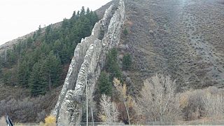
Wasatch County is a county in the U.S. state of Utah. As of the 2020 United States Census, the population was 34,788. Its county seat and largest city is Heber City. The county was named for a Ute word meaning "mountain pass" or "low place in the high mountains".

Utah County is the second-most populous county in the U.S. state of Utah. The county seat and largest city is Provo, which is the state's fourth-largest city, and the largest outside of Salt Lake County. As of the 2020 United States Census, the population was 665,665.

Weber County is a county in the U.S. state of Utah. As of the 2020 census, the population was 262,223, making it Utah's fourth-most populous county. Its county seat and largest city is Ogden, the home of Weber State University. The county was named after a fur trapper John Weber.
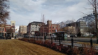
Provo is a city in and the county seat of Utah County, Utah, United States. It is 43 miles (69 km) south of Salt Lake City along the Wasatch Front, and lies between the cities of Orem to the north and Springville to the south. With a population at the 2020 census of 115,162, Provo is the fourth-largest city in Utah and the principal city in the Provo-Orem metropolitan area, which had a population of 526,810 at the 2010 census. It is Utah's second-largest metropolitan area after Salt Lake City.
Erda is a city in Tooele County, Utah, United States. The population was 4,642 at the 2010 census, a significant increase from the 2000 figure of 2,473. Erda was previously a Census Designated Place (CDP) and a township but officially received its incorporation certificate in January 2022.
Heber City is a city and county seat of Wasatch County, Utah. The population was 16,856 as of the 2020 United States census. The city is located 43 miles southeast of Salt Lake City.
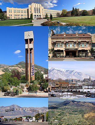
Ogden is a city in and the county seat of Weber County, Utah, United States, approximately 10 miles (16 km) east of the Great Salt Lake and 40 miles (64 km) north of Salt Lake City. The population was 87,321 in 2020, according to the US Census Bureau, making it Utah's eighth largest city. The city served as a major railway hub through much of its history, and still handles a great deal of freight rail traffic which makes it a convenient location for manufacturing and commerce. Ogden is also known for its many historic buildings, proximity to the Wasatch Mountains, and as the location of Weber State University.

The Wasatch Front is a metropolitan region in the north-central part of the U.S. state of Utah. It consists of a chain of mostly contiguous cities and towns stretched along the Wasatch Range from approximately Santaquin in the south to Logan in the north, and containing the cities of Salt Lake City, Bountiful, Layton, and Ogden.

Area code 435 is a telephone area code in the North American Numbering Plan (NANP) for most of the U.S. state of Utah. Area code 435 was created in 1997 in a split of area code 801.
The Provo–Orem, UT Metropolitan Statistical Area, as defined by the United States Office of Management and Budget, is an area consisting of two counties in Utah, anchored by the cities of Provo and Orem. As of the 2020 census, the MSA had a population of 671,185.

The Ogden-Clearfield, UT Metropolitan Statistical Area, as defined by the United States Office of Management and Budget, is an area consisting of four counties in north central Utah, anchored by the cities of Ogden and Clearfield. As of the 2010 census, the MSA had a population of 547,184. On February 28, 2013 the White House released a Bulletin Revising delineations of CSA's and MSA's, which led to the addition of Box Elder County to the Ogden-Clearfield Metropolitan Statistical Area, bringing the MSA population to 597,159. This county was removed in the latest definitions and added to the newly created Brigham City, micropolitan statistical area.
Utah is the 30th most populous state in the United States with a population of about 3.3 million, according to projections from the US Census Bureau's 2017 estimates. The state has also been characterized by a tremendous amount of growth in the last decade, with the highest percent increase in population of any state since 2010. Utah has a surface area of 84,899 square miles, though around 80% of its population is concentrated around a metropolitan area in the north-central part of the state known as the Wasatch Front.

The Heber Micropolitan Statistical Area, as defined by the United States Office of Management and Budget, is an area consisting of two counties in Utah. It is part of the Salt Lake City–Provo–Orem combined statistical area, along with the Salt Lake City metropolitan area, Ogden–Clearfield metropolitan area, and Provo–Orem metropolitan area.

