Sand Lake, Michigan

Last updated

Sand Lake, Michigan
Village of Sand Lake
Sand Lake, MI location.png
Location within Kent County
USA Michigan location map.svg
Red pog.svg
Sand Lake
Location within the state of Michigan
Usa edcp location map.svg
Red pog.svg
Sand Lake
Location within the United States
Coordinates: 43°17′31″N85°31′06″W / 43.29194°N 85.51833°W / 43.29194; -85.51833
CountryUnited States
State Michigan
County Kent
Founded1869
Government
  Type Village council
  PresidentMollie Doerr
   Clerk Donna Westerbrink
Area
[1]
  Total0.74 sq mi (1.92 km2)
  Land0.71 sq mi (1.84 km2)
  Water0.03 sq mi (0.08 km2)
Elevation
915 ft (279 m)
Population
 (2020)
  Total522
  Density736.25/sq mi (284.08/km2)
Time zone UTC-5 (Eastern (EST))
  Summer (DST) UTC-4 (EDT)
ZIP code(s)
49343
Area code 616
FIPS code 26-71360 [2]
GNIS feature ID1675442 [3]
Website Official website

Sand Lake is a village in Kent County in the U.S. state of Michigan. The population was 522 at the 2020 census.

Contents

History

The village of Sand Lake was founded in 1869 in northern Kent County and has long served as a bedroom community about 25 miles (40.2 km) northeast of the city of Grand Rapids. In 2009, the village had the highest tax rates of the five villages in Kent County, and some residents petitioned for a vote to have the village disincorporated in order to lower taxes. This proposal was defeated, and Sand Lake continued as an incorporated village. [4]

Geography

According to the U.S. Census Bureau, the village has a total area of 0.74 square miles (1.92 km2), of which 0.71 square miles (1.84 km2) is land and 0.03 square miles (0.08 km2) (4.05%) is water. [5]

Demographics

Historical population
CensusPop.Note
1880 581
1890 386−33.6%
1900 326−15.5%
1910 37013.5%
1920 366−1.1%
1930 358−2.2%
1940 3652.0%
1950 3947.9%
1960 3940.0%
1970 380−3.6%
1980 3882.1%
1990 45617.5%
2000 4927.9%
2010 5001.6%
2020 5224.4%
U.S. Decennial Census [6]

2010 census

As of the census [2] of 2010, there were 500 people, 188 households, and 116 families living in the village. The population density was 625 per square mile. There were 211 housing units at an average density of 263.75 per square mile. The racial makeup of the village was 94.6% White, 0.80% African American, 0.2% Native American, 1% Asian, 1.4% from other races, and 2% from two or more races. Hispanic or Latino of any race were 5.2% of the population.

There were 188 households, of which 34% had children under the age of 18 living with them, 39.9% were married couples living together, 14.4% had a female householder with no husband present, and 38.3% were non-families. 33% of all households were made up of individuals, and 26.1% had someone living alone who was 65 years of age or older. The average household size was 2.66 and the average family size was 3.34.

In the village, the population was spread out, with 33% under the age of 20, 7% from 20 to 24, 23.4% from 25 to 44, 24.8% from 45 to 64, and 11.8% who were 65 years of age or older. The median age was 33.2 years. For every 100 females, there were 65.29 males. For every 100 females age 20 and over, there were 95.91 males.

2000 census

As of the census [2] of 2000, there were 492 people, 184 households, and 110 families living in the village. The population density was 670.5 inhabitants per square mile (258.9/km2). There were 207 housing units at an average density of 282.1 per square mile (108.9/km2). The racial makeup of the village was 96.34% White, 0.20% African American, 1.22% Native American, 0.81% Asian, 1.02% from other races, and 0.41% from two or more races. Hispanic or Latino of any race were 1.02% of the population.

There were 184 households, out of which 35.9% had children under the age of 18 living with them, 47.3% were married couples living together, 9.8% had a female householder with no husband present, and 40.2% were non-families. 34.2% of all households were made up of individuals, and 19.6% had someone living alone who was 65 years of age or older. The average household size was 2.64 and the average family size was 3.43.

In the village, the population was spread out, with 32.1% under the age of 18, 8.3% from 18 to 24, 28.7% from 25 to 44, 15.0% from 45 to 64, and 15.9% who were 65 years of age or older. The median age was 33 years. For every 100 females, there were 85.7 males. For every 100 females age 18 and over, there were 80.5 males.

The median income for a household in the village was $31,875, and the median income for a family was $46,250. Males had a median income of $27,500 versus $21,985 for females. The per capita income for the village was $14,184. About 9.3% of families and 14.5% of the population were below the poverty line, including 9.0% of those under age 18 and 34.0% of those age 65 or over.

Education

Tri County Area Schools, which operates Tri County High School, serves Sand Lake. The district was a consolidation of the Sand Lake and Howard City school boards. It came into existence on April 3, 1962, the day members of those communities voted in favor of consolidating their schools. The consolidated schools began operation in fall 1962. [7]

Prior to the consolidation, Sand Lake High School, a K-12 school, served the community. Impetus for consolidation occurred when the State of Michigan adopted new standards for education which required school systems to spend additional funds. Some Sand Lake residents wished to consolidate with Cedar Springs Schools in Cedar Springs due to the strength of the Cedar Springs industrial economy and the good reputation of its school system, while others wished to consolidate with Howard City. Charles Northup, a former member of the Sand Lake school board, stated that Cedar Springs residents would have had primary control and naming of a consolidated school district including Sand Lake, while a consolidation with Howard City would result in joint control between the communities. According to a former principal of Sand Lake High, Earl Clegg, "community friction" occurred in the consolidation debate. [7] About 300 people went to a meeting in Sand Lake on proposed school consolidation on February 13, 1961. [7]

The Nelson Township Branch of the Kent District Library is located in Sand Lake.

Notable people

Related Research Articles

<span class="mw-page-title-main">Cedar Lake, Indiana</span> Town in Indiana, United States

Cedar Lake is a town in Hanover and Center townships, Lake County, Indiana, United States. It is near the Illinois state line. Its population was 11,560 at the 2010 census. The town is notable for its location on Cedar Lake, the Lake of the Red Cedars museum.

<span class="mw-page-title-main">Keswick, Iowa</span> City in Iowa, United States

Keswick is a city in Keokuk County, Iowa, United States. The population was 242 at the time of the 2020 census.

<span class="mw-page-title-main">Thornburg, Iowa</span> City in Iowa, United States

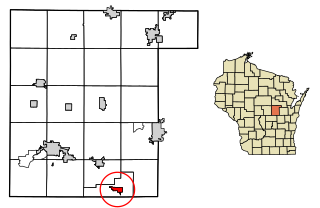
Thornburg is a village in Keokuk County, Iowa, United States. The population was 45 at the time of the 2020 census. Its sole enterprise is the Tri-County Community School, a public school serving grades K-12.

<span class="mw-page-title-main">Nelson Township, Michigan</span> Civil township in Michigan, United States

Nelson Township is a civil township of Kent County in the U.S. state of Michigan. The population was 4,895 at the 2020 census, which was up from 4,774 at the 2010 census.

<span class="mw-page-title-main">Howard City, Michigan</span> Village in Michigan, United States

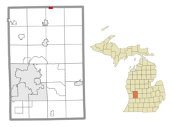
Howard City is a village in Montcalm County in the U.S. state of Michigan. The population was 1,835 at the 2020 census. The village is within Reynolds Township.

<span class="mw-page-title-main">Pierson, Michigan</span> Village in Michigan, United States

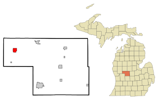
Pierson is a village in Montcalm County of the U.S. state of Michigan. The population was 229 at the 2020 census, up from 172 in 2010. The village is within Pierson Township.

Pierson Township is a civil township of Montcalm County in the U.S. state of Michigan. The population was 3,363 at the 2020 census. The village of Pierson is located within the township.

<span class="mw-page-title-main">Orchard Lake Village, Michigan</span> City in Michigan, United States

The City of Orchard Lake Village is a city in Oakland County in the U.S. state of Michigan. A northern suburb of Detroit, Orchard Lake Village is located roughly 27 miles (43.5 km) from downtown Detroit, and about 3 miles (4.8 km) southwest of Pontiac. The city is mostly surrounded by West Bloomfield Township, with a small northeast border with Keego Harbor. As of the 2010 census, the city had a population of 2,375.

<span class="mw-page-title-main">Wolverine Lake, Michigan</span> Village in Michigan, United States

Wolverine Lake is a village in Oakland County in the U.S. state of Michigan. The population was 4,312 at the 2010 census. The village is located within Commerce Township.

<span class="mw-page-title-main">Adams, Minnesota</span> City in Minnesota, United States

Adams is a city in Adams Township, Mower County, Minnesota, United States. The population was 683 at the 2020 census, down from 787 in 2010.

Toivola Township is a township in Saint Louis County, Minnesota, United States. At the 2010 census, the population was 170. Toivola is a name Finnish in origin.

<span class="mw-page-title-main">Cedar Rapids, Nebraska</span> Village in Nebraska, United States

Cedar Rapids is a village in Boone County, Nebraska, United States. The population was 382 at the 2010 census.

<span class="mw-page-title-main">De Witt, Nebraska</span> Village in Saline County, Nebraska, United States

De Witt is a village in Saline County, Nebraska, United States. The population was 520 at the 2020 census.

<span class="mw-page-title-main">Swanton, Nebraska</span> Village in Saline County, Nebraska, united States

Swanton is a village in Saline County, Nebraska, United States. The population was 75 at the 2020 census.

<span class="mw-page-title-main">Cedarville, Ohio</span> Village in Ohio, United States

Cedarville is a village in Greene County, Ohio, United States. The village is within the Dayton Metropolitan Statistical Area. The population was 4,257 at the 2020 census.

<span class="mw-page-title-main">Lewisburg, Ohio</span> Village in Ohio, United States

Lewisburg is a village in Preble County, Ohio, United States, founded in 1818. The current village incorporates two prior villages, the original Lewisburg and Euphemia, which merged in 1916. The population was 1,745 at the 2020 census. It is part of the Dayton Metropolitan Statistical Area.

<span class="mw-page-title-main">Kimberly, Wisconsin</span> Village in Wisconsin, United States

Kimberly is a village in Outagamie County, Wisconsin, United States. The population was 7,320 at the 2020 census. The village is east of Appleton.

<span class="mw-page-title-main">Cedar Grove, Wisconsin</span> Village in Wisconsin, United States

Cedar Grove is a village in Sheboygan County, Wisconsin, United States, within the Town of Holland. The population was 2,101 at the 2020 census. It is included in the Sheboygan, Wisconsin Metropolitan Statistical Area.

<span class="mw-page-title-main">Colfax, Wisconsin</span> Village in Wisconsin, United States

Colfax is a village in Dunn County, Wisconsin, United States. The population was 1,158 at the 2010 census. The village is surrounded by the Town of Colfax.

<span class="mw-page-title-main">Fremont, Wisconsin</span> Village in Wisconsin, United States

Fremont is a village in Waupaca County, Wisconsin, United States. It is surrounded by Town of Fremont. The population was 679 at the 2010 census. Fremont has been referred to as the "White Bass Capital of the World."

References

  1. "2020 U.S. Gazetteer Files". United States Census Bureau. Retrieved May 21, 2022.
  2. 1 2 3 "U.S. Census website". United States Census Bureau . Retrieved January 31, 2008.
  3. "US Board on Geographic Names". United States Geological Survey. October 25, 2007. Retrieved January 31, 2008.
  4. "Sand Lake civil war: Move to dissolve village comes down to taxes". MLive. Booth Newspapers. April 3, 2019. Retrieved October 15, 2021.
  5. "Michigan: 2010 Population and Housing Unit Counts 2010 Census of Population and Housing" (PDF). 2010 United States Census . United States Census Bureau. September 2012. p. 28 Michigan. Archived (PDF) from the original on October 19, 2012. Retrieved October 1, 2021.
  6. "Census of Population and Housing". Census.gov. Retrieved June 4, 2015.
  7. 1 2 3 Ransom, Kay. "Tri County Area Schools: Over 50 Years in the Making ." Tri County Area Schools. Retrieved on October 21, 2017.