Severe weather terminology (United States)

Last updated

This article describes severe weather terminology used by the National Weather Service (NWS) in the United States. The NWS, a government agency operating as an arm of the National Oceanic and Atmospheric Administration (NOAA) branch.It defines precise meanings for nearly all of its weather terms.

Contents

This article describes NWS terminology and related weather scales used by the agency. Some terms may be specific to certain cities or regions. Specific Area Message Encoding (SAME) product codes assigned to each term for NOAA Weather Radio (NWR) broadcasts are included in (following the title of the described alert type if used) products that do not have a specified code are identified where applicable as Non-Precipitation Warnings/Watches/Advisories (NPW), Coastal Flood Warnings/Watches/Advisories (CFW), Marine Weather Statement (MWS), Mesoscale Discussion (MCD) or Severe Weather Warnings/Watches/Advisories (WSW) as defined by NOAA.

Definitions of severe weather alerts

The NWS divides severe weather alerts into several types of hazardous/hydrologic events:

  1. Severe local storms – Short-fused, small-scale hazardous weather or hydrologic events produced by thunderstorms (including large hail, damaging winds, tornadoes, and flash floods).
  2. Winter storms – Weather hazards associated with freezing or frozen precipitation (freezing rain, sleet, and/or snow), or combined effects of winter precipitation and strong winds.
  3. Fire weather – Weather conditions that contribute to an increased risk and help cause the spread of wildfires.
  4. Flooding – Hazardous hydrological events resulting in temporary inundation of land areas not normally covered by water, often caused by excessive rainfall.
  5. Coastal/lakeshore hazards – Hydrological hazards that may affect property, marine or leisure activities in areas near ocean and lake waters including high surf and coastal or lakeshore flooding, as well as rip currents.
  6. Marine hazards – Hazardous events that may affect marine travel, fishing and shipping interests along large bodies of water, including hazardous seas and freezing spray.
  7. Tropical cyclone hazards – Hazardous tropical cyclone events that may affect property in inland areas or marine activities in coastal waters, resulting in wind damage, storm surge, tornadoes and flooding rain.
  8. Non-precipitation hazards – Weather hazards not directly associated with any of the above including extreme heat or cold, dense fog, high winds, and river or lakeshore flooding.

Severe local storms

An example of weather alerts on a national map from the National Weather Service. NWS Weather Map Example 3.jpg
An example of weather alerts on a national map from the National Weather Service.

Deprecated

  • Significant weather advisory (SPS; alt.: significant weather alert) – A strong thunderstorm below severe criteria, containing small hail below 1 inch (2.5 cm) diameter, and/or strong winds of 39–57 miles per hour (63–92 km/h), is indicated by Doppler weather radar and may create some adverse impacts on travel. These advisories are issued as special weather statements written in the style of severe thunderstorm and other short-fused warnings, usually on a county by county (or equivalent thereof) basis. Some areas use an entirely different format (most notably WFOs in the Northeast and Mid-Atlantic), denoting which locations in each county will be affected by the thunderstorm. The NWS ceased use of the "significant weather advisory" titling in July 2021; special weather statements for non-severe thunderstorms concurrently adopted product language following the Impact Based Warning format used for severe convective storms.

Winter precipitation

Deprecated

  • Heavy snow warning (WSW) – Heavy snowfall amounts are imminent; the criteria for amounts (based on 12-hour and 24-hour minimum accumulations) vary significantly over different county warning areas. [21] Discontinued beginning with the 2008-2009 winter storm season and replaced with the winter storm warning for heavy snow.
  • Sleet warning (WSW; alt.: heavy sleet warning) – Heavy sleet accumulations of 1 to 2 inches (2.5 to 5.1 cm) or more, which may cause significant disruptions to travel or utilities, are imminent or expected to occur within 12 hours. Discontinued beginning with the 2008-2009 winter storm season and replaced by the winter storm warning for heavy sleet. [22]
  • Sleet advisory (WSW) – Moderate sleet accumulations of 14 to 1 inch (0.64 to 2.54 cm) are imminent or expected to occur within 12 hours. Because sleet usually occurs with other precipitation types, a Winter Weather Advisory will almost always be used in such cases. Discontinued beginning with the 2008-2009 winter storm season and replaced with the winter weather advisory for sleet.
  • Snow advisory (WSW) – Moderate snowfall amounts are imminent; the criteria for amounts vary significantly over different county warning areas. Under the former definition, a snow advisory could be warranted if lesser snowfall accumulations were forecast to produce travel difficulties, especially early in the winter season. Discontinued beginning with the 2008-2009 winter storm season and replaced by the winter weather advisory for snow. [23]
  • Blowing snow advisory (WSW) – Sustained winds or frequent gusts of 25 to 35 miles per hour (40 to 56 km/h) accompanied by falling and blowing snow, occasionally reducing visibilities to 14 mile (0.40 km) or less, will occur for at least three hours. Discontinued beginning with the 2008-2009 winter storm season and replaced by the Winter Weather Advisory for Blowing Snow. [24]
  • Snow and blowing snow advisory (WSW) – Sustained winds of 25 to 35 miles per hour (40 to 56 km/h) are expected to be accompanied by falling and blowing snow, occasionally reducing visibilities to 14 mile (0.40 km) or less for at least three hours. Discontinued beginning with the 2008-2009 winter storm season and replaced by the winter weather advisory for snow and blowing snow.
  • Extreme cold watch (WSW) – Dangerously low temperatures are possible for a prolonged period of time. Frostbite and hypothermia are likely if exposed to these temperatures.
  • Extreme cold warning (WSW) – Dangerously low temperatures are expected for a prolonged period of time. Frostbite and hypothermia are likely if exposed to these temperatures. Initially used as an experiment in 2011 and discontinued beginning with the 2011-2012 winter storm season, it was reinstated in 2018 as a merger of the extreme cold warning and wind chill warning.
  • Lake effect snow watch (WSW) – Significant amounts of lake-effect snow (generally 6 inches (150 mm) within 12 hours or 8 inches (200 mm) within 24 hours) are possible in the next 12 to 48 hours. Discontinued on October 2, 2017; a winter storm watch is now issued instead.
  • Lake effect snow advisory (WSW) – Moderate amounts of lake-effect snow (generally 3 to 6 inches [76 to 152 mm]) are expected or occurring. Discontinued on October 2, 2017; a winter weather advisory for lake-effect snow is now issued instead.
  • Freezing rain advisory (WSW; alt.: freezing drizzle advisory) – Freezing rain or freezing drizzle producing ice accretion of up to 14 inch (6.4 mm) that may cause significant travel impairments is expected or occurring. Discontinued on October 2, 2017; a winter weather advisory for freezing rain is now issued instead.
  • Blizzard watch (WSW) – Sustained winds or frequent gusts of 35 miles per hour (30 kn; 56 km/h) or greater, accompanying considerable falling and/or blowing snow, frequently reducing visibilities to 14 mile (0.40 km) or less for a period of three hours or more are possible generally within 12 to 48 hours. The NWS deprecated issuance of blizzard watches in October 2017; a winter storm watch is now issued in its place.

Fire weather

Flooding

Coastal/lakeshore hazards

Marine hazards

Temperature

See also Windchill section below.

Windchill

  • Wind chill warning (NPW) – Extreme wind chills, capable of causing life-threatening medical conditions (such as severe frostbite and hypothermia) or death associated with accelerated heat loss from exposed skin, are imminent or occurring. The apparent temperature and wind speed criteria vary significantly over different county warning areas based on climate variability. [42] This product was intended to be deprecated sometime in 2021, and superseded by the Extreme Cold Warning product, which was to have included dual criteria for extreme wind chill and actual temperature values, and have its use expanded to WFOs elsewhere in the conterminious United States; however as of 2023, the Wind Chill Warning remains in use as a standalone product. [37] [38] [ needs update ]
    Particularly dangerous situation wind chill warning (NPW) – Extremely low wind chills of −30 °F (−34 °C) or lower creating an enhanced risk of frostbite, hypothermia and death are imminent or occurring.
  • Wind chill advisory (NPW) – Dangerous wind chills making it feel very cold are imminent or occurring. The apparent temperature and wind speed criteria vary significantly over different county warning areas based on climate variability. [43]
  • Wind chill watch (NPW) – Extreme wind chills that are capable of causing life-threatening medical conditions associated with accelerated heat loss from exposed skin are possible within the next 12 to 48 hours; the apparent temperature and wind speed criteria vary significantly over different county warning areas.

Aviation

The following advisories are issued by the National Weather Service Aviation Weather Center (outside of Alaska) or Alaska Aviation Weather Unit. Atmospheric ash plume advisories/warnings are also issued by the United States Geological Survey (Aviation Color Codes).

VAAs are standardized worldwide by the International Civil Aviation Organization.

Tropical weather

Other hazards

Non-meteorological hazards and administrative messages

The National Weather Service also relays messages for non-weather related hazardous events in text products and NOAA Weather Radio broadcasts: [49] [50]

Wind and tropical cyclones

Wind alerting is classified into groups of two Beaufort numbers, beginning at 6–7 for the lowest class of wind advisories. The last group includes three Beaufort numbers, 14–16. The actual alerts can be categorized into three classes: maritime wind warnings, land wind warnings, and tropical cyclone warnings. Advisory-force and gale-force winds will not trigger a separate wind advisory or warning if a Blizzard warning is already in effect. However, as seen with Hurricane Sandy, if widespread high wind warnings are in effect prior to the issuance of a blizzard warning, the high wind warnings may be continued.

Wind alert terms and signals

Wind speedMarine or Beach Hazard WarningLand WarningTropical Cyclone Warning(s)FlagsLightsBeaufort force
25 to 38 mph (22 to 33 knots) Small craft advisory [51] Wind Advisory Wind Advisory or Small craft advisory Small craft warning (USA).jpg Smallcraftlights.gif 6–7
39 to 54 mph (34 to 47 knots) Gale warning [52] High wind warning Tropical storm warning* Gale warning (USA).jpg Galelights.gif 8–9
55 to 73 mph (48 to 63 knots) Storm warning [53] High wind warningTropical storm warning† Storm warning (USA).jpg Stormlights.gif 10–11
74–110 mph (64 to 99 knots) Hurricane Force Wind Warning [54] Extreme wind warning Hurricane warning Hurricane warning (USA).jpg Hurricanelights.gif 12–13
Over 110 mph (100+ knots)Hurricane Force Wind Warning Extreme wind warning Major hurricane warning Hurricane warning (USA).jpg Hurricanelights.gif 14–16

*Tropical Storm Warning flags and lights will always be displayed the same as Storm Warning flags and lights.
A tropical storm with winds in this range is sometimes referred to as a "severe tropical storm".
The Extreme Wind Warning is issued shortly before the eyewall makes landfall

Hazardous weather risks

The various weather conditions described above have different levels of risk. The National Weather Service uses a multi-tier system of weather statements to notify the public of threatening weather conditions. These statements are used in conjunction with specific weather phenomena to convey different levels of risk. In order of increasing risk, these statements are:

Convective outlook categories

The Storm Prediction Center (SPC) issues Day 1, Day 2, and Day 3 Convective Outlooks depicting forecast areas of general (non-severe) and severe thunderstorm threats across the contiguous United States, along with a text narrative discussion consisting of a plain-language summary of the threat type(s) and timing focused on areas of highest risk, and a technical discussion written in scientific language that usually includes a synoptic overview of convective patterns as well as, if necessary, a geographically specific narrative of meteorological reasoning and justification for the type of coverage and intensity applicable to the severe thunderstorm threat.

The categorical forecast in the Day 1-3 Convective Outlooks—which estimates a severe weather event occurring within 25 miles (40 km) of a point and derives the attendant risk areas from probability forecasts of tornadoes, damaging winds, and large hail on Days 1 and 2, and a combined severe weather risk on Day 3—specifies the level of overall severe thunderstorm risk via numbers, descriptive labeling, and colors as follows: (The Day 4-8 Convective Outlook assesses the percentile probability of severe thunderstorm activity during that period at the 15% and 30% likelihood.) [61]

Convective thunderstorm risk categories
Risk categoryMap codeDescription
General or non-severe thunderstormsTSTMDelineates, to the right of a line, where a 10% or greater probability of thunderstorms is forecast during the valid period. While severe weather is not anticipated, thunderstorms occurring in areas under general risk can occasionally reach severe intensity.
Marginal1-MRGLAn area of severe storms of either limited organization and longevity, or very low coverage and marginal intensity.
Slight2-SLGTAn area of organized severe storms, which is not widespread in coverage with varying levels of intensity.
Enhanced3-ENHAn area of greater (relative to Slight risk) severe storm coverage with varying levels of intensity.
Moderate4-MDTAn area where widespread severe weather with several tornadoes and/or numerous severe thunderstorms is likely, some of which should be intense. This risk is usually reserved for days with several supercells producing intense tornadoes and/or very large hail, or an intense squall line with widespread damaging winds.
High5-HIGHAn area where a severe weather outbreak is expected from either numerous intense and long-tracked tornadoes or a long-lived derecho-producing thunderstorm complex that produces hurricane-force wind gusts and widespread damage. This risk is reserved for when high confidence exists in widespread coverage of severe weather with embedded instances of extreme severe (i.e., violent tornadoes or very damaging convective wind events).

Warning impact statements

Many of the National Weather Service's Weather Forecast Offices—primarily those located within the Central and Southern Region Headquarters—use a multi-tier impact-based warning (IBW) system of impact statements to notify the public and emergency management officials of the severity of specific severe weather phenomena. The impact statement system—initially used only for tornado and severe thunderstorm warnings—was first employed by the WFOs in Wichita and Topeka, Kansas, and Springfield, St. Louis and Kansas City/Pleasant Hill, Missouri beginning with the 2012 Spring severe weather season, eventually expanded to include 33 additional National Weather Service Weather Forecast Offices within the Central Region Headquarters in 2013, and then to eight additional offices within the Eastern, Southern and Western Regions in the spring of 2014. [5] Since July 28, 2021 (or as late as August 2 in certain County Warning Areas), the NWS has incorporated categorical “CONSIDERABLE” and “DESTRUCTIVE" damage threat indicators (similar to those incorporated into tornado warning products since the implementation of the Impact Based Warning system) at the bottom of the product text of certain severe thunderstorm warnings and related Severe Weather Statements to indicate higher-end hail and/or wind events caused by the parent storm cell. [62] [63]

Under this system, the warning product will include text denoting the specific hazard (i.e., 60 mph wind gusts and quarter size hail) and applicable sourcing (either via indication from Doppler weather radar, or visual confirmation from storm spotters or other emergency management officials) and the level of impact to life and/or property. In order of increasing risk by warning type, these statements—which may be modified at the discretion of the regional forecast office—are: [64]

Tornado Warning [64]
Tornado impact attributeImpact statement(s)
(in sentence order, where applicable)
Landspout / weak tornado
  • Expect damage to mobile homes, roofs, and vehicles.
  • Alternate wording: Expect damage to mobile homes, roofs, screen enclosures, carports, vehicles and trees along the path of the tornado.

(For landspouts and weak tornadoes, alternative impact statements may be utilized at the discretion of the Weather Forecast Office; all other statements are standard nationwide.)

"Base" (default)
  • Flying debris will be dangerous to those caught without shelter.
  • Mobile homes will be damaged or destroyed.
  • Damage to roofs, windows and vehicles will occur.
  • Tree damage is likely.
Considerable
(accompanies wording for a
PDS Tornado Warning)
  • You are in a life-threatening situation.
  • Flying debris may be deadly to those caught without shelter.
  • Mobile homes will be destroyed.
  • Considerable damage to homes, businesses, and vehicles is likely and complete destruction is possible.
Catastrophic
(accompanies wording for a
Tornado Emergency)
  • You are in a life-threatening situation.
  • Flying debris may be deadly to those caught without shelter.
  • Mobile homes will be destroyed.
  • Considerable damage to homes, businesses, and vehicles is likely and complete destruction is possible.
Severe Thunderstorm Warning [64]
Thunderstorm attributeImpact statement(s)
(in sentence order, where applicable)
Wind (60 mph)
  • 1) Expect damage to roofs, siding, and trees.


Alternate wording:

  • 1) Tree and power line damage is likely.
  • 2) Expect damage to some roofs, siding, carports, and fences.

(This alternate damage impact statement should include both aforementioned statements.)

Wind (70 mph)
(classified as "Considerable") [62]
  • 1) Expect considerable tree damage.
  • 2) Damage is likely to mobile homes, roofs, and outbuildings.


Alternate wording:

  • 1) Expect considerable tree and power line damage.
  • 2) Damage is likely to mobile homes, roofs, screen enclosures, carports, and outbuildings.
Wind (80 mph)
(classified as "Destructive"; accompanies wording for a
PDS Severe Thunderstorm Warning)
[62]
  • 1) Flying debris will be dangerous to those caught without shelter.
  • 2) Mobile homes will be heavily damaged.
  • 3) Expect considerable damage to roofs, windows, and vehicles.
  • 4) Extensive tree damage and power outages are likely.


Alternate wording:

  • 1) Flying debris will be dangerous to those caught without shelter.
  • 2) Mobile homes will likely be heavily damaged.
  • 3) Considerable damage to roofs, windows, and vehicles is likely.
  • 4) Expect considerable tree and power line damage.
Wind (90 mph)
(classified as "Destructive"; accompanies wording for a
PDS Severe Thunderstorm Warning)
[62]
  • 1) You are in a life-threatening situation.
  • 2) Flying debris may be deadly to those caught without shelter.
  • 3) Mobile homes will be heavily damaged or destroyed.
  • 4) Homes and businesses will have substantial roof and window damage.
  • 5) Expect extensive tree damage and power outages.


Alternate wording:

  • 1) You are in a life-threatening situation.
  • 2) Flying debris may be deadly to those caught without shelter.
  • 3) Mobile homes will be heavily damaged or destroyed.
  • 4) Homes and businesses will likely have substantial roof and window damage.
  • 5) Expect extensive tree damage and power line damage with widespread power outages.
Wind (100 mph+)
(classified as "Destructive"; accompanies wording for a
PDS Severe Thunderstorm Warning)
[62]
  • 1) You are in a life-threatening situation.
  • 2) Flying debris may be deadly to those caught without shelter.
  • 3) Mobile homes will be destroyed.
  • 4) Expect considerable damage to homes and businesses.
  • 5) Expect extensive tree damage and power outages.


Alternate wording:

  • 1) You are in a life-threatening situation.
  • 2) Flying debris may be deadly to those caught without shelter.
  • 3) Mobile homes will be heavily damaged or destroyed.
  • 4) Homes and businesses will likely have substantial roof and window damage.
  • 5) Expect extensive tree damage and power line damage with widespread power outages.
Hail (1.00" to 1.25")
  • Damage to vehicles is expected.


Alternate wording: Damage to vehicles is likely.

Hail (1.50" to 2.50")
(hail sizes of 1.75" to 2.50" classified as "Considerable" [62]
  • 1) People and animals outdoors will be injured.
  • 2) Expect damage to roofs, siding, windows, and vehicles.


Alternate wording:

  • 1) People and animals outdoors will likely be injured.
  • 2) Expect damage to roofs, siding, screen enclosures, windows, and vehicles.
Hail (2.75"+)
(classified as "Destructive"; accompanies wording for a
PDS Severe Thunderstorm Warning)
[62]
  • 1) People and animals outdoors will be severely injured.
  • 2) Expect shattered windows, extensive damage to roofs, siding, and vehicles.


Alternate wording:

  • 1) Severe injuries are likely with hail this size.
  • 2) Expect shattered windows, extensive damage to roofs, siding, screen enclosures, and vehicles.

Media distribution

Hazardous weather forecasts and alerts are provided to the public using the NOAA Weather Radio All Hazards system and through news media such as television, radio and internet sources. Many local television stations have overlay graphics which will either show a map or a list of the affected areas. The most common NWS weather alerts to be broadcast over NOAA Weather Radio using SAME technology are described in the following table:

Common NWS weather alerts
Event nameCodeDescription
Tornado watchTOAAlso known as a red box. Conditions are favorable for the development of severe thunderstorms producing tornadoes in and close to the watch area. Watches are usually in effect for several hours, with six hours being the most common (also automatically indicates a Severe Thunderstorm Watch).
Tornado warningTORA tornado is indicated by radar or sighted by storm spotters. The warning will include where the tornado is and what locations will be in its path (also automatically indicates a Severe Thunderstorm Warning).
Severe thunderstorm watchSVAAlso known as a yellow box or blue box. Conditions are favorable for the development of severe thunderstorms in and close to the watch area. Watches are usually in effect for several hours, with six hours being the most common.
Severe thunderstorm warningSVRIssued when a thunderstorm produces hail 1 inch (25 mm) or larger in diameter and/or winds which equal or exceed 58 miles per hour (93 km/h). Severe thunderstorms can result in the loss of life and/or property. Information in this warning includes: where the storm is, what locations will be affected, and the primary threat(s) associated with the storm. Tornadoes can also and do develop in severe thunderstorms without the issuance of a tornado warning.
Severe weather statementSVSIssued when the forecaster wants to follow up a warning with important information on the progress of severe weather elements.
Special marine warningSMWIssued when a thunderstorm over water produces hail 1 inch (25 mm) or larger in diameter, causes winds which equal or exceed 39 miles per hour (63 km/h), or is capable of producing or currently producing a waterspout. Information in this warning includes: where the storm is, what waters will be affected, and the primary threat associated with the storm.
Flood watchFLAIssued as either a Flood Watch or a River Flood Watch. Indicates that flooding is possible in and close to the watch area. Those in the affected area are urged to be ready to take action if a flood warning is issued or flooding is observed.
Flood warningFLWIssued as either a Flood Warning or a River Flood Warning. Indicates that flooding is imminent or occurring in the warned area.
Flash flood watchFFAAlso known as a green box. Indicates that flash flooding is possible in and close to the watch area. Those in the affected area are urged to be ready to take quick action if a flash flood warning is issued or flooding is observed.
Flash flood warningFFWSignifies a dangerous situation where rapid flooding of small rivers, streams, creaks, or urban areas are imminent or already occurring. Very heavy rain that falls in a short time period can lead to flash flooding, depending on local terrain, ground cover, degree of urbanization, degree of man-made changes to river banks, and initial ground or river conditions.
Blizzard watchBZAAn announcement for specific areas that blizzard conditions are possible.
Blizzard warningBZWA warning that sustained winds or frequent gusts of 30 kn (35 mph or 56 km/h) or higher and considerable falling and/or blowing snow reducing visibilities to 14 mile (0.40 km) or less are expected in a specified area. A blizzard warning can remain in effect when snowfall ends but a combination of strong winds and blowing snow continue, even though the winter storm itself may have exited the region (also automatically indicates a Winter Storm Warning for Heavy Snow and Blowing Snow).
Tropical storm watchTRAAn announcement for specific areas that tropical storm conditions are possible within 48 hours.
Tropical storm warningTRWA warning that sustained winds within the range of 34 to 63 kn (39 to 73 mph or 63 to 117 km/h) associated with a tropical cyclone are expected in a specified area within 36 hours or less.
Hurricane watchHUAAn announcement for specific areas that hurricane conditions are possible, and tropical storm conditions are possible within 48 hours.
Hurricane warningHUWA warning that sustained winds 64 kn (74 mph or 118 km/h) or higher associated with a hurricane are expected, and tropical storm conditions are expected within 36 hours in a specified area. A hurricane warning can remain in effect when dangerously high water or a combination of dangerously high water and exceptionally high waves continue, even though winds may be less than hurricane force (also automatically indicates a Tropical Storm Warning).

The NWS uses several scales in describing weather events or conditions. Several common scales are described below.

Hail diameter sizes

The size of individual hailstones that reach surface level is determined by speed of the updraft which create the individual ice crystals at atmospheric levels. Larger hailstones are capable of producing damage to property, and particularly with very large hailstones, resulting in serious injury or death due to blunt-force trauma induced by the impact of the hailstones. Hailstone size is typically correspondent to the size of an object for comparative purposes.

Hailstone sizeMeasurement (in)Measurement (cm)Updraft Speed (mph)Updraft Speed (m/s)
pea 0.250.64018
penny 0.751.94420
quarter*1.002.54922
half dollar 1.253.25424
walnut 1.503.86027
golf ball 1.754.46429
hen egg2.005.16931
tennis ball 2.506.47734
baseball 2.757.08136
tea cup 37.68438
grapefruit 410.19844
softball 4.5011.410346

*Begins hail sizes within the severe hail criterion.
Begins hail sizes within the Storm Prediction Center's significant severe criterion.

Beaufort wind scale

The Beaufort scale is an empirical measure that correlates wind speed to observed conditions at sea or on land.

Wind categoryBeaufort numberWind speedConditions
Advisory-force625–31 mph
(40–50 km/h)
Large branches in motion; whistling in telephone wires.
Advisory-force732–38 mph
(51–62 km/h)
Whole trees in motion; inconvenience felt walking against wind.
Gale-force8–939–54 mph
(63–88 km/h)
Twigs break off trees; wind generally impedes progress. Tropical storm criteria begin.
Storm-force10–1155–73 mph
(89–117 km/h)
Damage to chimneys and television antennas; pushes over shallow-rooted trees. Severe thunderstorm criteria begin (58 mph (93 km/h)).
Hurricane-force12–1374–112 mph
(118–181 km/h)
Peels shingles off roofs; windows broken if struck by debris; trees uprooted or snapped; mobile homes severely damaged or overturned; moving cars pushed off-road. Hurricane criteria begin.
Major hurricane-force
Extreme wind
14–16113–237 mph
(182–381 km/h)
Roofs torn off houses; cars lifted off ground; trees defoliated and sometimes debarked. Major hurricane criteria begin.

:Beaufort levels above 12 are non-standard in the United States. Instead, the Saffir–Simpson hurricane scale (Category 1, Category 2, etc.) is used.

Enhanced Fujita tornado intensity scale

The Enhanced Fujita scale, an updated version of the original Fujita scale that was developed by Ted Fujita with Allen Pearson, assigns a numerical rating from EF0 to EF5 to rate the damage intensity of tornadoes. EF0 and EF1 tornadoes are considered "weak" tornadoes, EF2 and EF3 are classified as "strong" tornadoes, with winds of at least major hurricane force, where EF4 and EF5 are categorized as "violent" tornadoes, with winds corresponding to category 5 hurricane winds and rising to match or exceed the strongest tropical cyclones on record. The EF scale is based on tornado damage (primarily to buildings), which makes it difficult to rate tornadoes that strike in sparsely populated areas, where few man-made structures are found. The Enhanced Fujita scale went into effect on February 1, 2007.

EF numberWind speedComparable hurricane windsDamageExamples
EFUN/AN/ANo surveyable damage. Intensity cannot be determined due to a lack of information. This rating applies to tornadoes that traverse areas where no structures or trees were impacted to allow a damage indicator to be assigned, cause damage in an area that cannot be accessed by a survey, or cause damage that cannot be differentiated from that of another tornado. [65] N/A
EF065–85 mph (105–137 km/h)Severe tropical storm – Category 1Light damage. Peels surface off some roofs; some damage to gutters or siding; branches broken off trees; shallow-rooted trees pushed over. Philadelphia (1999); Jacksonville (2004); St. Louis (2007); Windsor, Ontario (2009); Minneapolis (2009)
EF186–110 (138–178 km/h)Category 1–2Moderate damage. Roofs severely stripped; mobile homes overturned or badly damaged; loss of exterior doors; windows and other glass broken. Houston, (1992), Miami (1997), Bronx, New York (2010); Brooklyn and Queens, New York (2010); Minneapolis (2011)
EF2111–135 (179–218 km/h)Category 3Considerable damage. Roofs torn off well-constructed houses; foundations of frame homes shifted; mobile homes completely destroyed; large trees snapped or uprooted; light-object missiles generated; cars lifted off ground. Salt Lake City (1999); Brooklyn (2007); Atlanta (2008); Vaughan, Ontario (2009); Mobile (2012)
EF3136–165 (219–266 km/h)Category 4–5Severe damage. Entire stories of well-constructed houses destroyed; severe damage to large buildings such as shopping malls; trains overturned; trees debarked; heavy cars lifted off the ground and thrown; structures with weak foundations blown away some distance. St. Louis (1871); Miami (1925); Pine Lake, Alberta (2000); Springfield, Massachusetts (2011); El Reno, Oklahoma (2013)
EF4166–200 (267–322 km/h)Strong category 5Devastating damage. Well-constructed houses and whole frame houses completely leveled; cars thrown and small missiles generated. St. Louis (1896); Regina, Saskatchewan (1912); Worcester (1953); Jackson (2003); Tuscaloosa and Birmingham, Alabama (2011)
EF5>200 (>322 km/h) Hurricane Patricia Explosive damage. Strong frame houses leveled off foundations and swept away; automobile-sized missiles fly through the air in excess of 100 m (300 ft); steel reinforced concrete structures badly damaged; high-rise buildings have significant structural deformation; incredible phenomena will occur. Waco (1953); Birmingham (1977); Moore, Oklahoma (1999); Joplin (2011); Moore, Oklahoma (2013)

Saffir–Simpson hurricane category scale

The Saffir–Simpson hurricane wind scale, assigns a numerical classification of hurricanes into five categories distinguished by the intensities of their sustained winds. The scale spans from Category 1 (winds of at least 74 miles per hour (119 km/h)) to Category 5 (exceeding 156 miles per hour (251 km/h)). Unlike the Enhanced Fujita Scale, which assigns ratings for tornadoes after damage has been incurred and thoroughly assessed, categories on the Saffir-Simpson scale are assigned to most active cyclones that reach the minimum hurricane threshold, even before landfall.

CategorySustained winds Storm surge Central pressure Potential damageExample(s)
Saffir-Simpson Category 1.svg 33–42 m/s

74–95 mph
64–82 knot
119–153 km/h

4–5 ft

1.2–1.5 m

28.94 inHg

980 mbar

No real damage to building structures. Damage primarily to unanchored mobile homes, shrubbery, and trees. Also, some coastal flooding and minor pier damage. [66] Jerry (1989)

Ismael (1995)
Danny (1997)
Gaston (2004)
Kate (2015)

Saffir-Simpson Category 2.svg 43–49 m/s

96–110 mph
83–95 kn
154–177 km/h

6–8 ft

1.8–2.4 m

28.50–28.91 inHg

965–979 mbar

Some roofing material, door, and window damage. Considerable damage to vegetation, mobile homes, etc. Flooding damages piers and small craft in unprotected anchorages may break their moorings. [66] Carol (1954)

Diana (1990)
Erin (1995)
Marty (2003)
Juan (2003)

Saffir-Simpson Category 3.svg 50–58 m/s

111–129 mph
96–113 kn
178–209 km/h

9–12 ft

2.7–3.7 m

27.91–28.47 inHg

945–964 mbar

Some structural damage to small residences and utility buildings, with a minor amount of curtainwall failures. Mobile homes are destroyed. Flooding near the coast destroys smaller structures with larger structures damaged by floating debris. Terrain may be flooded well inland. [66] Alma (1966)

Alicia (1983)
Roxanne (1995)
Fran (1996)
Isidore (2002)
Sandy (2012)

Saffir-Simpson Category 4.svg 59–69 m/s

130–156 mph
114–135 kn
210–249 km/h

13–18 ft

4.0–5.5 m

27.17–27.88 inHg

920–944 mbar

More extensive curtainwall failures with some complete roof structure failure on small residences. Major erosion of beach areas. Terrain may be flooded well inland. [66] "Galveston" (1900)

Hazel (1954)
Iniki (1992)
Iris (2001)
Harvey (2017)
Laura (2020)
Ian (2022)

Saffir-Simpson Category 5.svg 70 m/s
157 mph
136 kn
250 km/h
19 ft
5.5 m
<27.17 inHg

<920 mbar

Complete roof failure on many residences and industrial buildings. Some complete building failures with small utility buildings blown over or away. Flooding causes major damage to lower floors of all structures near the shoreline. Massive evacuation of residential areas may be required. [66] "Labor Day" (1935)

Camille (1969)
Gilbert (1988)
Andrew (1992)
Wilma (2005)
Irma (2017)
Michael (2018)Dorian (2019)

See also

Related Research Articles

<span class="mw-page-title-main">Thunderstorm</span> Storm characterized by lightning and thunder

A thunderstorm, also known as an electrical storm or a lightning storm, is a storm characterized by the presence of lightning and its acoustic effect on the Earth's atmosphere, known as thunder. Relatively weak thunderstorms are sometimes called thundershowers. Thunderstorms occur in a type of cloud known as a cumulonimbus. They are usually accompanied by strong winds and often produce heavy rain and sometimes snow, sleet, or hail, but some thunderstorms produce little precipitation or no precipitation at all. Thunderstorms may line up in a series or become a rainband, known as a squall line. Strong or severe thunderstorms include some of the most dangerous weather phenomena, including large hail, strong winds, and tornadoes. Some of the most persistent severe thunderstorms, known as supercells, rotate as do cyclones. While most thunderstorms move with the mean wind flow through the layer of the troposphere that they occupy, vertical wind shear sometimes causes a deviation in their course at a right angle to the wind shear direction.

<span class="mw-page-title-main">Tornado warning</span> Weather warning indicating imminent danger of tornadoes

A tornado warning is a public warning that is issued by weather forecasting agencies to an area in the direct path of a tornado or a thunderstorm that is capable of producing a tornado. Modern weather surveillance technology such as Doppler weather radar allow for early detection of rotation in a thunderstorm, and for subsequent warnings to be issued before a tornado actually develops. It is nevertheless still not uncommon that warnings are issued based on reported visual sighting of a tornado, funnel cloud, or wall cloud, typically from weather spotters or the public, but also law enforcement or local emergency management. In particular, a tornado can develop in a gap of radar coverage, of which there are several known in the United States.

<span class="mw-page-title-main">Tornado watch</span> Weather watch indicating conditions favorable for tornado development in severe thunderstorms

A tornado watch is a severe weather watch product of the National Weather Service that is issued by national weather forecasting agencies when meteorological conditions are favorable for the development of severe thunderstorms capable of producing tornadoes. In addition to the potential for tornado development, thunderstorms that develop within the watch area may contain large hail, straight-line winds, intense rainfall and/or flooding that pose a similar damage risk as the attendant tornado threat. A tornado watch does not mean a tornado is active or will appear, just that favorable conditions increases the likelihood of such happening. A watch must not be confused with a tornado warning.

<span class="mw-page-title-main">Severe thunderstorm watch</span> Weather watch indicating conditions favorable for the development of severe thunderstorms

A severe thunderstorm watch is a statement issued by weather forecasting agencies to advise the public that atmospheric conditions in a given region may lead to the development of severe thunderstorms within the region over several hours. The criteria for issuing a watch varies from country to country and may also include torrential rainfall and tornadoes. A watch may also be issued several hours ahead of the arrival of a mature and organized complex of storms, such as a mesoscale convective system.
<span class="mw-page-title-main">Severe thunderstorm warning</span> Weather warning indicating an observed severe thunderstorm

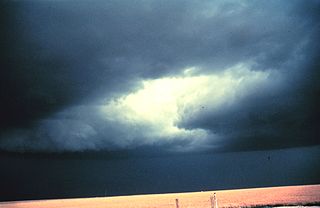
A severe thunderstorm warning is a type of public warning for severe weather that is issued by weather forecasting agencies worldwide when one or more severe thunderstorms have been detected by Doppler weather radar, observed by weather spotters, or reported by an emergency management agency, law enforcement, or the general public. Unlike a watch, a warning is issued to areas in the direct path of active severe thunderstorms, that are expecting a direct impact typically within an hour. Severe thunderstorms can cause property damage and injury due to large hail, high winds, and flooding due to torrential rainfall. The exact criteria to issue a warning varies from country to country.

<span class="mw-page-title-main">National Weather Service</span> U.S. forecasting agency of the National Oceanic and Atmospheric Administration

The National Weather Service (NWS) is an agency of the United States federal government that is tasked with providing weather forecasts, warnings of hazardous weather, and other weather-related products to organizations and the public for the purposes of protection, safety, and general information. It is a part of the National Oceanic and Atmospheric Administration (NOAA) branch of the Department of Commerce, and is headquartered in Silver Spring, Maryland, within the Washington metropolitan area. The agency was known as the United States Weather Bureau from 1890 until it adopted its current name in 1970.

<span class="mw-page-title-main">Storm Prediction Center</span> American severe weather forecasting center

The Storm Prediction Center (SPC) is a US government agency that is part of the National Centers for Environmental Prediction (NCEP), operating under the control of the National Weather Service (NWS), which in turn is part of the National Oceanic and Atmospheric Administration (NOAA) of the United States Department of Commerce (DoC).

<span class="mw-page-title-main">Gale warning</span> Weather forecast that includes a warning of a gale and high winds

A gale warning is an alert issued by national weather forecasting agencies around the world in an event that maritime locations currently or imminently experiencing winds of gale force on the Beaufort scale. Gale warnings allow mariners to take precautionary actions to ensure their safety at sea or to seek safe anchorage and ride out the storm on land. Though usually associated with deep low-pressure areas, winds strong enough to catalyze a gale warning can occur in other conditions too, including from anticyclones, or high-pressure systems, in the continental interior. The winds are not directly associated with a tropical cyclone.

The National Severe Storms Laboratory (NSSL) is a National Oceanic and Atmospheric Administration (NOAA) weather research laboratory under the Office of Oceanic and Atmospheric Research. It is one of seven NOAA Research Laboratories (RLs).

This article describes severe weather terminology used by the Meteorological Service of Canada, a branch within Environment and Climate Change Canada. The article primarily describes various weather warnings, and their criteria. Related weather scales and general weather terms are also addressed in this article. Some terms are specific to certain regions.

In weather forecasting in the United States, "particularly dangerous situation" (PDS) is enhanced wording used by the National Weather Service to convey special urgency in some watch or warning messages when there is a significant risk of extreme weather, most commonly from types of weather events that are usually less severe by comparison, such as a severe thunderstorm outbreak or flash flooding. It is used in the format "This is a particularly dangerous situation..." at the discretion of the issuing forecaster. A watch or warning bearing the phrase is referred to as a PDS watch or PDS warning as shorthand jargon.

A tornado emergency is an enhanced version of a tornado warning, which is used by the National Weather Service (NWS) in the United States during imminent, significant tornado occurrences in highly populated areas. Although it is not a new warning type from the NWS, issued instead within a severe weather statement or in the initial tornado warning, a tornado emergency generally means that significant, widespread damage is expected to occur and a high likelihood of numerous fatalities is expected with a large, strong to violent tornado.

A significant weather advisory was a hazardous weather statement issued by certain Weather Forecast Offices (WFO) of the National Weather Service (NWS) in the United States to alert the public of thunderstorm activity that is below designated severe criteria for and/or is not expected to produce severe weather. The title assigned to the advisory — alternately titled "significant weather alert" or referenced by its originating product, "special weather statement" — varied by the issuing WFO.

<span class="mw-page-title-main">Severe weather</span> Any dangerous meteorological phenomenon

Severe weather is any dangerous meteorological phenomenon with the potential to cause damage, serious social disruption, or loss of human life. Types of severe weather phenomena vary, depending on the latitude, altitude, topography, and atmospheric conditions. High winds, hail, excessive precipitation, and wildfires are forms and effects of severe weather, as are thunderstorms, downbursts, tornadoes, waterspouts, tropical cyclones, and extratropical cyclones. Regional and seasonal severe weather phenomena include blizzards (snowstorms), ice storms, and duststorms.

Convective storm detection is the meteorological observation, and short-term prediction, of deep moist convection (DMC). DMC describes atmospheric conditions producing single or clusters of large vertical extension clouds ranging from cumulus congestus to cumulonimbus, the latter producing thunderstorms associated with lightning and thunder. Those two types of clouds can produce severe weather at the surface and aloft.

A Special Weather Statement is a form of weather advisory. Special Weather Statements are issued by the National Weather Service of the United States (NWS) and the Meteorological Service of Canada (MSC). There are no set criteria for special weather statements in either country.

A weather warning generally refers to an alert issued by a meteorological agency to warn citizens of approaching dangerous weather. A weather watch, on the other hand, typically refers to an alert issued to indicate that conditions are favorable for the development of dangerous weather patterns, although the dangerous weather conditions themselves are not currently present.

<span class="mw-page-title-main">2010 New Year's Eve tornado outbreak</span> 2010 windstorm in the midwestern and southern United States

The 2010 New Year's Eve tornado outbreak was a three-day-long tornado outbreak that impacted the central and lower Mississippi Valley from December 30, 2010 to January 1, 2011. Associated with a low pressure system and a strong cold front, 37 tornadoes tracked across five states over the length of the severe event, killing nine and injuring several others. Activity was centered in the states of Missouri and later Mississippi on December 31. Seven tornadoes were rated EF3 on the Enhanced Fujita Scale; these were the strongest during the outbreak. Non-tornadic winds were recorded to have reached as high as 80 mph (130 km/h) at eight locations on December 31, while hail as large as 2.75 in (7.0 cm) was documented north-northeast of Mansfield, Missouri. Overall, damage from the outbreak totaled US$123.3 million, most of which was related to tornadoes. This is the most prolific tornado outbreak in Missouri in the month of December.

<span class="mw-page-title-main">National Weather Service Norman, Oklahoma</span> Weather Forecast Office of the National Weather Service

National Weather Service - Norman, Oklahoma is a Weather Forecast Office (WFO) of the National Weather Service based in Norman, Oklahoma, which is responsible for forecasts and the dissemination of weather warnings and advisories for central and most of western Oklahoma, and western portions of north Texas. It is located in the National Weather Center on the University of Oklahoma campus, where it acts as one of the NOAA Weather Partners, a group of close-together weather-related agencies of the National Oceanic and Atmospheric Administration. NWS Norman is currently overseen by Mark Fox, who serves as the Meteorologist In Charge of the office.

The following is a glossary of tornado terms. It includes scientific as well as selected informal terminology.

References

  1. 1 2 3 4 5 6 7 8 "NATIONAL WEATHER SERVICE INSTRUCTION 10-511: WFO SEVERE WEATHER PRODUCTS SPECIFICATION" (PDF). National Weather Service Analyze, Forecast, and Support Office. National Oceanic and Atmospheric Administration. April 15, 2020. Retrieved March 7, 2021.
  2. "National Weather Service glossary: Tornado Watch". National Weather Service. National Oceanic and Atmospheric Administration. June 25, 2009. Retrieved October 25, 2009.
  3. 1 2 "National Weather Service glossary: PDS". National Weather Service. National Oceanic and Atmospheric Administration. June 25, 2009. Retrieved October 25, 2009.
  4. "National Weather Service glossary: Tornado warning". National Weather Service. National Oceanic and Atmospheric Administration. June 25, 2009. Retrieved October 25, 2009.
  5. 1 2 3 "Impact Based Warnings". National Weather Service . National Oceanic and Atmospheric Administration. 2014. Retrieved March 12, 2014.
  6. "Many trapped, two dead as tornado hits nursing home in Arkansas -media". reuters.com. December 11, 2021. Archived from the original on December 11, 2021. Retrieved December 11, 2021.
  7. Kathryn Prociv; Nicole Acevedo (December 11, 2021). "'Quad-State Tornado' crossed four states in four hours, a rare December tornado". NBC News. Archived from the original on December 12, 2021. Retrieved December 12, 2021.
  8. "National Weather Service glossary: Severe thunderstorm watch". National Weather Service. National Oceanic and Atmospheric Administration. June 25, 2009. Retrieved October 25, 2009.
  9. "National Weather Service glossary: Severe thunderstorm warning". National Weather Service. National Oceanic and Atmospheric Administration. June 25, 2009. Retrieved October 25, 2009.
  10. "Severe Weather Statement". National Weather Service Cheyenne, Wyoming. August 16, 2019. Retrieved December 25, 2020 via Iowa Environmental Mesonet.
  11. 1 2 3 4 5 6 7 "NATIONAL WEATHER SERVICE INSTRUCTION 10-922: WEATHER FORECAST OFFICE WATER RESOURCES PRODUCTS SPECIFICATION" (PDF). National Weather Service Analyze, Forecast, and Support Office. National Oceanic and Atmospheric Administration. December 6, 2019. Retrieved January 7, 2020.
  12. "National Weather Service glossary: Flash Flood Warning". National Weather Service. National Oceanic and Atmospheric Administration. June 25, 2009. Retrieved October 25, 2009.
  13. 1 2 3 4 5 6 7 "NATIONAL WEATHER SERVICE INSTRUCTION 10-513: WFO WINTER WEATHER PRODUCTS SPECIFICATION" (PDF). National Weather Service Analyze, Forecast, and Support Office. National Oceanic and Atmospheric Administration. April 13, 2019. Retrieved January 7, 2020.
  14. "National Weather Service glossary: Blizzard warning". National Weather Service. National Oceanic and Atmospheric Administration. June 25, 2009. Retrieved October 25, 2009.
  15. "National Weather Service glossary: Winter storm warning". National Weather Service. National Oceanic and Atmospheric Administration. June 25, 2009. Retrieved October 25, 2009.
  16. "National Weather Service glossary: Ice Storm Warning". National Weather Service. National Oceanic and Atmospheric Administration. June 25, 2009. Retrieved October 25, 2009.
  17. "National Weather Service glossary: Winter storm watch". National Weather Service. National Oceanic and Atmospheric Administration. June 25, 2009. Retrieved October 25, 2009.
  18. "National Weather Service glossary: Winter Weather Advisory". National Weather Service. National Oceanic and Atmospheric Administration. June 25, 2009. Retrieved October 25, 2009.
  19. "National Weather Service glossary: Lake Effect Snow Warning". National Weather Service. National Oceanic and Atmospheric Administration. June 25, 2009. Retrieved October 25, 2009.
  20. "National Weather Service glossary: Snow Squall". National Weather Service. National Oceanic and Atmospheric Administration. June 25, 2009. Retrieved December 18, 2019.
  21. "National Weather Service glossary: Heavy Snow Warning". National Weather Service. National Oceanic and Atmospheric Administration. June 25, 2009. Retrieved October 25, 2009.
  22. "National Weather Service glossary: Sleet Warning". National Weather Service. National Oceanic and Atmospheric Administration. June 25, 2009. Retrieved October 25, 2009.
  23. "National Weather Service glossary: Snow Advisory". National Weather Service. National Oceanic and Atmospheric Administration. June 25, 2009. Retrieved October 25, 2009.
  24. "National Weather Service glossary: Blowing Snow Advisory". National Weather Service. National Oceanic and Atmospheric Administration. June 25, 2009. Retrieved October 25, 2009.
  25. "National Weather Service glossary: Flood Warning". National Weather Service. National Oceanic and Atmospheric Administration. June 25, 2009. Retrieved October 25, 2009.
  26. "National Weather Service glossary: Urban and Small Stream Flood Advisory". National Weather Service. National Oceanic and Atmospheric Administration. June 25, 2009. Retrieved October 25, 2009.
  27. 1 2 3 4 5 "NATIONAL WEATHER SERVICE INSTRUCTION 10-604: TROPICAL CYCLONE NAMES AND DEFINITIONS" (PDF). NWS Directives System. National Oceanic and Atmospheric Administration. May 10, 2018. Retrieved January 7, 2020.
  28. 1 2 Storm surge watch & warning to become operational in 2017 (PDF). National Hurricane Center (Report). National Oceanic and Atmospheric Administration. January 23, 2017. Retrieved August 24, 2017.
  29. "National Hurricane Center's views on the use of scales to communicate the storm surge hazard" (PDF). National Hurricane Center. National Oceanic and Atmospheric Administration. September 2012. Retrieved December 9, 2012.
  30. 1 2 3 4 5 6 7 8 9 10 11 12 13 14 15 16 17 18 19 20 21 22 "WFO NON-PRECIPITATION WEATHER PRODUCTS SPECIFICATION" (PDF). NWS Directives System. National Oceanic and Atmospheric Administration. November 18, 2011. pp. 6–7. Retrieved April 29, 2014.
  31. "National Weather Service glossary: Freezing Spray Advisory". National Weather Service. National Oceanic and Atmospheric Administration. October 14, 2010. Retrieved December 2, 2010.
  32. "National Weather Service glossary: Special Marine Warning". National Weather Service. National Oceanic and Atmospheric Administration. June 25, 2009. Retrieved October 25, 2009.
  33. "National Weather Service glossary: Excessive Heat Warning". National Weather Service. National Oceanic and Atmospheric Administration. June 25, 2009. Retrieved October 25, 2009.
  34. 1 2 "Weather Watch, Warning and Advisory Criteria". National Weather Service Baltimore-Washington. Retrieved January 7, 2020.
  35. "NWS Tests Extreme Cold Warning". The Weather Channel . The Weather Company LLC. January 4, 2011. Archived from the original on June 9, 2013.
  36. "National Weather Service ditching 'extreme cold' warnings". Bismarck Tribune . April 15, 2011.
  37. 1 2 "National Weather Service Public Information Statement PNS18-11" (PDF). Retrieved February 1, 2019.
  38. 1 2 "Update on Winter Weather Initiatives Partner Webinar" (PDF). Retrieved February 1, 2019.
  39. "National Weather Service glossary: Freeze Warning". National Weather Service. National Oceanic and Atmospheric Administration. June 25, 2009. Retrieved October 25, 2009.
  40. "National Weather Service glossary: Frost Advisory". National Weather Service. National Oceanic and Atmospheric Administration. June 25, 2009. Retrieved October 25, 2009.
  41. "National Weather Service glossary: Heat Advisory". National Weather Service. National Oceanic and Atmospheric Administration. June 25, 2009. Retrieved October 25, 2009.
  42. "National Weather Service glossary: Wind Chill Warning". National Weather Service. National Oceanic and Atmospheric Administration. June 25, 2009. Retrieved October 25, 2009.
  43. "National Weather Service glossary: Wind Chill Advisory". National Weather Service. National Oceanic and Atmospheric Administration. June 25, 2009. Retrieved October 25, 2009.
  44. 1 2 3 4 "ADDS SIGMET Help". Aviation Weather Center. National Oceanic and Atmospheric Administration. Retrieved April 29, 2014.
  45. "Washington, DC VAAC – Introduction". NOAA Satellite Information Service. National Oceanic and Atmospheric Administration. Retrieved April 29, 2014.
  46. 1 2 3 "NATIONAL WEATHER SERVICE INSTRUCTION 10-601: WEATHER FORECAST OFFICE TROPICAL CYCLONE PRODUCTS" (PDF). NWS Directives System. National Oceanic and Atmospheric Administration. June 1, 2019. Retrieved January 7, 2020.
  47. "National Weather Service glossary: Dense Fog Advisory". National Weather Service. National Oceanic and Atmospheric Administration. June 25, 2009. Retrieved October 25, 2009.
  48. "Product Descriptions". National Weather Service Boston, Massachusetts . Retrieved July 5, 2023.
  49. "NATIONAL WEATHER SERVICE INSTRUCTION 10-518: NON-WEATHER EMERGENCY PRODUCTS SPECIFICATION" (PDF). National Weather Service Analyze, Forecast, and Support Office. National Oceanic and Atmospheric Administration. August 5, 2019. Retrieved January 7, 2020.
  50. "Non-weather Related Emergency Messages". National Weather Service Memphis, Tennessee . Retrieved January 7, 2020.
  51. "National Weather Service glossary: Small Craft Advisory". National Weather Service. National Oceanic and Atmospheric Administration. June 25, 2009. Retrieved October 25, 2009.
  52. "National Weather Service glossary: Gale Warning". National Weather Service. National Oceanic and Atmospheric Administration. June 25, 2009. Retrieved October 25, 2009.
  53. "National Weather Service glossary: Storm Warning". National Weather Service. National Oceanic and Atmospheric Administration. June 25, 2009. Retrieved October 25, 2009.
  54. "National Weather Service glossary: Hurricane Force Wind Warning". National Weather Service. National Oceanic and Atmospheric Administration. June 25, 2009. Retrieved October 25, 2009.
  55. "National Weather Service glossary: Outlook". National Weather Service. National Oceanic and Atmospheric Administration. June 25, 2009. Retrieved October 25, 2009.
  56. "Weather Watch, Warning and Advisory Criteria". National Weather Service Weather Forecast Office Baltimore/Washington . Retrieved January 7, 2020.
  57. "National Weather Service glossary: Advisory". National Weather Service. National Oceanic and Atmospheric Administration. June 25, 2009. Retrieved October 25, 2009.
  58. 1 2 "Emergency Alert System (EAS) Event Codes/NWR Specific Area Message Encoding (NWR-SAME) Codes". National Weather Service. National Oceanic and Atmospheric Administration. October 11, 2005. Retrieved August 13, 2012.
  59. "National Weather Service glossary: Watch". National Weather Service. National Oceanic and Atmospheric Administration. June 25, 2009. Retrieved October 25, 2009.
  60. "National Weather Service glossary: Warning". National Weather Service. National Oceanic and Atmospheric Administration. June 25, 2009. Retrieved October 25, 2009.
  61. "SPC Products". Storm Prediction Center. National Oceanic and Atmospheric Administration. Retrieved January 7, 2020.
  62. 1 2 3 4 5 6 7 "National Weather Service Product Description Document: NWS Convective Warnings with the Impact-Based Warning Format" (PDF). National Weather Service Operations and Services. January 26, 2021. Retrieved February 26, 2021.
  63. "Service Change Notice 21-22" (PDF). National Weather Service Operations and Services. February 11, 2021. Retrieved February 26, 2021.
  64. 1 2 3 "National Weather Service Instruction 10-511: WFO Severe Weather Products Specification" (PDF). National Weather Service Operations and Services. August 20, 2018. Retrieved January 5, 2020.
  65. John D. Murphy (July 9, 2018). "National Weather Service Instruction 10-1605" (PDF). National Weather Service. pp. A74–A75. Retrieved February 16, 2021.
  66. 1 2 3 4 5 National Hurricane Center (June 22, 2006). "Saffir–Simpson Hurricane Scale Information". National Oceanic and Atmospheric Administration . Retrieved 2007-02-25.

PD-icon.svg This article incorporates public domain material from websites or documents of the National Oceanic and Atmospheric Administration .