Homewood is an unincorporated community and census-designated place (CDP) in Horry County, South Carolina, United States, just north of Conway in the northeastern part of the state. It was first listed as a CDP in the 2020 census with a population of 1,693.
Grandy is an unincorporated community and census-designated place (CDP) in Currituck County, North Carolina, USA. It was first listed as a CDP in the 2020 census with a population of 2,776. It is located along US 158 between the Currituck Sound and the North River.

Barnardsville is an unincorporated community and census-designated place (CDP) in Buncombe County, North Carolina, United States. It was first listed as a CDP in the 2020 census with a population of 559.

Alexis is an unincorporated community and census-designated place (CDP) in Gaston County, North Carolina, United States. It is located approximately three miles north of Stanley. It was first listed as a CDP in the 2020 census with a population of 589.

Ketchuptown is a historic unincorporated community and census-designated place (CDP) located in Horry County, South Carolina, United States. Ketchuptown is at the intersection of Highways 23 and 99, about 9 miles (14 km) north of Aynor. As of the 2020 census, it had a population of 84.
DeBordieu Colony, DeBordieu Beach or simply DeBordieu is a private, unincorporated community and census-designated place (CDP) in Georgetown County, South Carolina, United States. It consists of approximately 2,700 acres (11 km2) of land, of which roughly 800 acres is wildlife preserve inaccessible to the citizens of Georgetown County. Parts of DeBordieu lie on Debidue Island. DeBordieu is located south of Pawleys Island and north of Georgetown east of U.S. Route 17. It is an oceanfront gated community with a private golf and country club.

Hamer is an unincorporated community and census-designated place (CDP) in Dillon County, South Carolina, United States. It was first listed as a CDP in the 2020 census with a population of 820.
Caesars Head is an unincorporated community and census-designated place (CDP) on top of Caesars Head, a mountain in Greenville County, South Carolina, United States. It was first listed as a CDP in the 2020 census with a population of 84.
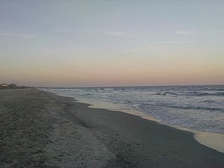
Litchfield Beach, also known simply as Litchfield, is an unincorporated community and census-designated place (CDP) in South Carolina, United States. It was first listed as a CDP in the 2020 census with a population of 8,370.
Milwaukee is an unincorporated community and census-designated place (CDP) in Northampton County, North Carolina, United States. It was first listed as a CDP in the 2020 census with a population of 157.
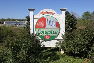
Conestee is an unincorporated community and census-designated place (CDP) in Greenville County, South Carolina, United States. It was first listed as a CDP in the 2020 census with a population of 904.

Jackson Springs is an unincorporated community and census-designated place (CDP) in Moore County, North Carolina, United States. It was first listed as a CDP in the 2020 census with a population of 154.

Farmington is an unincorporated community and census-designated place (CDP) in Davie County, North Carolina, United States, located at the intersection of NC 801 and Farmington Road (SR 1410). It was first listed as a CDP in the 2020 census with a population of 291. Located nearby is the Farmington Dragway.
Emma is an unincorporated community and census-designated place (CDP) in Buncombe County, North Carolina, United States. It was first listed as a CDP in the 2020 census with a population of 2,174.
Long Creek is an unincorporated community and census-designated place (CDP) in Pender County, North Carolina, United States. It was first listed as a CDP in the 2020 census with a population of 277.
Finklea is an unincorporated community and census-designated place (CDP) in Horry County, South Carolina, United States. As of the 2020 census it had a population of 291.
White Knoll is an unincorporated area and census-designated place (CDP) in Lexington County, South Carolina, United States. It was first listed as a CDP prior to the 2020 census with a population of 7,858.
Arkwright is an unincorporated area and census-designated place (CDP) adjacent to the city of Spartanburg in Spartanburg County, South Carolina, United States. It was first listed as a CDP prior to the 2020 census with a population of 2,311.
Ben Avon is an unincorporated area and census-designated place (CDP) adjacent to the city of Spartanburg in Spartanburg County, South Carolina, United States. It was first listed as a CDP prior to the 2020 census. The population as of 2020 was 2,428.
Whitney is an unincorporated area and census-designated place (CDP) adjacent to the city of Spartanburg in Spartanburg County, South Carolina, United States. It was first listed as a CDP prior to the 2020 census with a population of 4,409.

