Cramerton, North Carolina

Last updated

Cramerton, North Carolina
Seal of Cramerton, North Carolina.jpg
NCMap-doton-Cramerton.PNG
Location of Cramerton, North Carolina
Coordinates: 35°13′44″N81°04′18″W / 35.22889°N 81.07167°W / 35.22889; -81.07167
Country Flag of the United States (23px).png  United States
State Flag of North Carolina.svg  North Carolina
County Gaston
Government
  TypeCommissioner-Manager Form of Government
  MayorNelson Wills
  Mayor Pro TemporeRichard Atkinson
  CommissionersDr. Dixie Abernathy, Scott Kincaid, Kathy Ramsey and Jennifer Ramsey
Area
[1]
  Total4.94 sq mi (12.80 km2)
  Land4.64 sq mi (12.03 km2)
  Water0.30 sq mi (0.78 km2)
Elevation
[2]
571 ft (174 m)
Population
 (2020)
  Total5,296
  Density1,140.64/sq mi (440.38/km2)
Time zone UTC-5 (Eastern (EST))
  Summer (DST) UTC-4 (EDT)
ZIP code
28032 and a portion of 28012
Area code 704
FIPS code 37-15260 [3]
GNIS feature ID2406332 [2]
Website www.cramerton.org

Cramerton is a small town in Gaston County, North Carolina, United States. It is a suburb of Charlotte and located east of Gastonia. The population was 4,165 at the 2010 census. [4] A well-known feature is the Cramer Mountain gated development, featuring homes around an 18-hole golf course at Cramer Mountain Country Club.

Contents

Geography

Cramerton is located at an elevation of 620 feet (189 m). Two topographic high points, Berry Mountain, elevation 922 feet (281 m), and Cramer Mountain, approximate elevation 850 feet (259 m), are located in the southwestern part of town.

According to the United States Census Bureau, the town has a total area of 4.0 square miles (10.3 km2), of which 3.7 square miles (9.5 km2) is land and 0.31 square miles (0.8 km2), or 7.51%, is water. [4]

Cramerton is bisected by the South Fork Catawba River, which makes a sharp S-curve around the center of town. Just southwest of downtown, Duharts Creek flows into the South Fork Catawba. Duharts Creek is formed by the confluence of Armstrong Branch and New Hope Branch on the western edge of town. [5]

Cramerton town limits include a portion of zip code 28012 that encompass the neighborhood of Lakewood and Stuart W. Cramer High School on the eastern shore of the South Fork River. [6]

The town is located seven miles east of Gastonia and 16 miles west of Charlotte.

History

Originally named Mayesworth, [7] the town was founded in 1906 when J.H. Mayes built a spinning mill along the banks of the South Fork of the Catawba River, just east of Gastonia. In 1910, textile engineer and Thomasville native Stuart Warren Cramer became owner and president of the mill and property. He turned the mill and the surrounding community into a model mill village. [8] In 1921, Cramer changed the name of the town to Cramerton, and the name of the mill to Cramerton Mills in 1922. [9] In 1923, Cramer built the Mayflower Weave Mill.

Cramer is credited with designing and equipping "about one-third of the new cotton mills in the South" between 1895 and 1915, and simultaneously acquiring extensive holdings in textile mills. Among Cramer's numerous industrial engineering patents was one for the "Cramer System of Air Conditioning", which included the automatic regulation of temperature and humidity. These early innovations in air conditioning resulted more from the need to remove lint from the air (a persistent problem in the textile mills) than to cool the factory atmosphere. The term "air conditioning" is attributed to Cramer. [10]

In 1946 the mills and homes were sold to Burlington Industries, who in turn sold the homes to residents. The Town of Cramerton incorporated in 1967 and began providing municipal services. [11]

In 1997, a luxury home on Cramer Mountain was briefly the residence Steven Eugene Chambers, a participant in the October 1997 Loomis Fargo robbery. [12] The Mayworth School was listed on the National Register of Historic Places in 2002. [13]

Demographics

Historical population
CensusPop.Note
1950 3,211
1960 3,123−2.7%
1970 2,142−31.4%
1980 1,869−12.7%
1990 2,37126.9%
2000 2,97625.5%
2010 4,16540.0%
2020 5,29627.2%
U.S. Decennial Census [14]

2020 census

Cramerton racial composition [15]
RaceNumberPercentage
White (non-Hispanic)4,21379.55%
Black or African American (non-Hispanic)4658.78%
Native American 200.38%
Asian 1603.02%
Pacific Islander 10.02%
Other/Mixed 2164.08%
Hispanic or Latino 2214.17%

As of the 2020 United States census, there were 5,296 people, 1,637 households, and 1,165 families residing in the town.

2000 census

As of the census [3] of 2000, there were 2,976 people, 1,169 households, and 859 families residing in the town. The population density was 830.5 inhabitants per square mile (320.7/km2). There were 1,229 housing units at an average density of 343.0 per square mile (132.4/km2). The racial makeup of the town was 94.12% White, 2.35% African American, 0.50% Native American, 1.92% Asian, 0.20% from other races, and 0.91% from two or more races. Hispanic or Latino of any race were 0.37% of the population.

There were 1,169 households, out of which 35.4% had children under the age of 18 living with them, 60.7% were married couples living together, 9.8% had a female householder with no husband present, and 26.5% were non-families. 22.2% of all households were made up of individuals, and 10.0% had someone living alone who was 65 years of age or older. The average household size was 2.54 and the average family size was 2.97.

In the town, the population was spread out, with 25.9% under the age of 18, 5.8% from 18 to 24, 31.7% from 25 to 44, 25.1% from 45 to 64, and 11.5% who were 65 years of age or older. The median age was 37 years. For every 100 females, there were 91.6 males. For every 100 females age 18 and over, there were 88.1 males.

The median income for a household in the town was $47,610, and the median income for a family was $56,071. Males had a median income of $37,679 versus $27,330 for females. The per capita income for the town was $25,503. About 3.3% of families and 4.9% of the population were below the poverty line, including 4.2% of those under age 18 and 10.9% of those age 65 or over.

Government

Cramerton operates under the council-manager form of government with a mayor and a five-member town board and a town manager. In 2011, after 50 years of service, the town ended its contract with the Cramerton Volunteer Fire Department. The town then worked to create a new town-managed department that provides fire protection for Cramerton as well as neighboring McAdenville. The new Town of Cramerton Fire Department has been in place since 2012.

Cramerton operates its own police department. Based on a contract signed in 2006 by both the McAdenville and Cramerton town councils, officers of the Cramerton Police Department also handle patrol duties within the McAdenville town limits between the hours of 6 PM and 6 AM daily. Cramerton police also assist McAdenville officers with felony criminal investigations. [16]

Cramerton is in South Point Township.

Business and industry

The textile industry has long been central to Cramerton's economy, but globalization has caused many of the local plants to close and devastated the local economy. Burlington Industries, which had operated the former Cramerton Mills, went bankrupt in 2001. Employers like Eagle Mountain Finishers and Lakewood Dyed Yarns (both subsidiaries of Joan Fabrics Corp.) were closed in 2006 and 2007. [17] Textile companies Brookline Inc. and Wagner Knitting, Inc., have also been affected by the economic downturn. Syncot Fibers and Plastics, Inc., operates a facility in Cramerton specializing in the recycling of nylon.

In the twenty-first century, like many nearby communities affected by the exit of many businesses in the textile industry, the town has seen some significant growth and revitalization in the years following the aftermath of the 2007–2008 financial crisis. As a suburb of the greater Gaston and Charlotte area, the town is within commuting distance for workers of businesses within other industries, such as financial and banking services, technology, travel and tourism, and retail.

Within Cramerton, especially in the Downtown district, there are a number of companies operating within the restaurant, coffee shop, retail, and recreational-related industries. The downtown area includes Cramerton's Centennial Park (which includes the Veteran's Memorial) and Goat Island Park (which is accessible by two foot bridges); these attractions are intended to bring visitors to the area that support the local businesses.

The Gaston Business Association and Montcross Area Chamber of Commerce are the major commerce associations of businesses representing Cramerton and other communities. [18] [19]

Transportation

The primary east–west highway passing through Cramerton is U.S. Route 29/U.S. Route 74 (Wilkinson Boulevard). North Carolina Highway 279 (New Hope Road) forms Cramerton's southwest border.

Freight rail service is provided by the Norfolk Southern Railway. While Amtrak's passenger train also follows the Norfolk Southern main line, the nearest station is in Charlotte. The Gastonia station is closed.

Charlotte Area Transit System's (CATS) Gastonia Express (Route 85X) offers Monday thru Friday express bus service to/from uptown Charlotte, via the Abbey Plaza Shopping Center Station in Belmont, about 3 miles (5 km) east of Cramerton. [20]

The nearest airport is Charlotte/Douglas International Airport in Mecklenburg County, about 9.5 miles (15.3 km) east of Cramerton.

Education

Public education in Cramerton is administered by the Gaston County Schools public school system.

Elementary school-age children in Cramerton attend either New Hope Elementary School (south of Cramerton in unincorporated South Point Township), J.B. Page Elementary School (pre-K to grade 1) or Belmont Central Elementary School (grades 2–5) in Belmont, McAdenville Elementary School in McAdenville, or Gardner Park Elementary School in Gastonia.

Most middle school students attend Cramerton Middle School. Portions of the town are zoned to Holbrook Middle School in Lowell or Belmont Middle School in Belmont.

Current high school-age students attend Stuart W. Cramer High School. While the school is located in Cramerton, it has a Belmont mailing address because it is in zip code 28012, which is split between Cramerton and Belmont.

Private schools in Cramerton include Cramerton Christian Academy, with programs for Pre-K through Grade 12. It is operated by Cramerton Freewill Baptist Church.

Recreation

The town has a history of golfing as a recreational activity, which was supported by the town's founder Stuart W. Cramer. Historically, the town has had three golfing courses, with the fourth golfing course being built by Cramer on Cramer Mountain. The Cramer Mountain golf course is still in active operation, and is operated by the private member club "Cramer Mountain Club". The Cramer Mountain golf course was designed by renown golfing course architect Dan Maples, a member of the American Society of Golf Course Architects. [21]

Since the town is situated along the South Fork Catawba River, it also has an active recreational culture of waterspouts, such as kayaking and canoeing. The Goat Island Park in Cramerton also features an 18-hole Disc Golf course. [22]

Points of interest

Mayworth School at 236 Eighth Avenue in Cramerton is listed on the National Register of Historic Places. [23]

Notable people

Related Research Articles

<span class="mw-page-title-main">Lincoln County, North Carolina</span> County in North Carolina, United States

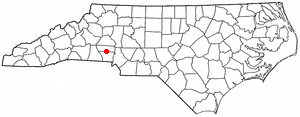
Lincoln County is a county located in the U.S. state of North Carolina. As of the 2020 census, the population was 86,810, making it the most populous "Lincoln County" in the United States. Its county seat is Lincolnton.

<span class="mw-page-title-main">Gaston County, North Carolina</span> County in North Carolina, United States

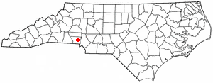
Gaston County is a county in the U.S. state of North Carolina. As of the 2020 census, the population was 227,943. The county seat is Gastonia. Dallas served as the original county seat from 1846 until 1911.

<span class="mw-page-title-main">Belmont, North Carolina</span> City in North Carolina, United States

Belmont is a small suburban city in Gaston County, North Carolina, United States, located about 9 miles (14 km) east of Gastonia. The population was 10,076 at the 2010 census. Once known as Garibaldi Station, it was named for the New York banker August Belmont. Belmont is home to Belmont Abbey College.

<span class="mw-page-title-main">Bessemer City, North Carolina</span> City in North Carolina, United States

Bessemer City is a small suburban city in Gaston County, North Carolina, United States. The population is 5,340. The city is approximately 6 miles (10 km) northwest of Gastonia and 25 miles (40 km) west of Charlotte. It was settled in 1756 and founded in 1893.

<span class="mw-page-title-main">Cherryville, North Carolina</span> City in North Carolina, United States

Cherryville is a city in northwestern Gaston County, North Carolina, United States. The population was 5,760 at the 2010 census. The New Year's Shooters celebrate the area's German heritage by beginning each year with a customary chant and the honorary shooting of muskets. Cherryville is located approximately 38 miles (61 km) west of Charlotte and 16 miles (26 km) northwest of Gastonia.

<span class="mw-page-title-main">Dallas, North Carolina</span> Town in North Carolina, United States

Dallas is a town in Gaston County, North Carolina, United States, and a suburb of Charlotte, located north of Gastonia. The population was 4,488 at the 2010 census. It was named for George M. Dallas, Vice President of the United States under James K. Polk.

<span class="mw-page-title-main">Gastonia, North Carolina</span> City in North Carolina, United States

Gastonia is the most populous city in and county seat of Gaston County, North Carolina, United States. It is the second-largest satellite city of the Charlotte area, behind Concord. The population was 80,411 in the 2020 census, up from 71,741 in 2010. Gastonia is the 13th-most populous city in North Carolina. It is part of the Charlotte-Concord-Gastonia, NC-SC Metropolitan Statistical Area, which is part of the Charlotte-Concord, NC-SC Combined Statistical Area.

<span class="mw-page-title-main">High Shoals, North Carolina</span> City in North Carolina, United States

High Shoals is a city in Gaston County, North Carolina, United States, named for the high rocky shoal across the Catawba River. The population was 696 at the 2010 census.

<span class="mw-page-title-main">Lowell, North Carolina</span> City in North Carolina, United States

Lowell is a small city in Gaston County, North Carolina, United States, located east of Gastonia. The population was 3,526 at the 2010 census.

<span class="mw-page-title-main">McAdenville, North Carolina</span> Town in North Carolina, United States

McAdenville is a small town in Gaston County, North Carolina, United States. It is a suburb of Gastonia and located east of Gastonia. The population was 890 at the 2020 census.

<span class="mw-page-title-main">Mount Holly, North Carolina</span> City in North Carolina, United States

Mount Holly is a small suburban city in northeastern Gaston County, North Carolina, United States. The city is situated just west of the Catawba River, north of Interstate 85, south of North Carolina State Highway 16. The population was 17,703 at the 2020 census, up from 13,656 in 2010.

<span class="mw-page-title-main">Lincolnton, North Carolina</span> City in North Carolina, United States

Lincolnton is a city in Lincoln County, North Carolina, United States within the Charlotte metropolitan area. The population was 10,486 at the 2010 census. Lincolnton is northwest of Charlotte, on the South Fork of the Catawba River. The city is the county seat of Lincoln County.

<span class="mw-page-title-main">North Carolina Highway 7</span> State highway in Gaston County, North Carolina, US

North Carolina Highway 7 (NC 7) is a primary state highway in the U.S. state of North Carolina. Entirely within Gaston County, it connects the towns of Lowell, McAdenville, and Belmont with the city of Gastonia.

The South Fork Catawba River begins south of Hickory, North Carolina just northwest of the intersection of US Highway 321 and North Carolina Highway 10, at the confluence of the Henry Fork and Jacob Fork located adjacent to the east side of the Jacob Fork Newton City Park. The South Fork Catawba River travels 48.5 miles, passing along the communities of Lincolnton, High Shoals, McAdenville, and Cramerton, to Lake Wylie where its now submerged confluence with the Catawba River lies near the North Carolina and South Carolina border.

Gaston County Schools is a public school district located in Gaston County, North Carolina. With 30,046 students enrolled in 56 schools as of the 2021–22 academic year, it is the tenth largest public school district in North Carolina.

<span class="mw-page-title-main">South Point High School (North Carolina)</span> Public high school in Belmont, North Carolina, United States

South Point High School is a public high school in Belmont, North Carolina, United States. It was established in 1964 and is part of the Gaston County Schools district.

South Point Township is a township in southeastern Gaston County, North Carolina, United States. It is represented on the Gaston County Board of Commissioners by Ronnie Worley of Cramerton. As of the 2010 census it had a population of 40,484.

<span class="mw-page-title-main">Stuart W. Cramer</span> American architect

Stuart Warren Cramer was an American engineer, inventor, and contractor, who gained prominence after designing and building near 150 cotton mills in the southern United States. He was the founder of Cramerton, North Carolina and became involved in the nascent air conditioning industry, as well as being a founding partner in Duke Power.

Stuart W. Cramer High School is a public high school in the Gaston County Schools district located in Cramerton, North Carolina. Its attendance range covers the central portion of eastern Gaston County and includes all of the towns of Cramerton and McAdenville and portions of Belmont and Mount Holly. Jessica Steiner serves as principal. Assistant principals include Brittany Beckham, Phillip Morris and Chris Gardner. Mike Patton serves as athletic director. The school was named for Stuart W. Cramer of Thomasville, North Carolina. Cramer was the founder of Cramerton, North Carolina, a leading industrialist in the textiles and air conditioning industries, and one of the founding partners of Duke Power.

References

  1. "ArcGIS REST Services Directory". United States Census Bureau. Retrieved September 20, 2022.
  2. 1 2 U.S. Geological Survey Geographic Names Information System: Cramerton, North Carolina
  3. 1 2 "U.S. Census website". United States Census Bureau . Retrieved January 31, 2008.
  4. 1 2 "Geographic Identifiers: 2010 Demographic Profile Data (G001): Cramerton town, North Carolina". U.S. Census Bureau, American Factfinder. Archived from the original on February 12, 2020. Retrieved March 27, 2013.
  5. Cramerton Watershed Archived May 2, 2007, at the Wayback Machine , Gaston County government website.
  6. Google Map of Cramerton
  7. "1905 - 1915". Cramerton Historical Society. Retrieved February 14, 2024.
  8. Moore, Maddie. "LibGuides: Gaston County History: Cities & Towns: Cramerton". gastonlibrary.libguides.com. Retrieved February 14, 2024.
  9. "1915 - 1926". Cramerton Historical Society. Retrieved February 14, 2024.
  10. The Parks-Cramer Company Complex Archived October 4, 2006, at the Wayback Machine , Charlotte-Mecklenburg Historic Landmarks Commission. Retrieved on July 3, 2008
  11. Cramerton Online, official town government website. Retrieved on July 1, 2008
  12. "25 years later: The Loomis Fargo heist". wcnc.com. October 4, 2022. Retrieved February 14, 2024.
  13. "National Register Information System". National Register of Historic Places . National Park Service. July 9, 2010.
  14. "Census of Population and Housing". Census.gov. Retrieved June 4, 2015.
  15. "Explore Census Data". data.census.gov. Retrieved December 20, 2021.
  16. Cramerton-McAdenville Contract Police Services Archived September 5, 2008, at the Wayback Machine , Cramerton Police Department Website. Retrieved on July 21, 2008.
  17. Thomas J. Monigan. "Cramerton hopes to turn loss of industry into economic gain" Archived February 15, 2009, at the Wayback Machine , Gaston Gazette, August 14, 2007. Retrieved on July 21, 2008.
  18. Gaston Business Association
  19. Montcross Area Chamber of Commerce | Cramerton, NC
  20. Route 85X
  21. Cramerton's Golf Legacy
  22. Cramerton's Goat Island Park
  23. National Register of Historic Places-Gaston County