Dellview, North Carolina

Last updated

Dellview, North Carolina
NCMap-doton-Cherryville.PNG
Location in the U.S. state of North Carolina
Coordinates: 35°23′12″N81°24′46″W / 35.38667°N 81.41278°W / 35.38667; -81.41278
Country United States
State North Carolina
County Gaston
Area
[1]
  Total0.11 sq mi (0.29 km2)
  Land0.11 sq mi (0.29 km2)
  Water0.00 sq mi (0.00 km2)
Elevation
[2]
961 ft (293 m)
Population
 (2020)
  Total6
  Density53.10/sq mi (20.48/km2)
Time zone UTC-5 (Eastern (EST))
  Summer (DST) UTC-4 (EDT)
ZIP code
28021 [3]
Area code 704
FIPS code 37-16820 [4]
GNIS feature ID2406373 [2] US Board on Geographic Names. United States Geological Survey.

Dellview is an inactive incorporated town in Gaston County, North Carolina, United States. Its population was 13 at the 2010 census [5] but dropped to 6 as of the 2020 census. [6]

Contents

Dellview is located in the Muddy Fork watershed, a tributary of Buffalo Creek flowing to the Broad River in South Carolina. The town collects no taxes from its residents, almost all of whom are relatives. Dellview also doesn't request any state money. The town has no police department, nor a water or sewer system. [7] Since it is inactive, the town has no elected officials or municipal elections, [8] and is now governed by Gaston County.

Dellview Road, the community's only paved road, forms the town's northern border. North of it lies the town of Cherryville. [9]

Demographics

Historical population
CensusPop.Note
2020 6
U.S. Decennial Census [10]

History

Dellview was incorporated as a town in 1925 as a political gesture. Gaston County law prohibited the shooting of stray dogs that crossed onto a citizen's land. The law was disliked by two families of the Dellinger name, who were both poultry farmers. They complained that stray dogs were raiding their chicken coops on their farms, which neighbored each other. To remedy the situation, the Dellingers petitioned fellow kinsman David R. Dellinger, who was a North Carolina state representative, to propose a bill to the General Assembly for incorporating the Dellinger's farms into a town known as "Dellview" (the clipped form of Dellinger merged with the word "view"). The bill passed, formally incorporating the town in 1925. Immediately thereafter, the town leaders passed an ordinance allowing for the citizens to shoot any stray dog that crosses onto their property. [11]

No one for Dellview responded to a Census Mapping Survey in 1978, and as a result, the town was declared inactive, and thereby the governing rights were transferred fully back to Gaston County. In 1980, the decision was reversed after a citizen petitioned, but the town was declared inactive once again on the Census 2000. [12] For many years, the town of Dellview enjoyed the distinction of being the smallest incorporated community in the state. [13] [11]

Related Research Articles

<span class="mw-page-title-main">Gaston County, North Carolina</span> County in North Carolina, United States

Gaston County is a county in the U.S. state of North Carolina. As of the 2020 census, the population was 227,943. The county seat is Gastonia. Dallas served as the original county seat from 1846 until 1911.

<span class="mw-page-title-main">Belmont, North Carolina</span> City in North Carolina, United States

Belmont is a small suburban city in Gaston County, North Carolina, United States, located about 9 miles (14 km) east of Gastonia. The population was 10,076 at the 2010 census. Once known as Garibaldi Station, it was named for the New York banker August Belmont. Belmont is home to Belmont Abbey College.

<span class="mw-page-title-main">Bessemer City, North Carolina</span> City in North Carolina, United States

Bessemer City is a small suburban city in Gaston County, North Carolina, United States. The population is 5,340. The city is approximately 6 miles (10 km) northwest of Gastonia and 25 miles (40 km) west of Charlotte. It was settled in 1756 and founded in 1893.

<span class="mw-page-title-main">Cherryville, North Carolina</span> City in North Carolina, United States

Cherryville is a city in northwestern Gaston County, North Carolina, United States. The population was 5,760 at the 2010 census. The New Year's Shooters celebrate the area's German heritage by beginning each year with a customary chant and the honorary shooting of muskets. Cherryville is located approximately 38 miles (61 km) west of Charlotte and 16 miles (26 km) northwest of Gastonia.

<span class="mw-page-title-main">Dallas, North Carolina</span> Town in North Carolina, United States

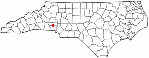
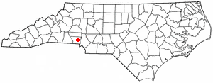
Dallas is a town in Gaston County, North Carolina, United States, and a suburb of Charlotte, located north of Gastonia. The population was 4,488 at the 2010 census. It was named for George M. Dallas, Vice President of the United States under James K. Polk.

<span class="mw-page-title-main">Gastonia, North Carolina</span> City in North Carolina, United States

Gastonia is the most populous city in and county seat of Gaston County, North Carolina, United States. It is the second-largest satellite city of the Charlotte area, behind Concord. The population was 80,411 in the 2020 census, up from 71,741 in 2010. Gastonia is the 13th-most populous city in North Carolina. It is part of the Charlotte-Concord-Gastonia, NC-SC Metropolitan Statistical Area, which is part of the Charlotte-Concord, NC-SC Combined Statistical Area.

<span class="mw-page-title-main">High Shoals, North Carolina</span> City in North Carolina, United States

High Shoals is a city in Gaston County, North Carolina, United States, named for the high rocky shoal across the Catawba River. The population was 696 at the 2010 census.

<span class="mw-page-title-main">Lowell, North Carolina</span> City in North Carolina, United States

Lowell is a small city in Gaston County, North Carolina, United States, located east of Gastonia. The population was 3,526 at the 2010 census.

<span class="mw-page-title-main">Mount Holly, North Carolina</span> City in North Carolina, United States

Mount Holly is a small suburban city in northeastern Gaston County, North Carolina, United States. The city is situated just west of the Catawba River, north of Interstate 85, south of North Carolina State Highway 16. The population was 17,703 at the 2020 census, up from 13,656 in 2010.

<span class="mw-page-title-main">Spencer Mountain, North Carolina</span> Town in North Carolina, United States

Spencer Mountain is a town in Gaston County, North Carolina, United States. The population was 37 at the 2010 census.

<span class="mw-page-title-main">Creedmoor, North Carolina</span> City in North Carolina, United States

Creedmoor is a city in Granville County, North Carolina, United States. The population was 4,124 at the 2010 census.

<span class="mw-page-title-main">Maggie Valley, North Carolina</span> Town in North Carolina, United States

Maggie Valley is a town in Haywood County, North Carolina, United States. The population was 1,687 at the 2020 census. A popular tourist destination, it is home to Cataloochee Ski Area and the former Ghost Town in the Sky amusement park. Maggie Valley is part of the Asheville metropolitan area.

<span class="mw-page-title-main">Wake Forest, North Carolina</span> Town in North Carolina, United States

Wake Forest is a town in Franklin and Wake counties in the U.S. state of North Carolina; located almost entirely in Wake County, it lies just north of the state capital, Raleigh. At the 2020 census, the population was 47,601, up from 30,117 in 2010. It is part of the Raleigh metropolitan area. Wake Forest was the original home of Wake Forest University for 122 years before it moved to Winston-Salem in 1956.

<span class="mw-page-title-main">Virgilina, Virginia</span> Town in Virginia, United States

Virgilina is a town in Halifax County, Virginia, United States. The population was 154 at the 2010 census. Virgilina was once a copper mining town. It was a stop on the Atlantic and Danville Railway as recently as the 1950s. It is named "Virgilina" because it is located on the Virginia and North Carolina border.

<span class="mw-page-title-main">Archdale, North Carolina</span> City in North Carolina, United States

Archdale is a city in Guilford and Randolph counties in the U.S. state of North Carolina. Located 15 miles southwest of Greensboro, it is part of the Greensboro-High Point Metropolitan Statistical Area of the Piedmont Triad metro region. The population of the city was 11,907 at the 2020 census.

Cherryville Township is a township in northwestern Gaston County, North Carolina, United States. As of the 2010 census it had a population of 16,500. It includes the incorporated city of Cherryville, the inactive incorporated town of Dellview, the unincorporated community of Tryon, and a portion of the town of High Shoals. It is represented on the Gaston County Board of Commissioners by Allen Fraley of Cherryville.

Dallas Township is a township in north-central Gaston County, North Carolina, United States. As of the 2010 census it had a population of 21,436. It includes the incorporated towns of Dallas, High Shoals, and Stanley. It also includes small portions of the city of Gastonia and a small outlying portion of the town of Ranlo. Unincorporated areas in the township include Alexis, Hardins, Ashebrook Park, and Vinton Woods.

Riverbend Township is a township in northeastern Gaston County, North Carolina, United States. As of the 2010 census, it had a population of 26,596.

South Point Township is a township in southeastern Gaston County, North Carolina, United States. It is represented on the Gaston County Board of Commissioners by Ronnie Worley of Cramerton. As of the 2010 census it had a population of 40,484.

<span class="mw-page-title-main">North Carolina's 14th congressional district</span> U.S. House district for North Carolina

North Carolina's 14th congressional district is a congressional district in the United States House of Representatives created after the 2020 United States census. The newly created district was drawn by a three-judge panel in the Wake County Superior Court as part of a remedial map for the 2022 United States House of Representatives elections. It covers the southern half of Mecklenburg County and three-fourths of Gaston County. It includes most of Charlotte, as well as Gastonia, Mount Holly, and Belmont.

References

  1. "ArcGIS REST Services Directory". United States Census Bureau. Retrieved September 20, 2022.
  2. 1 2 U.S. Geological Survey Geographic Names Information System: Dellview, North Carolina
  3. "Dellview NC ZIP Code". zipdatamaps.com. 2023. Retrieved February 17, 2023.
  4. "U.S. Census website". United States Census Bureau . Retrieved January 31, 2008.
  5. "Geographic Identifiers: 2010 Demographic Profile Data (G001): Dellview town, North Carolina". U.S. Census Bureau, American Factfinder. Archived from the original on February 12, 2020. Retrieved March 27, 2013.
  6. Stradling, Richard (August 12, 2021). "Adjust your scorecard: These are NC's largest cities, new census count says". The News & Observer. Archived from the original on August 12, 2021.
  7. "Gaston County: Natural Resources: Muddy Creek Watershed". Archived from the original on May 2, 2007. Retrieved April 15, 2007.
  8. Gaston County Municipal elections: Dellview
  9. "Gaston County planning maps: Dellview (PDF)" (PDF). Archived from the original (PDF) on September 28, 2007. Retrieved April 15, 2007.
  10. "Census of Population and Housing". Census.gov. Retrieved June 4, 2016.
  11. 1 2 "Local History Articles by Robert Ragan: Robert Ragan Jan. 14, 2001 - Dec. 30, 2001". Gaston County Public Library. Archived from the original on December 24, 2014.
  12. Census.gov : Geographic Boundary Changes (37 North Carolina)
  13. Gaston County: Municipalities Archived December 22, 2008, at the Wayback Machine

35°23′12″N81°24′46″W / 35.38667°N 81.41278°W / 35.38667; -81.41278