Cumberland County, North Carolina

Last updated

Cumberland County
Cumberland County, North Carolina courthouse.jpg
Cumberland County Courthouse in Fayetteville
Flag of Cumberland County North Carolina.png
Cumberland County nc seal.png
Cumberland County Logo.png
Motto(s): 
"Out Of Many, One"
Map of North Carolina highlighting Cumberland County.svg
Location within the U.S. state of North Carolina
North Carolina in United States.svg
North Carolina's location within the U.S.
Coordinates: 35°03′N78°50′W / 35.05°N 78.83°W / 35.05; -78.83
CountryFlag of the United States.svg United States
StateFlag of North Carolina.svg  North Carolina
Founded1754
Named for Prince William, Duke of Cumberland
Seat Fayetteville
Largest communityFayetteville
Area
  Total658.48 sq mi (1,705.5 km2)
  Land652.56 sq mi (1,690.1 km2)
  Water5.92 sq mi (15.3 km2)  0.90%
Population
 (2020)
  Total334,728
  Estimate 
(2023)
337,890
  Density513.4/sq mi (198.2/km2)
Time zone UTC−5 (Eastern)
  Summer (DST) UTC−4 (EDT)
Congressional districts 7th, 9th
Website www.cumberlandcountync.gov

Cumberland County is a county located in the U.S. state of North Carolina. As of the 2020 census, the population was 334,728, [1] making it the fifth-most populous county in North Carolina. Its county seat is Fayetteville. [2] Cumberland County is part of the Fayetteville, NC Metropolitan Statistical Area.

Contents

History

The county was formed in 1754 from Bladen County. It was named for Prince William Augustus, Duke of Cumberland (1721–1765), captain-general of the British army and victorious commander at the Battle of Culloden.

In 1771 parts of Cumberland County, Johnston County, and Orange County were combined to form Wake County. In July 1784 the western part of Cumberland County became Moore County; the eastern part became Fayette County in honor of the Marquis de la Fayette, but the name Cumberland County was restored three months later. The county was represented as Fayette County in the North Carolina General Assembly of April 1784. In 1855 the northern part of Cumberland County became Harnett County. Finally, in 1911 parts of Cumberland County and Robeson County were combined to form Hoke County. [3]

Geography

Cumberland County, North Carolina
Interactive map of Cumberland County

According to the U.S. Census Bureau, the county has a total area of 658.48 square miles (1,705.5 km2), of which 652.56 square miles (1,690.1 km2) is land and 5.92 square miles (15.3 km2) (0.90%) is water. [4]

State and local protected areas/sites

Major water bodies

Adjacent counties

Major highways

Major infrastructure

Demographics

Historical population
CensusPop.Note
1790 8,730
1800 9,2646.1%
1810 9,3821.3%
1820 14,44654.0%
1830 14,8342.7%
1840 15,2843.0%
1850 20,61034.8%
1860 16,369−20.6%
1870 17,0354.1%
1880 23,83639.9%
1890 27,32114.6%
1900 29,2497.1%
1910 35,28420.6%
1920 35,064−0.6%
1930 45,21929.0%
1940 59,32031.2%
1950 96,00661.8%
1960 148,41854.6%
1970 212,04242.9%
1980 247,16016.6%
1990 274,56611.1%
2000 302,96310.3%
2010 319,4315.4%
2020 334,7284.8%
2023 (est.)337,890 [1] 0.9%
U.S. Decennial Census [10]
1790–1960 [11] 1900–1990 [12]
1990–2000 [13] 2010 [14] 2020 [1]

2020 census

Cumberland County racial composition [15]
RaceNumberPercentage
White (non-Hispanic)133,20139.79%
Black or African American (non-Hispanic)124,17337.1%
Native American 4,6471.39%
Asian 8,9432.67%
Pacific Islander 1,3570.41%
Other/Mixed 22,9096.84%
Hispanic or Latino 39,49811.8%

As of the 2020 census, there were 334,728 people, 128,135 households, and 78,365 families residing in the county.

2010 census

At the 2010 census, [16] 302,963 people, 107,358 households, and 77,619 families resided in the county. The population density was 464 people per square mile (179 people/km2). The 118,425 housing units had an average density of 181 units per square mile (70 units/km2). The racial makeup of the county was 55.15% White, 34.90% African American, 1.55% Native American, 1.88% Asian, 0.30% Pacific Islander, 3.13% from other races, and 3.09% from two or more races. About 6.90% of the population were Hispanics or Latinos of any race.

By 2005, Cumberland County's population was 51.5% non-Hispanic Whites, 36.7% African American, 6.4% Latino, 3.1% more than one race, 2.1% Asian, and 1.7% Native American.

Of the 107,358 households, 39.4% had children under 18 living with them, 52.9% were married couples living together, 15.5% had a female householder with no husband present, and 27.7% were not families. About 22.4% of all households were made up of individuals, and 5.9% had someone living alone who was 65 or older. The average household size was 2.65, and the average family size was 3.11.

In the county, the age distribution was 27.9% under 18, 13.7% from 18 to 24, 32.9% from 25 to 44, 17.8% from 45 to 64, and 7.7% who were 65 or older. The median age was 30.0 years. For every 100 females, there were 102.30 males. For every 100 females 18 and over, there were 101.90 males.

The median income for a household in the county was $37,466, and for a family was $41,459. Males had a median income of $28,308 versus $22,379 for females. The per capita income for the county was $17,376. About 10.4% of families and 12.8% of the population were below the poverty line, including 16.8% of those under age 18 and 13.70% of those 65 or over.

Government and politics

Cumberland County is a member of the regional Mid-Carolina Council of Governments.

United States presidential election results for Cumberland County, North Carolina [17]
Year Republican Democratic Third party
No.%No.%No.%
2020 60,03240.80%84,46957.40%2,6491.80%
2016 51,26540.21%71,60556.16%4,6363.64%
2012 50,66639.69%75,79259.38%1,1830.93%
2008 52,15140.88%74,69358.55%7310.57%
2004 49,13951.60%45,78848.08%2990.31%
2000 38,12949.42%38,62650.07%3960.51%
1996 29,80444.83%32,73949.25%3,9365.92%
1992 27,13942.10%30,29146.98%7,04010.92%
1988 27,05753.07%23,78946.66%1330.26%
1984 31,60258.18%22,61441.63%1030.19%
1980 21,54047.63%22,07348.80%1,6153.57%
1976 14,22636.78%24,29762.81%1600.41%
1972 24,37670.46%9,85328.48%3661.06%
1968 9,14331.95%9,93834.72%9,53933.33%
1964 9,09339.61%13,86460.39%00.00%
1960 8,07241.03%11,60158.97%00.00%
1956 6,69943.05%8,86256.95%00.00%
1952 7,47445.82%8,83954.18%00.00%
1948 1,74119.21%4,99655.13%2,32525.66%
1944 2,01423.34%6,61576.66%00.00%
1940 1,11815.60%6,05084.40%00.00%
1936 1,02413.60%6,50586.40%00.00%
1932 93115.56%5,01283.77%400.67%
1928 3,53451.73%3,29748.27%00.00%
1924 1,37231.67%2,92367.47%370.85%
1920 1,97237.89%3,23362.11%00.00%
1916 1,21738.17%1,97161.83%00.00%
1912 2358.41%1,67860.08%88031.51%
1908 1,45344.23%1,83255.77%00.00%
1904 1,12941.37%1,59458.41%60.22%
1900 2,13851.98%1,96447.75%110.27%
1896 2,20046.36%2,50952.88%360.76%
1892 1,33327.17%2,17844.39%1,39528.43%
1888 2,02844.56%2,52355.44%00.00%
1884 2,19247.03%2,46952.97%00.00%
1880 2,13750.33%2,10949.67%00.00%

Education

Cumberland County is home to Fayetteville State University (an HBCU in the CIAA Conference), Methodist University (a member of the USA South Athletic Conference), and Fayetteville Technical Community College.

The Cumberland County Schools district serves most areas for grades PK-12. [18] The Department of Defense Education Activity (DoDEA) operates public schools on Fort Liberty for PK-8, but for high school Fort Liberty students attend local public schools in their respective counties. [19] The Cumberland Schools system is the fourth largest public school system in the state of North Carolina. There are 17 high schools in Cumberland County: Cape Fear, Cross Creek Early College, Cumberland International Early College, Douglas Byrd, E.E. Smith, Fuller Performance Learning Center, Gray's Creek, Howard Health and Life Sciences, Jack Britt, Massey Hill Classical, Pine Forest, Reid Ross Classical, Seventy-First, South View, Terry Sanford, Alger B. Wilkins, Ramsey Street, and Westover.

Cumberland County Public Library and Information Center

The Cumberland County Public Library & and Information Center began as the Fayetteville Library Society after being incorporated by the North Carolina General Assembly in 1794. [20] The Fayetteville Library Society was the first library organization or group to become incorporated in the state of North Carolina. [21] The current library director is Ms. Jody Risacher [22] and she is also a member of the 2018 Library Board of Trustees for Cumberland County. Board of trustee members are appointed every three years by the Cumberland County Board of Commissioners. [23]

Director Risacher was initially hired as the deputy director for the Cumberland County Public Library and Information Center in the late 1990s and became the library's director in 2008. Director Risacher was named the Library Director of the Year by the North Carolina Public Library Association in 2013. [24]

Cumberland County Public Library and Information Center has eight branches: Bordeaux Branch, Cliffdale Regional Branch, East Regional Branch, Headquarters Branch, Hope Mills Branch, North Regional Branch, Spring Lake Branch, and West Regional Branch. The newest branch is the West Regional Branch Library which opened in 2010, and the oldest branch was the Gillespie Street Branch, which originated as the James Walker Hood Library in 1942 and was a branch specifically for African Americans. [25] Its mission statement is “The library opens windows to the world by encouraging expression, enlightenment, and exploration”. [26]

In 2012, the Cumberland County Public Library and Information Center received the National Medal for Museum and Library Service, which is only awarded to five libraries in the United States each year. [27]

In 2018, the Cumberland County Public Library and Information Center won two grants via the American Library Association [28] and the Arts Council of Cumberland County for a total of $5,300.00. One grant was used to support a pilot program at a local high school and the other to support the Cumberland County Storytelling Festival and Artrepreneur program. [29]

The Cumberland County Court Library, which was previously located in the Judge E. Maurice Braswell Courthouse, moved to the Headquarters Library in February 2018. The Court Library is now situated in the Local and State History Room and collection materials are now available to the general public via local libraries. Library staff is available to assist patrons with finding information but they cannot offer patrons legal advice. [30]

Some of the current services offered by the branch libraries include children's, young adult, and adult programming, genealogy and local history, homeschooling resources, and homework help for students. Cumberland County Public Library & Information Center offers patrons access to free downloads for audiobooks, ebooks, magazines, videos, and resources for education purposes. Patrons are able to access these resources remotely online via the use of the patron's library card number and pin. The library branches also offer computer training courses/classes, as well as story times, and opportunities for people or groups in the community to reserve spaces for meetings and programs. [31]

Economic Impact of the Arts

An October 2023 study released by Americans for the Arts, (AFTA) [32] found that nonprofit arts and culture organizations in Cumberland County created $72.2 million in total economic activity in 2022, supported over 1100 jobs, provided $44.1 million in personal income to residents and generated $9.5 million in local, state and federal tax revenue. [33] At an April 2024 event the Arts Council of Fayetteville/Cumberland County announced that arts and cultural activities drew more than 900,000 visitors to the region. [34]

Communities

Map of Cumberland County with municipal and township labels Map of Cumberland County North Carolina With Municipal and Township Labels.PNG
Map of Cumberland County with municipal and township labels

City

Towns

Census-designated place

Townships

  • Beaver Dam
  • Black River
  • Carvers Creek
  • Cedar Creek
  • Cross Creek
  • Eastover
  • Gray's Creek
  • Manchester
  • Pearces Mill
  • Rockfish
  • Seventy-First

See also

Related Research Articles

<span class="mw-page-title-main">Yancey County, North Carolina</span> County in North Carolina, United States

Yancey County is a county located in the U.S. state of North Carolina. As of the 2020 census, the population was 18,470. Its county seat is Burnsville.

<span class="mw-page-title-main">Wake County, North Carolina</span> County in North Carolina, United States

Wake County is located in the U.S. state of North Carolina. As of the 2020 census, its population was 1,129,410, making it North Carolina's most populous county. From July 2005 to July 2006, Wake County was the 9th-fastest growing county in the United States, with Cary and Raleigh being the 8th- and 15th-fastest growing communities, respectively.

<span class="mw-page-title-main">Union County, North Carolina</span> County in North Carolina, United States

Union County is a county located in the U.S. state of North Carolina. As of the 2020 census, the population was 238,267. Its county seat is Monroe. Union County is included in the Charlotte-Concord-Gastonia, NC-SC Metropolitan Statistical Area.

<span class="mw-page-title-main">Stokes County, North Carolina</span> County in North Carolina, United States

Stokes County is a county located in the U.S. state of North Carolina. As of the 2020 census, the population was 44,520. Its county seat is Danbury.

<span class="mw-page-title-main">Sampson County, North Carolina</span> County in North Carolina, United States

Sampson County is a county located in the U.S. state of North Carolina. As of the 2020 census, the population was 59,036. Its county seat is Clinton.

<span class="mw-page-title-main">Randolph County, North Carolina</span> County in North Carolina, United States

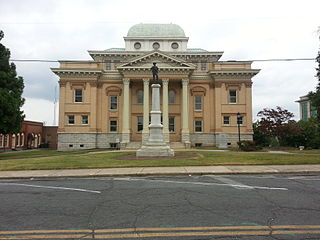
Randolph County is a county located in the U.S. state of North Carolina. As of the 2020 census, the population was 144,171. Its county seat is Asheboro.

<span class="mw-page-title-main">New Hanover County, North Carolina</span> County in North Carolina, United States

New Hanover County is a county located in the U.S. state of North Carolina. As of the 2020 census, the population was 225,702. Though the second-smallest county in North Carolina by land area, it is one of the most populous, as its county seat, Wilmington, is one of the state's largest communities. The county was created in 1729 as New Hanover Precinct and gained county status in 1739. New Hanover County is included in the Wilmington, NC Metropolitan Statistical Area, which also includes neighboring Pender and Brunswick counties.

<span class="mw-page-title-main">Moore County, North Carolina</span> County in North Carolina, United States

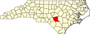
Moore County is a county located in the U.S. state of North Carolina. As of the 2020 census, its population was 99,727. Its county seat is Carthage and its largest community Pinehurst. It is a border county between the Piedmont and the Atlantic Coastal Plain.

<span class="mw-page-title-main">Martin County, North Carolina</span> County in North Carolina, United States

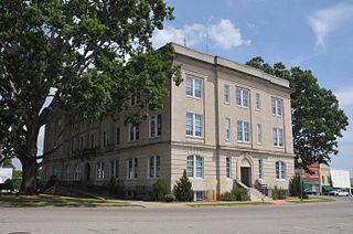
Martin County is a county located in the U.S. state of North Carolina. As of the 2020 census, the population was 22,031. Its county seat is Williamston.

<span class="mw-page-title-main">Madison County, North Carolina</span> County in North Carolina, United States

Madison County is a county located in the U.S. state of North Carolina. As of the 2020 census, the population was 21,193. Its county seat is Marshall. Madison County is part of the Asheville, NC Metropolitan Statistical Area.

<span class="mw-page-title-main">Johnston County, North Carolina</span> County in North Carolina, United States

Johnston County is a county located in the U.S. state of North Carolina. As of the 2020 census, the population was 215,999. Its county seat is Smithfield.

<span class="mw-page-title-main">Iredell County, North Carolina</span> County in North Carolina, United States

Iredell County is a county located in the U.S. state of North Carolina. As of the 2020 census, the population was 186,693. Its county seat is Statesville, and its largest community is Mooresville. The county was formed in 1788, subtracted from Rowan County. It is named for James Iredell, one of the first justices of the Supreme Court. Iredell County is included in the Charlotte-Concord-Gastonia, NC-SC Metropolitan Statistical Area, as defined by the Office of Management and Budget, with data from the U.S. Census Bureau.

<span class="mw-page-title-main">Hoke County, North Carolina</span> County in North Carolina, United States

Hoke County is a county in the U.S. state of North Carolina. As of the 2020 census, its population was 52,082. Its county seat is Raeford.

<span class="mw-page-title-main">Harnett County, North Carolina</span> County in North Carolina, United States

Harnett County is a county located in the U.S. state of North Carolina. As of the 2020 census, the population was 133,568. Its county seat is Lillington; its largest community is Anderson Creek. Harnett County is part of the Anderson Creek, NC Micropolitan Statistical Area.

<span class="mw-page-title-main">Franklin County, North Carolina</span> County in North Carolina, United States

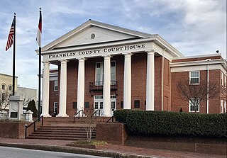
Franklin County is a county located in the U.S. state of North Carolina. As of the 2020 census, the population was 68,573. Its county seat is Louisburg.

<span class="mw-page-title-main">Forsyth County, North Carolina</span> County in North Carolina, United States

Forsyth County is located in the northwest Piedmont of the U.S. state of North Carolina. As of the 2020 census, the population was 382,590, making it the fourth-most populous county in North Carolina. Its county seat is Winston-Salem. Forsyth County is part of the Winston-Salem, NC, Metropolitan Statistical Area, which is also included in the Greensboro–Winston-Salem–High Point, NC, Combined Statistical Area. Portions of Forsyth County are in the Yadkin Valley wine region.

<span class="mw-page-title-main">Buncombe County, North Carolina</span> County in North Carolina, United States

Buncombe County is a county located in the U.S. state of North Carolina. It is classified within Western North Carolina. The 2020 census reported the population was 269,452, making it the 7th-most populous county in North Carolina. Its county seat is Asheville. Buncombe County is part of the Asheville, NC Metropolitan Statistical Area.

<span class="mw-page-title-main">Bladen County, North Carolina</span> County in North Carolina, United States

Bladen County is a county located in the U.S. state of North Carolina. As of the 2020 census, the population was 29,606. Its county seat is Elizabethtown. The county was created in 1734 as Bladen Precinct and gained county status in 1739.

<span class="mw-page-title-main">Fayetteville, North Carolina</span> County seat of Cumberland County, North Carolina, United States

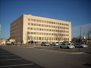
Fayetteville is a city in and the county seat of Cumberland County, North Carolina, United States. It is best known as the home of Fort Liberty, a major U.S. Army installation northwest of the city.

The following is a timeline of the history of the city of Fayetteville, North Carolina, USA.

References

  1. 1 2 3 "QuickFacts: Cumberland County, North Carolina". United States Census Bureau. Retrieved March 21, 2024.
  2. "Find a County". National Association of Counties. Archived from the original on May 31, 2011. Retrieved June 7, 2011.
  3. Cheney, John L. Jr., ed. (1974). North Carolina Government, 1585–1974. pp.  212–213.
  4. "2020 County Gazetteer Files – North Carolina". United States Census Bureau. August 23, 2022. Retrieved September 9, 2023.
  5. "Oak Grove Plantation at Averasboro". www.visitfayettevillenc.com. Retrieved July 27, 2022.
  6. Urban Exploration Abandoned Linden School , retrieved July 27, 2022
  7. 1 2 "NCWRC Game Lands". www.ncpaws.org. Retrieved March 30, 2023.
  8. "Taliaferro's Division Monument". NCpedia. Retrieved July 27, 2022.
  9. "William T. Smith House - UNDER CONTRACT". Preservation NC. Retrieved July 27, 2022.
  10. "U.S. Decennial Census". United States Census Bureau. Retrieved January 13, 2015.
  11. "Historical Census Browser". University of Virginia Library. Archived from the original on August 11, 2012. Retrieved January 13, 2015.
  12. Forstall, Richard L., ed. (March 27, 1995). "Population of Counties by Decennial Census: 1900 to 1990". United States Census Bureau. Retrieved January 13, 2015.
  13. "Census 2000 PHC-T-4. Ranking Tables for Counties: 1990 and 2000" (PDF). United States Census Bureau. April 2, 2001. Archived (PDF) from the original on March 27, 2010. Retrieved January 13, 2015.
  14. "State & County QuickFacts". United States Census Bureau. Archived from the original on June 6, 2011. Retrieved October 18, 2013.
  15. "Explore Census Data". data.census.gov. Retrieved December 23, 2021.
  16. "U.S. Census website". United States Census Bureau . Retrieved January 31, 2008.
  17. Leip, David. "Dave Leip's Atlas of U.S. Presidential Elections". uselectionatlas.org. Retrieved March 15, 2018.
  18. "2020 CENSUS - SCHOOL DISTRICT REFERENCE MAP: Cumberland County, NC" (PDF). U.S. Census Bureau. Archived (PDF) from the original on July 5, 2022. Retrieved July 4, 2022. - Text list
  19. "Fort Bragg/Cuba Community". Department of Defense Education Activity . Retrieved July 5, 2022.
  20. "The origins of the North Carolina state library, 1700-1840" (PDF). Archived (PDF) from the original on June 28, 2007. Retrieved November 25, 2018.
  21. "Useful Books: Community Libraries in Antebellum North Carolina" . Retrieved November 25, 2018.
  22. "About the Library". Archived from the original on November 26, 2018. Retrieved November 25, 2018.
  23. "Board of Trustees". Archived from the original on November 26, 2018. Retrieved November 25, 2018.
  24. "Cumberland County Library Director Named Director of the Year" (PDF). Retrieved November 25, 2018.
  25. "Library History". Archived from the original on November 26, 2018. Retrieved November 25, 2018.
  26. "Long Range Plan FY 2016 -2020" (PDF). Archived from the original (PDF) on November 26, 2018. Retrieved November 25, 2018.
  27. "Cumberland County Library Director Named Director of the Year" (PDF). Retrieved November 25, 2018.
  28. "Public Library Received American Library Association Grant" (PDF). Archived from the original (PDF) on November 26, 2018. Retrieved November 25, 2018.
  29. "Public Library Receives Arts Council Grants" . Retrieved November 25, 2018.[ permanent dead link ]
  30. ". Court Library Services Moving to Headquarters Location". Archived from the original on November 26, 2018. Retrieved November 25, 2018.
  31. "Cumberland County Public Library & Information Center Homepage". Archived from the original on November 26, 2018. Retrieved November 25, 2018.
  32. "Groundbreaking Arts & Economic Prosperity 6 Study Reveals Impact of the Arts on Communities Across America". Americans for the Arts. Retrieved May 13, 2024.
  33. Meador, Stephanie (April 17, 2024). "Arts Council of Fayetteville/Cumberland County details economic impact of local arts industry". Greater Fayetteville Business Journal. Retrieved May 13, 2024.
  34. Woolverton, Paul (April 17, 2024). "Study: Cumberland arts industry generated $72.2 million of economic activity in 2022". CityView. Retrieved May 13, 2024.