Johnston County, North Carolina

Last updated

Johnston County
Johnston County, NC courthouse from NE 2.JPG
Johnston County Flag.gif
Johnston County Seal.png
Johnston County Logo.png
Map of North Carolina highlighting Johnston County.svg
Location within the U.S. state of North Carolina
North Carolina in United States.svg
North Carolina's location within the U.S.
Coordinates: 35°31′N78°22′W / 35.51°N 78.37°W / 35.51; -78.37
CountryFlag of the United States.svg United States
StateFlag of North Carolina.svg  North Carolina
EstablishedJune 28, 1746
(277 years ago)
 (1746-06-28)
Named for Gabriel Johnston
Seat Smithfield
Largest community Clayton
Area
  Total795.65 sq mi (2,060.7 km2)
  Land792.02 sq mi (2,051.3 km2)
  Water3.63 sq mi (9.4 km2)  0.46%
Population
 (2020)
  Total215,999
  Estimate 
(2023)
241,955
  Density272.72/sq mi (105.30/km2)
Time zone UTC−5 (Eastern)
  Summer (DST) UTC−4 (EDT)
ZIP Codes
27501, 27504, 27520, 27524, 27527, 27529, 27542, 27555, 27557, 27568, 27569, 27576, 27577, 27591, 27592, 27597, 27603, 28334, 28366
Area code 919, 984
Congressional district 13th
Website johnstonnc.com

Johnston County is a county located in the U.S. state of North Carolina. As of the 2020 census, the population was 215,999. [1] Its county seat is Smithfield. [2]

Contents

Johnston County is included in the Raleigh-Cary, NC Metropolitan Statistical Area, which is also included in the Raleigh-Durham-Cary, NC Combined Statistical Area, which had an estimated population of 2,368,947 in 2023. [3]

History

Johnston County and St. Patrick's Parish were established on June 28, 1746, from the upper part of Craven County. [4] On March 1, 1752, part of Granville, Johnston, and Bladen counties were combined to form Orange County and St. Matthew's Parish. [5] On November 23, 1758, Johnston County was divided between the Parish of St. Patrick and the Parish of St. Stephen, St. Patrick's Parish becoming Dobbs County. [6] On December 5, 1770, parts of Johnston, Cumberland, and Orange counties were combined to form Wake County and St. Margaret's Parish. [7] Finally, on February 13, 1855, parts of Edgecombe, Nash, Johnston, and Wayne counties were combined to form Wilson County. [8]

Most early growers in Johnston County were subsistence farmers. A few grew tobacco as a cash crop or reared pigs and cattle, which were sold in Virginia. Smithfield was the westernmost freight port on the Neuse River, and in 1770 the colonial government erected a tobacco warehouse there to store the crop before it was shipped out. Eli Whitney's cotton gin was introduced in the county in about 1804, leading cotton to become the area's leading cash crop. Production for sale at markets remained low before the 1850s due to poor transportation links with other parts of the state. In 1856 the North Carolina Railroad was completed, connecting Johnston County with major urban areas. As result, farming for sale increased, lumber and turpentine industries developed, and the towns of Princeton, Pine Level, Selma, and Clayton were eventually created. About 1,500 Johnstonian men fought in the American Civil War, of whom about a third died. Lingering political tensions and the emancipation of slaves created social and economic turmoil. The new state constitution of 1868 created the county's first townships, which were altered up until 1913. [9] In 1886 the "Short-Cut" line of the Wilmington and Weldon Railroad was laid through Johnston, eventually giving rise to the towns of Kenly, Micro, Four Oaks, and Benson. [10]

The Panic of 1893 caused cotton prices to sharply decline, leading area farmers to switch to bright leaf tobacco as their primary cash crop. A new tobacco market was established in Smithfield in 1898, and the county's first bank was created. Within several years, cotton mills were erected in Smithfield, Clayton, and Selma. During World War I, a brief surge in tobacco and cotton prices brought a boom to the local economy. As a result, the county embarked on a school-construction campaign and consolidated all public schools under a single county system. [11] In the 1920s the state built the county's first two paved highways, and shortly thereafter many towns began paving their main streets. [12] While local commerce enjoyed significant success during the decade, area farmers struggled due to drops in tobacco and cotton prices. The Wall Street Crash of 1929 and ensuing Great Depression caused all banks in the county close. [11] Following the passage of a state bond issue in 1949, most roads in the county and town streets were paved. [13]

Etymology

Johnston County was named after Governor Gabriel Johnston by an act of the General Assembly during the creation of the county in 1746. [14]

Geography

Johnston County, North Carolina
Interactive map of Johnston County

According to the U.S. Census Bureau, the county has a total area of 795.65 square miles (2,060.7 km2), of which 792.02 square miles (2,051.3 km2) is land and 3.63 square miles (9.4 km2) (0.46%) is water. [15]

State and local protected areas

Major water bodies

Adjacent counties

Major highways

Major infrastructure

Demographics

Historical population
CensusPop.Note
1790 5,691
1800 6,30110.7%
1810 6,8679.0%
1820 9,60739.9%
1830 10,93813.9%
1840 10,599−3.1%
1850 13,72629.5%
1860 15,65614.1%
1870 16,8977.9%
1880 23,46138.8%
1890 27,23916.1%
1900 32,25018.4%
1910 41,40128.4%
1920 48,99818.3%
1930 57,62117.6%
1940 63,79810.7%
1950 65,9063.3%
1960 62,936−4.5%
1970 61,737−1.9%
1980 70,59914.4%
1990 81,30615.2%
2000 121,96550.0%
2010 168,87838.5%
2020 215,99927.9%
2023 (est.)241,955 [1] 12.0%
U.S. Decennial Census [18]
1790–1960 [19] 1900–1990 [20]
1990–2000 [21] 2010 [22] 2020 [1]

2020 census

Johnston County racial composition [23]
RaceNumberPercentage
White (non-Hispanic)136,46463.18%
Black or African American (non-Hispanic)33,04115.3%
Native American 8800.41%
Asian 1,8310.85%
Pacific Islander 710.03%
Other/Mixed 9,3124.31%
Hispanic or Latino 34,40015.93%

As of the 2020 census, there were 215,999 people, 73,567 households, and 53,743 families residing in the county.

2000 census

At the 2000 census, [24] there were 121,965 people, 46,595 households, and 33,688 families residing in the county. The population density was 154 people per square mile (59 people/km2). There were 50,196 housing units at an average density of 63 units per square mile (24 units/km2). The racial makeup of the county was 78.09% White, 15.65% Black or African American, 0.41% Native American, 0.30% Asian, 0.04% Pacific Islander, 4.53% from other races, and 0.99% from two or more races. 7.74% of the population were Hispanic or Latino of any race.

There were 46,595 households, out of which 35.40% had children under the age of 18 living with them, 57.80% were married couples living together, 10.60% had a female householder with no husband present, and 27.70% were non-families. 23.10% of all households were made up of individuals, and 8.60% had someone living alone who was 65 years of age or older. The average household size was 2.58 and the average family size was 3.02.

In the county, the population was spread out, with 26.10% under the age of 18, 8.10% from 18 to 24, 34.20% from 25 to 44, 21.70% from 45 to 64, and 9.80% who were 65 years of age or older. The median age was 34 years. For every 100 females there were 98.70 males. For every 100 females age 18 and over, there were 96.30 males.

The median income for a household in the county was $40,872, and the median income for a family was $48,599. Males had a median income of $33,008 versus $25,582 for females. The per capita income for the county was $18,788. About 8.90% of families and 12.80% of the population were below the poverty line, including 16.00% of those under age 18 and 19.40% of those age 65 or over.

Law and Government

The county is governed by the Johnston County Board of Commissioners, a seven-member board of County Commissioners, elected to serve four-year terms. The commissioners enact policies such as establishment of the property tax rate, regulation of land use and zoning outside municipal jurisdictions, and adoption of the annual budget. Commissioners generally meet each month. [25]

Current (2024) members of the Johnston County Board of Commissioners are: [26]

Rick Hester is the county manager. [27]

Johnston County is a member of the regional Triangle J Council of Governments.

In 2011, the Johnston County 911 Communications Center became one of four 911 agencies in the world to hold an Accredited Center of Excellence status from the National Academies of Emergency Dispatch in fire, police, and EMD protocols (giving them a Tri-ACE status). The dispatch has been re-accredited three times with the most recent being in 2017. [28] [29]

Politics

For most of the time after the Civil War, Johnston County was a classic Solid South county, going Democratic in all but three elections from 1880 to 1964. However, from 1968 onward it has turned increasingly Republican, with the only breaks in this tradition being its support for third-party candidate George Wallace in 1968 and for Democrat Jimmy Carter in 1976. Carter's unsuccessful bid for reelection in 1980 is the last time that a Democrat has managed even 40 percent of the county's vote.

United States presidential election results for Johnston County, North Carolina [30]
Year Republican Democratic Third party
No.%No.%No.%
2020 68,35361.38%41,25737.05%1,7471.57%
2016 54,37263.29%28,36233.01%3,1753.70%
2012 48,42763.15%27,29035.58%9741.27%
2008 43,62261.42%26,79537.73%6000.84%
2004 36,90367.89%17,26631.76%1880.35%
2000 27,21266.12%13,70433.30%2390.58%
1996 18,70458.23%11,17534.79%2,2406.97%
1992 15,41848.67%11,28435.62%4,97715.71%
1988 15,56363.97%8,71735.83%490.20%
1984 16,21067.32%7,83332.53%370.15%
1980 10,44451.26%9,60147.12%3311.62%
1976 8,51145.08%10,30154.56%670.35%
1972 14,27279.24%3,48819.37%2511.39%
1968 6,76433.05%4,49221.95%9,21245.01%
1964 7,52342.15%10,32657.85%00.00%
1960 6,66040.18%9,91459.82%00.00%
1956 4,89333.18%9,85266.82%00.00%
1952 5,42935.19%9,99764.81%00.00%
1948 3,21124.71%9,18870.69%5984.60%
1944 4,42334.81%8,28265.19%00.00%
1940 4,19229.59%9,97670.41%00.00%
1936 4,33927.83%11,25372.17%00.00%
1932 3,88728.77%9,57470.86%500.37%
1928 7,69660.42%5,04139.58%00.00%
1924 4,91051.20%4,65648.56%230.24%
1920 5,58848.10%6,03051.90%00.00%
1916 2,85745.17%3,46854.83%00.00%
1912 1,33525.80%2,75753.28%1,08320.93%
1908 2,82752.16%2,59347.84%00.00%
1904 1,55337.65%2,57262.35%00.00%
1900 1,99738.64%3,15461.03%170.33%
1896 1,82435.29%3,34364.67%20.04%
1892 1,03621.62%3,13565.44%62012.94%
1888 2,12941.52%2,99258.35%70.14%
1884 1,83139.50%2,80560.50%00.00%
1880 1,63144.20%2,05955.80%00.00%

Education

Higher education

Johnston County is home to Johnston Community College (JCC), a public, two-year, post-secondary college located in Smithfield. The college has off-campus centers throughout Johnston County. [31]

Primary and secondary education

Public education in Johnston County is served by the Johnston County School District, which has 46 schools and serves more than 35,400 students. [32] In addition, three charter schools and five private schools are located in the county. In 2021, the county school board banned the teaching of critical race theory. [33]

Libraries

The Johnston County Public Affiliated Library system operates six branches throughout the county. The library system keeps books, periodicals and audio books and has recently expanded the selection to include downloadable e-books. [34] The Hocutt-Ellington Memorial Library in Clayton left the Johnston County affiliated library system in 2015. [35]

Culture

The Bentonville Battlefield State Historic Site is the largest Civil War battlefield in North Carolina. The Battle of Bentonville was fought in 1865, and was the only Confederate offensive targeted to stop General Sherman's march through the South.

The Tobacco Farm Life Museum in Kenly has been collecting artifacts and showcasing the heritage of the Eastern North Carolina farmer for over 35 years. The site includes a museum and restored farmstead, blacksmith shop, and one-room school house. [36]

The Ava Gardner Museum, located in Smithfield, contains a collection of artifacts such as scripts, movie posters, costumes and personal belongings of actress Ava Gardner, who was born and raised in Johnston County. The museum holds an annual festival.

The Johnston County Heritage Centers in Smithfield contains county artifacts and genealogical records. [37]

The Johnston County Arts Council promotes arts in the county and its schools. [38] Smithfield is the location of an annual Ava Gardner Festival, which celebrates the life of the actress. [39]

The Meadow community is the location of Meadow Lights, an annual display of Christmas lights. [40]

Media

Radio and Television

Johnston County is located in the Raleigh-Durham radio market, ranked by Nielsen as the 37th largest in the United States. Johnston County's first radio station, WMPM, 1270 AM, in Smithfield, signed on in 1950. [41] The county is also home to WPYB, 1130 AM in Benson, WHPY, 1590 AM in Clayton, WTSB, 1090 AM in Selma, and WKJO, 102.3 FM in Smithfield.

The county is also part of the larger, 23-county Raleigh-Durham-Fayetteville Designated Market Area—the nation's 24th-largest. WNGT-CD, (virtual channel 34.1) a Class A low-powered TV station licensed to both Smithfield and Selma. The station began frequency sharing with Raleigh's WRAL-TV in November 2020, greatly expanding its coverage. Goldsboro-licensed CBS affiliate WNCN, virtual channel 17/RF channel 8, originally known as WYED-TV, signed on from studios and a transmitter in Clayton in 1988 before moving to Raleigh studios in 1995.

Newspapers

  • Clayton News-Star
  • Kenly News
  • Four Oaks-Benson News in Review
  • Princeton News Leader
  • The Selma News
  • Pine Level News
  • Johnstonian News
  • The Daily Record
  • The Smithfield Herald
  • The Cleveland Post
  • The Garner-Cleveland Record
  • The News & Observer

Communities

Map of Johnston County with municipal and township labels Map of Johnston County North Carolina With Municipal and Township Labels.PNG
Map of Johnston County with municipal and township labels

Towns

Townships

  • Banner
  • Bentonville
  • Beulah
  • Boon Hill
  • Brogden
  • Clayton
  • Cleveland
  • Elevation
  • Ingrams
  • Meadow
  • Micro
  • O'Neals
  • Pine Level
  • Pleasant Grove
  • Selma
  • Smithfield
  • Wilders
  • Wilson Mills

Unincorporated communities

See also

Related Research Articles

<span class="mw-page-title-main">Wilson County, North Carolina</span> County in North Carolina, United States

Wilson County is a county located in the U.S. state of North Carolina. As of the 2020 census, the population was 78,784. The county seat is Wilson. The county comprises the Wilson, NC Micropolitan Statistical Area, which is also included within the Rocky Mount-Wilson-Roanoke Rapids, NC Combined Statistical Area.

<span class="mw-page-title-main">Warren County, North Carolina</span> County in North Carolina, United States

Warren County is a county located in the northeastern Piedmont region of the U.S. state of North Carolina, on the northern border with Virginia, made famous for a landfill and birthplace of the environmental justice movement. As of the 2020 census, its population was 18,642. Its county seat is Warrenton. It was a center of tobacco and cotton plantations, education, and later textile mills.

<span class="mw-page-title-main">Wake County, North Carolina</span> County in North Carolina, United States

Wake County is located in the U.S. state of North Carolina. As of the 2020 census, its population was 1,129,410, making it North Carolina's most populous county. From July 2005 to July 2006, Wake County was the 9th-fastest growing county in the United States, with Cary and Raleigh being the 8th- and 15th-fastest growing communities, respectively.

<span class="mw-page-title-main">Person County, North Carolina</span> County in North Carolina, United States

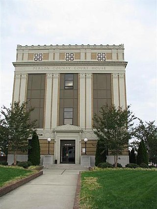
Person County is a county located in the U.S. state of North Carolina. The population was 39,097 as of the 2020 census. The county seat is Roxboro.

<span class="mw-page-title-main">Orange County, North Carolina</span> County in North Carolina, United States

Orange County is a county located in the Piedmont region of the U.S. state of North Carolina. As of the 2020 census, the population was 148,696. Its county seat is Hillsborough.

<span class="mw-page-title-main">Lee County, North Carolina</span> County in North Carolina, United States

Lee County is a county located in the U.S. state of North Carolina. As of the 2020 census, the population was 63,285. The county seat is Sanford.

<span class="mw-page-title-main">Franklin County, North Carolina</span> County in North Carolina, United States

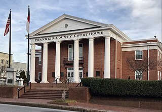
Franklin County is a county located in the U.S. state of North Carolina. As of the 2020 census, the population was 68,573. Its county seat is Louisburg.

<span class="mw-page-title-main">Benson, North Carolina</span> Town in North Carolina, United States

Benson is a town in Johnston County, North Carolina, United States, near the intersection of Interstates 95 and 40. Benson celebrates Mule Days on the fourth Saturday of September, a festival that attracts over 60,000 people each year. In 2010, the population was 3,311, up from 2,923 in 2000.

<span class="mw-page-title-main">Clayton, North Carolina</span> Town in North Carolina, United States

Clayton is a town in Johnston County, North Carolina, United States, and is considered a satellite town of Raleigh. As of 2010, Clayton's population was 16,116, up from 6,973 at the 2000 census. By 2019 the town's estimated population was 24,887. Much of that growth can be attributed to the town's proximity to the Research Triangle area and access to major highways such as I-40 and US 70.

<span class="mw-page-title-main">Four Oaks, North Carolina</span> Town in North Carolina, United States

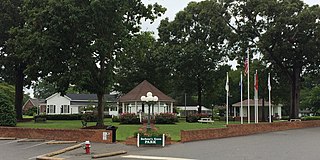
Four Oaks is a town in Johnston County, North Carolina, United States. As of the 2010 census it had a population of 1,921, up from 1,424 in 2000.

<span class="mw-page-title-main">Selma, North Carolina</span> Town in North Carolina, United States

Selma is a town in Johnston County, North Carolina, United States. In 2010, the population was 6,073, and as of 2018 the estimated population was 6,913. Selma is part of the Raleigh-Durham-Cary Combined Statistical Area. The area has a population over 1.7 million residents, though the town of Selma is able to maintain its rural character. The Everitt P. Stevens House, located in Selma, was the site of the last Grand Review of the Confederate Army held on April 6, 1865, after its defeat at the Battle of Bentonville.

<span class="mw-page-title-main">Smithfield, North Carolina</span> Town in North Carolina, United States

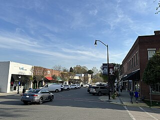
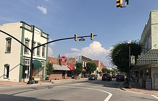
Smithfield is a town in and the county seat of Johnston County, North Carolina, United States. As of the 2010 census, its population was 10,966, and in 2019 the estimated population was 12,985. Smithfield is home to the Ava Gardner Museum and is situated along the Neuse River, where visitors enjoy the annual Smithfield Ham and Yam Festival, walks along the Buffalo Creek Greenway, and the historic downtown district. The town is located near North Carolina's Research Triangle and is about 30 miles (48 km) southeast of downtown Raleigh. The Raleigh-Durham-Cary combined statistical area has a population over 2 million residents.

<span class="mw-page-title-main">Knightdale, North Carolina</span> Town in North Carolina, United States

Knightdale is a town in Wake County, North Carolina, United States. As of the 2020 census, Knightdale has a population of 19,435, up from 11,401 in 2010. The U.S. Census Bureau estimates the town's population to be 17,843, as of July 1, 2019. Knightdale's population grew 10.4% from 2010 to 2013, making it the second fastest-growing community in the Research Triangle region for that time period.

<span class="mw-page-title-main">Wendell, North Carolina</span> Town in North Carolina

Wendell is a town in Wake County, North Carolina, United States. It is a satellite town of Raleigh, the state capital. The population was 5,845 at the 2010 census.

<span class="mw-page-title-main">Zebulon, North Carolina</span> Town in North Carolina, United States

Zebulon is the easternmost town in Wake County, North Carolina, United States. The population was 6,903 at the 2020 census. Zebulon is part of the Research Triangle metropolitan region. In May 2022, Zebulon was ranked North Carolina's second fastest growing town, only behind neighboring Wendell.

<span class="mw-page-title-main">Research Triangle</span> Geographic region of North Carolina, U.S.

The Research Triangle, or simply The Triangle, are both common nicknames for a metropolitan area in the Piedmont region of the U.S. state of North Carolina. Anchored by the cities of Raleigh and Durham and the town of Chapel Hill, the region is home to three major research universities: North Carolina State University, Duke University, and the University of North Carolina at Chapel Hill, respectively. The "Triangle" name originated in the 1950s with the creation of Research Triangle Park located between the three anchor cities, which is the largest research park in the United States and home to numerous high tech companies.

<span class="mw-page-title-main">North Carolina Highway 96</span> State highway in North Carolina, US

North Carolina Highway 96 (NC 96) is a 112-mile-long (180 km) primary state highway in the U.S. state of North Carolina. It is a predominantly rural highway that travels north-south, from NC 55, west of Newton Grove, to the Virginia state line near Virgilina, Virginia, where it continues on as Virginia State Route 96. It also connects the cities of Smithfield, Selma, Zebulon, Youngsville and Oxford.

<span class="mw-page-title-main">U.S. Route 70 in North Carolina</span> Highway in North Carolina

U.S. Route 70 (US 70) is a part of the United States Numbered Highway System that runs from Globe, Arizona, to the Crystal Coast of the US state of North Carolina. In North Carolina, it is a major 488-mile-long (785 km) east–west highway that runs from the Tennessee border to the Atlantic Ocean. From the Tennessee state line near Paint Rock to Asheville it follows the historic Dixie Highway, running concurrently with US 25. The highway connects several major cities including Asheville, High Point, Greensboro, Durham, Raleigh, Goldsboro, and New Bern. From Beaufort on east, US 70 shares part of the Outer Banks Scenic Byway, a National Scenic Byway, before ending in the community of Atlantic, located along Core Sound.

<span class="mw-page-title-main">North Carolina Highway 231</span> State highway in North Carolina, US

North Carolina Highway 231 (NC 231) is a 25.4-mile-long (40.9 km) primary state highway in the U.S. state of North Carolina. NC 231 travels through Wake County, Johnston County, and Nash County between its southern terminus at US 64 Business in Wendell and its northern terminus at US 64 Alternate/NC 98 near Spring Hope. Throughout Wake County and Johnston County, NC 231 primarily follows a southeast-northwest alignment. Entering into Nash County, NC 231 turns to follow a northerly alignment until reaching its northern terminus. NC 231 serves the towns of Wendell, Middlesex, and Spring Hope.

<span class="mw-page-title-main">Johnston County School District</span>

The Johnston County School District serves Johnston County, North Carolina. Currently, Johnston County has 48 schools, which serve over 36,879 students, and experiences a 4% increase in enrollment yearly. The district is centered in the county seat, Smithfield. Dr. Eric C. Bracy was appointed as superintendent on July 1, 2020.

References

  1. 1 2 3 "QuickFacts: Johnston County, North Carolina". United States Census Bureau. Retrieved March 21, 2024.
  2. "Find a County". National Association of Counties. Archived from the original on May 31, 2011. Retrieved June 7, 2011.
  3. "Metropolitan and Micropolitan Statistical Areas Population Totals: 2020-2023". United States Census Bureau, Population Division. March 14, 2024. Retrieved March 15, 2024.
  4. Complete Revisal of All the Acts of Assembly, 1773, p. 103.
  5. Complete Revisal of All the Acts of Assembly, 1773, p. 146.
  6. Complete Revisal of All the Acts of Assembly, 1773, p. 223.
  7. Complete Revisal of All the Acts of Assembly, 1773, pp. 476–478.
  8. Public Laws of the State of North-Carolina, Passed by the General Assembly, at its Session of 1854–'55: Together with the Comptroller's Statement of Public Revenue and Expenditure. Raleigh: Holden & Wilson. 1855. p. 30. LCCN   83644405 via Internet Archive.
  9. Johnson & Barbour 1997, p. 7.
  10. Johnson & Barbour 1997, pp. 7–8.
  11. 1 2 Johnson & Barbour 1997, p. 8.
  12. Johnson & Barbour 1997, p. 8, 13.
  13. Johnson & Barbour 1997, p. 13.
  14. Gannett, Henry (1905). The Origin of Certain Place Names in the United States (Report) (2nd ed.). Washington: Government Printing Office. p. 170 via United States Geological Survey.
  15. "2020 County Gazetteer Files – North Carolina". United States Census Bureau. August 23, 2022. Retrieved September 9, 2023.
  16. "Hannah Creek Near Benson, NC - 02088210". waterdata.usgs.gov. Retrieved October 28, 2023.
  17. "Mill Creek Historical Marker". www.hmdb.org. Retrieved April 30, 2023.
  18. "U.S. Decennial Census". United States Census Bureau. Retrieved January 17, 2015.
  19. "Historical Census Browser". University of Virginia Library. Retrieved January 17, 2015.
  20. Forstall, Richard L., ed. (March 27, 1995). "Population of Counties by Decennial Census: 1900 to 1990". United States Census Bureau. Retrieved January 17, 2015.
  21. "Census 2000 PHC-T-4. Ranking Tables for Counties: 1990 and 2000" (PDF). United States Census Bureau. April 2, 2001. Archived (PDF) from the original on March 27, 2010. Retrieved January 17, 2015.
  22. "State & County QuickFacts". United States Census Bureau. Archived from the original on July 13, 2011. Retrieved October 21, 2013.
  23. "Explore Census Data". data.census.gov. Retrieved December 23, 2021.
  24. "U.S. Census website". United States Census Bureau . Retrieved January 31, 2008.
  25. "Scheduled Board Meetings". www.johnstonnc.com. Retrieved March 16, 2018.
  26. "Meet the Commissioners". www.johnstonnc.com. November 30, 2023. Retrieved April 9, 2024.
  27. Bergquist, Garrett (June 23, 2021). "A tradition of service and leadership". Spectrum News 1. Retrieved July 21, 2023.
  28. "Johnston 911 Center Re-accredited". JoCo Report. September 22, 2017. Retrieved July 21, 2023.
  29. Barbour, Jason (March 4, 2015). "Johnston County, NC Successfully Tests Wireless Broadband Technology To Improve 9-1-1 Reliability". www.businesswire.com. Retrieved July 21, 2023.
  30. Leip, David. "Dave Leip's Atlas of U.S. Presidential Elections". uselectionatlas.org. Retrieved March 16, 2018.
  31. "Johnston Community College". Archived from the original on September 23, 2019. Retrieved February 4, 2020.
  32. "District Profile - Johnston County Schools". Archived from the original on February 2, 2017. Retrieved January 26, 2017.
  33. "North Carolina school board bans critical race theory from its classrooms". TheGuardian.com . October 5, 2021.
  34. "Johnston County Affiliated Libraries". www.jocolib.org. Retrieved March 16, 2018.
  35. "Clayton Transition Announcement". Mary Duncan Public Library. March 6, 2015. Retrieved March 16, 2018.
  36. "Home | Tobacco Farm Life Museum, Inc". Tobacco Farm Life Mu. Retrieved September 22, 2022.
  37. Mickey (January 28, 2022). "Johnston County Heritage Center Spotlighted In New Video". JoCo Report. Retrieved August 1, 2022.
  38. "Johnston County Arts Council". Archived from the original on February 11, 2008. Retrieved January 13, 2008.
  39. "Ava Gardner Festival". www.johnstoncountync.org. Retrieved November 6, 2022.
  40. "Calendar of Events in Smithfield/Johnston County, NC". www.johnstoncountync.org. September 22, 2022. Retrieved September 22, 2022.
  41. "Broadcasting Station License Record" (PDF). licensing.fcc.gov. September 22, 2022. Archived from the original (PDF) on June 24, 2021. Retrieved September 22, 2022.

Bibliography

Further reading