Camden County, North Carolina

Last updated

Camden County
Historic Camden County Courthouse.jpg
Camden County Flag.gif
Camden County Seal.jpg
Camden County Logo.png
Motto: 
"Boundless Opportunities."
Map of North Carolina highlighting Camden County.svg
Location within the U.S. state of North Carolina
North Carolina in United States.svg
North Carolina's location within the U.S.
Coordinates: 36°20′N76°10′W / 36.34°N 76.16°W / 36.34; -76.16
CountryFlag of the United States.svg United States
StateFlag of North Carolina.svg  North Carolina
Founded1777
(Consolidated July 1, 2006) [1]
Named for Charles Pratt, 1st Earl Camden
Seat Camden
Largest communityCamden
Area
  Total310.25 sq mi (803.5 km2)
  Land240.33 sq mi (622.5 km2)
  Water69.92 sq mi (181.1 km2)  22.54%
Population
 (2020)
  Total10,355
  Estimate 
(2023)
11,137
  Density43.00/sq mi (16.60/km2)
Time zone UTC−5 (Eastern)
  Summer (DST) UTC−4 (EDT)
Congressional district 3rd
Website www.camdencountync.gov

Camden County is a consolidated city-county [1] located in the U.S. state of North Carolina. As of the 2020 census, the population was 10,355, [2] making it the fourth-least populous county in North Carolina. Its county seat is Camden. [3] Camden County is included in the Virginia Beach-Chesapeake, VA-NC Combined Statistical Area. [4]

Contents

History

The county was formed in 1777 from the northeastern part of Pasquotank County. It was named for Charles Pratt, 1st Lord Camden, who had opposed the Stamp Act. The county is the site of the southern terminus of the Dismal Swamp Canal. It was the site of the Battle of South Mills on April 19, 1862, during the American Civil War, which was a minor victory to the Confederacy.

Shiloh Baptist Church, founded around 1727 by Paul Palmer, is the oldest Baptist church in North Carolina. [5] It is located in the Shiloh township.

Though technically there are (or were) no incorporated municipalities in Camden County (with the exception of a small portion of Elizabeth City; most of which is in bordering Pasquotank County), the county became the first consolidated city-county entity in North Carolina on July 1, 2006. [1]

Camden County is the location of Academi's Blackwater Lodge and Training Center for paramilitary and security operations.

Geography

Camden County, NC [6]
Climate chart (explanation)
J
F
M
A
M
J
J
A
S
O
N
D
 
 
3.7
 
 
51
31
 
 
3.4
 
 
54
33
 
 
3.9
 
 
61
39
 
 
3.5
 
 
71
47
 
 
3.9
 
 
78
56
 
 
4.4
 
 
86
66
 
 
5.5
 
 
89
70
 
 
5.5
 
 
87
68
 
 
5
 
 
82
63
 
 
3.5
 
 
73
51
 
 
3.3
 
 
64
43
 
 
3.6
 
 
54
34
Average max. and min. temperatures in °F
Precipitation totals in inches
Metric conversion
J
F
M
A
M
J
J
A
S
O
N
D
 
 
94
 
 
10
−1
 
 
86
 
 
12
1
 
 
99
 
 
16
4
 
 
89
 
 
21
9
 
 
99
 
 
26
14
 
 
112
 
 
30
19
 
 
140
 
 
32
21
 
 
140
 
 
30
20
 
 
127
 
 
28
17
 
 
89
 
 
23
11
 
 
84
 
 
18
6
 
 
91
 
 
12
1
Average max. and min. temperatures in °C
Precipitation totals in mm
Camden County, North Carolina
Interactive map of Camden County

According to the U.S. Census Bureau, the county has a total area of 310.25 square miles (803.5 km2), of which 240.33 square miles (622.5 km2) is land and 69.92 square miles (181.1 km2) (22.54%) is water. [7]

National protected area

State and local protected areas

Major water bodies

Adjacent counties

Major highways

Demographics

Historical population
CensusPop.Note
1790 4,022
1800 4,1914.2%
1810 5,34727.6%
1820 6,34718.7%
1830 6,7336.1%
1840 5,663−15.9%
1850 6,0496.8%
1860 5,343−11.7%
1870 5,3610.3%
1880 6,27417.0%
1890 5,667−9.7%
1900 5,474−3.4%
1910 5,6403.0%
1920 5,382−4.6%
1930 5,4611.5%
1940 5,440−0.4%
1950 5,223−4.0%
1960 5,5987.2%
1970 5,453−2.6%
1980 5,8296.9%
1990 5,9041.3%
2000 6,88516.6%
2010 9,98045.0%
2020 10,3553.8%
2023 (est.)11,137 [2] 7.6%
U.S. Decennial Census [8]
1790–1960 [9] 1900–1990 [10]
1990–2000 [11] 2010 [12] 2020 [2]

2020 census

Camden County racial composition [13]
RaceNumberPercentage
White (non-Hispanic)8,20079.19%
Black or African American (non-Hispanic)1,04910.13%
Native American 400.39%
Asian 1181.14%
Pacific Islander 10.01%
Other/Mixed 6075.86%
Hispanic or Latino 3403.28%

As of the 2020 census, there were 10,355 people, 3,933 households, and 3,154 families residing in the county.

2010 census

At the 2010 census, [14] there were 9,980 people, 2,662 households, and 2,023 families residing in the county. The population density was 29 people per square mile (11 people/km2). There were 2,973 housing units at an average density of 12 units per square mile (4.6 units/km2). The racial makeup of the county was 82.1% White, 13.2% Black or African American, 0.3% Native American, 1.5% Asian, 0.1% Pacific Islander, 0.7% from other races, and 2.1% from two or more races. 2.2% of the population were Hispanic or Latino of any race.

There were 2,662 households, out of which 31.60% had children under the age of 18 living with them, 62.20% were married couples living together, 9.40% had a female householder with no husband present, and 24.00% were non-families. 20.70% of all households were made up of individuals, and 9.50% had someone living alone who was 65 years of age or older. The average household size was 2.58 and the average family size was 2.97.

In the county, the population was spread out, with 24.50% under the age of 18, 6.30% from 18 to 24, 30.50% from 25 to 44, 25.20% from 45 to 64, and 13.60% who were 65 years of age or older. The median age was 39 years. For every 100 females there were 98.40 males. For every 100 females age 18 and over, there were 96.90 males.

The median income for a household in the county was $39,493, and the median income for a family was $45,387. Males had a median income of $36,274 versus $24,875 for females. The per capita income for the county was $18,681. 10.10% of the population and 7.90% of families were below the poverty line. Out of the total people living in poverty, 12.60% are under the age of 18 and 20.30% are 65 or older.

Government and politics

Camden County is a member of the Albemarle Commission regional council of governments and is represented by Bobby Hanig in the 1st district in the North Carolina State Senate and Edward Charles Goodwin in the 1st district in the North Carolina House of Representatives. [15]

United States presidential election results for Camden County, North Carolina [16]
Year Republican Democratic Third party
No.%No.%No.%
2020 4,31272.43%1,53725.82%1041.75%
2016 3,54670.83%1,27425.45%1863.72%
2012 3,10966.09%1,50832.06%871.85%
2008 3,14065.13%1,59733.13%841.74%
2004 2,48064.75%1,33934.96%110.29%
2000 1,62857.51%1,18741.93%160.57%
1996 1,07441.86%1,18646.22%30611.93%
1992 1,03938.84%1,15343.10%48318.06%
1988 1,14450.87%1,08148.07%241.07%
1984 1,28254.25%1,07545.49%60.25%
1980 81338.94%1,21258.05%633.02%
1976 56231.07%1,23168.05%160.88%
1972 90960.20%55636.82%452.98%
1968 1809.06%70735.58%1,10055.36%
1964 53438.03%87061.97%00.00%
1960 33825.00%1,01475.00%00.00%
1956 34329.67%81370.33%00.00%
1952 34025.45%99674.55%00.00%
1948 12716.30%57673.94%769.76%
1944 19321.09%72278.91%00.00%
1940 13412.24%96187.76%00.00%
1936 11710.40%1,00889.60%00.00%
1932 787.85%91592.05%10.10%
1928 24528.19%62471.81%00.00%
1924 13222.88%43675.56%91.56%
1920 14220.82%54079.18%00.00%
1916 8618.86%36880.70%20.44%
1912 409.88%30374.81%6215.31%

Education

There are five schools in Camden County: Grandy Primary School, Camden Intermediate School, Camden Middle School, Camden County High School, and Camden Early College. However, one other former school lies in Shiloh. It was a community school for the Shiloh area. The Shiloh School sign is still visible on the top of the facade at the front of the building.

Communities

Map of Camden County with municipal and township labels Map of Camden County North Carolina With Municipal and Township Labels.PNG
Map of Camden County with municipal and township labels

City

Census-designated places

Unincorporated communities

Townships

See also

Related Research Articles

<span class="mw-page-title-main">Kershaw County, South Carolina</span> County in South Carolina, United States

Kershaw County is a county located in the U.S. state of South Carolina. As of the 2020 census, its population was 65,403. The county seat and largest community is Camden. The county was created in 1791 from parts of Claremont, Lancaster, Fairfield, and Richland counties. It is named for Col. Joseph Kershaw (1727–1791), an early settler and American Revolutionary War patriot.

<span class="mw-page-title-main">Wayne County, North Carolina</span> County in North Carolina, United States

Wayne County is a county located in the U.S. state of North Carolina. As of the 2020 census, the population was 117,333. Its county seat is Goldsboro, and it is home to Seymour Johnson Air Force Base.

<span class="mw-page-title-main">Washington County, North Carolina</span> County in North Carolina, United States

Washington County is a county located in the U.S. state of North Carolina. As of the 2020 census, the population was 11,003. Its county seat is Plymouth. The county was formed in 1799 from the western third of Tyrrell County. It was named for George Washington.

<span class="mw-page-title-main">Pitt County, North Carolina</span> County in North Carolina, United States

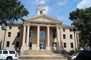
Pitt County is a county located in the Inner Banks region of the U.S. state of North Carolina. As of the 2020 census, the population was 170,243, making it the 14th-most populous county in North Carolina. Its county seat is Greenville.

<span class="mw-page-title-main">Perquimans County, North Carolina</span> County in North Carolina, United States

Perquimans County is a county located in the U.S. state of North Carolina. As of the 2020 census, the population was 13,005. Its county seat is Hertford. The Harvey Point Defense Testing Activity facility is located in Perquimans County.

<span class="mw-page-title-main">Northampton County, North Carolina</span> County in North Carolina, United States

Northampton County is a county located in the U.S. state of North Carolina. As of the 2020 census, the population was 17,471. Its county seat is Jackson.

<span class="mw-page-title-main">Pasquotank County, North Carolina</span> County in North Carolina, United States

Pasquotank County is a county located in the U.S. state of North Carolina. As of the 2020 census, the population was 40,568. Its county seat is Elizabeth City.

<span class="mw-page-title-main">Nash County, North Carolina</span> County in North Carolina, United States

Nash County is a county located in the U.S. state of North Carolina. As of the 2020 census, the population was 94,970. Its county seat is Nashville.

<span class="mw-page-title-main">Hertford County, North Carolina</span> County in North Carolina, United States

Hertford County is a county located in the U.S. state of North Carolina. As of the 2020 census, the population was 21,552. Its county seat is Winton. It is classified within the region known in the 21st century as the Inner Banks.

<span class="mw-page-title-main">Greene County, North Carolina</span> County in North Carolina, United States

Greene County is a county located in the U.S. state of North Carolina. As of the 2020 census, the population was 20,451. Its county seat is Snow Hill.

<span class="mw-page-title-main">Gates County, North Carolina</span> County in North Carolina, United States

Gates County is a county located in the northeastern portion of the U.S. state of North Carolina, on the border with Virginia. As of the 2020 census, the population was 10,478, making it the fifth-least populous county in North Carolina. Its county seat is Gatesville. Gates County is included in the Virginia Beach-Chesapeake, VA-NC Combined Statistical Area. It is part of the Albemarle Sound area of the Inner Banks.

<span class="mw-page-title-main">Edgecombe County, North Carolina</span> County in North Carolina, United States

Edgecombe County is a county located in the U.S. state of North Carolina. As of the 2020 census, the population was 48,900. Its county seat is Tarboro.

<span class="mw-page-title-main">Currituck County, North Carolina</span> County in North Carolina, United States

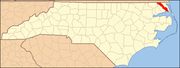
Currituck County is the northeasternmost county in the U.S. state of North Carolina. As of the 2020 census, the population was 28,100. Its county seat is Currituck. The county was formed in 1668 as a precinct of Albemarle County and later gained county status in 1739. The name is "traditionally said to be an indigenous word for wild geese; Coratank." Currituck County is included in the Virginia Beach-Chesapeake, VA-NC Combined Statistical Area. It is in the northeastern section of the state and is bounded by the Atlantic Ocean, Currituck Sound, Camden County, Dare County and the Commonwealth of Virginia. Currituck Court House, mentioned as early as 1755, was the name of the county seat. Today the words "Court House" have been dropped and only Currituck is used as the community name.

<span class="mw-page-title-main">Bertie County, North Carolina</span> County in North Carolina, United States

Bertie County is a county located in the northeast area of the U.S. state of North Carolina. As of the 2020 census, the population was 17,934. Its county seat is Windsor. The county was created in 1722 as Bertie Precinct and gained county status in 1739.

<span class="mw-page-title-main">Beaufort County, North Carolina</span> County in North Carolina, United States

Beaufort County is a county located in the U.S. state of North Carolina. As of the 2020 census, the population was 44,652. Its county seat is Washington. The county was founded in 1705 as Pamptecough Precinct. Originally included in Bath County, it was renamed Beaufort Precinct in 1712 and became Beaufort County in 1739.

<span class="mw-page-title-main">Anson County, North Carolina</span> County in North Carolina, United States

Anson County is a county located in the U.S. state of North Carolina. As of the 2020 census, the population was 22,055. Its county seat is Wadesboro.

<span class="mw-page-title-main">Webster, North Carolina</span> Town in North Carolina, United States

Webster is a town in Jackson County, North Carolina, United States. As of the 2010 census, the population was 363, down from 486 in 2000.

<span class="mw-page-title-main">Hertford, North Carolina</span> Town in North Carolina, United States

Hertford is a town and the county seat of Perquimans County, North Carolina, United States. The current population of Hertford, North Carolina is 1,912 based on the 2020 census. The US Census estimates the 2021 population at 1,925. The last official US Census in 2010 recorded the population at 2,143. Hertford is located in North Carolina's Inner Banks region and is part of both the Elizabeth City Micropolitan Statistical Area and the Hampton Roads region. It is named after the county town of Hertford, England.

Brogden is a census-designated place (CDP) in Wayne County, North Carolina, United States. The population was 2,510 in 2020. It is included in the Goldsboro, North Carolina Metropolitan Statistical Area.

<span class="mw-page-title-main">Elizabeth City, North Carolina</span> City in North Carolina, United States

Elizabeth City is a city in Pasquotank and Camden counties, North Carolina, United States. As of the 2020 census, it had a population of 18,629. Elizabeth City is the county seat and most populous city of Pasquotank County. It is the cultural, economic and educational hub of the sixteen-county Historic Albemarle region of northeastern North Carolina.

References

  1. 1 2 3 "Ordinance No. 2006-06-02". www.camdencountync.gov. June 19, 2006. Archived from the original on July 31, 2007. Retrieved December 16, 2023.
  2. 1 2 3 "QuickFacts: Camden County, North Carolina". United States Census Bureau. Retrieved March 21, 2024.
  3. "Find a County". National Association of Counties. Archived from the original on May 31, 2011. Retrieved June 7, 2011.
  4. "OMB Bulletin No. 23-01: Revised Delineations of Metropolitan Statistical Areas, Micropolitan Statistical Areas, and Combined Statistical Areas, and Guidance on Uses of the Delineations of These Areas" (PDF). United States Office of Management and Budget . July 21, 2023. Retrieved August 10, 2023.
  5. "People Called Baptists". Baptist State Convention of North Carolina. Retrieved January 3, 2007.
  6. http://www.usa.com/camden-county-nc-weather.htm#HistoricalTemperature [ bare URL ]
  7. "2020 County Gazetteer Files – North Carolina". United States Census Bureau. August 23, 2022. Retrieved September 9, 2023.
  8. "U.S. Decennial Census". United States Census Bureau. Retrieved January 13, 2015.
  9. "Historical Census Browser". University of Virginia Library. Retrieved January 13, 2015.
  10. Forstall, Richard L., ed. (March 27, 1995). "Population of Counties by Decennial Census: 1900 to 1990". United States Census Bureau. Retrieved January 13, 2015.
  11. "Census 2000 PHC-T-4. Ranking Tables for Counties: 1990 and 2000" (PDF). United States Census Bureau. April 2, 2001. Archived (PDF) from the original on March 27, 2010. Retrieved January 13, 2015.
  12. "State & County QuickFacts". United States Census Bureau. Archived from the original on June 6, 2011. Retrieved October 18, 2013.
  13. "Explore Census Data". data.census.gov. Retrieved December 22, 2021.
  14. "U.S. Census website". United States Census Bureau . Retrieved January 31, 2008.
  15. "Representation - North Carolina General Assembly". www.ncleg.gov. Retrieved April 18, 2022.
  16. Leip, David. "Dave Leip's Atlas of U.S. Presidential Elections". uselectionatlas.org. Retrieved March 14, 2018.