
The Baltimore–Washington Parkway is a controlled-access parkway in the U.S. state of Maryland, running southwest from Baltimore to Washington, D.C. The road begins at an interchange with U.S. Route 50 (US 50) near Cheverly in Prince George's County at the Washington, D.C. border, and continues northeast as a parkway maintained by the National Park Service (NPS) to MD 175 near Fort Meade, serving many federal institutions. This portion of the parkway is dedicated to Gladys Noon Spellman, a representative of Maryland's 5th congressional district, and has the unsigned Maryland Route 295 (MD 295) designation. Commercial vehicles, including trucks, are prohibited within this stretch. This section is administered by the NPS's Greenbelt Park unit. After leaving park service boundaries the highway is maintained by the state and signed with the MD 295 designation. This section of the parkway passes near Baltimore–Washington International Thurgood Marshall Airport.

The Capital Beltway is a 64-mile (103 km) auxiliary Interstate Highway in the Washington metropolitan area that surrounds Washington, D.C., the capital of the United States, and its inner suburbs in adjacent Maryland and Virginia. It is the basis of the phrase "inside the Beltway", used when referring to issues dealing with US federal government and politics. The highway is signed as Interstate 495 (I-495) for its entire length, and its southern and eastern half runs concurrently with I-95.
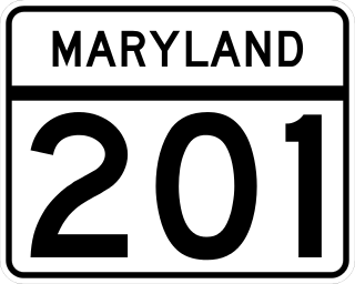
Maryland Route 201 is a state highway in the U.S. state of Maryland. Known for most of its length as Kenilworth Avenue, the highway runs 9.40 miles (15.13 km) from the District of Columbia boundary in Tuxedo, where the highway continues south as District of Columbia Route 295, north to MD 212 in Beltsville. MD 201 is a four to six-lane divided highway that connects Washington, D.C., with the northern Prince George's County municipalities of Cheverly, Bladensburg, Edmonston, Riverdale Park, College Park, Berwyn Heights, and Greenbelt. The highway also provides part of the connections from Interstate 95 (I-95)/I-495 to a pair of Washington Metro stations. MD 201 was built as two separate highways in the late 1920s: MD 201 from Washington, D.C., to Bladensburg and MD 205 from Bladensburg to Greenbelt. These highways, some of which became MD 769, were replaced with a relocated Kenilworth Avenue in the mid 1950s, including the Kenilworth Interchange with U.S. Route 50 and the Baltimore–Washington Parkway in Tuxedo. MD 201 was extended north to Beltsville in the early 1960s. The Maryland State Highway Administration (MDSHA) plans to extend MD 201 north toward Laurel.

Maryland Route 450 is a state highway in the U.S. state of Maryland. The state highway runs 30.19 miles (48.59 km) from U.S. Route 1 Alternate in Bladensburg east to US 50/US 301 and MD 2 near Arnold. MD 450 forms a local complement to US 50 from near Washington, D.C. through Annapolis. In Prince George's County, the highway is a four- to six-lane divided highway that serves Bladensburg, Landover Hills, New Carrollton, Lanham, and Bowie. In Anne Arundel County, MD 450 connects Crofton with Parole and Annapolis with the portion of the county east of the Severn River. The highway serves as one of the main streets of Annapolis, including the state capital's historic core, and is the primary vehicular access to the U.S. Naval Academy.
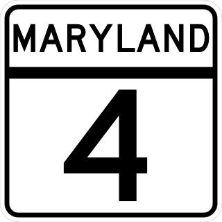
Maryland Route 4 is a state highway in the U.S. state of Maryland. The highway runs 64.85 miles (104.37 km) from MD 5 in Leonardtown north to Southern Avenue in Suitland at the District of Columbia boundary, beyond which the highway continues into Washington as Pennsylvania Avenue. MD 4 is a four- to six-lane highway that connects Washington and communities around Interstate 95 (I-95)/I-495 with southern Prince George's County with southwestern Anne Arundel County. The highway is the primary highway for the length of Calvert County, during most of which the route runs concurrently with MD 2. MD 4 also connects Calvert and St. Mary's counties via the Governor Thomas Johnson Bridge across the Patuxent River. The highway connects the Southern Maryland county seats of Leonardtown, Prince Frederick, and Upper Marlboro.
The Clara Barton Parkway is a parkway in the U.S. state of Maryland and the District of Columbia. The highway runs 6.8 miles (10.9 km) from MacArthur Boulevard in Carderock, Maryland, east to Canal Road at the Chain Bridge in Washington. The Clara Barton Parkway is a two- to four-lane parkway that parallels the Potomac River and the Chesapeake and Ohio Canal (C&O) in southwestern Montgomery County, Maryland, and the far western corner of Washington. The parkway provides access to the communities of Cabin John and Glen Echo and several units of the Chesapeake and Ohio Canal National Historical Park. The Maryland portion of the George Washington Memorial Parkway was constructed from Carderock past Interstate 495 (I-495) to Glen Echo in the early to mid-1960s. The parkway was proposed to continue west to Great Falls and east to Georgetown. However, these proposals never came to fruition and the parkway was extended only to the Chain Bridge in the early 1970s. The Maryland portion of the George Washington Memorial Parkway was renamed in 1989 for Clara Barton, the founder of the American Red Cross, and whose original headquarters is located in Glen Echo.
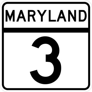
Maryland Route 3, part of the Robert Crain Highway, is the designation given to the former alignment of U.S. Route 301 from Bowie, Maryland, United States, to Baltimore. It is named for Robert Crain of Baltimore. It is unique in Maryland in that it has a business route and a truck route which do not connect to their parent; however, the business route is also a part of the Robert Crain Highway. MD 3's current orientation is vestigial from the construction of Maryland's freeway system.

Maryland Route 5 is a 74.34-mile (119.64 km) long state highway that runs north–south in the U.S. state of Maryland. The highway runs from Point Lookout in St. Mary's County north to the Washington, D.C. border in Suitland, Prince George's County. MD 5 begins as two-lane undivided Point Lookout Road which runs from Point Lookout to an intersection with MD 235 in the northern part of St. Mary's County. Point Lookout Road passes through rural areas as well as the county seat of Leonardtown. After the MD 235 intersection, the route becomes four-lane divided Three Notch Road and continues into Charles County, where it becomes Leonardtown Road. Here, the route bypasses Hughesville and continues north toward the Waldorf area, which it bypasses to the east on Mattawoman Beantown Road. The route merges onto U.S. Route 301 and enters Prince George's County, splitting from US 301 at an interchange in Brandywine. From here, MD 5 continues north on Branch Avenue, running through suburban areas, before becoming a freeway as it passes Andrews Air Force Base and has an interchange with Interstate 95 (I-95)/I-495. Past the Capital Beltway, the route runs through suburban areas of Hillcrest Heights and Suitland before reaching the Washington, D.C. border, where Branch Avenue SE continues, crossing Pennsylvania Avenue SE and eventually terminating at Randle Circle.
State Route 123 or Virginia State Route 123 is a primary state highway in the U.S. state of Virginia. The state highway runs 29.27 miles (47.11 km) from U.S. Route 1 in Woodbridge north to the Chain Bridge across the Potomac River into Washington from Arlington. It goes by five local names. From its southern terminus to the Occoquan River Bridge, it is known as Gordon Boulevard. From the Occoquan River Bridge to the city of Fairfax it is known as Ox Road. From Fairfax until it enters the Town of Vienna, it is known as Chain Bridge Road. Then, as it passes through the Town of Vienna, it is known as Maple Avenue. After leaving the Town of Vienna, the name reverts to Chain Bridge Road, and continues this way until the intersection with I-495 in Tysons. Between Tysons and the George Washington Memorial Parkway, it is known as Dolley Madison Boulevard. After crossing over the George Washington Memorial Parkway, the name once again reverts to Chain Bridge Road and continues this way until the end of the road, at Chain Bridge. SR 123 is a partial circumferential highway in Northern Virginia that connects Woodbridge in eastern Prince William County with the independent city of Fairfax and the Fairfax County communities of Vienna, Tysons, and McLean, the last being the home of the National Counterterrorism Center and the Central Intelligence Agency. The state highway also connects all of the major highways that radiate from Washington, including Interstate 95 (I-95), I-66, US 29, US 50, SR 267, and the George Washington Memorial Parkway. Furthermore, SR 123 crosses another pair of circumferential highways, I-495 and the Fairfax County Parkway, and SR 7, a major northwest–southeast highway through Northern Virginia. The state highway is a part of the National Highway System for its entire length.

Maryland Route 198 is a state highway in the U.S. state of Maryland. The highway runs 14.14 miles (22.76 km) from MD 650 near Spencerville east to the entrance of Fort George G. Meade beyond its junction with MD 32. MD 198 connects Laurel in far northern Prince George's County with the northeastern Montgomery County communities of Spencerville and Burtonsville and Maryland City and Fort Meade in western Anne Arundel County. The highway is a four-to-six-lane divided highway between U.S. Route 29 in Burtonsville and the Baltimore–Washington Parkway in Maryland City.

U.S. Route 50 is a major east–west route of the U.S. Highway system, stretching just over 3,000 miles (4,800 km) from West Sacramento, California, east to Ocean City, Maryland, on the Atlantic Ocean. In the U.S. state of Maryland, US 50 exists in two sections. The longer of these serves as a major route connecting Washington, D.C., with Ocean City; the latter is the eastern terminus of the highway. The other section passes through the southern end of Garrett County for less than 10 miles (16 km) as part of the Northwestern Turnpike, entering West Virginia at both ends. One notable section of US 50 is the dual-span Chesapeake Bay Bridge across the Chesapeake Bay, which links the Baltimore–Washington metropolitan area with the Eastern Shore region, allowing motorists to reach Ocean City and the Delaware Beaches.

Maryland Route 193 is a state highway in the U.S. state of Maryland. Known for most of its length as University Boulevard and Greenbelt Road, the state highway runs 26.07 mi (41.96 km) from MD 185 in Kensington east to MD 202 north of Upper Marlboro. MD 193 serves as a major east-west commuter route in eastern Montgomery County and northern Prince George's County, connecting Wheaton, Silver Spring, Langley Park, College Park, and Greenbelt. The state highway also provides the primary access to the University of Maryland and Goddard Space Flight Center. In central Prince George's County, MD 193 is the main north–south highway connecting Glenn Dale and Greater Upper Marlboro with the affluent suburbs of Woodmore and Kettering.
Maryland Route 410 (MD 410) is a state highway in the U.S. state of Maryland and known for most of its length as East–West Highway. The highway runs east to west for 13.92 miles (22.40 km) from MD 355 in Bethesda east to Pennsy Drive in Landover Hills. MD 410 serves as a major east–west commuter route through the inner northern suburbs of Washington, D.C., connecting the commercial districts of Bethesda, Silver Spring, and Hyattsville. In addition, the highway serves the industrial area of Landover Hills and the residential suburbs of Chevy Chase, Takoma Park, Chillum, Riverdale, and East Riverdale. The road also connects many of the arterial highways and freeways that head out of Washington. Additionally, it provides a highway connection to transit and commercial hubs centered around Washington Metro subway stations in Bethesda, Takoma Park, Hyattsville, Silver Spring, and New Carrollton–the latter two of which provide additional connections to MARC and Amtrak trains.

Maryland Route 337 is a state highway in the U.S. state of Maryland. Known for most of its length as Allentown Road, the highway runs 3.41 miles (5.49 km) from MD 5 in Camp Springs east to MD 4 near Forestville. MD 337 runs along the southern end of Morningside and the northern edge of Andrews Air Force Base and provides access to several entrances to the military base. The state highway runs concurrently with the easternmost portion of Suitland Parkway. The parkway stretch of MD 337 is maintained by the National Park Service (NPS) instead of the Maryland State Highway Administration (MDSHA). MD 337 was constructed in the mid- to late 1910s along a course further south than the modern highway. The highway was moved to its present alignment to make way for the construction of Andrews Air Force Base during World War II. The easternmost part of the highway was constructed as Suitland Parkway. The Allentown Road portion of MD 337 was expanded to a multi-lane divided highway in the late 1970s and early 1980s. The Suitland Parkway segment was expanded to a divided highway in the mid-1990s. MDSHA plans to build an interchange at MD 337's eastern terminus with MD 4.
Maryland Route 202 is a state highway in the U.S. state of Maryland. The highway runs 13.92 miles (22.40 km) from MD 725 in Upper Marlboro north to MD 450 in Bladensburg. MD 202 connects the central Prince George's County communities of Bladensburg, Cheverly, Landover, and Largo with the county seat of Upper Marlboro. The state highway was constructed from Bladensburg to Largo in the mid- to late 1920s and from Largo to Upper Marlboro in the early 1930s. MD 202 was relocated through Landover in the early 1940s. The highway was expanded to a divided highway with several interchanges from Bladensburg through Landover and Largo from the early 1960s to the mid-1970s. In the 1990s, MD 202's divided highway segment was extended halfway to Upper Marlboro and expanded again through Largo, including the construction of several auxiliary routes to connect the highway with FedExField.

U.S. Route 1 (US 1) is the easternmost and longest of the major north–south routes of the older 1920s era United States Numbered Highway System, running from Key West, Florida, to Fort Kent, Maine. In the U.S. state of Maryland, it runs 81 miles (130 km) from the Washington, D.C. line to the Pennsylvania state line near the town of Rising Sun.

U.S. Route 40 in the U.S. state of Maryland runs from Garrett County in Western Maryland to Cecil County in the state's northeastern corner. With a total length of 221 miles (356 km), it is the longest numbered highway in Maryland. Almost half of the road overlaps or parallels with Interstate 68 (I-68) or I-70, while the old alignment is generally known as US 40 Alternate, US 40 Scenic, or Maryland Route 144. West of Baltimore, in the Piedmont and Appalachian Mountains / Blue Ridge region of the Western Maryland panhandle of the small state, the portions where it does not overlap an Interstate highway are mostly two-lane roads. The portion northeast of Baltimore going toward Wilmington in northern Delaware and Philadelphia in southeastern Pennsylvania is a four-lane divided highway, known as the Pulaski Highway. This section crosses the Susquehanna River at the north end of the Chesapeake Bay on the Thomas J. Hatem Memorial Bridge.

Randolph Road is a county highway in the U.S. state of Maryland. The highway is the major component of a mostly four- to six-lane 16.8-mile (27.0 km) highway spanning southern Montgomery County and northwestern Prince George's County that also includes Montrose Road, Josiah Henson Memorial Parkway, and Cherry Hill Road, and forms an important link between eastern Montgomery County and Rockville. Montrose Road begins at Maryland Route 189 in Potomac. The highway heads east through a junction with Interstate 270 (I-270) before the main course continues as Josiah Henson Memorial Parkway in North Bethesda. Josiah Henson Memorial Parkway continues through a junction with MD 355, east of which the highway becomes Randolph Road. Randolph Road intersects MD 586 and MD 185 in Wheaton, MD 97 in Glenmont, and MD 650 in Colesville. The highway continues southeast toward Fairland, where it meets U.S. Route 29. The highway continues from US 29 as Cherry Hill Road through an intersection with MD 212 in Calverton before reaching its eastern end at US 1 in College Park.
Maryland Route 218 is a state highway located in Prince George's County in the U.S. state of Maryland. Known as Suitland Road, the highway runs 1.64 miles (2.64 km) from near Southern Avenue at the District of Columbia boundary east to MD 458 in Suitland. MD 218 provides access to the Suitland Federal Center, which is home to the U.S. Census Bureau. The state highway was constructed in the late 1920s and widened in the early 1940s and again in the late 1940s. The county portion of Suitland Road was reconstructed by the state in the mid-1950s.
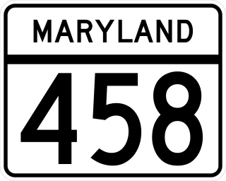
Maryland Route 458 is a state highway in the U.S. state of Maryland. Known as Silver Hill Road, the highway runs 3.12 miles (5.02 km) from MD 5 in Silver Hill north to Walker Mill Road in District Heights. MD 458 is a four- to six-lane divided highway that connects the inner suburbs of Hillcrest Heights, Silver Hill, Suitland, and District Heights in western Prince George's County. The highway also connects those communities with the Suitland station of the Washington Metro. MD 458 was originally constructed in the early 1930s between the original alignments of MD 5 and MD 4. The route was relocated in District Heights in 1960 and widened to a divided highway in the mid-1960s. MD 458 was extended to its present southern and northern termini in the late 1960s and mid-1980s, respectively.


