West Point, Minnesota

Last updated
West Point
USA Minnesota location map.svg
Red pog.svg
West Point
Usa edcp location map.svg
Red pog.svg
West Point
Coordinates: 45°33′28″N93°23′21″W / 45.55778°N 93.38917°W / 45.55778; -93.38917 Coordinates: 45°33′28″N93°23′21″W / 45.55778°N 93.38917°W / 45.55778; -93.38917
Country United States
State Minnesota
County Isanti
Elevation
945 ft (288 m)
Time zone UTC-6 (Central (CST))
  Summer (DST) UTC-5 (CDT)
ZIP code
55008 and 55371
Area code(s) 763
GNIS feature ID655005 [1]

West Point is an unincorporated community in Isanti County, Minnesota, United States.

Unincorporated area Region of land not governed by own local government

In law, an unincorporated area is a region of land that is not governed by a local municipal corporation; similarly an unincorporated community is a settlement that is not governed by its own local municipal corporation, but rather is administered as part of larger administrative divisions, such as a township, parish, borough, county, city, canton, state, province or country. Occasionally, municipalities dissolve or disincorporate, which may happen if they become fiscally insolvent, and services become the responsibility of a higher administration. Widespread unincorporated communities and areas are a distinguishing feature of the United States and Canada. In most other countries of the world, there are either no unincorporated areas at all, or these are very rare; typically remote, outlying, sparsely populated or uninhabited areas.

Isanti County, Minnesota County in the United States

Isanti County is a county in the U.S. state of Minnesota. As of the 2010 United States Census, the population was 37,816. Its county seat is Cambridge.

Minnesota State of the United States of America

Minnesota is a state in the Upper Midwest, Great Lakes, and northern regions of the United States. Minnesota was admitted as the 32nd U.S. state on May 11, 1858, created from the eastern half of the Minnesota Territory. The state has a large number of lakes, and is known by the slogan the "Land of 10,000 Lakes". Its official motto is L'Étoile du Nord.

The community is located at the junction of State Highway 47 (MN 47) and Roanoke Street NW. The Rum River flows through the community.

Minnesota State Highway 47 is a highway in east–central Minnesota, which runs from its intersection with Central Avenue in Minneapolis and continues north to its northern terminus at its intersection with U.S. Highway 169 in Aitkin.

Rum River river in the United States of America

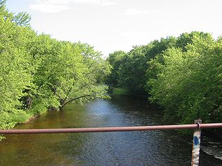
The Rum River is a slow, meandering channel that connects Minnesota's Mille Lacs Lake with the Mississippi River. It runs for 151 miles (243 km) through the communities of Onamia, Milaca, Princeton, Cambridge, Isanti, and St. Francis before ending at the Twin Cities suburb of Anoka, roughly 20 miles northwest of downtown Minneapolis. It is one of the six protected Wild and Scenic rivers in Minnesota.

West Point is located at the survey point boundary line for:

Section (United States land surveying) square subdivision of a U.S. survey township

In U.S. land surveying under the Public Land Survey System (PLSS), a section is an area nominally one square mile, containing 640 acres, with 36 sections making up one survey township on a rectangular grid.

Wyanett Township, Isanti County, Minnesota Township in Minnesota, United States

Wyanett Township is a township in Isanti County, Minnesota, United States. The population was 1,698 at the 2000 census.

Springvale Township, Isanti County, Minnesota Township in Minnesota, United States

Springvale Township is a township in Isanti County, Minnesota, United States. The population was 1,384 at the 2000 census.

Bradford Township, Isanti County, Minnesota Township in Minnesota, United States

Bradford Township is a township in Isanti County, Minnesota, United States. The population was 3,472 at the 2000 census.

Related Research Articles

Alborn, Minnesota Unincorporated community in Minnesota, United States

Alborn is an unincorporated community in Alborn Township, Saint Louis County, Minnesota, United States.

Coin, Minnesota Unincorporated community in Minnesota, United States

Coin is an unincorporated community in Brunswick Township, Kanabec County, Minnesota, United States.

Crown, Minnesota Unincorporated community in Minnesota, United States

Crown is an unincorporated community in Stanford Township, Isanti County, Minnesota, United States. The community is located north of St. Francis.

Pine Brook, Minnesota Unincorporated community in Minnesota, United States

Pine Brook is an unincorporated community in Isanti County, Minnesota, United States.

Bradford, Minnesota Unincorporated community in Minnesota, United States

Bradford is an unincorporated community in Bradford Township, Isanti County, Minnesota, United States.

Dalbo, Minnesota Unincorporated community in Minnesota, United States

Dalbo is an unincorporated community in Dalbo Township, Isanti County, Minnesota, United States.

Athens, Minnesota Unincorporated community in Minnesota, United States

Athens is an unincorporated community in Athens Township, Isanti County, Minnesota, United States.

Blomford, Minnesota Unincorporated community in Minnesota, United States

Blomford is an unincorporated community in Isanti County, Minnesota, United States.

Day, Minnesota Unincorporated community in Minnesota, United States

Day is an unincorporated community in Maple Ridge Township, Isanti County, Minnesota, United States.

Grandy, Minnesota Unincorporated community in Minnesota, United States

Grandy is an unincorporated community in Cambridge Township, Isanti County, Minnesota, United States.

Stanchfield, Minnesota Unincorporated community in Minnesota, US

Stanchfield is an unincorporated community and census-designated place (CDP) in Stanchfield Township, Isanti County, Minnesota, United States. As of the 2010 census, its population was 118.

Oxlip, Minnesota Unincorporated community in Minnesota, United States

Oxlip is an unincorporated community in Isanti County, Minnesota, United States. The community is located within Spencer Brook Township and Bradford Township.

Springvale, Minnesota Unincorporated community in Minnesota, United States

Springvale is an unincorporated community in Springvale Township, Isanti County, Minnesota, United States.

Stanley, Minnesota Unincorporated community in Minnesota, United States

Stanley is an unincorporated community in Isanti Township, Isanti County, Minnesota, United States.

Walbo, Minnesota Unincorporated community in Minnesota, United States

Walbo is an unincorporated community in Springvale Township, Isanti County, Minnesota, United States.

Weber, Minnesota Unincorporated community in Minnesota, United States

Weber is an unincorporated community in Isanti County, Minnesota, United States.

Wyanett, Minnesota Unincorporated community in Minnesota, United States

Wyanett is an unincorporated community in Wyanett Township, Isanti County, Minnesota, United States.

Edgewood, Minnesota Unincorporated community in Minnesota, United States

Edgewood is an unincorporated community in Isanti Township, Isanti County, Minnesota, United States.

Spring Lake, Isanti County, Minnesota Unincorporated community in Minnesota, United States

Spring Lake is an unincorporated community in North Branch Township, Isanti County, Minnesota, United States.

Greeley, Minnesota Unincorporated community in Minnesota, United States

Greeley is an unincorporated community in Royalton Township, Pine County, Minnesota, United States.

References

  1. "West Point, Minnesota". Geographic Names Information System . United States Geological Survey.