
Crow Wing County is a county in the East Central part of the U.S. state of Minnesota. As of the 2020 census, the population was 66,123. Its county seat is Brainerd. The county was formed in 1857, and was organized in 1870.

Cass County is a county in the central part of the U.S. state of Minnesota. As of the 2020 census, the population was 30,066. Its county seat is Walker. The county was formed in 1851, and was organized in 1897.

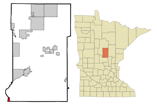
Farm Island Township is a township in Aitkin County, Minnesota, United States. The population was 1,099 as of the 2010 census.
Fort Ripley is a city in Crow Wing County, Minnesota, United States, near the confluence of the Mississippi and Nokasippi Rivers. The population was 69 at the 2010 census. It is part of the Brainerd Micropolitan Statistical Area.
Wolford Township is a township in Crow Wing County, Minnesota, United States. The population was 326 at the 2000 census. Wolford Township was named for Richard Wolford, an early settler.

Manganese is a ghost town and former mining community in the U.S. state of Minnesota that was inhabited between 1912 and 1960. It was built in Crow Wing County on the Cuyuna Iron Range in sections 23 and 28 of Wolford Township, about 2 miles (3 km) north of Trommald, Minnesota. After its formal dissolution, Manganese was absorbed by Wolford Township; the former town site is located between Coles Lake and Flynn Lake. First appearing in the U.S. Census of 1920 with an already dwindling population of 183, the village was abandoned by 1960.
Merrifield is an unincorporated community and census-designated place (CDP) in Lake Edward Township, Crow Wing County, Minnesota, United States, near Brainerd. It is along Crow Wing County Road 3 near County Road 127. Its population was 140 as of the 2010 census.
Lake Hubert is an unincorporated community in Lake Edward Township, Crow Wing County, Minnesota, United States. Lake Hubert is 2 miles (3.2 km) southeast of Nisswa. It is along Crow Wing County Road 13 near County Road 137. Lake Hubert has the ZIP code 56459.
Crow Wing is an unincorporated community in Crow Wing Township, Crow Wing County, Minnesota, United States, south of Brainerd and Baxter. It is along State Highway 371 near 50th Avenue SW and 85th Street. Crow Wing is three miles northeast of Crow Wing State Park and the former town of Old Crow Wing.
Barrows is an unincorporated community in Crow Wing Township, Crow Wing County, Minnesota, United States, near Brainerd. It is located along Business Highway 371 near Depot Street, Barrows Avenue, and 70th Avenue.
Woodrow is an unincorporated community in Oak Lawn Township, Crow Wing County, Minnesota, United States, near Brainerd. It is along Woodrow Road near Dullum Road.
Swanburg is an unincorporated community in Timothy Township, Crow Wing County, Minnesota, United States. It is along Crow Wing County Road 1 near Swanburg Road. Nearby places include Pine River, Manhattan Beach, and Crosslake.
St. Mathias is an unincorporated community in St. Mathias Township, Crow Wing County, Minnesota, United States. It is along Crow Wing County Road 121 near Hay Creek Road and Sleepy Hollow Road. Nearby places include Fort Ripley, Brainerd, and St. Mathias Park. Hay Creek and the Nokasippi River both flow nearby.
Pine Center is an unincorporated community in Roosevelt Township, Crow Wing County, Minnesota, United States. The community is located near the junction of Crow Wing County Roads 2 and 8. Nearby places include Brainerd, Garrison, Hillman, and Vineland.
Mission is an unincorporated community in Mission Township, Crow Wing County, Minnesota, United States, near Crosby and Merrifield. It is along Crow Wing County Road 11 near Mission Way.
Loerch is an unincorporated community in Oak Lawn Township, Crow Wing County, Minnesota, United States, near Brainerd. It is along Loerch Road near Dullum Road.
Little Pine is an unincorporated community in Little Pine Township, Crow Wing County, Minnesota, United States, near Emily. It is along Crow Wing County Road 1 near County Road 106. The Little Pine River flows nearby.
Iron Hub is an unincorporated community in Rabbit Lake Township, Crow Wing County, Minnesota, United States, near Deerwood and Aitkin. It is along Iron Hub Road near Crow Wing County Road 32 and State Highway 210.
Ideal Corners is an unincorporated community in Ideal Township, Crow Wing County, Minnesota, United States, near Pequot Lakes. It is along County Road 16 near County Road 39.
Bay Lake is an unincorporated community in Bay Lake Township, Crow Wing County, Minnesota, United States, near Deerwood. It is along State Highway 6 near the junction with Crow Wing County Road 14.


