York University Heights

Last updated
York University Heights/Northwood Park
Neighbourhood
Q4132759 York University Subway Station A01.jpg
View of York University Heights from York University station
York University Heights map.PNG
CountryFlag of Canada (Pantone).svg  Canada
ProvinceFlag of Ontario.svg  Ontario
City Toronto
Municipality established1850 York Township
Changed municipality1922 North York from York Township
Changed municipality1998 Toronto from North York
Population
 (2016) [1]
  Total27,593
  Density2,086/km2 (5,400/sq mi)

York University Heights, also known as Northwood Park, is a neighbourhood in Toronto, Ontario, Canada. It is one of Toronto's northernmost neighbourhoods, located along the northern boundary of Steeles Avenue in the former city of North York. The neighbourhood is so named because it contains the main campus of York University. This area is most popular with immigrants of Italian and Chinese descent who have established communities in the area. It is located between Sheppard Avenue and Steeles Avenue east of Black Creek (Derrydowns Park).

Contents

The neighborhood contains many private residences, many of which are detached and semi-detached bungalows, townhouses as well as a recent new urbanism development, the Village at York, there is also a handful of condominiums, several lowrise apartments, and a few high rise apartments.

History

The Village at York University

The Village at York University is one of the last major new-home developments within the City of Toronto including condominium townhouses, semi-detached and detached homes. First residents moved into the first phase of approximately 550 homes in the summer of 2005. A second phase, which started construction in 2007, adds about 300 more homes but includes no new townhouses. It is located just south of the York University campus, north of Finch Avenue.

Characteristics of The Village:

The Village is served by a residents' group representing both renters and homeowners, which was incorporated in mid-2006.

Education

In the northwest of the neighbourhood is the campus for York University, which also holds Seneca College's Seneca@York campus. Seneca@York4.JPG
In the northwest of the neighbourhood is the campus for York University, which also holds Seneca College's Seneca@York campus.

Two public school boards operate schools in York University Heights, the separate Toronto Catholic District School Board (TCDSB), and the secular Toronto District School Board (TDSB). The French first language public secular school board, Conseil scolaire Viamonde, and it separate counterpart, Conseil scolaire catholique MonAvenir also offer schooling to applicable residents of Morningside, although they do not operate a school in the neighbourhood, with CSCM/CSV students attending schools situated in other neighbourhoods in Toronto.

Both TCDSB, and TDSB operate public elementary schools in the neighbourhood. TCDSB operates one elementary school in the neighbourhood, St. Wilfred Catholic School; whereas TDSB operate five institions that provide primary education, Derrydown Public School, Elia Middle School, Lamberton Public School, Sheppard Public School, and Stilecroft Public School. Both school boards also operate public secondary schools in the neighbourhood. TCDSB operates James Cardinal McGuigan Catholic High School, whereas TDSB operates C. W. Jefferys Collegiate Institute.

In addition to elementary and secondary education institutions, the northwest portion of the neighbourhood is home to two public post-secondary institutions, York University, as well as a branch of Seneca College, located at the same university campus.

Demographics

Major ethnic populations (2016): [1]

Transportation

Entrance to Finch West station, a subway station in the neighbourhood. Q4132860 Finch West A03.jpg
Entrance to Finch West station, a subway station in the neighbourhood.

Several major roadways pass through the neighbourhood including north–south Keele Street, and east–west roadways Finch and Sheppard Avenue. To the north, the neighbourhood is bounded by Steeles Avenue.

Public transit

Public transportation in the neighbourhood is provided by the Toronto Transit Commission (TTC). The TTC operates a number of public transportation services, including bus routes, and the Toronto subway. Three subway stations of Line 1 Yonge–University are located in the neighbourhood, Pioneer Village station on Steeles Avenue, York University station, and Finch West station on Finch Avenue. Pioneer Village station also provides access to York Region Transit bus routes.

Until March 18, 2020, the neighbourhood was also serviced by York University GO Station, a railway station on GO Transit's Barrie line, located east of the university campus. The station was permanently closed due to low passenger usage. [3] [4]

Related Research Articles

<span class="mw-page-title-main">Agincourt, Toronto</span> Neighbourhood in Toronto, Ontario, Canada

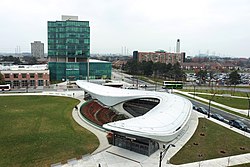
Agincourt is a neighbourhood and former village in Toronto, Ontario, Canada. Agincourt is located in northeast Toronto, along Sheppard Avenue between Kennedy and Markham Roads. It is officially recognized by the City of Toronto as occupying the neighbourhoods of Agincourt South–Malvern West and Agincourt North.

<span class="mw-page-title-main">Downsview</span> Neighbourhood in Toronto, Ontario, Canada

Downsview is a neighbourhood in the north end of Toronto, Ontario, Canada, located in the district of North York. The area takes its name from the Downs View farm established around 1842 near the present-day intersection of Keele Street and Wilson Avenue. It now extends beyond the intersection of Sheppard Avenue and Dufferin Street, though it is popularly seen as including the areas to the north right up to the Toronto city limit at Steeles Avenue. The area includes several large post-World War II subdivisions. Within the area is Downsview Airport, the former site of Canadian Forces Base Downsview, which has since been largely converted following the end of the Cold War into an urban park known as Downsview Park. The airport is still used as a manufacturing and testing facility for Bombardier Aerospace.

<span class="mw-page-title-main">Jane and Finch</span> Neighbourhood in Toronto, Ontario, Canada

Jane and Finch is a neighbourhood located in the northwest end of Toronto, Ontario, Canada, in the district of North York. Centred at the intersection of Jane Street and Finch Avenue West, the area is roughly bounded by Highway 400 to the west, Black Creek to the east, Sheppard Avenue to the south, and Steeles Avenue to the north.

<span class="mw-page-title-main">Newtonbrook</span> Neighbourhood of Toronto

Newtonbrook is a neighbourhood in Toronto, Ontario, Canada. It is located in the area around Yonge Street and Finch Avenue in the district of North York between the east and west branches of the Don River. Officially, the area is divided into two neighbourhoods; Newtonbrook West and Newtonbrook East.

<span class="mw-page-title-main">Malvern, Toronto</span> Neighbourhood in Toronto, Ontario, Canada

Malvern is a neighbourhood in the city of Toronto, Ontario, Canada, with a population of 44,315. It is located in the northeast corner of the city.

<span class="mw-page-title-main">Willowdale, Toronto</span> Neighbourhood in Toronto, Ontario, Canada

Willowdale is a neighbourhood in the city of Toronto, Ontario, Canada, located in the district of North York. It developed from three postal villages: Newtonbrook, Willowdale and Lansing.

<span class="mw-page-title-main">Henry Farm</span> Neighbourhood in Toronto, Ontario, Canada

Henry Farm is a neighbourhood in the City of Toronto, Ontario, Canada. It is located in the north central part of the city within the former city of North York.

<span class="mw-page-title-main">Bayview Village</span> Neighbourhood in Toronto, Ontario, Canada

Bayview Village is an neighbourhood in Toronto, Ontario, Canada. It is part of the federal Don Valley North riding and the provincial Don Valley North electoral district, and Toronto electoral Ward 17: Don Valley North. In 2006, it had a population of 15,370.

<span class="mw-page-title-main">Humber Summit</span> Neighbourhood in Toronto, Ontario, Canada

Humber Summit is a neighbourhood in Toronto, Ontario, Canada. It is one of the northernmost neighbourhoods in Toronto, located in the North York district of the city. It is bounded by Steeles Avenue to the north, Highway 400 to the east, Finch Avenue to the south, and follows the Humber River to the west.

<span class="mw-page-title-main">Humbermede</span> Neighbourhood in Toronto, Ontario, Canada

Humbermede, often called Emery, is a neighbourhood of Toronto, Ontario, Canada. Humbermede, like many of the "Humber" neighbourhoods in the city, gets its name from the Humber River. It is bounded on the west by the Humber River, on the north by Finch Avenue West, on the east by the Highway 400 and on the south by Sheppard Avenue West.

<span class="mw-page-title-main">Glen Park, Toronto</span> Neighbourhood in Toronto, Ontario, Canada

Glen Park is a neighbourhood in the city of Toronto, Ontario, Canada, located in the former suburb of North York. It is bounded by Lawrence Avenue to the north, Bathurst Street to the east, a line south of Stayner Avenue to the south, and the CNR tracks to the west. It is also included as part of the larger official Yorkdale-Glen Park neighbourhood.

<span class="mw-page-title-main">Lawrence Manor</span> Neighbourhood in Toronto, Ontario, Canada

Lawrence Manor is a neighbourhood in the city of Toronto, Ontario, Canada. This neighbourhood is bounded by Bathurst Street on the east, Highway 401 to the north, the Allen to the west, and Lawrence Avenue to the south. The western side of the area borders along Bathurst Heights and the large public housing project.

<span class="mw-page-title-main">Clanton Park, Toronto</span> Neighbourhood in Toronto, Ontario, Canada

Clanton Park is a neighbourhood in Toronto, Ontario, Canada. Located in the district of North York, it is part of federal and provincial electoral district York Centre, and Toronto electoral wards 9: York Centre (West) and 10: York Centre (East). In 2006, it had a population of 13,035.

<span class="mw-page-title-main">Westminster-Branson</span> Neighbourhood in Toronto, Ontario, Canada

Westminster-Branson is a neighbourhood in the city of Toronto, Ontario, Canada. It is in the northernmost part of the city within the area of North York.

<span class="mw-page-title-main">Pleasant View, Toronto</span> Neighbourhood in Toronto, Ontario, Canada

Pleasant View is a neighbourhood in the city of Toronto, Ontario, Canada that is located in the district of North York at the northern end of the city. It is bordered by Victoria Park to the East, Sheppard Avenue to the South, Highway 404 to the west and the Finch hydro corridor to the north. The neighbourhood is home to several high-rise apartment and condominium buildings, such as The Clippers.

<span class="mw-page-title-main">Don Valley Village</span> Neighbourhood in Toronto, Ontario, Canada

Don Valley Village is a neighbourhood in the city of Toronto, Ontario, Canada. It is located in the former suburb of North York. Located north of Highway 401 and bisected by Don Mills Road, it is bounded by Sheppard Avenue to the south, Leslie Street to the west, Finch Avenue to the north and Highway 404 to the east. Like the nearby Don River Valley, the neighbourhood has hill and dale topography.

<span class="mw-page-title-main">Hillcrest Village</span> Neighbourhood in Toronto, Ontario, Canada

Hillcrest Village is a neighbourhood located in Toronto, Ontario, Canada. It is located in the northern district of North York. It is bordered by Finch to the South, Leslie Street to the West, Steeles to the North and Victoria Park to the East. Both neighbourhoods share the Don Valley as a point of reference in the Eastern border of the neighbourhoods.

<span class="mw-page-title-main">Bayview Woods-Steeles</span> Neighbourhood in Toronto, Ontario, Canada

Bayview Woods-Steeles is a neighbourhood located in the northern tip of the city of Toronto, Ontario, Canada in the district of North York. It is part of federal and provincial electoral district Willowdale, and Toronto electoral ward 24: Willowdale (East). In 2006, it had a population of 13,295. The area is divided by a series of ravines, and is often not considered a neighbourhood unto itself. Rather the sections are more often divided between the neighbouring areas of Hillcrest Village, Bayview Village, and Newtonbrook.

<span class="mw-page-title-main">Woburn, Toronto</span> Neighbourhood in Toronto, Ontario, Canada

Woburn is a neighbourhood located in eastern Toronto, Ontario, Canada, in the former suburb of Scarborough. Woburn is bordered by Highway 401 to the north, Orton Park Road to the east, Lawrence Avenue to the south, and McCowan Road to the west.

<span class="mw-page-title-main">Morningside Heights, Toronto</span> Neighbourhood in Toronto, Ontario, Canada

Morningside Heights is a residential neighbourhood in Toronto, Ontario, Canada. It is located in the northeast corner of the city, in the district of Scarborough, just north of the neighbourhood of Malvern and west of Rouge Park and the Rouge. The subdivision, comprising approximately 750 acres (3.0 km2), was one of the last large tracts of undeveloped land within the City of Toronto, located between Finch Avenue East and Steeles Avenue East, from Tapscott Road to the Rouge River.

References

  1. 1 2 "2016 Neighborhood Profile York University Heights" (PDF). City of Toronto. Retrieved 9 January 2019.
  2. "Planning & Development". 14 July 2017.
  3. "GO Train Shuttle Service". York University. Archived from the original on July 19, 2021. Retrieved July 19, 2021.
  4. "York University GO Station closes to make way for Barrie Line expansion". Metrolinx. July 19, 2021. Archived from the original on July 19, 2021. Retrieved July 19, 2021.

Coordinates: 43°45′43″N79°30′00″W / 43.762°N 79.500°W / 43.762; -79.500