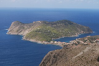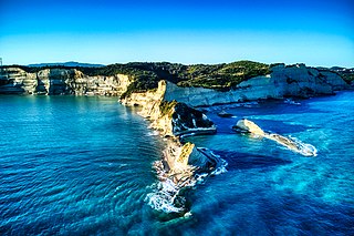
Kefalonia or Cephalonia, formerly also known as Kefallinia or Kephallenia (Κεφαλληνία), is the largest of the Ionian Islands in western Greece and the 6th largest island in Greece after Crete, Euboea, Lesbos, Rhodes and Chios. It is also a separate regional unit of the Ionian Islands region. It was a former Latin Catholic diocese Kefalonia–Zakynthos (Cefalonia–Zante) and short-lived titular see as just Kefalonia. The capital city of Cephalonia is Argostoli.

The Ionian Islands are a group of islands in the Ionian Sea, west of mainland Greece. They are traditionally called the Heptanese, but the group includes many smaller islands in addition to the seven principal ones.

Argostoli is a town and a municipality on the island of Kefalonia, Ionian Islands, Greece. Since the 2019 local government reform it is one of the three municipalities on the island. It has been the capital and administrative centre of Kefalonia since 1757, following a population shift down from the old capital of Agios Georgios, also known as Kastro, to take advantage of the trading opportunities provided by the sheltered bay upon which Argostoli sits.

The 1999 Düzce earthquake occurred on 12 November at with a moment magnitude of 7.2 and a maximum Mercalli intensity of IX (Violent), causing damage and at least 845 fatalities in Düzce, Turkey. The epicenter was approximately 100 km (62 mi) to the east of the extremely destructive 1999 İzmit earthquake that happened nearly three months earlier. Both strike-slip earthquakes were caused by movement on the North Anatolian Fault.

The 1999 Athens earthquake occurred on September 7 at near Mount Parnitha in Greece with a moment magnitude of 6.0 and a maximum Mercalli intensity of IX (Violent). The proximity to the Athens metropolitan area resulted in widespread structural damage, mainly to the nearby suburban towns of Ano Liosia, Acharnes, Fyli, Thrakomakedones, Kifissia, Metamorfosi, Kamatero and Nea Filadelfeia. More than 100 buildings across those areas collapsed trapping scores of victims under their rubble while dozens more were severely damaged. With damage estimated at $3–4.2 billion, 143 people were killed, and up to 1,600 were treated for injuries in Greece's deadliest natural disaster in almost half a century.
The 2007 Alum Rock earthquake occurred on in Alum Rock Park in San Jose, in the U.S. state of California. It measured 5.6 on the moment magnitude scale and had a maximum Mercalli intensity of VI (Strong). The event was then the largest in the San Francisco Bay Area since the 1989 Loma Prieta earthquake, which measured 6.9 on the moment magnitude scale, but was later surpassed by the 2014 South Napa earthquake. Ground shaking from the Alum Rock quake reached San Francisco and Oakland and other points further north. Sixty thousand felt reports existed far beyond Santa Rosa, as far north as Eugene, Oregon.

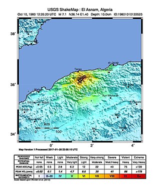
The 1980 El Asnam earthquake occurred on October 10 at with a moment magnitude of 7.1 and a maximum Mercalli intensity of X (Extreme). The shock occurred in the Algerian town of El Asnam. The shocks were felt over 550 km (340 mi) away, with the initial earthquake lasting 35 seconds. It was the largest earthquake in Algeria, and was followed three hours later by a magnitude 6.2 aftershock. The earthquake created about 42 km (26 mi) of surface rupture and had a vertical slip of up to 4.2 m (14 ft). No foreshocks were recorded. The earthquake was found to have occurred very close to the epicenter of the 1954 Chlef earthquake using joint epicenter determination techniques. It occurred at a previously unknown reverse fault.
The 1971 Bingöl earthquake was a Mw 6.6 earthquake that occurred at on 22 May. It had a surface-wave magnitude of 6.9 and a maximum intensity of VIII (Severe) on the Mercalli intensity scale, killing 755–1,000 people.
The 1303 Crete earthquake occurred at about dawn on 8 August. It had an estimated magnitude of about 8, a maximum intensity of IX (Violent) on the Mercalli intensity scale, and triggered a major tsunami that caused severe damage and loss of life on Crete and at Alexandria. It badly damaged the Lighthouse of Alexandria.
The 2006 Mozambique earthquake occurred at 22:19 UTC on 22 February. It had a magnitude of 7.0 on the moment magnitude scale and caused 4 deaths and 36 injuries. The epicenter was near Machaze in Manica Province of southern Mozambique, just north of the Save River. It was the largest historical earthquake in Mozambique and the first earthquake in southern Africa to have an identified surface rupture.
The 1886 Peloponnese earthquake occurred at 23:27 local time on 27 August. It had an estimated magnitude between 6.8 and 7.3 on the moment magnitude scale and a maximum felt intensity of X (Extreme) on the Mercalli intensity scale. It caused extensive damage in Messenia, with the towns of Filiatra and Marathos both severely affected. Between 326 and 600 people were killed. It was felt over a wide area from the Khedivate of Egypt to Malta and possibly as far away as Bern and Marseille.

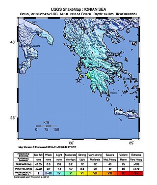
A strong earthquake measuring magnitude Mw 6.8 occurred in the Ionian Sea near the coasts of Greece during the night between 25 and 26 October 2018 at 22:54:51 UTC. Sea level changes were predicted, and a tsunami advisory was issued. Reports of sea level change of up to 20 centimeters were reported in Greece and Italy.
The 1988 Myanmar–India earthquake, also known as the Indo–Burma earthquake struck the Sagaing Region of Myanmar, about 30 kilometres (19 mi) from the border with India on 6 August at 7:06 am MMT with a moment magnitude (Mw ) of 7.3 or Richter magnitude (ML ) of 7.5. At least five people were killed, more than 30 were injured, and another 30 were missing as a result. Serious damage was reported in India and Bangladesh, while some minor damage occurred in Myanmar. The earthquake was reportedly felt in the Soviet Union.
The 1839 Martinique earthquake occurred on the morning of January 11 with an estimated magnitude of 7.8 Ms , the largest in the Lesser Antilles since 1690. The maximum intensity of this earthquake was assigned IX on both the Mercalli and MSK intensity scales, which left the cities of Saint-Pierre and Fort Royal almost completely destroyed. Estimation on the number of human losses varies from 390 to even 4,000 making this one of the deadliest earthquakes in the Caribbean.
The 1889 Chilik earthquake occurred on July 11 on the Gregorian calendar, or June 30 on the Julian calendar at 15:14 local time in the Tien Shan mountains. The earthquake measured an estimated Mw 7.9–8.0 on the moment magnitude scale and was assigned a maximum intensity of X (Devastating) on the MSK 64 and Rossi-Forel scales. Over 92 people across Kazakhstan, Kyrgyzstan and China were killed.

The 2021 Hormozgan earthquakes was a doublet earthquake event in Iran that occurred on November 14, 2021 with magnitudes of 6.0 and 6.4 on the moment magnitude scale. The two quakes occurred just a minute and a half apart, killing 2 people and injuring a further 100.
On 29 November, at 14:10 UTC, a magnitude 7.7 earthquake struck off the southern coast of Taliabu Island Regency in North Maluku, Indonesia. At least 41 people were killed on the nearby islands and a tsunami was triggered. Several hundred homes, buildings and offices were damaged or destroyed.


