Albany Park is one of 77 well-defined community areas of Chicago. Located on the Northwest Side of the City of Chicago with the North Branch of the Chicago River forming its east and north boundaries, it includes the ethnically diverse Albany Park neighborhood, with one of the highest percentages of foreign-born residents of any Chicago neighborhood.

Druid Hill Park is a 745-acre (3.01 km2) urban park in northwest Baltimore, Maryland. Its boundaries are marked by Druid Park Drive (north), Swann Drive and Reisterstown Road, and the Jones Falls Expressway / Interstate 83 (east).

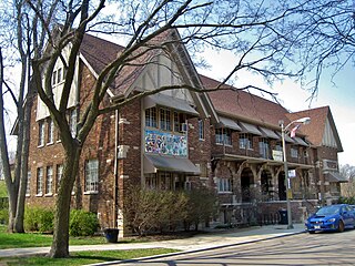
Bolton Hill is a neighborhood in Baltimore, Maryland, with 20 blocks of mostly preserved buildings from the late 19th century. It is listed on the National Register of Historic Places, preserved as a Baltimore City Historic District, and included within the boundaries of Baltimore National Heritage Area. The neighborhood is bounded by North Avenue, Mount Royal Avenue, Cathedral Street, Dolphin Street, and Eutaw Place. Bolton Hill is a largely residential neighborhood with three-story row houses with red brick, white marble steps, and high ceilings. There are also larger more ornate originally single-family houses, many houses of worship, parks, monuments, and a few large apartment buildings. Many significant residents have lived in the neighborhood, including F. Scott Fitzgerald, Woodrow Wilson, the Cone sisters, and Florence Rena Sabin.

Reservoir Hill, also known as Whitelock, is a neighborhood in the city of Baltimore, Maryland, United States. It is located south of Druid Hill Park, north of Bolton Hill, east of Penn-North, and west of Jones Falls. It is bounded by Druid Park Lake Drive, the Jones Falls Expressway, North Avenue, and McCulloh Street. It is contained in the 21217 ZIP code.

Butchers Hill is a neighborhood in Southeast Baltimore, Maryland, United States. It is north of Fells Point, east of Washington Hill, and northwest of Patterson Park. It is south of Fayette Street, west of Patterson Park Avenue, north of Pratt Street, and east of Washington Street. It is in the 21231 zip code.

Park Heights is an area of Baltimore City, Maryland, that lies approximately 10 miles northwest of downtown Baltimore and within two miles of the Baltimore County line. A 1,500-acre community, Park Heights comprises 12 smaller neighborhoods that together contain approximately 30,000 residents. It is bounded on the south by Druid Park Drive, on the west by Wabash Avenue, on the east by Greenspring Avenue, and on the north by Northern Parkway. Interstate-83 is less than a half mile to the east. Two major roadways—Park Heights Avenue and Reisterstown Road—run north-south through Park Heights, serving as the neighborhood's "Main Streets" as well as commuter corridors. Limited commercial uses—primarily retail—are scattered along these roads; there is also some industrial activity on the neighborhood's western edge.

Forest Park is a region of Northwest Baltimore, Maryland located west of Reisterstown Road, south of Northern Parkway, and east of the Baltimore City/County line. In Baltimore, the region is referred to by locals simply as "Forest Park" and includes the neighborhoods of Ashburton, Callaway-Garrison, Central Forest Park, Dolfield, Dorchester, East Arlington, Forest Park, Grove Park, Hanlon Longwood, Howard Park, Garwyn Oaks, Purnell, West Arlington, West Forest Park, and Windsor Hills.

Brooklyn is one of the southernmost neighborhoods in Baltimore, Maryland. It is located near Anne Arundel County along Governor Ritchie Highway which is also Maryland Route 2. Its main roads are South Hanover Street,, Potee Street, and East Patapsco Avenue, Sixth Street, Tenth Street, and West Bay Avenue which borders the neighboring Curtis Bay community to the east, running through Bay Brook Park, which separates the two. South Hanover Street also serves as the dividing line between east–west streets in Brooklyn, as Charles Street does not exist here. Often mistaken as Brooklyn Park, Brooklyn shares the 21225 ZIP Code with the greater Brooklyn Park area which is across the Baltimore City Line in and the other neighboring community of Cherry Hill to the west and northwest across the now small western branch of the Patapsco River flowing from Ellicott City and Elkridge and along the shoreline-hugging southern extension "South Hanover Street" of the downtown's old colonial-era "Hanover Street" across the 1914-1917 Hanover Street Bridge, later renamed the Vietnam Veterans Memorial Bridge in the 1990s.
Sidney William Bijou was an American developmental psychologist who developed an approach of treating childhood disorders using behavioral therapy, in which positive actions were rewarded and negative behaviors were largely ignored, rather than punished.

Edgecomb, also known as Parklane, is a neighborhood in the North District of Baltimore, located between the neighborhoods of Cylburn (north) and Greenspring (south). Its boundaries are marked by Dupont Avenue (north), Coldspring Lane (south), Pimlico Road (west) and Greenspring Avenue (east). Central Park Heights, is located on the opposite side of Pimlico Road in the Northwest District. The neighborhood of Coldspring is located to Edgecomb's east, across Greenspring Avenue.

Cylburn is a neighborhood in the North District of Baltimore, located between the neighborhoods of Levindale (north) and Edgecomb (south). Its boundaries are marked by Cylburn Avenue (north), Dupont Avenue (south), Pimlico Road (west) and Greenspring Avenue (east). Central Park Heights, is located on the opposite side of Pimlico Road in the Northwest area of Baltimore City. Cylburn Arboretum and the neighborhood of Cold Spring are located to Cylburn's east, across Greenspring Avenue. The heavily wooded property with its historic mansion and grounds, walking trails, famous collections and gardens overlook the Jones Falls Valley with the Jones Falls Expressway further to the east.

Harwood is a small neighborhood located in the north-central area of Baltimore, Maryland, USA. It sits east of Charles Village, south of Abell, west of Waverly and north of Barclay. Its boundaries are Guilford and Greenmount Avenues to the east and west, and 25th and 29th streets to the north and south. These streets together encompass about 14 city blocks.

Beverly Hills is a neighborhood in the Northeast District of Baltimore, located between the neighborhoods of Moravia-Walther, Arcadia and Lauraville. Its boundaries are drawn by Harford Road (west), Weaver Avenue (south), Harcourt Road (east), Moravia Road (northeast) and Grindon Avenue (north).
Hanlon Longwood is a neighborhood in the Northwest District of Baltimore, located between the neighborhoods of Garwyn Oaks (west) and Burleigh–Leighton (east). It is bounded by North Dukeland Street (east), Garrison Boulevard (west) and the Gwynns Falls Parkway (south). The neighborhood's north boundary is marked by North Longwood Street, North Hilton Street and Liberty Heights Avenue.
Langston Hughes is a neighborhood in the Northwest District of Baltimore, located between the neighborhoods of Central Park Heights (east) and Woodmere. Its roughly pentagonal boundaries are marked by West Belvedere Avenue (northwest), Litchfield Avenue (northeast), Reisterstown Road (south) and Oakmont Avenue (east).

There have been a variety of ethnic groups in Baltimore, Maryland and its surrounding area for 12,000 years. Prior to European colonization, various Native American nations have lived in the Baltimore area for nearly 3 millennia, with the earliest known Native inhabitants dating to the 10th millennium BCE. Following Baltimore's foundation as a subdivision of the Province of Maryland by British colonial authorities in 1661, the city became home to numerous European settlers and immigrants and their African slaves. Since the first English settlers arrived, substantial immigration from all over Europe, the presence of a deeply rooted community of free black people that was the largest in the pre-Civil War United States, out-migration of African-Americans from the Deep South, out-migration of White Southerners from Appalachia, out-migration of Native Americans from the Southeast such as the Lumbee and the Cherokee, and new waves of more recent immigrants from Latin America, the Caribbean, Asia and Africa have added layers of complexity to the workforce and culture of Baltimore, as well as the religious and ethnic fabric of the city. Baltimore's culture has been described as "the blending of Southern culture and [African-American] migration, Northern industry, and the influx of European immigrants—first mixing at the port and its neighborhoods...Baltimore’s character, it’s uniqueness, the dialect, all of it, is a kind of amalgamation of these very different things coming together—with a little Appalachia thrown in...It’s all threaded through these neighborhoods", according to the American studies academic Mary Rizzo.
The history of Russians in Baltimore dates back to the mid-19th century. The Russian community is a growing population and constitutes a major source of new immigrants to the city. Historically the Russian community was centered in East Baltimore, but most Russians now live in Northwest Baltimore's Arlington neighborhood and in Baltimore's suburb of Pikesville.
The history of Hispanics and Latinos in Baltimore dates back to the mid-20th century. The Hispanic and Latino community of Baltimore is the fastest growing ethnic group in the city. There is a significant Hispanic/Latino presence in many Southeast Baltimore neighborhoods, particularly Highlandtown, Upper Fell's Point, and Greektown. Overall Baltimore has a small but growing Hispanic population, primarily in the Southeast portion of the area from Fells Point to Dundalk.
Jews have settled in Maryland since the 17th century. As of 2018, Maryland's population was 3.9% Jewish at 201,600 people. The largest Jewish populations in Maryland are in Montgomery County and the Baltimore metropolitan area, particularly Pikesville and northwest Baltimore. As of 2010, Baltimore and Baltimore County was home to a Jewish community of around 100,000 people. The Maryland suburbs of Washington, D.C. have a Jewish population of around 116,700 as of 2017, with the majority residing in lower Montgomery County. Rockville/Potomac area is the center of Montgomery County's Jewish population, while sizable communities also exist in the Bethesda/Chevy Chase area and in Silver Spring's Kemp Mill neighborhood. Smaller Jewish communities also exist in Gaithersburg, Germantown, White Oak, Olney, and Takoma Park. Columbia, Frederick, and Annapolis are also home to smaller but significant Jewish populations.
Levindale is a neighborhood in northwest Baltimore which includes Sinai Hospital, the Levindale Hebrew Geriatric Center and Hospital, and a small number of detached homes and apartment buildings towards its south.

