Johnston Square, Baltimore

Last updated
Johnston Square
Johnston Square gateway sign, Greenmount Avenue and E. Biddle Street (southeast corner), Baltimore, MD 21202 (46258590315).jpg
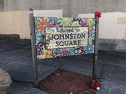
Johnston Square gateway sign at the corner of Greenmount Avenue and E. Biddle Street in Baltimore
Country Flag of the United States.svg  United States
State Flag of Maryland.svg  Maryland
City Flag of Baltimore, Maryland.svg Baltimore
Time zone UTC−5 (Eastern)
  Summer (DST) UTC−4 (EDT)
Area Codes 410, 443, 667

Johnston Square is a neighborhood in central Baltimore, Maryland located east of the Fallsway and west of the Oliver neighborhood, bordered by Greenmount Cemetery at the north and Eager Street at the south.

The neighborhood is erroneously listed by a number of real estate websites as "Johnson Square." The sites also erroneously list the Western border of the neighborhood as Hunter Street. The area bordered by Hunter Street to the West and I-83 to the East is actually more closely associated with the Mt. Vernon and Belvedere neighborhoods, two areas with some of the city's highest incomes and lowest crime rates.

The neighborhood contains Johnston Square Elementary School and two parks, Johnston Square Park and Ambrose Kennedy Park. It is one of five neighborhoods whose Urban Renewal Plans are included in the East Baltimore Revitalization Plan. [1] The neighborhood contains portions of the Baltimore City Correctional Facilities and its residents are mostly low income African-American families. It has been used as a filming location on the HBO drama The Wire.

Related Research Articles

Pasadena, Maryland Census-designated place in Maryland, United States

Pasadena is a census-designated place (CDP) in Anne Arundel County, Maryland, United States. The population was 24,287 at the 2010 census.

Mondawmin, Baltimore Neighborhood of Baltimore in Maryland, United States

Mondawmin is a neighborhood located in the city of Baltimore, Maryland, United States. The neighborhood is surrounded by Druid Hill Park, the Whitelock Community, and Lower Park Heights. Included within its boundaries are Frederick Douglass High School, and Mondawmin Mall. The Baltimore Metro Subway serves the neighborhood, with a station at Mondawmin Mall that is also a hub for many bus routes.

Upton, Baltimore Neighborhood of Baltimore in Maryland, United States

Upton is a neighborhood in Baltimore City, Maryland, United States. The neighborhood is in the western section of the city, roughly between Fremont Avenue and McCulloh Street, extending from Dolphin Street to Bloom Street. Its principal thoroughfare is Pennsylvania Avenue.

Washington Hill, Baltimore Neighborhood of Baltimore in Maryland, United States

Washington Hill is a neighborhood in Baltimore, Maryland, United States. It is north of Fells Point, south of Johns Hopkins Hospital, east of Old Town and Jonestown and west of Butchers Hill. It is bounded by Fayette Street, Washington Street, Lombard Street, and Central Avenue. The neighborhood surrounds Broadway running north from Fells Point to terminate at East North Avenue and is named for the now-defunct Washington Medical College later known as the Church Home and Hospital on Broadway where famed writer/poet Edgar Allan Poe was taken to die in 1849 after being found comatose in a downtown Baltimore street. In the median strip of Broadway is a statue of seven-term mayor of Baltimore, Ferdinand Claiborne Latrobe.

Park Hill, Denver

Park Hill is a neighborhood in Denver, Colorado, U.S. Located in the northeastern quadrant of the city, it is bordered by Colorado Boulevard on the west, East Colfax Avenue on the south, Quebec Street on the east, and East 52nd Avenue on the north. The entire Park Hill neighborhood is located in the area known as East Denver. It is further divided by the City and County of Denver into three administrative neighborhoods, South Park Hill, North Park Hill, and Northeast Park Hill.

Kresson, Baltimore Neighborhood of Baltimore in Maryland, United States

Kresson is a neighborhood of Southeast Baltimore, Maryland, United States.

Middle East, Baltimore Neighborhood of Baltimore in Maryland, United States

Middle East is a neighborhood in the heart of East Baltimore, Maryland.

O'Donnell Heights is a neighborhood named for a public housing development in the far southeastern part of the city of Baltimore, Maryland, United States. It is located south and east of Interstate 95, just west of the border with Baltimore County, and north of the St. Helena neighborhood.

Sandtown-Winchester, Baltimore Neighborhood statistical area in Baltimore, Maryland, United States

Sandtown-Winchester is a neighborhood in West Baltimore, Maryland. Known locally as Sandtown, the community's name was derived from the trails of sand that dropped from wagons leaving town after filling up at the local sand and gravel quarry back in the days of horse-drawn wagons. It is located north of Lafayette Street, west of Fremont Avenue, south of North Avenue, and east of Monroe Street, covering an area of 72 square blocks, patrolled by the Baltimore Police Department's Western District. The community is 98.5% black.

Greenmount West, Baltimore Neighborhood of Baltimore in Maryland, United States

Greenmount West is a neighborhood in the state-designated Station North Arts District of Baltimore City. Its borders consist of Hargrove Alley to the west, Hoffman Street and the Amtrak railroad tracks to the south, the south side of North Avenue to the north, and Greenmount Avenue to the east. Residents in the area include a mix of low, middle and high income families, artists, commuters to Washington DC and working-class Baltimoreans with the majority of residents of African American descent.

Loch Raven, Baltimore

Loch Raven is a neighborhood in the Northeastern part of Baltimore, Maryland. It is located in the Upper Northwood Section of Northeast Baltimore east of Loch Raven Boulevard, west of Mount Pleasant Park, and borders the Baltimore City/County Line and served by the Loch Raven Improvement Association.

Forest Park, Baltimore Neighborhood of Baltimore in Maryland, United States

Forest Park is a region of Northwest Baltimore, Maryland located west of Reisterstown Road, south of Northern Parkway, and east of the Baltimore City/County line. In Baltimore, the region is referred to by locals simply as "Forest Park" and includes the neighborhoods of Ashburton, Callaway-Garrison, Central Forest Park, Dolfield, Dorchester, East Arlington, Forest Park, Grove Park, Hanlon Longwood, Howard Park, Garwyn Oaks, Purnell, West Arlington, West Forest Park, and Windsor Hills.

Brooklyn, Baltimore Neighborhood of Baltimore in Maryland, United States

Brooklyn is one of the southernmost neighborhoods in Baltimore, Maryland. It is located near Anne Arundel County along Governor Ritchie Highway which is also Maryland Route 2. Its main roads are South Hanover Street,, Potee Street, and East Patapsco Avenue, Sixth Street, Tenth Street, and West Bay Avenue which borders the neighboring Curtis Bay community to the east, running through Bay Brook Park, which separates the two. South Hanover Street also serves as the dividing line between east–west streets in Brooklyn, as Charles Street does not exist here. Often mistaken as Brooklyn Park, Brooklyn shares the 21225 ZIP Code with the greater Brooklyn Park area which is across the Baltimore City Line in and the other neighboring community of Cherry Hill to the west and northwest across the now small western branch of the Patapsco River flowing from Ellicott City and Elkridge and along the shoreline-hugging southern extension "South Hanover Street" of the downtown's old colonial-era "Hanover Street" across the 1914-1917 Hanover Street Bridge, later renamed the Vietnam Veterans Memorial Bridge in the 1990s.

Medfield, Baltimore Neighborhood of Baltimore in Maryland, United States

Medfield is a neighborhood located in north Baltimore, Maryland, United States of America. It is located to the north of the trendy Hampden neighborhood and south of affluent Roland Park neighborhood. Its unofficial boundaries are Coldspring Lane to the north; Jones Falls Expressway to the west; Falls Road/Hickory Avenue to the east; and West 41st Street to the south.

Mid-Govans, Baltimore Neighborhood of Baltimore in Maryland, United States

Mid-Govans is a community in northeast Baltimore, Maryland and part of the development of York Road, a historic Baltimore route to Pennsylvania. As the name suggests, Mid-Govans is located in the center of the larger neighborhood, Govans, with the rough boundaries of York Road to the west, Belvedere Avenue to the north, Midwood Avenue to the east, and Woodbourne Avenue to the south.

Pen Lucy, Baltimore Neighborhood of Baltimore in Maryland, United States

Pen Lucy is a small community in the North District of Baltimore and part of the development of York Road, a historic Baltimore route to Pennsylvania. The Pen Lucy neighborhood features many different housing types. The neighborhood is bounded by Argonne Drive (south), East 43rd Street (north), Greenmount Avenue (west) and The Alameda (east). The Pen Lucy Neighborhood Association, Inc., a non profit community organization represents the residents of the Pen Lucy Community.

Keswick is a residential neighborhood in Baltimore, Maryland. The area is mostly surrounded by, and sometimes considered a part of, the Roland Park neighborhood. It also borders the Evergreen neighborhood to the north and Guilford to the east. Keswick is delineated as south of West Cold Spring Lane, east of Kittery Lane, north of Overhill Road, and west of Stony Run stream.

Remington, Baltimore Neighborhood of Baltimore in Maryland, United States

Remington is a neighborhood in northern Baltimore bordered to the north by Hampden, Wyman Park, and Johns Hopkins University and to the east by Charles Village. The southernmost boundary is North Avenue and the long southwestern boundary is formed by Falls Road in the I-83 corridor. The neighborhood is split between two Baltimore City Council Districts.

Shelltown, San Diego Community of San Diego in California

Shelltown is a neighborhood located within Southeast San Diego, approximately 5 minutes from downtown San Diego by car and 25 minutes by bicycle. It is bordered by National City on the south, Interstate 5 and Barrio Logan on the west, 43rd Avenue on the east, and Gamma Court and the neighborhood of Southcrest on the north. Prior to the 1980s the northern border of Shelltown was National Ave and many residents still consider that the northern border.

Harwood, Baltimore Neighborhood of Baltimore in Maryland, United States

Harwood is a small neighborhood located in the north-central area of Baltimore, Maryland, USA. It sits east of Charles Village, south of Abell, west of Waverly and north of Barclay. Its boundaries are Guilford and Greenmount Avenues to the east and west, and 25th and 29th streets to the north and south. These streets together encompass about 14 city blocks.

References

  1. "Archived copy" (PDF). Archived from the original (PDF) on 2013-12-21. Retrieved 2013-12-15.{{cite web}}: CS1 maint: archived copy as title (link)

Coordinates: 39°18′11″N76°36′20.5″W / 39.30306°N 76.605694°W / 39.30306; -76.605694