
Route 70 is a state highway located in the U.S. state of New Jersey. It extends 59.84 mi (96.30 km) from an interchange with Route 38 in Pennsauken Township, Camden County, east to an intersection with Route 34 and Route 35 in Wall Township, Monmouth County. Route 70 cuts across the middle of the state as a two-lane highway through the Pine Barrens in Burlington and Ocean counties. A popular truck route, it provides access between Philadelphia and the surrounding Delaware Valley metropolitan area and the Jersey Shore resorts, particularly Long Beach Island by way of Route 72. It is also a congested commercial route within Philadelphia's New Jersey suburbs. The western section in Cherry Hill and Marlton is a four- to eight-lane divided highway that serves as a major suburban arterial and is locally known as Marlton Pike. The eastern section in Monmouth and Ocean counties is also a multilane divided highway that runs through suburban areas. Route 70 is officially known as the John Davison Rockefeller Memorial Highway its entire length in honor of John Davison Rockefeller.

Whitemarsh Township is a Home rule municipality in Montgomery County, Pennsylvania. It retains its former classification of "Township" in its official name despite being a home rule municipality. The population was 17,349 at the 2010 census. Whitemarsh is adjacent to the neighborhood of Andorra in the Roxborough section of Philadelphia, and is bordered in Montgomery County by Springfield, Upper Dublin, Whitpain, and Plymouth townships, Conshohocken, and the Schuylkill River, which separates it from Lower Merion Township.

Nottingham is an unincorporated community and census-designated place that is located in West Nottingham Township in Chester County, Pennsylvania, United States.

Addington Highlands is a township in central eastern Ontario, Canada, in the County of Lennox and Addington. Bon Echo Provincial Park is located primarily in Addington Highlands.

Drummond/North Elmsley is a township in eastern Ontario, Canada in Lanark County. It is situated on the north shore of the Rideau River between the town of Perth and the town of Smiths Falls. It is a predominantly rural municipality. The township offices are located in the hamlet of Port Elmsley.
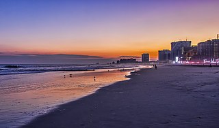
South Jersey comprises the southern portion of the U.S. state of New Jersey located between Pennsylvania and the lower Delaware River in the west and the Atlantic Ocean in the east. The designation of South Jersey with a distinct toponym is a colloquialism rather than an administrative definition and reflects geographical and perceived cultural and other differences between South Jersey and the northern part of the state. South Jersey is part of the Philadelphia metropolitan area, the seventh-largest metropolitan region in the nation with 6.288 million residents in the core metropolitan statistical area and 7.366 million residents in the combined statistical area as of 2020. South Jersey is known for containing the unique ecoregion known as the Pine Barrens, which remains largely undisturbed despite its location within the Northeastern megalopolis. The South Jersey Pine Barrens are the largest remaining example of the Atlantic coastal pine barrens ecosystem.

Chatsworth is an unincorporated community located within Woodland Township in Burlington County, New Jersey, United States. The area is served as United States Postal Service ZIP Code 08019. The New Jersey Central's Blue Comet passenger train was wrecked here in 1939. Chatsworth has been called "Capital of the Pine Barrens."
Lafayette Hill is an unincorporated community, which is situated primarily within Whitemarsh Township, Montgomery County, Pennsylvania. A small part of this community is also located in Springfield Township.

Bald Hill Township is one of sixteen townships in Jefferson County, Illinois, USA. As of the 2010 census, its population was 767 and it contained 359 housing units.

Elk Prairie Township is one of sixteen townships in Jefferson County, Illinois, USA. As of the 2010 census, its population was 725 and it contained 350 housing units.

Barren Township is one of twelve townships in Franklin County, Illinois, USA. As of the 2010 census, its population was 496 and it contained 224 housing units.
Central Barren is an unincorporated community in Morgan Township, Harrison County, Indiana.

Prospertown is an unincorporated community located within the New Jersey townships of Jackson and Plumsted in Ocean County and Upper Freehold in Monmouth County. The community is home to Prospertown Lake and is adjacent to Six Flags Great Adventure, both located on County Route 537. The center of the community is located at the intersection of CR 537, Hawkin Road, and Emleys Hill Road. Most of the area consists of pine forests but there are some homes along the roads in the area.

Miquon is an unincorporated community in Montgomery County, Pennsylvania, United States. Located partly in Whitemarsh Township and partly in Springfield Township, it lies between the Roxborough section of Philadelphia and the Spring Mill section of Whitemarsh Township. Its borders are, roughly, Barren Hill Road, Ridge Pike, Manor Road, and the Schuylkill River. The sections of Miquon along the river and west of Harts Lane share the 19428 zip code with Conshohocken. The section east of Harts Lane shares the 19444 zip code with Lafayette Hill.

Apple Pie Hill is a hill in Tabernacle Township, Burlington County, New Jersey. It is 205 feet (62 m) tall, making it one of the highest points of the New Jersey Pine Barrens. A 60-foot-tall (18 m) fire tower stands atop the summit, offering views of the surrounding Pine Barrens. The skylines of Atlantic City and Philadelphia are visible from the top of the tower. It lies along the Batona Trail in Wharton State Forest, making it a popular hiking destination.

Spring Mill is an unincorporated community in Whitemarsh Township, Montgomery County, Pennsylvania, United States.

Central Township is one of the eight townships located in Perry County, Missouri, United States.

Bullock is an unincorporated community that straddles Woodland Township, Burlington County and Manchester Township, Ocean County in the middle of the New Jersey Pine Barrens. Much of the area surrounding Bullock is a part of the Brendan T. Byrne State Forest though there are some clearings for small houses along Savoy Boulevard in Woodland Township and Pasadena Road in Manchester Township. The settlement is located where these two roads, the New Jersey Southern Railroad, and the Keith line converge.
Germantown Pike is a historic road in Pennsylvania that opened in 1687, running from Philadelphia northwest to Collegeville. The road is particularly notable for the "imposing mansions" that existed in the Germantown neighborhood in Philadelphia. The road was left in ruins after the British destroyed it in the Revolutionary War during the 1777 Battle of Germantown, and was not rebuilt until 1809. Portions of Germantown Pike were signed as U.S. Route 422 (US 422) before the latter was rerouted along a freeway alignment to King of Prussia.


