Black Mountain (near Los Altos, California)

Last updated
Black Mountain
BlMtn.jpg
View of the Santa Cruz Mountains from the summit of Black Mountain on a cloudy day
Highest point
Elevation 2,812 ft (857 m)  NAVD 88 [1]
Coordinates 37°19′08″N122°08′51″W / 37.318788108°N 122.147496339°W / 37.318788108; -122.147496339 [1]
Geography
Location Santa Clara County, California
United States
Parent range Santa Cruz Mountains
Topo map USGS Mindego Hill

Black Mountain is a summit on Monte Bello Ridge in the Santa Cruz Mountains of west Santa Clara County, California, south of Los Altos and Los Altos Hills, and west of Cupertino; it is within the Palo Alto city limits though not near the developed part of the city. [2] It is located on the border between Rancho San Antonio Open Space Preserve and Monte Bello Open Space Preserve, with the summit located in the former. Early Spanish explorers commonly named tree- or chaparral-covered summits which look black in the distance Loma Prieta, from the Spanish (loma-hill, prieta-dark). [3] The Spanish also called the middle portion of the Santa Cruz Mountains the Sierra Morena meaning (morena-brunette, sierra-mountain range), extending from Half Moon Bay Road (California State Route 92) south to a gap at Lexington Reservoir, and which includes a summit called Sierra Morena. [4] [5] [6] There are over 100 "Black Mountains" in California. [7]

Contents

History

After extensive logging operations in the nineteenth century, Italian farmers and winemakers settled on the flanks of Montebello Ridge. Dairies in the Santa Cruz Mountains supplied much of the milk for San Francisco and the Peninsula. There was a large dairy near what is now the Montebello Open Space Preserve's main parking area on Page Mill Road, and cattle freely grazed the slopes of Black Mountain. Ranch buildings dotted the landscape.

Oseo Perrone, a physician and immigrant from Mattarana, La Spezia Province, Italy, came to San Francisco in 1881, became interested in viticulture and purchased a large ranch at 2,600 feet (790 m) on Black Mountain in 1885 where he, and then his nephew of the same name, began production of Montebello Winery (now Ridge Vineyards) wine in 1892. [8]

George Morell, founding publisher of the Palo Alto Times and a Trustee of Stanford University, bought the Black Mountain Ranch on the mountain's summit in 1940. "Nature in the raw" is what led Mr. Morell to buy Black Mountain Ranch, according to his essay, "History of Black Mountain and Monte Bello Ridge," written in 1959. [9] Morell donated the land comprising the former Johnson, Winship, Morell ranches to Stanford University. [10]

In 1975, when the Black Mountain Ranch lands were acquired by the Midpeninsula Regional Open Space District (MROSD) from Stanford, a commune of about 100 people, called "The Land", were evicted. The Land lived along the Canyon Trail from Page Mill Road to Indian Creek and built a variety of dwellings on platforms scattered amongst the oak woodlands and secluded canyons. A large ranch building was used as a central dining hall, and maintained a woodworking shop, a stained-glass workshop, and a food store selling bulk items. Commune members grew their own food in gardens, engaged in artistic pursuits, and gathered for holiday dinners and celebrations. [11]

Three creeks, each with an interesting history, spring from Black Mountain and flow to southwest San Francisco Bay.

Stevens Creek originates in the Montebello Open Space Preserve on the west flank of the mountain and flows southeast then north to the Bay. Stevens Creek was originally called Arroyo San José de Cupertino by Spanish explorer Juan Bautista de Anza, who camped along the creek on his expedition from Monterey to San Francisco. Anza completed the first overland route to San Francisco Bay when he and Father Pedro Font sighted the bay from a prominent knoll near the entry of Rancho San Antonio County Park. In Anza's diary on March 25, 1776, he states that he "arrived at the "Arroyo San José de Cupertino", which is useful only for travelers. Here we halted for the night, having come eight leagues in seven and a half hours. From this place we have seen at our right the estuary which runs from the port of San Francisco." [12] The Arroyo San José de Cupertino became Cupertino Creek, but was later re-named for Elijah Stephens (how his name was misspelled is unknown), a South Carolina-born blacksmith and trapper who settled on Cupertino Creek in 1848. Stephens renamed his 160-acre (65 ha) property at the base of Black Mountain "Blackberry Farm". Stephens is notable for being the captain of the Stephens-Townsend-Murphy Party, the first wagon train to cross the Sierra Nevada (two years before the ill-fated Donner Party). [13]

Adobe Creek, originally named Yeguas Creek then San Antonio Creek, flows down Black Mountain's north flank to the Bay at the Palo Alto Flood Basin, just west of the Bay Trail on the levee separating it from Charleston Slough. The founders of Adobe Systems, a software company, lived next to Adobe Creek in Los Altos, and named their company after the creek. The upper watershed of Adobe Creek is protected by the Hidden Villa, a nonprofit educational organization founded by Frank and Josephine Duveneck, who purchased the land in 1924 and offered it as a gathering place for discussion, reflection, and incubation of social reform. Over the following decades, the Duvenecks established the first Hostel on the Pacific Coast (1937), the first multiracial summer camp (1945), and Hidden Villa's Environmental Education Program (1970). [14]

Permanente Creek, named Río Permanente by early Spanish explorers because of its perennial flow, descends the east flank of Black Mountain then courses north to the Bay at the Mountain View Slough. Permanente Creek is also the namesake for Kaiser Permanente. Bess Kaiser and her spouse, industrialist Henry Kaiser, had a lodge on the creek's headwaters above the large Permanente Quarry and Cement Plant, and, in 1945, Bess felt that the name of their attractive and dependable stream would be a good name for their medical program at the shipyards. That medical program became Kaiser Permanente. [15]

Black Mountain Summit Pano.jpg
Panorama from the summit of Black Mountain

Habitat and wildlife

Rainfall on the summit of Black Mountain averages 40 inches (1.0 m) per year, much higher than the Santa Clara Valley which lies in its rain shadow. [9]

From its name, Black Mountain's dark summit was once covered with forest or chaparral instead of the current grasslands. [3] Evidence of a large historic Coast Douglas-fir (Pseudotsuga menziesii var. menziesii) forest includes the "Skid Road Trail" in the Stevens Creek valley west of Black Mountain. Nineteenth century loggers used oxen to drag huge firs and smaller Tanbark oak (Lithocarpus densiflorus) trees along the trail. "Skids" were flat-topped logs doused with water to reduce friction. [16] Although the summit today is mostly grassland and oak, the Stevens Creek valley contains the last remaining Douglas-fir forest in Santa Clara County. [9] Until the 1975 conversion of Black Mountain to open space by the Midpeninsula Regional Open Space District, forest succession was inhibited by grazing dairy cattle. Today, saplings sown by large remnant Douglas-fir trees are distributed widely over the mountain in an example of forest succession.

The Monte Bello ridge's grasslands include California poppy, checker mallow, purple owl's-clover, bluedicks, and blue-eyed grass. Large mammals on the ridge include coyotes, bobcats, deer, badgers and mountain lions. Common raptors include red-tailed hawks, northern harriers, and American kestrels, and less commonly, rough-legged hawks, prairie falcons, merlins, and golden eagles can be seen during fall and spring migratory seasons. Monte Bello hosts a wide variety of owl species, including great horned, barn, pygmy, long-eared, western screech, and northern saw-whet. Secretive Virginia rails (Rallus limicola) inhabit the sag pond at the beginning of the Canyon Trail.

Geology

The geology of the mountain is complex and has features different from the rest of the Santa Cruz Mountains. The San Andreas Fault runs along the base of Monte Bello Ridge, of which Black Mountain is the highest point at 2,812 feet (857 m). It is the second highest summit on the Sierra Morena portion of the Santa Cruz Mountains, after Castle Rock at 3,214 feet (980 m). Everything west of the San Andreas fault rides to the northwest on the Pacific Plate's Salinian Block, which is made up largely of Mesozoic-era granitic rocks, similar to those of the Sierra Nevada, and overlain by more recent sedimentary rocks of marine origin. East of the fault, the North American Plate rides to the southeast, and here the bedrock is the Franciscan Assemblage, made up of rocks common in the Bay Area such as sandstone, basalt, and metamorphics. On the very summit of Black Mountain are Calera limestone rocks which are relatively unique in the Bay Area. Microfossils in the limestone deposits suggest that the mountain originated as a seamount at 22 degrees north in the tropical Pacific about 100 million years ago (early Aptian to late Turonian) [17] and was transported to Los Altos by the Pacific Plate. [18] [19] [20] These rocks occur as jagged gray boulders and outcrops just southwest of the radio towers on the summit, as well as in the large Permanente Quarry downhill east of the preserve where the limestone is mined to produce cement. Calera is the Spanish word for 'limekiln', reflecting how limestone was burned historically to produce lime, a key ingredient for mortar. [21] The summit is also unusual as it is higher than the Skyline Ridge to the west, allowing a view of the ocean on a clear day.

Small quantities of gold and mercury have been mined from the mountain. Legend has it that a lone Indian eked out a living on gold extracted from a "lost mine". The location has since been lost. [9]

Black Mountain today

View from the highest point of the trail connecting Montebello Road and Page Mill Road. Black Mountain summit.jpg
View from the highest point of the trail connecting Montebello Road and Page Mill Road.

The mountain is a popular destination for hikers and mountain bikers. The summit is most easily accessed from the Monte Bello parking area on Page Mill Road, via a 2.5-mile (4.0 km) route from about 2,200 feet (670 m). The summit can also be reached from the northwestern entrance of Rancho San Antonio on Rhus Ridge Road in Los Altos Hills by a 5 miles (8.0 km) route from about 400-foot (120 m). This strenuous hike is not recommended for novice or beginning hikers.

The summit can also be reached by Montebello Road which begins near the Stevens Creek Reservoir. This maintained road can be followed most of the way to the summit. It has an average grade of 15% and while it is open to motor vehicles the traffic is comparatively light. On the summit there are three broadcasting stations. One is a private radio station owned by Stanford University, another is owned by the Federal Aviation Administration, and Foothill College's radio station, KFJC, also broadcasts from there [22]

There are several wineries along Montebello Road, including Ridge Vineyards, Fellom Ranch Vineyards and Picchetti Brothers Winery.

See also

Related Research Articles

<span class="mw-page-title-main">Los Altos, California</span> City in California, United States

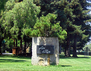
Los Altos is a city in Santa Clara County, California, in the San Francisco Bay Area. The population was 31,625 according to the 2020 census.

<span class="mw-page-title-main">Cupertino, California</span> City in California, United States

Cupertino is a city in Santa Clara County, California, United States, directly west of San Jose on the western edge of the Santa Clara Valley with portions extending into the foothills of the Santa Cruz Mountains. The population was 60,381 as of the 2020 census. The city is widely known for being the home of Apple Inc., headquartered within the city at Apple Park.

<span class="mw-page-title-main">Santa Cruz Mountains</span> Mountain range in California, United States

The Santa Cruz Mountains are a mountain range in central and Northern California, United States, constituting a part of the Pacific Coast Ranges. They form a ridge down the San Francisco Peninsula, south of San Francisco. They separate the Pacific Ocean from the San Francisco Bay and the Santa Clara Valley, and continue south to the Central Coast, bordering Monterey Bay and ending at the Salinas Valley. The range passes through the counties of San Mateo, Santa Clara, and Santa Cruz, with the Pajaro River forming the southern boundary.

<span class="mw-page-title-main">California State Route 35</span> Highway in California

State Route 35, generally known as Skyline Boulevard for most of its length, is a mostly two-lane state highway in the U.S. state of California. It runs along the ridge of the Santa Cruz Mountains from the high point of State Route 17 near Lexington Reservoir in Santa Clara County to State Route 1 just south of Daly City in San Mateo County, where it crosses SR 1 and loops around Lake Merced to become Sloat Boulevard in San Francisco. SR 35 then continues along Sloat Boulevard until it reaches its terminus when it meets SR 1 again at 19th Avenue.

<span class="mw-page-title-main">Midpeninsula Regional Open Space District</span>

Formed in 1972 by voter initiative, the Midpeninsula Regional Open Space District (MROSD) is a non-enterprise special district in the San Francisco Bay Area. It has acquired and preserved a regional green belt of open space land and provides opportunities for ecologically-sensitive public enjoyment and education.

<span class="mw-page-title-main">Stevens Creek Reservoir</span> Reservoir in Santa Clara County, California

Stevens Creek Reservoir is an artificial lake located in the foothills of the Santa Cruz Mountains near Cupertino, California. A 1,063-acre (430 ha) county park surrounds the reservoir and provides limited fishing, picnicking, hiking, and horseback riding activities. Although swimming is not allowed, non-power boating is allowed for certain parts of the year. No powered boats or jet skis are allowed. All vessels must be inspected for invasive Quagga mussels prior to launch.

<span class="mw-page-title-main">Stevens Creek (California)</span> Creek in Santa Clara County, California

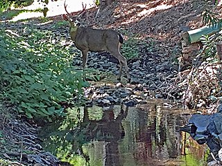
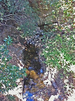
Stevens Creek is a 20.9-mile-long (33.6 km) stream in Santa Clara County, California. The creek originates in the Santa Cruz Mountains on the western flank of Black Mountain in the Monte Bello Open Space Preserve near the terminus of Page Mill Road at Skyline Boulevard. It flows southeasterly through the Stevens Creek County Park before turning northeast into Stevens Creek Reservoir. It then continues north for 12.5 miles (20.1 km) through Cupertino, Los Altos, Sunnyvale and Mountain View before emptying into the San Francisco Bay at the Whisman Slough, near Google's main campus.

<span class="mw-page-title-main">San Francisquito Creek</span> River in California, United States

San Francisquito Creek is a creek that flows into southwest San Francisco Bay in California, United States. Historically it was called the Arroyo de San Francisco by Juan Bautista de Anza in 1776. San Francisquito Creek courses through the towns of Portola Valley and Woodside, as well as the cities of Menlo Park, Palo Alto, and East Palo Alto. The creek and its Los Trancos Creek tributary define the boundary between San Mateo and Santa Clara counties.

The Picchetti Winery, also known as the Picchetti Ranch, is a winery located at 13100 Montebello Road in Cupertino, California in the Picchetti Ranch Open Space Preserve. The Picchetti brothers, Secondo and Vincenzo, for whom the ranch was named, were among the earliest settlers to plant grapes on this ridge, which they named "Monte Bello" or "beautiful mountain." This ridge was later to become one of Santa Clara County's important vineyard areas.

<span class="mw-page-title-main">Rancho San Antonio County Park</span>

Rancho San Antonio County Park and Rancho San Antonio Open Space Preserve are a conjoined public recreational area in the Santa Cruz Mountains, in the northwest quadrant of Santa Clara County, California. The County Park is bordered by Los Altos with some parts of the eastern part of the County Park in western Cupertino. The Open Space Preserve is on the west side of the County Park, also bordered by Los Altos Hills, Monte Bello Open Space Preserve, and the Permanente Quarry.

<span class="mw-page-title-main">Permanente Quarry</span> Limestone quarry in Santa Clara County, California, USA

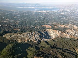
The Permanente Quarry and cement plant is in an unincorporated area of Santa Clara County, California, just west of Cupertino. The limestone and aggregate mining operation and cement plant is owned by Lehigh Southwest Cement, a subsidiary of Heidelberg Cement. Limestone was mined beginning in 1902 but remained a small operation until 1939 when it was purchased by Henry J. Kaiser to supply the 5.5 million barrels of cement to build Shasta Dam. With increased production Kaiser supplied all of the cement used by the Navy in the Pacific Theater of World War 2. At 7 million barrels, it was more cement than the Shasta Dam project. Roughly 70 percent of the cement used in the communities of Santa Clara County was acquired from the cement plant.

<span class="mw-page-title-main">Adobe Creek (Santa Clara County)</span> Stream in Santa Clara County, California

Adobe Creek, historically San Antonio Creek, is a 14.2-mile-long (22.9 km) northward-flowing stream originating on Black Mountain in the Santa Cruz Mountains. It courses through the cities of Los Altos Hills, Los Altos, and Palo Alto on its way to the Palo Alto Flood Basin and thence to southwestern San Francisco Bay in Santa Clara County, California, United States. Historically, Adobe Creek was a perennial stream and hosted runs of steelhead trout entering from the Bay, but these salmonids are now blocked by numerous flood control structures, including a tidal gate at the creek's mouth and a long concretized rectangular channel culminating in an impassable drop structure at El Camino Real. The co-founders of Adobe Systems both lived on Adobe Creek.

Hidden Villa is a United States nonprofit educational organization teaching programs on environmental and multicultural awareness. In 1924, Frank and Josephine Duveneck founded this working organic farm and wilderness area on land comprising the upper Adobe Creek watershed on the foothills of Black Mountain in Los Altos Hills, California, part of the Santa Cruz Mountains. Hidden Villa is important historically as the site of the West's first American youth hostel and the nation's first multicultural children's summer camp.

<span class="mw-page-title-main">Permanente Creek</span> River in California, United States

Permanente Creek is a 13.3-mile-long (21.4 km) stream originating on Black Mountain in Santa Clara County, California, United States. Named by early Spanish explorers as Arroyo Permanente or Río Permanente because of its perennial flow, the creek descends the east flank of Black Mountain then courses north through Los Altos and Mountain View, discharging into southwest San Francisco Bay historically at the Mountain View Slough but now virtually entirely diverted via the Permanente Creek Diversion Channel to Stevens Creek and Whisman Slough in San Francisco Bay.

<span class="mw-page-title-main">Santa Clara County, California</span> County in California, United States

Santa Clara County, officially the County of Santa Clara, is the sixth-most populous county in the U.S. state of California, with a population of 1,936,259 as of the 2020 census. Santa Clara County and neighboring San Benito County form the San Jose–Sunnyvale–Santa Clara metropolitan statistical area, which is part of the larger San Jose–San Francisco–Oakland combined statistical area. Santa Clara is the most populous county in the San Francisco Bay Area and in Northern California.

<span class="mw-page-title-main">Hale Creek</span> River in California, United States

Hale Creek is a short stream originating in the foothills of Los Altos Hills, California in Santa Clara County, California, United States. Its source is in the Rancho San Antonio Open Space Preserve, west of Neary Quarry. The creek flows northeasterly 4.6 miles (7.4 km) through the cities of Los Altos Hills, Los Altos, and Mountain View before joining Permanente Creek.

<span class="mw-page-title-main">Monte Bello Open Space Preserve</span>

Monte Bello Open Space Preserve is a 3,133-acre (12.68 km2) open space preserve, located near Palo Alto in the Santa Cruz Mountains, in San Mateo and Santa Clara Counties, California, United States. The preserve encompasses the upper Stevens Creek watershed in the valley between Monte Bello Ridge and Skyline Ridge. "Monte Bello" means "beautiful mountain" in Italian, and refers to Black Mountain which is the highest part of Montebello Ridge. The straight valley of upper Stevens Creek is also the rift valley of the San Andreas Fault.

<span class="mw-page-title-main">Los Trancos Creek</span> River in California, United States

Los Trancos Creek is a creek that flows northerly from Monte Bello Ridge on the northeast slope of the Santa Cruz Mountains to its confluence with San Francisquito Creek at Stanford University in California, United States. The creek forms the boundary between northwestern Santa Clara County and southeastern San Mateo County.

West Santa Clara is an unincorporated census county division (CCD) located on the eastern side of the Santa Cruz Mountains in northwest Santa Clara County, California. The area covers approximately 50 square miles (130 km2), much of it open space, and contains Boronda Lake, Felt Lake, and Lake Ranch reservoirs, as well as Sanborn and Stevens Creek county parks. The Foothills, Los Trancos, Monte Bello, Pearson-Arastradero, Picchetti Ranch, Rancho San Antonio and Saratoga Gap preserves are also located in the area.

References

  1. 1 2 "Black Mountain". NGS Data Sheet. National Geodetic Survey, National Oceanic and Atmospheric Administration, United States Department of Commerce.
  2. "Comprehensive Plan - City of Palo Alto". www.cityofpaloalto.org. City of Palo Alto. Retrieved 16 July 2017.. In particular chapter 2, Land Use and Design Maps shows Black Mountain as within Palo Alto.
  3. 1 2 Geological Survey of California (1865). Geology, volume I Report of progress and synopsis of the field-work, from 1860 to 1864. London: Oxford University. p. 65. Retrieved 2009-12-15.
  4. "Morena Sierra". Geographic Names Information System . United States Geological Survey, United States Department of the Interior.
  5. John Hunter Thomas (1991). Flora of the Santa Cruz Mountains of California A Manual of the Vascular Plants. Stanford University Press. p. 5. ISBN   978-0-8047-1862-2 . Retrieved 2010-10-25.
  6. Luther A. Ingersoll (1893). Henry D. Barrows (ed.). A memorial and biographical history of the coast counties of Central California. Lewis Publishing Company. p.  190 . Retrieved 2010-10-25.
  7. Erwin G. Gudde; William Bright (2004). California Place Names The Origin and Etymology of Current Geographical Names. Berkeley, California: University of California Press. p. 37. ISBN   0-520-24217-3.
  8. Eugene T. Sawyer (1922). History of Santa Clara County California with Biographical Sketches of The Leading Men and Women of the County Who Have Been Identified With Its Growth and Development From the Early Days to the Present (PDF). Los Angeles, California: Historic Record Company. pp. 1567–1568. Retrieved Jan 2, 2010.
  9. 1 2 3 4 George Morell (Sep 15, 1959). History of Black Mountain and Monte Bello Ridge (Report).
  10. "Black Mountain Backpack Camp" (PDF). Midpeninsula Regional Open Space District. Retrieved Jan 2, 2010.
  11. David Weintraub. "Peninsula Treasure: Monte Bello Tales and Trails". Bay Nature. Retrieved Jan 2, 2010.
  12. de Anza, Juan Bautista (1776). "Diary of Juan Bautista de Anza October 23, 1775 - June 1, 1776". Web de Anza, University of Oregon. Archived from the original on November 25, 2009. Retrieved 2009-12-14.
  13. "Stevens Creek: Historic, Navigable, Misspelled". Mountain View, CA: The Rengstorff House. Archived from the original on 2012-09-19. Retrieved 2009-09-21.
  14. "About Hidden Villa". HiddenVilla.org. Archived from the original on 2010-01-11. Retrieved 2009-09-21.
  15. Gilford, Steve (Summer 1998). "Search for the Source of the Permanente" (PDF). The Permanente Journal. 2 (3): 135–37. Archived from the original (PDF) on 2008-12-03. Retrieved 2009-12-14.
  16. Weintraub, David (2004). San Francisco Bay Area A Comprehensive Hiking Guide. Berkeley, California: Wilderness Press. p. 256. ISBN   0-89997-291-8.
  17. Sliter, William; McGann, Mary (1992). Age and correlation of the Calera Limestone in the Permanente terrane of northern California. U.S. Geological Survey. p. 5. doi: 10.3133/ofr92306 .
  18. Weintraub, David (2003). Peninsula Trails and Tales. Portland, OR: Graphic Arts Books. p. 384. ISBN   1-55868-850-1.
  19. Sloan, Doris (2006). Geology of the San Francisco Bay Region. Berkeley and Los Angeles, California: University of California Press. p. 172. ISBN   0-520-23629-7.
  20. John A. Tarduno; Michael McWilliams; Michel G. Debiche; William V. Sliter; M. C. Blake (1985). "Franciscan Complex Calera limestones: accreted remnants of Farallon Plate oceanic plateaus". Nature. 317 (6035): 345–347. doi:10.1038/317345a0. S2CID   4350067.
  21. Andrew Alden (2011-04-14). "Calera Limestone, a Gift from the Ancient Pacific". Quest KQED. Retrieved 2012-08-23.
  22. "KFJC 89.7FM". kfjc.org. Retrieved 2021-04-02.