Blackwells Mills, New Jersey

Last updated

Blackwells Mills, New Jersey
Bridge Tender's House and Bridge, Blackwells Mills, NJ.jpg
Bridge tender's house and bridge leading to Blackwells Mills
Location map of Somerset County, New Jersey.svg
Red pog.svg
Blackwells Mills
Location in Somerset County
USA New Jersey relief location map.svg
Red pog.svg
Blackwells Mills
Location in New Jersey
Usa edcp relief location map.png
Red pog.svg
Blackwells Mills
Location in the United States
Coordinates: 40°29′01″N74°34′04″W / 40.483582°N 74.567789°W / 40.483582; -74.567789 [1] [2]
Country Flag of the United States.svg  United States
State Flag of New Jersey.svg  New Jersey
County Somerset
Township Franklin
Area
[3]
  Total7.80 sq mi (20.21 km2)
  Land7.68 sq mi (19.89 km2)
  Water0.12 sq mi (0.32 km2)  5.70%
Elevation
[4]
89 ft (27 m)
Population
 (2020) [5]
  Total9,473
  Density1,233.46/sq mi (476.24/km2)
Time zone UTC−05:00 (Eastern (EST))
  Summer (DST) UTC−04:00 (Eastern (EDT))
Area codes 609/640 and 732/848
FIPS code 34-06025 [1] [6]
GNIS feature ID02583968 [1]

Blackwells Mills is an unincorporated community and census-designated place (CDP) [7] located in Franklin Township in Somerset County, in the U.S. state of New Jersey. [8] [9] [10] As of the 2010 U.S. census, the CDP's population was 803. [11]

Contents

History

Blackwells Mills is on the east side of the Millstone River in Franklin Township, Somerset County, New Jersey. A mill was built in 1746 by Peter Schenk. His daughter married a Mercer and the mill passed to her family. The mill was purchased by William Blackwell in 1804 with his uncle Capt. Jacob Blackwell. These men were from nearby Hopewell Township. William Blackwell built a fine Federal period house on the land across the road on the Hillsborough side. Following Hurricane Floyd, the house was moved westward to higher ground. It is still standing. Following the death of William Blackwell in the 1850s, his son John came into possession of the mill. John Blackwell died early in life, and his widow sold the mill to Augustus VanZant in 1872. On May 31, 1771 the west bank of the Millstone River became Hillsborough Township. [12]

The mill burned down in 1885 and was rebuilt. A major restoration was done in 1943. [12]

Geography

According to the U.S. Census Bureau, Blackwells Mills had a total area of 1.296 square miles (3.356 km2), including 1.222 square miles (3.165 km2) of land and 0.074 square miles (0.191 km2) of water (5.70%). [1] [2]

Demographics

Historical population
CensusPop.Note
2010 803
2020 9,4731,079.7%
Population sources:
2010 [11] 2020 [5]

2010 census

The 2010 United States census counted 803 people, 238 households, and 218 families in the CDP. The population density was 657.1 per square mile (253.7/km2). There were 241 housing units at an average density of 197.2 per square mile (76.1/km2). The racial makeup was 69.12% (555) White, 10.96% (88) Black or African American, 0.12% (1) Native American, 17.93% (144) Asian, 0.37% (3) Pacific Islander, 0.00% (0) from other races, and 1.49% (12) from two or more races. Hispanic or Latino of any race were 4.48% (36) of the population. [11]

Of the 238 households, 61.3% had children under the age of 18; 85.7% were married couples living together; 4.6% had a female householder with no husband present and 8.4% were non-families. Of all households, 3.8% were made up of individuals and 0.4% had someone living alone who was 65 years of age or older. The average household size was 3.34 and the average family size was 3.43. [11]

32.6% of the population were under the age of 18, 5.6% from 18 to 24, 23.0% from 25 to 44, 34.4% from 45 to 64, and 4.4% who were 65 years of age or older. The median age was 40.9 years. For every 100 females, the population had 94.9 males. For every 100 females ages 18 and older there were 96.0 males. [11]

Blackwells Mills Canal House

The Blackwells Mills Canal House, located at Blackwells Mills Road and Canal Road along the Delaware and Raritan Canal, was built c.1830s, at the same time as the canal. It was constructed to house the bridge tender, who would open the swing bridge when canal boats came through, then close it to allow traffic to cross over the canal. It is a contributing property of the Delaware and Raritan Canal historic district, added to the National Register of Historic Places on May 11, 1973. [13]

Related Research Articles

<span class="mw-page-title-main">Somerset County, New Jersey</span> County in New Jersey, United States

Somerset County is a county located in the north-central part of the U.S. state of New Jersey. As of the 2020 census, the county was the state's 13th-most-populous county, with a population of 345,361, its highest decennial count ever and an increase of 21,917 (+6.8%) from the 2010 census count of 323,444. Somerset County constitutes part of the New York metropolitan area. Its county seat is Somerville. The most populous place in the county was Franklin Township, with 68,364 residents at the time of the 2020 census, while Hillsborough Township, with 55.00 square miles (142.4 km2), covered the largest total area of any municipality. The county is part of the Central Jersey region of the state.

<span class="mw-page-title-main">Kingston, New Jersey</span> Populated place in Middlesex and Somerset counties, New Jersey, US

Kingston is an unincorporated community and census designated place (CDP) along the border of South Brunswick Township in Middlesex County and Franklin Township in Somerset County, and also located relatively near Princeton in Mercer County in the U.S. state of New Jersey. The historic settlement is in the Raritan Valley region, located along the course of the Millstone River. As of the 2010 United States Census, the CDP's population was 1,493, of which 1,222 were in South Brunswick Township and 271 in Franklin Township.

<span class="mw-page-title-main">Laurence Harbor, New Jersey</span> Populated place in Middlesex County, New Jersey, US

Laurence Harbor is an unincorporated community and census-designated place (CDP) located on the Raritan Bay within Old Bridge Township, in Middlesex County, in the U.S. state of New Jersey. As of the 2020 United States census, the CDP's population was 6,635, an increase of 99 (+1.5%) from the 6,536 recorded at the 2010 census, which in turn reflected an increase of 309 (+5.0%) from the 6,227 counted in the 2000 census.

<span class="mw-page-title-main">Plainsboro Center, New Jersey</span> Populated place in Middlesex County, New Jersey, US

Plainsboro Center is an unincorporated community and census-designated place (CDP) located within Plainsboro Township, situated in southern Middlesex County, within the U.S. state of New Jersey. As of the 2020 United States census, the CDP's population was 2,760, its highest decennial count ever and an increase of 48 (+1.8%) from the 2,712 recorded at the 2010 census, which in turn reflected an increase of 503 (+22.8%) from the 2,209 counted in the 2000 census.

<span class="mw-page-title-main">Franklin Township, Somerset County, New Jersey</span> Township in Somerset County, New Jersey, US

Franklin Township is a township in Somerset County, in the U.S. state of New Jersey. It is centrally located in the Raritan Valley region, within the New York Metropolitan Area. As of the 2020 United States census, the township's population was 68,364, an increase of 6,064 (+9.7%) from the 2010 census count of 62,300, which in turn reflected an increase of 11,397 (+22.4%) from the 50,903 counted in the 2000 census. The township was the state's 19th most-populous municipality in 2020, after being ranked 22nd in 2010.

<span class="mw-page-title-main">Hillsborough Township, New Jersey</span> Township in Somerset County, New Jersey, US

Hillsborough Township is a township in Somerset County, in the U.S. state of New Jersey. Located in the Raritan Valley region, the township is a suburban and exurban bedroom community of New York City within the New York Metropolitan Area. As of the 2020 United States census, the township's population was 43,276, an increase of 4,973 (+13.0%) from the 2010 census count of 38,303, which in turn reflected an increase of 1,669 (+4.6%) from the 36,634 counted in the 2000 census.

<span class="mw-page-title-main">Somerset, New Jersey</span> Place in Somerset County, New Jersey, United States

Somerset is an unincorporated community and census-designated place (CDP) located within Franklin Township, in Somerset County, in the U.S. state of New Jersey. As of the 2010 United States Census, the CDP's population was 22,083.

<span class="mw-page-title-main">Belle Mead, New Jersey</span> Populated place in Somerset County, New Jersey, US

Belle Mead is an unincorporated community and census-designated place (CDP) located within Montgomery Township, in Somerset County, in the U.S. state of New Jersey. As of the 2020 United States census, the CDP's population was 5,569, reflecting an expansion of the CDP from 0.74 square miles (1.9 km2) in 2010 to 4.03 square miles (10.4 km2) in 2020.

Martinsville is an unincorporated community and census-designated place (CDP) located within Bridgewater Township, in Somerset County, in the U.S. state of New Jersey. As of the 2010 United States Census, the CDP's population was 11,980.

<span class="mw-page-title-main">Zarephath, New Jersey</span> Populated place in Somerset County, New Jersey, US

Zarephath is an unincorporated community and census-designated place (CDP) and located in Franklin Township, in Somerset County, in the U.S. state of New Jersey, about 15 mi (24 km) north of Princeton. As of the 2020 United States census, the CDP's population was 69, an increase of 32 (+86.5%) from the 37 enumerated at the 2010 census.

Six Mile Run is an unincorporated community and census-designated place (CDP) located in Franklin Township, in Somerset County, in the U.S. state of New Jersey. As of the 2010 United States Census, the CDP's population was 3,184.

<span class="mw-page-title-main">Griggstown, New Jersey</span> Populated place in Somerset County, New Jersey, US

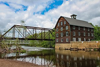
Griggstown is an unincorporated community and census-designated place (CDP) located within Franklin Township, in Somerset County, in the U.S. state of New Jersey. As of the 2010 United States Census, the CDP's population was 819. The area was first settled around 1733. The Millstone River and the Delaware and Raritan Canal both flow through Griggstown.

<span class="mw-page-title-main">Middlebush, New Jersey</span> Populated place in Somerset County, New Jersey, US

Middlebush is an unincorporated community and census-designated place (CDP) located in Franklin Township, in Somerset County, in the U.S. state of New Jersey. As of the 2010 United States Census, the CDP's population was 2,326. It is perhaps most distinguished as being the host section for Franklin Township's municipal complex.

<span class="mw-page-title-main">Blawenburg, New Jersey</span> Populated place in Somerset County, New Jersey, US

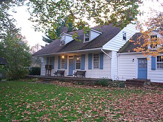
Blawenburg is an unincorporated community and census-designated place (CDP) located within Montgomery Township, in Somerset County, in the U.S. state of New Jersey. As of the 2010 United States Census, the CDP's population was 280. It is located at the juncture of two large roads, CR 518 and CR 601.

<span class="mw-page-title-main">East Millstone, New Jersey</span> Populated place in Somerset County, New Jersey, US

East Millstone is an unincorporated community and census-designated place (CDP) located in Franklin Township in Somerset County, in the U.S. state of New Jersey.

Weston is an unincorporated community and census-designated place (CDP) located in Franklin Township, in Somerset County, in the U.S. state of New Jersey. As of the 2010 United States Census, the CDP's population was 1,235.

Franklin Center is an unincorporated community and census-designated place (CDP) located in Franklin Township, in Somerset County, in the U.S. state of New Jersey. As of the 2010 United States Census, the CDP's population was 4,460.

<span class="mw-page-title-main">Finderne, New Jersey</span> Populated place in Somerset County, New Jersey, US

Finderne is an unincorporated community and census-designated place (CDP) located within Bridgewater Township, in Somerset County, in the U.S. state of New Jersey. As of the 2010 United States Census, the CDP's population was 5,600.

<span class="mw-page-title-main">Green Knoll, New Jersey</span> Populated place in Somerset County, New Jersey, US

Green Knoll is an unincorporated community and census-designated place (CDP) located within Bridgewater Township, in Somerset County, in the U.S. state of New Jersey. As of the 2010 United States Census, the CDP's population was 6,200.

<span class="mw-page-title-main">Ten Mile Run, New Jersey</span> Populated place in Somerset County, New Jersey, US

Ten Mile Run is an unincorporated community and census-designated place (CDP) located in Franklin Township, in Somerset County, in the U.S. state of New Jersey. As of the 2010 United States Census, the CDP's population was 1,959.

References

  1. 1 2 3 4 Gazetteer of New Jersey Places, United States Census Bureau. Accessed July 21, 2016.
  2. 1 2 US Gazetteer files: 2010, 2000, and 1990, United States Census Bureau. Accessed September 4, 2014.
  3. "ArcGIS REST Services Directory". United States Census Bureau. Retrieved October 11, 2022.
  4. U.S. Geological Survey Geographic Names Information System: Blackwells Mills Census Designated Place, Geographic Names Information System. Accessed August 23, 2012.
  5. 1 2 QuickFacts Blackwells Mills CDP, New Jersey, United States Census Bureau. Accessed June 17, 2023.
  6. Geographic Codes Lookup for New Jersey, Missouri Census Data Center. Accessed June 9, 2023.
  7. State of New Jersey Census Designated Places - BVP20 - Data as of January 1, 2020, United States Census Bureau. Accessed December 1, 2022.
  8. GCT-PH1 - Population, Housing Units, Area, and Density: 2010 - County -- County Subdivision and Place from the 2010 Census Summary File 1 for Somerset County, New Jersey Archived 2020-02-12 at archive.today , United States Census Bureau. Accessed February 11, 2013.
  9. 2006-2010 American Community Survey Geography for New Jersey, United States Census Bureau. Accessed February 11, 2013.
  10. New Jersey: 2010 - Population and Housing Unit Counts - 2010 Census of Population and Housing (CPH-2-32), United States Census Bureau, August 2012. Accessed February 11, 2013.
  11. 1 2 3 4 5 DP-1 - Profile of General Population and Housing Characteristics: 2010 Demographic Profile Data for Blackwells Mills CDP, New Jersey Archived 2020-02-12 at archive.today , United States Census Bureau. Accessed August 23, 2012.
  12. 1 2 "Blackwells Mills". Hillsborough Township. Archived from the original on July 1, 2007. Retrieved December 8, 2011.
  13. Historic Sites Survey Team (May 11, 1973). "NRHP Nomination: Delaware and Raritan Canal". National Park Service.{{cite journal}}: Cite journal requires |journal= (help)