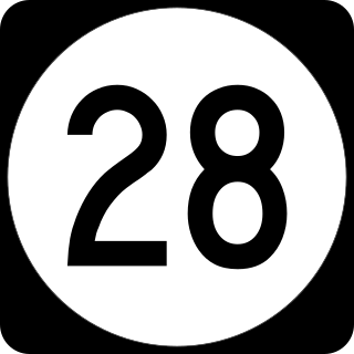
Route 28 is a state highway in the central part of New Jersey, United States that is 26.44 mi (42.55 km) long. Its western terminus is at U.S. Route 22 in Bridgewater Township, Somerset County while its eastern terminus is at Route 27 in Elizabeth, Union County. From its western terminus, Route 28 heads east through Raritan, intersecting County Route 567 and then U.S. Route 202 and U.S. Route 206 at the Somerville Circle before heading through the central part of Somerville. Past Somerville, the route interchanges with Interstate 287 in Bridgewater Township before intersecting many 500-series county roads including County Route 525 and County Route 527 in Bound Brook, County Route 529 in Dunellen, Middlesex County, County Route 531 in Plainfield, Union County, and County Route 509 in Westfield. Route 28 continues east, intersecting Route 59 and the Garden State Parkway in Cranford before heading to Elizabeth, where it crosses Route 439 before ending at Route 27. Route 28 is a two- to four-lane road its entire length that passes through suburban areas and runs within a close distance of New Jersey Transit’s Raritan Valley Line for much of its length.

Plainsboro Center is an unincorporated community and census-designated place (CDP) located within Plainsboro Township, in Middlesex County, in the U.S. state of New Jersey. As of the 2010 United States Census, the CDP's population was 2,712.

Bridgewater Township is a township in Somerset County in the U.S. state of New Jersey, located within the heart of the Raritan Valley region. Situated within Central New Jersey and crisscrossed by several major highways, the township is known for being both the regional commercial hub for Somerset County and as a suburban bedroom community of New York City within the New York Metropolitan Area. The township is located roughly 32 miles (51 km) away from Manhattan and about 20 miles (32 km) away from Staten Island.
Raritan is a borough in Somerset County, in the U.S. state of New Jersey. As of the 2020 United States census, the borough's population was 7,835, an increase of 954 (+13.9%) from the 2010 census count of 6,881, which in turn reflected an increase of 543 (+8.6%) from the 6,338 counted in the 2000 census.

Cedar Knolls is an unincorporated community located within Hanover Township in Morris County, New Jersey, United States. It is part of Hanover Township along with Whippany.

Chadds Ford is a census-designated place (CDP) in Delaware and Chester counties, Pennsylvania, United States, comprising the unincorporated communities of Chadds Ford and Chadds Ford Knoll. It was first listed as a CDP prior to the 2020 census.
Auburn is an unincorporated community and census-designated place (CDP) in Salem County, in the U.S. state of New Jersey. It includes the Auburn section of Oldmans Township and extends southeast to include rural and semi-suburban land in Pilesgrove Township.

Finderne is an unincorporated community and census-designated place (CDP) located within Bridgewater Township, in Somerset County, in the U.S. state of New Jersey. As of the 2010 United States Census, the CDP's population was 5,600.

Bradley Gardens is an unincorporated community and census-designated place (CDP) located within Bridgewater Township, in Somerset County, in the U.S. state of New Jersey. As of the 2010 United States Census, the CDP's population was 14,206.
Green Knoll is an unincorporated community and census-designated place (CDP) located within Bridgewater Township, in Somerset County, in the U.S. state of New Jersey. As of the 2010 United States Census, the CDP's population was 6,200.
Absecon Highlands is an unincorporated community and census-designated place (CDP) in Atlantic County, in the U.S. state of New Jersey. It is in the eastern part of the county, in southern Galloway Township. It is bordered to the south by the city of Absecon and to the east by Reeds Bay, a tidal water body the connects to the Atlantic Ocean through Broad Creek and Absecon Inlet. The CDP includes the neighborhoods of Absecon Highlands, Seaview Estates, Seaview Park, Conovertown, and Holly Brook.
Arrowhead Lake is an unincorporated community and census-designated place (CDP) in Cumberland County, in the U.S. state of New Jersey. It is in the northwestern part of the county, in the northern part of Stow Creek Township. A small artificial lake is in the northwestern part of the CDP, with a residential neighborhood on its southern shore.
Carlls Corner is a census-designated place (CDP) in Cumberland County, in the U.S. state of New Jersey. It is in the northern part of the county, in Upper Deerfield Township. It is bordered at its southwest corner by the city of Bridgeton, the county seat.
Centre Grove is a census-designated place (CDP) in Cumberland County, in the U.S. state of New Jersey. It is in the center part of the county, on the east side of Lawrence Township. It is bordered to the east by the city of Millville. Bridgeton, the Cumberland county seat, is 9 miles (14 km) to the northwest.
Ampere North is a unincorporated community and census-designated place (CDP) in Bloomfield Township, Essex County, in the U.S. state of New Jersey. It is in the southern corner of the township, bordered to the north by the Watsessing CDP, to the northeast by Silver Lake, to the southwest by East Orange, and to the southeast by Newark. Ampere Parkway runs through the center of the CDP, from Bloomfield Avenue at the northeast border of the community, south into the Ampere neighborhood in East Orange.
Regency at Monroe is a gated community and census-designated place (CDP) in Monroe Township, Middlesex County, New Jersey, United States. It is in the eastern part of the township, bordered by Mounts Mills Road to the north, Spotswood-Englishtown Road to the east, and Buckelew Avenue to the southwest. It is 7 miles (11 km) northwest of Freehold, 15 miles (24 km) south-southeast of New Brunswick, and 22 miles (35 km) northeast of Trenton.
Renaissance at Monroe is a planned community and census-designated place (CDP) in Monroe Township, Middlesex County, New Jersey, United States. It is in the southwest part of the township, bordered to the east by Monroe Manor and to the east by East Windsor Township in Mercer County. New Jersey Route 33 forms the northern edge of the community; it is 1.5 miles (2.4 km) west to Exit 8 on the New Jersey Turnpike and 11 miles (18 km) east to Freehold.
Bedminster is an unincorporated community and census-designated place (CDP) comprising the primary community in Bedminster Township, Somerset County, in the U.S. state of New Jersey. It was first listed as a CDP prior to the 2020 census.
Cranford is a census-designated place (CDP) comprising the downtown part of Cranford Township, Union County, in the U.S. state of New Jersey. It was first listed as a CDP prior to the 2020 census with a population of population was 2,032.

Connecticut Farms is a neighborhood and census-designated place (CDP) within Union Township, Union County, in the U.S. state of New Jersey. It was first listed as a CDP prior to the 2020 census.


