
State Road 528 (SR 528), alternatively named the Martin Andersen Beachline Expressway, is a partially-tolled freeway in the U.S. state of Florida; it is maintained by the Florida's Turnpike Enterprise (FTE), the Central Florida Expressway Authority (CFX), and the Florida Department of Transportation (FDOT). Spanning approximately 53 miles (85 km) along a west–east axis, it connects Interstate 4 (I-4) in Orlando with I-95, Titusville, and Cape Canaveral on the Space Coast. It passes close to the tourist areas of Orlando, including SeaWorld and Universal Orlando, and serves the north entrance to Orlando International Airport. Near its east end, it passes over the Intracoastal Waterway on the Emory L. Bennett Causeway, and ends at SR A1A and SR 401 near Port Canaveral.

U.S. Route 3 (US 3) is a United States Numbered Highway running 277.90 miles (447.24 km) from Cambridge, Massachusetts, through New Hampshire, to the Canada–United States border near Third Connecticut Lake, where it connects to Quebec Route 257.

U.S. Route 92 or U.S. Highway 92 is a 181-mile (291 km.) U.S. Route entirely in the U.S. state of Florida. The western terminus is at US 19 Alt. and SR 687 in downtown St. Petersburg. The eastern terminus is at SR A1A in Daytona Beach.
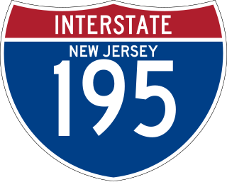
Interstate 195 (I-195) is an auxiliary route of the Interstate Highway System located in the US state of New Jersey. Its western end is at I-295 and Route 29 just south of Trenton in Hamilton Township, Mercer County, while its eastern end is at the Garden State Parkway, Route 138, and Route 34 in Wall Township, Monmouth County. I-195 is 34.17 miles (54.99 km) in length. The route is mostly a four-lane highway that mainly runs through agrarian and wooded areas in Central Jersey. It has an interchange with the New Jersey Turnpike (I-95) in Robbinsville Township and serves as a main access road to New Jersey's state capital of Trenton, the Horse Park of New Jersey, the Six Flags Great Adventure amusement park, and the Jersey Shore. I-195 is occasionally referred to as the Central Jersey Expressway. On April 6, 1988, President Ronald Reagan signed H.R. 4263 naming I-195 in New Jersey the James J. Howard Interstate Highway, in honor of the late James J. Howard.

New York State Route 878 (NY 878) is an expressway on Long Island and in New York City. The route exists in two sections, which both form the Nassau Expressway. NY 878's western terminus is the Belt Parkway and Conduit Avenue (NY 27) in Ozone Park, within southern Queens. Its southern terminus is immediately before the Village of Atlantic Beach, at the Atlantic Beach Bridge in Lawrence, within southwestern Nassau County. NY 878 is discontinuous between Farmers Boulevard in Queens and the town of Inwood in Nassau County. The two sections are connected to each other by Rockaway Boulevard and Rockaway Turnpike.
State Road 589 (SR 589), also known as the Veterans Expressway and Suncoast Parkway, is a controlled-access toll road near the Florida Gulf Coast. Maintained and operated by Florida's Turnpike Enterprise, this 68-mile (109 km) transportation corridor extends from State Road 60 in Tampa, north to State Road 44 near Lecanto. The Veterans Expressway was built to accommodate the increasing commuter traffic in the Tampa-St. Petersburg metropolitan area, with the Suncoast Parkway opening in 2001, extending from near the northern terminus of the Veterans Expressway to U.S. Route 98, with a possible northern extension to U.S. Route 19/U.S. Route 98 in Crystal River in Citrus County in the planning and development stages. As of February 28, 2022, Phase I of the extension is now open between US 98 and Florida State Road 44. Phase II, which would further extend the highway to County Road 486, is undergoing the design phase.

New Hampshire Route 101 is a state-maintained highway in southern New Hampshire extending from Keene to Hampton Beach. It is the major east–west highway in the southern portion of the state. Most of its eastern portion is a major freeway linking the greater Manchester area to the Seacoast Region. At 95.189 miles (153.192 km) in length, NH 101 nearly spans the entire width of southern New Hampshire.

The Schuylkill Expressway, locally known as "the Schuylkill", is a freeway through southern Montgomery County and Philadelphia. It is the easternmost segment of Interstate 76 (I-76) in the U.S. state of Pennsylvania. It extends from the Valley Forge interchange of the Pennsylvania Turnpike in King of Prussia, paralleling its namesake Schuylkill River for most of the route, southeast to the Walt Whitman Bridge over the Delaware River in South Philadelphia. It serves as the primary corridor into Philadelphia from points west. Maintenance and planning for most of the highway are administered through Pennsylvania Department of Transportation (PennDOT) District 6, with the Delaware River Port Authority (DRPA) maintaining the approach to the Walt Whitman Bridge.

The Lee Roy Selmon Expressway is a 14.168-mile (22.801 km) controlled-access toll road in Hillsborough County, Florida. It connects the South Tampa neighborhood near MacDill Air Force Base with Downtown Tampa and the bedroom community of Brandon. The expressway was built in stages, opening between 1976 and 1987. An approximately 1.9-mile extension to the thoroughfare's western terminus opened to traffic on Monday, April 19, 2021.
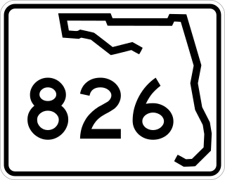
State Road 826 is a bypass route around the greater Miami area, traveling approximately 30 miles (48 km) in a northeasterly arc from U.S. Route 1 in Pinecrest to its terminus at State Road A1A in Sunny Isles Beach. Between its southern terminus and the Golden Glades Interchange, State Road 826 is known as the Palmetto Expressway, a heavily traveled freeway with portions of the road carrying in excess of 250,000 vehicles a day. Unlike many of the other non-interstate freeways in Miami-Dade County, the Palmetto Expressway is untolled. East of the interchange, State Road 826 is a surface road connecting North Miami and North Miami Beach to Sunny Isles Beach over the Intracoastal Waterway.

The Dolphin East-West Expressway is a 15.4-mile (24.8 km) freeway, with the westernmost 14 miles (23 km) as an all-electronic tollway signed as State Road 836, and the easternmost 1.292 miles (2.079 km) between Interstate 95 (I-95) and SR A1A cosigned as Interstate 395 (I-395).

Interstate 95 (I-95) is the main Interstate Highway of Florida's Atlantic Coast. It begins at a partial interchange with US Highway 1 (US 1) just south of downtown Miami and heads north through Jacksonville, and to the Georgia state line at the St. Marys River near Becker. The route also passes through the cities of Fort Lauderdale, West Palm Beach, Port St. Lucie, Titusville, and Daytona Beach.
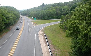
A two-lane expressway or two-lane freeway is an expressway or freeway with only one lane in each direction, and usually no median barrier. It may be built that way because of constraints, or may be intended for expansion once traffic volumes rise. The term super two is often used by roadgeeks for this type of road, but traffic engineers use that term for a high-quality surface road. Most of these roads are not tolled.

Interstate 75 (I-75) is a part of the Interstate Highway System that runs from the Hialeah–Miami Lakes border, a few miles northwest of Miami, to Sault Ste. Marie in the Upper Peninsula of Michigan. I-75 begins its national northward journey near Miami, running along the western parts of the Miami metropolitan area before traveling westward across Alligator Alley, resuming its northward direction in Naples, running along Florida's Gulf Coast, and passing the cities of Fort Myers, Punta Gorda, Venice, and Sarasota. The freeway passes through the Tampa Bay area before turning inward toward Ocala, Gainesville, and Lake City before leaving the state and entering Georgia. I-75 runs for 471 miles (758 km) in Florida, making it the longest Interstate in the state and also the longest in any state east of the Mississippi River. The Interstate's speed limit is 70 mph (110 km/h) for its entire length in Florida.
State Road 568 (SR 568) is a short freeway stub of the Veterans Expressway (SR 589) north of Tampa. The road was built in 1994, but was reassigned as SR 568 in 2001 when SR 589 moved to the new Suncoast Parkway. It connects the aforementioned SR 589 to SR 597. SR 568 is on the segment of the Veterans Expressway that was intended to be extended to Lutz, Florida in the vicinity of the northern interchange with I-75 and I-275.
The Lee Roy Selmon Expressway originated from an expressway system called the Tampa Bay Crosstown Expressway System. The expressways were planned during the 1950s, '60s and '70s. However, the system fizzled out due to financial burdens, land acquisition issues, and community concerns.
Highway revolts have occurred in cities and regions across the United States. In many cities, there remain unused highways, abruptly terminating freeway alignments, and short stretches of freeway in the middle of nowhere, all of which are evidence of larger projects which were never completed. In some instances, freeway revolts have led to the eventual removal or relocation of freeways that had been built.