Carancahua Bay

Last updated

Carancahua Bay
Carancahua Bay.jpg
View of northern Carancahua Bay
Relief map of Texas.png
Red pog.svg
Carancahua Bay
Location Texas Gulf Coast
Coordinates 28°41′28″N96°24′08″W / 28.691039°N 96.402283°W / 28.691039; -96.402283
River sourcesEast Carancahua Creek, West Carancahua Creek
Ocean/sea sources Gulf of Mexico
Basin  countries United States

Carancahua Bay is a northern extension of Matagorda Bay located in Jackson and Calhoun counties in Texas, United States. It is oriented from the southeast to the northwest but meanders as it reaches the north to the confluence with Carancahua Creek watershed. Generally slender, Carancahua Bay is only about 1 mile (1.6 km) in width north of its circular mouth. [1]

Contents

This shallow bay serves as a nursery bay for shrimp and as an ecosystem for diverse species of birds and fish. Commercial Fish farms have been established on the east shore. The small communities of Port Alto, Cape Carancahua POA Community, Boca Chica POA Community, and Carancahua Community have been established on the western and eastern shores. Two other small communities, El Campo Beach Community and Schicke Point Community, are located on the south-west shore near the mouth of the Carancahua Bay.

History

Carancahua Bay (yellow), Chocolate Bay (brown), East Matagorda Bay (red), Keller Bay (lime), Lavaca Bay (orange), Matagorda Bay (purple), Tres Palacios Bay (magenta), Turtle Bay (olive) Matagorda bay.jpg
Carancahua Bay (yellow), Chocolate Bay (brown), East Matagorda Bay (red), Keller Bay (lime), Lavaca Bay (orange), Matagorda Bay (purple), Tres Palacios Bay (magenta), Turtle Bay (olive)

The name Carancahua derives from the term that formerly referred to the Karankawa Indians, who resided on its shores. [2] Texas' Spanish Royal Governor, Martín de Alarcón was the first documented European to tour the bay while exploring Matagorda Bay with Tejas guides in 1718. During the expedition, two Karankawa Indians were spotted near the bay going about their daily lives and were frightened at the sight of Alarcón and his men. They quickly swam across the bay despite the guides' signal to them that Alarcón meant no harm. The next day, the Indians came ashore from a sixteen-passenger canoe (which could hold 4 men, 4 women and 8 children) and notified the Tejas guide that they wished for Alarcón and his men to leave. As a peace offering, Alarcón presented the Indians with tobacco and clothing on behalf of the Spanish crown, which they accepted. In exchange, the Indians offered Alarcón dried fish, and directed him toward the former French fort of St. Louis, believing Alarcón wanted to establish a colony on the bay. Alarcón declared the bay for Spain, but did not establish a permanent settlement. [3]

Only a handful of settlements have been established on the bay. The town of Carancahua first formed as a small collection of cabins that were used in the 1880s as a stop for mail between Texana and Matagorda. However, the bay's propensity for flooding and malaria prevented growth. [4] In fact, the bay was notorious for its swarms of mosquitos that would fly from the Colorado River delta, and documented by a late 19th-century rancher: [1]

A fairly strong easterly wind had been blowing for three days; on the evening of the third day, the mosquitos arrived, flying high, about fifty feet, and looking like a cloud of mist over Carancahua Bay. At the ranch, they set everything on fire that had blood in it, and all work was suspended by unanimous consent...little or nothing was done for nearly five days; by this time the main body had passed, though plenty remained to make everything uncomfortable for about two weeks. This migration was from east to west and the line was about three miles wide. [1]

Approximately 50 people lived at Carancahua in 1915, but the population dwindled to 25 in the next decade. The town remains a community, but the current population is unknown. [4] Across the bay, a settlement of about ten permanent residents, initially known as Persimmon Point, was renamed Port Alto in 1939. The town grew, attracting retirees and vacationers who contributed to a peak summer population of 205 in 1961. Hurricane Carla destroyed the town in September 1961, but it was rebuilt five years later. In 1970, a beachfront was constructed along the shoreline as the listed population reached 170 people. The 2000 census reported that 45 people lived in the town. [5] The original Schicke Point was home to a small ranching and farm operation. The name derives from an original resident of the point (Clarence Schicke) who came from Illinois as a game hunter and fisherman for local restaurants. After Hurricane Carla destroyed the ranch home and operations, C. Schicke turned to commercial fishing and building small cabins in the area. Schicke Point is located near the mouth of Carancahua Bay at Carancahua Pass and is a location attractive to sports fishermen. The village has approximately 90 residents, including legendary anglers Roy Cross (1924-2009), Otto Mendel (1913-2008), and fishing spoon expert Robert Cross. Cape Carancahua is a gated residential community, located on the bay's northern shore.

Features

Bayfront of Carancahua Bay from Port Alto Carancahua Bayfront.jpg
Bayfront of Carancahua Bay from Port Alto

The bay has two extensions near its mouth with Matagorda Bay at Carancahua Pass, including Redfish Lake to the southwest and Salt Lake, just above the former. On the bay's eastern shore, the mouth is headed by Schicke Point, which curves north to the Schicke Point Community, where several private piers are located. About one mile (1.6 km) inland from the community's shoreline are the Piper Lakes. North from the Schicke Point Community, the El Campo Club Community is found, with several residences on a straight line along the coast with docks stretched into the water. Further north, the bay takes a sharp turn to the west past a wetland area then heads north and becomes more slender as it passes from Calhoun into Jackson County. The shoreline continues north and passes several oil wells to Boca Chica POA Community, where a few piers are scattered along the shore. Just north of the Boca Chica POA Community, a small inlet is formed, at the base of which, the Fivemile Draw is found. To the north of Fivemile Draw is Carancahua Community, where several docks line the shore and continue until the bay winds to the west to a large wetland. Past the wetland, the width of the bay shrinks and continues southward along the shore of the Cape Carancahua POA Community, surrounded by water on three sides. Past the cape, the bay turns to the north and is crossed by Texas State Highway 35. It then heads west and north again, while gradually becoming narrower until it reaches the marsh at the mouth of Carancahua Creek. [6] The East and West Carancahua Creeks, which merge before their confluence, feed the bay. West Carancahua Creek runs 28 miles (45 km) south from its source near White Hall Community, near Ganado, Texas to meet with East Carancahua Creek, [7] which runs southwest for 32 miles (51 km) from its source in southern Wharton County. Both streams are intermittent in their upper reaches. [7] [8] The western shore mimics the shape of the east. As it moves south of the Carancahua Creek mouth, Weedhaven is formed, south of which, the shore counters Cape Carancahua and heads northeast past several oil wells to a sharp point. The shoreline continues directly south until it reaches a large swamp. Past the swamp is the town of Port Alto, where several docks and piers are located.

Ecosystem

Beach of sand and shell on the shore of Carancahua Bay Carancahua Bay Beach.jpg
Beach of sand and shell on the shore of Carancahua Bay

Carancahua Bay is protected by the State of Texas and locally by the 300-member Carancahua Bay Protection Association. It is a nursery bay for shrimp, [9] and is a habitat for shellfish including oysters. [10] Finfish such as the redfish and black drum are commonly caught from the bay by recreational fishermen. [11] Birds common to the bay include the wood ibis, roseate spoonbill, snowy egret, great-tailed grackle, Louisiana heron, willet, black-necked stilt, crested caracara and the black vulture. [12]

During a 2004 assessment of Texas waterways, the Texas Commission on Environmental Quality found higher than normal levels of bacteria at the mouth of Carancahua Creek and alkaline pH levels, symptomatic of algal bloom. The issues discovered by the Commission were common in the water bodies examined for the study, and they noted that such issues would be addressed. [13]

Industry

The bay is off limits to shrimping due to its legal status as a nursery, however shrimp farms have been established and approved along its shores. [9] The harvest of shellfish, particularly oysters, is heavily regulated, but allowed at certain times and places. [10] Whereas the main Matagorda Bay is an approved area for shellfish production, Carancahua Bay is divided between restricted and conditionally approved areas. The Texas Department of State Health Services described the areas conditionally approved as being from the mouth of the bay to a "beige house" on the eastern shore and cutoff across to a "grey barn" on the western shore, save for a small sliver of water that includes most of the shoreline of Port Alto, which is restricted. All areas north of the diagonal line are restricted as well. [14]

Several oil and natural gas wells are scattered throughout the shoreline and a few are included in the waters of Carancahua Bay. The most notable include the wells of the Appling Field segment, a mile offshore from Port Alto, [15] which is believed to contain 33 billion cubic feet (0.93 billion cubic meters) of natural gas. The field was first discovered in the 1950s, but later abandoned. Brigham Exploration is working with Royale Energy to develop ten reserves in the area, spotted during a seismic survey. [16]

Related Research Articles

<span class="mw-page-title-main">Calhoun County, Texas</span> County in Texas, United States

Calhoun County is a county located in the U.S. state of Texas. As of the 2020 census, the population was 20,106. Its county seat is Port Lavaca. The county is named for John Caldwell Calhoun, the seventh vice president of the United States. Calhoun County comprises the Port Lavaca, TX Micropolitan Statistical Area, which is also included in the Victoria-Port Lavaca, TX Combined Statistical Area.

<span class="mw-page-title-main">Sabine Lake</span> Estuary on the Texas–Louisiana border

Sabine Lake is a bay on the Gulf coasts of Texas and Louisiana, located approximately 90 miles (140 km) east of Houston and 160 miles (260 km) west of Baton Rouge, adjoining the city of Port Arthur. The lake is formed by the confluence of the Neches and Sabine Rivers and connects to the Gulf of Mexico through Sabine Pass. It forms part of the Texas–Louisiana border, falling within Jefferson and Orange Counties in Texas and Cameron Parish, Louisiana.

<span class="mw-page-title-main">Indianola, Texas</span> Ghost town in Calhoun County, Texas, United States

Indianola is a ghost town located on Matagorda Bay in Calhoun County, Texas, United States. The community, once the county seat of Calhoun County, is a part of the Victoria, Texas, Metropolitan Statistical Area. In 1875, the city had a population of 5,000, but on September 15 of that year, a powerful hurricane struck, killing between 150 and 300 and almost destroying the town. Indianola was rebuilt, only to be wiped out on August 19, 1886, by another intense hurricane followed by a fire. Indianola was designated a Recorded Texas Historic Landmark in 1963, marker number 2642.

<span class="mw-page-title-main">Lavaca Bay</span> Body of water in Calhoun County, Texas, United States

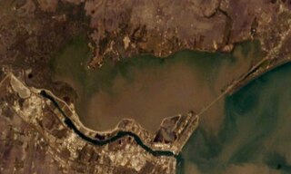
Lavaca Bay is a northwestern extension of the Matagorda Bay system found mostly in Calhoun County, Texas, United States. The ports of Port Lavaca and Point Comfort have been established on the bay, and are the main areas of human habitation. Linnville was located on the bay until its abandonment after the Great Raid of 1840, and the major port of Indianola was found near the confluence with the main Matagorda Bay, until the town's final destruction following the massive hurricane of 1886. Smaller communities include Olivia, Alamo Beach and Magnolia Beach. Lavaca Bay is approximately 82 miles (130 km) northeast of Corpus Christi, about 121 miles (190 km) southwest of Houston, and 145 miles (230 km) southeast of San Antonio.

<span class="mw-page-title-main">Matagorda Bay</span> Bay on the Texas coast, United States of America

Matagorda Bay is a large Gulf of Mexico bay on the Texas coast, lying in Calhoun and Matagorda counties and located approximately 80 miles (130 km) northeast of Corpus Christi, 143 miles (230 km) east-southeast of San Antonio, 108 miles (174 km) south-southwest of Houston, and 167 miles (269 km) south-southeast of Austin. It is one of seven major estuaries along the Gulf Coast of Texas and serves as the mouth of numerous streams, most notably the Lavaca and Colorado Rivers. The Texas seaport of Port Lavaca is located on the system's northwestern extension of Lavaca Bay. The city of Palacios is found on northeastern extension of Tres Palacios Bay, and Port O'Connor is located on the southwestern tip of the main bay's shore. The ghost town of Indianola, which was a major port before it was destroyed by two hurricanes in the late 19th century, is also found on the bay.

St. George's Bay - informally referred to as Bay St. George due to its French translation Baie St-George - is a large bay in the province of Newfoundland and Labrador, Canada. It is located on the west coast of the island of Newfoundland and comprises a sub-basin of the Gulf of St. Lawrence. The estimated population of the entire bay is 16,000, based on the demographic data of each community.

<span class="mw-page-title-main">Corpus Christi Bay</span> Estuary bay on the Texas coast

Corpus Christi Bay is a scenic semi-tropical bay on the Texas coast found in San Patricio and Nueces counties, next to the major city of Corpus Christi. It is separated from the Gulf of Mexico by Mustang Island, and is fed by the Nueces River and Oso Creek from its western and southern extensions, Nueces Bay and Oso Bay. The bay is located approximately 136 miles (219 km) south of San Antonio, and 179 miles (288 km) southwest of Houston.

<span class="mw-page-title-main">Sargent, Texas</span> Unincorporated community and Census designated place in Texas, United States

Sargent is a small unincorporated community located in the eastern corner of Matagorda County, Texas, United States.

<span class="mw-page-title-main">San Antonio Bay</span> Estuary bay on the Texas coast

San Antonio Bay is a bay on the Texas Gulf Coast situated between Matagorda and Aransas Bay. It consists mainly of the combined waters of the San Antonio and Guadalupe rivers, and is located at the mouth of the Guadalupe River, about 55 miles (89 km) northeast of Corpus Christi and 130 miles (209 km) southeast of San Antonio. It is protected from the Gulf of Mexico by Matagorda Island, leaving only relatively small and distant outlets to the Gulf for little mixing of bay and Gulf waters. The remoteness of the bay has prevented the establishment of major ports as seen on Aransas Bay and Corpus Christi Bay, to the south.

<span class="mw-page-title-main">Copano Bay</span> Bay in Texas on the Gulf of Mexico fed by the two rivers and a creek

Copano Bay is a northwestern extension of Aransas Bay, west of Rockport, Texas in Refugio and Aransas counties. It is supplied with seawater from the Gulf of Mexico via Aransas Bay, and fed freshwater from the Aransas River, Mission River and Copano Creek. As an estuary, the bay is home to a diverse ecosystem consisting of various birds including the endangered whooping crane, and numerous finfish including the redfish as well as shellfish such as oysters. It is classified as a nursery for shrimp, which prohibits production from the bay. Copano Bay is also a historic location for human usage and settlement that dates back to the 18th century, beginning with the historic port of El Copano and the 19th century settlements of St. Mary's of Aransas and Copano. The present-day towns of Bayside, Copano Village and Holiday Beach were all founded in the 20th century. Oil and natural gas are pumped from below the bay's surface, and contribute to the livelihood of the local economies. Recently, areas around the bay were affected by Hurricane Harvey which crossed over the bay as a Category 3 hurricane.

<span class="mw-page-title-main">Nueces Bay</span> Bay in Texas, United States

Nueces Bay is a northwestern extension of Corpus Christi Bay in the San Patricio and Nueces Counties of Texas. The bay is fed by the Nueces River, forming a natural estuary, which renders it ecologically and economically vital to the surrounding area. It serves as a habitat for the propagation of fish and shellfish, which sustain diverse species of birds and other wildlife. The bay is threatened by pollution from the heavy industry on its southern shore, which prevents oyster farming. Petrochemical production and oil are important to the surrounding economies of the major settlements of Corpus Christi and Portland, found on the eastern shore and connected by the Nueces Bay Causeway at the bay's confluence with Corpus Christi Bay.

St. Charles Bay is an inlet of Aransas Bay in Aransas County, Texas. It is flanked by Lamar peninsula on the west and Blackjack peninsula on the east. The bay hosts a valued ecosystem for the endangered whooping crane, and is a prime location for birding and fishing. Goose Island State Park and the Aransas National Wildlife Refuge are located along the bay's shores, attracting nature enthusiasts year-round.

Espiritu Santo Bay is a northeastern extension of San Antonio Bay in Calhoun County, Texas. It is separated from Matagorda Bay by a line of barrier islands that run south from Port O'Connor to Matagorda Island.

<span class="mw-page-title-main">Tres Palacios Bay</span>

Tres Palacios Bay is a northeastern extension of Matagorda Bay on the Texas coast in Matagorda County. It is fed by the Tres Palacios River. The city of Palacios is located on its shores. A channel that connects Palacios to the Intracoastal Waterway has been dredged through the bay.

<span class="mw-page-title-main">Laguna Madre (United States)</span> Hypersaline lagoon in Texas, US

The Laguna Madre is a long, shallow, hypersaline lagoon along the western coast of the Gulf of Mexico in Nueces, Kenedy, Kleberg, Willacy and Cameron Counties in Texas, United States. It is one of seven major estuaries along the Gulf Coast of Texas. The roughly 20-mile (32 km) long Saltillo Flats land bridge divides it into Upper and Lower lagoons joined by the Intracoastal Waterway, which has been dredged through the lagoon. Cumulatively, Laguna Madre is approximately 130 miles (210 km) long, the length of Padre Island in the US. The main extensions include Baffin Bay in Upper Laguna Madre, Red Fish Bay just below the Saltillo Flats, and South Bay near the Mexican border. As a natural ecological unit, the Laguna Madre of the United States is the northern half of the ecosystem as a whole, which extends into Tamaulipas, Mexico approximately 144 miles (232 km) south of the US border, to the vicinity of the Rio Soto La Marina and the town of La Pesca, extending approximately 275 miles (443 km) through USA and Mexico in total.

<span class="mw-page-title-main">East Bay (Texas)</span>

East Bay also known as East Galveston Bay, is the eastern extension of Galveston Bay found in Chambers County, Texas. The bay is oriented northeast to southwest, and is approximately five miles wide and twenty miles in length. It covers the area north of the entire Bolivar Peninsula, and south of mainland Texas, including the small community of Smith Point at the western extreme. The bay's one extension is Rollover Bay, which is found to the extreme east near the town of Gilchrist.

<span class="mw-page-title-main">Guadalupe Bay</span>

Guadalupe Bay is a slender inlet of San Antonio Bay in Calhoun County, Texas, United States, near the settlements of Seadrift and Long Mott. It is fed by the Guadalupe River, and is the site of the river's two mouths.

<span class="mw-page-title-main">Estuaries of Texas</span> Estuaries on the Gulf coast of Texas

The U.S. state of Texas has a series of estuaries along its coast on the Gulf of Mexico, most of them bounded by the Texas barrier islands. Estuaries are coastal bodies of water in which freshwater from rivers mixes with saltwater from the sea. Twenty-one drainage basins terminate along the Texas coastline, forming a chain of seven major and five minor estuaries: listed from southwest to northeast, these are the Rio Grande Estuary, Laguna Madre, the Nueces Estuary, the Mission–Aransas Estuary, the Guadalupe Estuary, the Colorado–Lavaca Estuary, East Matagorda Bay, the San Bernard River and Cedar Lakes Estuary, the Brazos River Estuary, Christmas Bay, the Trinity–San Jacinto Estuary, and the Sabine–Neches Estuary. Each estuary is named for its one or two chief contributing rivers, excepting Laguna Madre, East Matagorda Bay, and Christmas Bay, which have no major river sources. The estuaries are also sometimes referred to by the names of their respective primary or central water bodies, though each also includes smaller secondary bays, inlets, or other marginal water bodies.

Olivia is an unincorporated community in Calhoun County, Texas, United States. According to the Handbook of Texas, the community had a population of 215 in 2000. It is part of the Victoria, Texas Metropolitan Statistical Area.

Schicke Point is an unincorporated community in Calhoun County, Texas, United States. According to the Handbook of Texas, the community had a population of 70 in 2000. It is part of the Victoria, Texas Metropolitan Statistical Area.

References

  1. 1 2 3 Howard, Leland Ossian (1912). The Mosquitoes of North and Central America and the West Indies: A general consideration of mosquitoes, their habits, and their relations to the human species. Carnegie Institution of Washington. pp.  339–340.
  2. "Carancahua Bay". Handbook of Texas Online. Texas State Historical Association. May 30, 2010. Retrieved 20 June 2010.
  3. Foster, William C. (1995). Spanish expeditions into Texas, 1689-1768. University of Texas Press. p. 137. ISBN   978-0-292-72489-1.
  4. 1 2 Hardin, Stephen L. (May 30, 2010). "Carancahua, Texas". Handbook of Texas Online. Texas State Historical Association. Retrieved 20 June 2010.
  5. "Port Alto, Texas". Handbook of Texas Online. Texas State Historical Association. May 30, 2010. Retrieved 20 June 2010.
  6. "Olivia Topographic Map". Trails.com. Retrieved 20 June 2010.
  7. 1 2 "West Carancahua Creek". Handbook of Texas Online. Texas State Historical Association. May 30, 2010. Retrieved 20 June 2010.
  8. "East Carancahua Creek". Handbook of Texas Online. Texas State Historical Association. May 30, 2010. Retrieved 20 June 2010.
  9. 1 2 Popplewell, Louise (January 13, 2003). "Groups will voice concerns over possible water release into bay". The Victoria Advocate.
  10. 1 2 "Agency reopens Carancahua Bay". The Victoria Advocate. January 30, 1993.
  11. "Bay catches". The Victoria Advocate. April 25, 1996.
  12. Pearson, T. Gilbert (1920). Bird-lore. Vol. 22. Macmillan Co. p. 321.
  13. Bowen, Greg (December 4, 2004). "Unsafe Waterways". The Victoria Advocate. p. 6A.
  14. "Classification of Shellfish Harvesting Areas of Matagorda, Tres Palacios and Carancahua Bays" (PDF). Texas Department of State Health Services. November 1, 2009. Archived from the original (PDF) on 26 January 2010. Retrieved 4 July 2010.
  15. "Production Data Published for Well". The Victoria Advocate. October 17, 1985. p. 3D.
  16. "Royale Energy Successful at Caranchua Bay Natural Gas Field". Rigzone. Bishop Interactive. March 1, 2005. Retrieved 4 July 2010.

28°41′28″N96°24′08″W / 28.691039°N 96.402283°W / 28.691039; -96.402283