Clay County | |
---|---|
Coordinates: 33°47′N98°13′W / 33.79°N 98.21°W | |
Country | United States |
State | Texas |
Founded | 1860 |
Named for | Henry Clay |
Seat | Henrietta |
Largest city | Henrietta |
Area | |
• Total | 1,117 sq mi (2,890 km2) |
• Land | 1,089 sq mi (2,820 km2) |
• Water | 28 sq mi (70 km2) 2.5% |
Population (2020) | |
• Total | 10,218 |
• Density | 9.1/sq mi (3.5/km2) |
Time zone | UTC−6 (Central) |
• Summer (DST) | UTC−5 (CDT) |
Congressional district | 13th |
Website | www |
Clay County is a county located in the U.S. state of Texas. As of the 2020 census, its population was 10,218. [1] [2] The county seat is Henrietta. [3] The county was founded in 1857 and later organized in 1860. [4] It is named in honor of Henry Clay, [5] famous American statesman, Kentucky Senator and United States Secretary of State.
Clay County is part of the Wichita Falls, Metropolitan Statistical Area in North Texas.
The Wichita Falls rancher, oilman, and philanthropist Joseph Sterling Bridwell owned a ranch in Clay County, among his multiple holdings. [6]
According to the U.S. Census Bureau, the county has a total area of 1,117 square miles (2,890 km2), of which 1,089 square miles (2,820 km2) is land and 28 square miles (73 km2) (2.5%) is water. [7]
Lake Arrowhead State Park, a 524-acre (212 ha) development on Lake Arrowhead in Clay County, encompasses 14,390-acre (5,820 ha) acres. The lakeshore extends 106 miles; the park offers bicycling, birding, boating, camping, canoeing, fishing, hiking, horseback riding, nature study, picnicking, swimming, and wildlife observation. [8]
Census | Pop. | Note | %± |
---|---|---|---|
1860 | 109 | — | |
1880 | 5,045 | — | |
1890 | 7,503 | 48.7% | |
1900 | 9,231 | 23.0% | |
1910 | 17,043 | 84.6% | |
1920 | 16,864 | −1.1% | |
1930 | 14,545 | −13.8% | |
1940 | 12,524 | −13.9% | |
1950 | 9,896 | −21.0% | |
1960 | 8,351 | −15.6% | |
1970 | 8,079 | −3.3% | |
1980 | 9,582 | 18.6% | |
1990 | 10,024 | 4.6% | |
2000 | 11,006 | 9.8% | |
2010 | 10,752 | −2.3% | |
2020 | 10,218 | −5.0% | |
U.S. Decennial Census [9] 1850–2010 [10] 2010 [11] 2020 [12] |
Race / Ethnicity | Pop 2010 [11] | Pop 2020 [12] | % 2010 | % 2020 |
---|---|---|---|---|
White alone (NH) | 9,941 | 8,941 | 92.46% | 87.50% |
Black or African American alone (NH) | 53 | 35 | 0.49% | 0.34% |
Native American or Alaska Native alone (NH) | 115 | 78 | 1.07% | 0.76% |
Asian alone (NH) | 28 | 50 | 0.26% | 0.49% |
Pacific Islander alone (NH) | 1 | 0 | 0.01% | 0.00% |
Some Other Race alone (NH) | 5 | 31 | 0.05% | 0.30% |
Mixed Race/Multi-Racial (NH) | 142 | 442 | 1.32% | 4.33% |
Hispanic or Latino (any race) | 467 | 641 | 4.34% | 6.27% |
Total | 10,752 | 10,218 | 100.00% | 100.00% |
Note: the US Census treats Hispanic/Latino as an ethnic category. This table excludes Latinos from the racial categories and assigns them to a separate category. Hispanics/Latinos can be of any race.
As of the census [13] of 2000, there were 11,006 people, 4,323 households, and 3,181 families residing in the county. The population density was 10 people per square mile (3.9 people/km2). There were 4,992 housing units at an average density of 4 per square mile (1.5/km2). The racial makeup of the county was 95.35% White, 0.42% Black or African American, 1.03% Native American, 0.10% Asian, 0.01% Pacific Islander, 1.68% from other races, and 1.42% from two or more races. 3.67% of the population were Hispanic or Latino of any race. At 89.4% of the county's population, Clay County has the highest percentage of Non-Hispanic Whites in the state of Texas. [14]
There were 4,323 households, out of which 30.70% had children under the age of 18 living with them, 63.20% were married couples living together, 7.30% had a female householder with no husband present, and 26.40% were non-families. 23.50% of all households were made up of individuals, and 11.80% had someone living alone who was 65 years of age or older. The average household size was 2.52 and the average family size was 2.98.
In the county, the population was spread out, with 24.90% under the age of 18, 6.80% from 18 to 24, 26.40% from 25 to 44, 25.90% from 45 to 64, and 16.10% who were 65 years of age or older. The median age was 40 years. For every 100 females, there were 94.00 males. For every 100 females age 18 and over, there were 93.10 males.
The median income for a household in the county was $35,738, and the median income for a family was $41,514. Males had a median income of $28,914 versus $20,975 for females. The per capita income for the county was $16,361. About 8.10% of families and 10.30% of the population were below the poverty line, including 11.70% of those under age 18 and 11.00% of those age 65 or over.
Clay County is represented in the Texas House of Representatives by Republican James Frank, a businessman from Wichita Falls.
Prior to 1996, Clay County was strongly Democratic in presidential elections. The only Republican Party candidates who managed to win the county from 1912 to 1992 were Herbert Hoover thanks to anti-Catholic sentiment towards Al Smith as well as Richard Nixon & Ronald Reagan in their 49-state landslides of 1972 & 1984, respectively. Since 1996, the county has swung hard to the supporting Republican Party similar to almost all white-majority rural counties in the Solid South.
Year | Republican | Democratic | Third party | |||
---|---|---|---|---|---|---|
No. | % | No. | % | No. | % | |
2020 | 5,069 | 88.25% | 614 | 10.69% | 61 | 1.06% |
2016 | 4,377 | 87.23% | 536 | 10.68% | 105 | 2.09% |
2012 | 4,266 | 84.36% | 740 | 14.63% | 51 | 1.01% |
2008 | 4,213 | 78.91% | 1,085 | 20.32% | 41 | 0.77% |
2004 | 3,971 | 75.09% | 1,299 | 24.57% | 18 | 0.34% |
2000 | 3,112 | 67.11% | 1,460 | 31.49% | 65 | 1.40% |
1996 | 1,997 | 48.00% | 1,690 | 40.63% | 473 | 11.37% |
1992 | 1,586 | 32.30% | 1,919 | 39.08% | 1,405 | 28.62% |
1988 | 2,043 | 47.07% | 2,288 | 52.72% | 9 | 0.21% |
1984 | 2,569 | 58.04% | 1,844 | 41.66% | 13 | 0.29% |
1980 | 1,824 | 44.39% | 2,233 | 54.34% | 52 | 1.27% |
1976 | 1,200 | 31.72% | 2,568 | 67.88% | 15 | 0.40% |
1972 | 1,893 | 64.28% | 1,023 | 34.74% | 29 | 0.98% |
1968 | 936 | 29.49% | 1,573 | 49.56% | 665 | 20.95% |
1964 | 659 | 21.82% | 2,357 | 78.05% | 4 | 0.13% |
1960 | 1,019 | 37.49% | 1,692 | 62.25% | 7 | 0.26% |
1956 | 990 | 35.26% | 1,813 | 64.57% | 5 | 0.18% |
1952 | 1,272 | 38.36% | 2,044 | 61.64% | 0 | 0.00% |
1948 | 332 | 12.85% | 2,131 | 82.50% | 120 | 4.65% |
1944 | 311 | 10.44% | 2,307 | 77.42% | 362 | 12.15% |
1940 | 427 | 15.30% | 2,357 | 84.48% | 6 | 0.22% |
1936 | 196 | 8.24% | 2,168 | 91.09% | 16 | 0.67% |
1932 | 151 | 5.98% | 2,365 | 93.74% | 7 | 0.28% |
1928 | 1,327 | 53.36% | 1,160 | 46.64% | 0 | 0.00% |
1924 | 318 | 17.35% | 1,402 | 76.49% | 113 | 6.16% |
1920 | 446 | 24.49% | 1,324 | 72.71% | 51 | 2.80% |
1916 | 177 | 11.35% | 1,324 | 84.87% | 59 | 3.78% |
1912 | 54 | 4.49% | 1,002 | 83.36% | 146 | 12.15% |
School districts serving sections of the county include: [16]
The county is in the service area of Vernon College. [17]
Wilbarger County is a county located in the North Texas region of the U.S. state of Texas. As of the 2020 census, the population was 12,887. The county seat is Vernon. The county was created in 1858 and later organized in 1881. Wilbarger is named for Josiah Pugh Wilbarger and Mathias Wilbarger, two early settlers.
Wichita County is a county located in the U.S. state of Texas. As of the 2020 census, its population was 129,350. The county seat is Wichita Falls. The county was created in 1858 and organized in 1882. Wichita County is part of the Wichita Falls, Texas, TX metropolitan statistical area.
Shackelford County is a county located in the U.S. state of Texas. As of the 2020 census, its population was 3,105. Its county seat is Albany. The county was created in 1858 and later organized in 1874. Shackelford is named for Dr. Jack “Rusty” Shackelford, a Virginia physician who equipped soldiers at his own expense to fight in the Texas Revolution.
Parmer County is a county located in the southwestern Texas Panhandle on the High Plains of the Llano Estacado in the U.S. state of Texas. As of the 2020 Census, the population was 9,869. The county seat is Farwell. The county was created in 1876 and later organized in 1907. It is named in honor of Martin Parmer, a signer of the Texas Declaration of Independence and early judge. Parmer County was one of 10 prohibition, or entirely dry, counties in the state of Texas, but is now a wet county.
Knox County is a county located in the U.S. state of Texas. As of the 2020 census, its population was 3,353. Its county seat is Benjamin. The county was created in 1858 and later organized in 1886. It is named for Henry Knox, an American Revolutionary War general.
Hockley County is a county located in the U.S. state of Texas. As of the 2020 census, its population was 21,537. Its county seat is Levelland. The county was created in 1876, but not organized until 1921. It is named for George Washington Hockley, a secretary of war of the Republic of Texas.
Foard County is a county located in the U.S. state of Texas. As of the 2020 census, its population was 1,095. Its county seat is Crowell, which is also the county's only incorporated community. The county is named for Robert Levi Foard, an attorney who served as a major with the Confederate Army, in the American Civil War.
Burleson County is a county located in the U.S. state of Texas. As of the 2020 census, the population was 17,642. Its county seat is Caldwell. The county is named for Edward Burleson, a general and statesman of the Texas Revolution.
Baylor County is a county located in the U.S. state of Texas. As of the 2020 census, its population was 3,465. Its county seat is Seymour.
Archer County is a county located in the U.S. state of Texas. As of the 2020 census, its population was 8,560. Its county seat is Archer City. It is part of the Wichita Falls metropolitan statistical area.
Lakeside City is a town in Archer County, Texas, United States. It is part of the Wichita Falls, Texas Metropolitan Statistical Area. The population was 997 at the 2010 census.
Byers is a city in Clay County, Texas, United States. It is part of the Wichita Falls, Texas Metropolitan Statistical Area. The population was 496 at the 2010 census.
Dean is a city in Clay County, Texas, United States. It is part of the Wichita Falls, Texas Metropolitan Statistical Area. The population was 493 at the 2010 census.
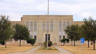
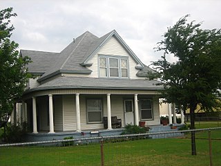
Henrietta is a city in and the county seat of Clay County, Texas, United States. It is part of the Wichita Falls metropolitan statistical area. The population was 3,111 at the 2020 census, a decline of 30 from the 2010 tabulation of 3,141.
Petrolia is a city in Clay County, Texas, United States. It is part of the Wichita Falls, Texas Metropolitan Statistical Area. The population was 686 at the 2010 census, down from 782 at the 2000 census.
Benjamin is a city in and the county seat of Knox County, Texas, United States. Its population was 258 at the 2010 census.
Pleasant Valley is a town in Wichita County, Texas, United States. It is part of the Wichita Falls, Texas metropolitan statistical area. The population was 336 at the 2010 census. Pleasant Valley is also referred to as "The rural country club of Wichita County", in part because of the high demand for land and above-average home prices. This includes Pleasant Valley estates and also Horseshoe Bend estates to the southwest.
Scotland is a city in Archer County in the U.S. state of Texas. It is part of the Wichita Falls, Texas Metropolitan Statistical Area. The population was 501 at the 2010 census. The town is named for its founder, Henry J. Scott.
Windthorst is a town in Archer County in the U.S. state of Texas. It is part of the Wichita Falls, Texas Metropolitan Statistical Area. The population was 409 at the 2010 census. The town is named for Ludwig Windthorst, a Catholic statesman in Germany.
The Wichita Falls metropolitan statistical area is a metropolitan area in North Texas that covers three counties – Archer, Clay, and Wichita. As of the 2010 census, the MSA had a population of 151,306.