Connecticut Route 101

Last updated

Connecticut Highway 101.svg

Route 101

Connecticut Route 101
Map of Windham County in northeastern Connecticut with Route 101 highlighted in red
Route information
Maintained by CTDOT
Length9.46 mi [1]  (15.22 km)
Existed1935–present
Major junctions
West endUS 44.svg US 44 in Pomfret
Major intersectionsI-395.svg I-395 in Killingly
East endRhode Island 101.svg Route 101 in Foster, RI
Location
Country United States
State Connecticut
Counties Windham
Highway system
  • Connecticut State Highway System
Connecticut Highway 100 wide.svg Route 100 Connecticut Highway 102 wide.svg Route 102

Route 101 is a state highway in northeastern Connecticut running from Pomfret to the Rhode Island state line in Killingly. The road originated as a 19th-century toll road known as the Connecticut and Rhode Island Turnpike. Route 101 was designated along the modern alignment in 1935 when an earlier Route 101 was renumbered to U.S. Route 44.

Contents

Route description

Route 101 starts at U.S. Route 44 as Mashamoquet Road then Killingly Road in the town of Pomfret. It runs along the Mashamoquet Brook State Park before intersecting with Route 169. It proceeds eastward, soon passing over the Quinebaug River into the town of Killingly. East of the river, the road becomes known as Hartford Pike. Route 101 then intersects Interstate 395 and Route 12, then passes near Chase Pond, a small pond related to the Chase Reservoir. [2] Route 101 then passes between two large lakes; on the north, the Middle Reservoir (also known as the Chestnut Hill Reservoir), and on the south, the Bog Meadow Pond. [2] It passes by more reservoirs, as it reaches its end at the Connecticut Rhode Island border. [1] Route 101 continues in Rhode Island as Rhode Island Route 101. [2]

Route 101 from the western terminus to milepost 6.78 in East Killingly is also known as the Leif Ericson Highway. [1] [3]

History

In the 19th century, modern day Route 101 was originally known as the Connecticut and Rhode Island Turnpike and was one of several routes connecting Hartford (via the Boston Turnpike) and Providence. It began at the Boston Turnpike in Phoenixville (at the junction of modern Route 198 and Route 44) and went eastward along modern Route 44 to west of Pomfret Landing, then along modern Route 101 through Killingly Center to the Rhode Island state line. Beyond the state line it continued as the Rhode Island and Connecticut Turnpike to Providence.

In 1922, Connecticut numbered its state highways. The turnpike from Phoenixville to west of Pomfret Landing was designated as part of Route 101. The original Route 101 began in South Chaplin, where it split off from New England Route 3. It ran northward via modern Route 198 to Phoenixville then turned eastward along the Connecticut and Rhode Island Turnpike (modern Route 44) to west of Pomfret Landing. Route 101 then continued along modern Route 44 northward to Pomfret Center and eastward through Putnam to the Rhode Island line. Route 101 followed modern Route 44 through Rhode Island all the way to Plymouth, Massachusetts. At the same time, the eastern half of the Connecticut and Rhode Island Turnpike was designated as Highway 137 west of Route 12 and Highway 139 east of Route 12.

In 1932, Route 101 was extended westward across the entire state. It now began in Canaan and ran through Hartford to Phoenixville, where it continued east along its 1920s alignment. The portion of old Route 101 between South Chaplin and Phoenixville became part of Route 91 (now Route 198). Old state highways 137 and 139 were combined into a new Route 202. In 1935, U.S. Route 44 and U.S. Route 202 were designated by AASHO. US 44 used the alignment of the extended Route 101. Old Route 202 was renumbered to Route 101 (since the number was now available) to avoid a numbering conflict with US 202. This route number change was done in cooperation with Rhode Island, which designated the continuation as Rhode Island Route 101. [4] Route 101 was one of the few state routes that survived the 1932 state highway renumbering. [4]

Junction list

The entire route is in Windham County.

Locationmi [1] kmDestinationsNotes
Pomfret 0.000.00US 44.svg US 44  Pomfret, Abington
0.420.68Connecticut Highway 169 wide.svg Route 169  Brooklyn, Pomfret
Killingly 4.877.84I-395.svg I-395  Norwich, Worcester, MA Exit 41 (I-395)
5.028.08Connecticut Highway 12.svg Route 12  Putnam, Dayville
9.4615.22East plate.svg
Rhode Island 101.svg
Route 101 east Foster, Scituate
Rhode Island state line
1.000 mi = 1.609 km; 1.000 km = 0.621 mi

Related Research Articles

<span class="mw-page-title-main">Boston Post Road</span> Road in the northeast United States

The Boston Post Road was a system of mail-delivery routes between New York City and Boston, Massachusetts that evolved into one of the first major highways in the United States.

<span class="mw-page-title-main">Interstate 384</span> Highway in Connecticut

Interstate 384 (I-384) is an auxiliary Interstate Highway located entirely within the state of Connecticut. It runs 8.2 miles (13.2 km) east to west, going from I-84 and I-291 in East Hartford to US Route 6 (US 6) and US 44 in Bolton.

<span class="mw-page-title-main">Interstate 395 (Connecticut–Massachusetts)</span> Highway in Connecticut and Massachusetts

Interstate 395 (I-395) is an auxiliary Interstate Highway in the U.S. states of Connecticut and Massachusetts; it is maintained by the Connecticut Department of Transportation (ConnDOT) and the Massachusetts Department of Transportation (MassDOT). Spanning nearly 67 miles (108 km) on a south–north axis, it is the only spur route of Interstate 95 in Connecticut. The 36-mile (58 km) section between its splits from I-95 in East Lyme and Route 695 in Plainfield is a component highway of the Connecticut Turnpike. Within that state, the highway is named the American Ex-Prisoner of War Memorial Highway from Plainfield to Thompson.

<span class="mw-page-title-main">Rhode Island Route 101</span>

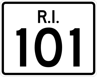
Route 101 is a numbered state highway running 9.7 miles (15.6 km) in Rhode Island. It begins at the Connecticut state line in the town of Foster and ends at U.S. Route 6 (US 6) in the town of Scituate.

<span class="mw-page-title-main">Connecticut Route 17</span>

Route 17 is a primary north–south state route beginning in New Haven, through Middletown, and ending in Glastonbury, with a length of 36.33 miles (58.47 km).

<span class="mw-page-title-main">Connecticut Route 20</span>

Route 20 is a 31.56-mile (50.79 km) state highway in the U.S. state of Connecticut. It extends from Route 8 in rural Winchester to Interstate Route 91 in Windsor. Route 20 consists of two distinct sections: a long, winding, scenic rural road, and a section of the freeway linking I-91 to Bradley International Airport.

<span class="mw-page-title-main">Connecticut Route 25</span>

Route 25 is a 28.59-mile (46.01 km), primary state highway connecting the city of Bridgeport and the town of Brookfield in the U.S. state of Connecticut. Route 25 is a six-lane freeway from Bridgeport to northern Trumbull and a two-lane surface road the rest of the way to Brookfield.

<span class="mw-page-title-main">Connecticut Route 4</span>

Route 4 is an east–west primary state highway connecting rural Litchfield County to the Greater Hartford area of the U.S. state of Connecticut. It runs 46.72 miles (75.19 km) from the town of Sharon to the town of West Hartford.

<span class="mw-page-title-main">Connecticut Route 58</span>

Route 58 is a primary state highway in the U.S. state of Connecticut connecting the towns of Fairfield and Bethel. Route 58 is 18.58 miles (29.90 km) long and is one of the primary routes to the downtown Danbury area via Routes 302 and 53.

<span class="mw-page-title-main">Interstate 95 in Rhode Island</span> Section of Interstate 95

Interstate 95 (I-95) is the main north–south Interstate Highway on the east coast of the United States, running generally southwest-northeast through the U.S. state of Rhode Island. It runs from the border with Connecticut near Westerly, through Warwick and Providence, and to the Massachusetts state line in Pawtucket. It has two auxiliary routes, both of which enter Massachusetts—I-195: a spur from Providence east to Cape Cod, and I-295, a western bypass of the Providence-Pawtucket area.

<span class="mw-page-title-main">Route 169 (Connecticut–Massachusetts)</span>

Route 169 is a 47.36-mile-long (76.22 km) state highway in the U.S. states of Connecticut and Massachusetts. It begins in the city of Norwich, Connecticut, and runs 38 miles (61 km) through Northeastern Connecticut, continuing across the state line into Southbridge, Massachusetts. The route ends in Charlton after another nine miles (14 km). A portion of the route in the town center of Pomfret is on the National Register of Historic Places as Pomfret Street Historic District, and 32.10 miles (51.66 km) of the road is designated as the Connecticut State Route 169 National Scenic Byway.

<span class="mw-page-title-main">U.S. Route 6 in Rhode Island</span> Section of U.S. Highway in Rhode Island, United States

U.S. Route 6 (US 6) is a major east–west road in the U.S. state of Rhode Island. Nationally, the route continues west to Bishop, California and east to Provincetown, Massachusetts. In western Rhode Island, it forms part of one of several routes between Hartford, Connecticut and Providence, Rhode Island, and was planned to be replaced by Interstate 84. The part of I-84 that was built, from Interstate 295 to Olneyville, is now part of US 6. At Olneyville, US 6 joins Route 10 and heads east towards downtown Providence, where it turns south on Interstate 95 and east on Interstate 195. US 6 splits from I-195 in East Providence, crossing into Massachusetts on Warren Avenue. The whole route of US 6 is a state highway maintained by the Rhode Island Department of Transportation.

<span class="mw-page-title-main">State Route 343 (New York−Connecticut)</span> Highway in New York and Connecticut

New York State Route 343 (NY 343) is a state highway located entirely within central Dutchess County, in the Hudson Valley region of the U.S. state of New York. It runs east–west from the intersection of NY 82 in the village of Millbrook to the town of Amenia, where it crosses the Connecticut state line and continues eastward as Route 343, a Connecticut state highway located entirely within the town of Sharon. Along the way, it has a 7.3-mile (11.7 km) concurrency with NY 22 from vicinity of the hamlet of Dover Plains to the hamlet of Amenia.

<span class="mw-page-title-main">Connecticut Route 14</span> Highway in Connecticut

Connecticut Route 14 is one of several secondary routes from eastern Connecticut into Rhode Island. It runs from the Willimantic section of the town of Windham to the Rhode Island state line in Sterling.

<span class="mw-page-title-main">Connecticut Route 64</span>

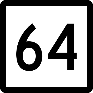
Route 64 is a Connecticut state highway connecting the towns of Woodbury and Waterbury via Middlebury.

<span class="mw-page-title-main">Connecticut Route 244</span>

Route 244 is a secondary state highway in rural Northeastern Connecticut. It connects the towns of Eastford and Pomfret.

<span class="mw-page-title-main">Connecticut Route 190</span> Highway in Connecticut

Route 190 is a state route in the northern part of the U.S. state of Connecticut. It starts at Route 75 in the town of Suffield and proceeds eastward across the Connecticut River through the towns of Enfield, Somers, and Stafford. It ends at Route 171, in the town of Union. Route 190 was established in 1932 as a route between the state line at Southwick and the town of Enfield. The route was later extended eastward to Union but was truncated in the west to Suffield center.

<span class="mw-page-title-main">Connecticut Route 184</span>

Route 184 is a state highway in southeastern Connecticut, running from Groton to North Stonington.

<span class="mw-page-title-main">Interstate 84 in Connecticut</span> Highway in Connecticut

Interstate 84 (I-84) is an east–west Interstate Highway across the state of Connecticut through Danbury, Waterbury, Hartford, and Union.

<span class="mw-page-title-main">U.S. Route 44</span> Highway in the United States

U.S. Route 44 (US 44) is an east–west United States Numbered Highway that runs for 237 miles (381 km) through four states in the Northeastern United States. The western terminus is at US 209 and New York State Route 55 (NY 55) in Kerhonkson, New York, a hamlet in the Hudson Valley region. The eastern terminus is at Route 3A in Plymouth, Massachusetts.

References

  1. 1 2 3 4 "Connecticut State Highway Log" (PDF). Archived from the original (PDF) on September 27, 2011. Retrieved January 15, 2008.
  2. 1 2 3 Google (January 29, 2008). "overview of Route 101" (Map). Google Maps . Google. Retrieved January 29, 2008.
  3. The name is misspelled as "Leif Erickson" in Public Act 03-115.
  4. 1 2 Kurumi. "Connecticut Routes, Route 101". Kurumi. Retrieved February 8, 2008.

Route map:

Template:Attached KML/Connecticut Route 101
KML is from Wikidata