Connecticut Route 115

Last updated

Connecticut Highway 115.svg

Route 115

Connecticut Route 115
Map of New Haven County in southern Connecticut with Route 115 highlighted in red
Route information
Maintained by CTDOT
Length5.66 mi [1]  (9.11 km)
Existed1932 [2] –present
Major junctions
South endConnecticut Highway 34.svg Route 34 in Derby
North endConnecticut Highway 67.svg Route 67 in Seymour
Location
Country United States
State Connecticut
Counties New Haven
Highway system
  • Connecticut State Highway System
Connecticut Highway 114 wide.svg Route 114 Connecticut Highway 116 wide.svg Route 116

Route 115 is a Connecticut state highway in the Lower Naugatuck River Valley area, running from Route 34 in Derby to Route 67 in Seymour. The road runs along the east bank of the lower Naugatuck River.

Contents

Route description

Route 115 begins as Derby Avenue in Derby, continuing north from Route 34, which turns west to cross the Naugatuck River. It enters the city of Ansonia after 0.8 miles (1.3 km), becoming Main Street. At the Derby-Ansonia line, Route 115 meets the western end of Route 243 (for Woodbridge and New Haven) and its continuation across the Naugatuck River (Division Street), which provides access to shopping areas as well as the Route 8 expressway. Route 115 continues north into Ansonia center, passing by the Ansonia station of the Waterbury Branch of the Metro-North Railroad. It then meets the east end of Route 334 (Maple Avenue) and proceeds north as North Main Street, entering the town of Seymour about 1.2 miles (1.9 km) later. In Seymour, it becomes South Main Street, meeting and briefly overlapping Route 313 (for Woodbridge and New Haven) then ending 0.2 miles (0.32 km) later at an intersection with Route 67 near the Seymour railroad station. [1]

The entire length of Route 115 is also designated as Veterans Memorial Highway. [3]

History

In the 1920s, the route through Derby, Ansonia, and Seymour on the east bank of the Naugatuck River was designated as State Highway 200. The corresponding road on the west side was New England Route 8. In the 1932 state highway renumbering, Highway 200 was renumbered to Route 115, [2] originally running from its current southern end at Route 34 to the intersection of Main Street and Broad Street (both part of the original Route 8). In 1936, Route 8 was relocated to River Street (modern Route 313). The former Route 8 alignment became Route 8A. In 1962, Route 8A was deleted and the Main Street portion was assigned as a northern extension of Route 115. [4]

Junction list

The entire route is in New Haven County.

Locationmi [1] kmDestinationsNotes
Derby 0.000.00Connecticut Highway 34.svg Route 34  New Haven, Newtown
DerbyAnsonia line0.851.37East plate.svg
Connecticut Highway 243 wide.svg
Route 243 east Woodbridge, New Haven
Ansonia 1.973.17West plate.svg
Connecticut Highway 334 wide.svg
Route 334 west Seymour
Seymour 5.308.53East plate.svg
Connecticut Highway 313 wide.svg
Route 313 east Woodbridge, New Haven
Eastern terminus of CT 313 overlap
5.378.64West plate.svg
Connecticut Highway 313 wide.svg
Route 313 west
Western terminus of CT 313 overlap
5.669.11Connecticut Highway 67.svg Route 67  Oxford, Woodbridge
1.000 mi = 1.609 km; 1.000 km = 0.621 mi

Related Research Articles

<span class="mw-page-title-main">Ansonia, Connecticut</span> City in Connecticut, United States

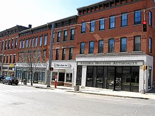
Ansonia is a city in New Haven County, Connecticut, United States. Located on the Naugatuck River, it is immediately north of Derby, and about 12 miles (19 km) northwest of New Haven. The city is part of the Naugatuck Valley Planning Region. The population was 18,918 at the time of the 2020 census. The ZIP code for Ansonia is 06401. The city is served by the Metro-North Railroad. Ansonia Station is a stop on the railroad passenger commuter service's Waterbury Branch connecting to New York's Grand Central Terminal. Ansonia also is served by the Connecticut Transit bus carrier. Connecticut Route 8 serves Ansonia.

<span class="mw-page-title-main">Derby, Connecticut</span> City in Connecticut, United States

Derby is a city in New Haven County, Connecticut, United States, approximately 8 miles (13 km) west-northwest of New Haven. It is located in southwest Connecticut at the confluence of the Housatonic and Naugatuck rivers. It shares borders with the cities of Ansonia to the north and Shelton to the southwest, and the towns of Orange to the south, Seymour to the northwest, and Woodbridge to the east. The city is part of the Naugatuck Valley Planning Region. The population was 12,325 at the 2020 census. It is the smallest city in Connecticut by area, at 5.3 square miles (14 km2).

<span class="mw-page-title-main">U.S. Route 5</span> Highway in the United States

U.S. Route 5 (US 5) is a north–south United States Numbered Highway running through the New England states of Connecticut, Massachusetts, and Vermont. Significant cities along the route include New Haven, Connecticut; Hartford, Connecticut; and Springfield, Massachusetts. From Hartford northward to St. Johnsbury, Vermont, the road closely follows the route of the Connecticut River.

<span class="mw-page-title-main">Connecticut Route 34</span> State highway in Connecticut, US

Route 34 is a primary state highway in the U.S. state of Connecticut. Route 34 is 24.37 miles (39.22 km) long, and extends from Washington Avenue near I-84/US 6 in Newtown to the junction of I-95 and I-91 in New Haven. The highways connects the New Haven and Danbury areas via the Lower Naugatuck River Valley. The portion of the route between New Haven and Derby was an early toll road known as the Derby Turnpike.

The Naugatuck River Valley is the watershed area of the Naugatuck River in the western part of Connecticut. The Naugatuck Valley straddles parts of Litchfield County, New Haven, and Fairfield counties. The Route 8 corridor and Waterbury Branch of the Metro-North railroad line run along the river valley. Geographically, it comprises the municipalities located within the Naugatuck River basin. During the 19th and 20th centuries, the area was one of the main manufacturing centers in New England, and most of the communities around the river were emblematic New England mill towns.

<span class="mw-page-title-main">Connecticut Route 8</span> Highway in Connecticut

Route 8 is a 67.36-mile (108.41 km) state highway in Connecticut that runs north–south from Bridgeport, through Waterbury, all the way to the Massachusetts state line where it continues as Massachusetts Route 8. Most of the highway is a four-lane freeway but the northernmost 8.8 miles (14.2 km) is a two-lane surface road.

<span class="mw-page-title-main">Connecticut Route 63</span> State highway in Connecticut, US

Route 63 is a secondary state highway in the U.S. state of Connecticut, from New Haven up to Canaan, running for 52.57 miles (84.60 km). It connects the Greater New Haven area to Northwestern Connecticut via the western suburbs of Waterbury.

<span class="mw-page-title-main">Connecticut Route 67</span> State highway in Connecticut, US

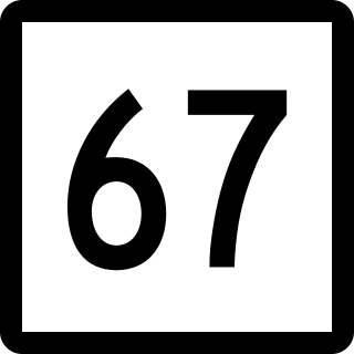
Route 67 is a secondary state highway in the U.S. state of Connecticut, from the town of New Milford in the Greater Danbury area to the town of Woodbridge in the outskirts of New Haven. The route runs for 31.00 miles (49.89 km). It generally follows a northwest-southeast path, and is signed north-south.

<span class="mw-page-title-main">Connecticut Route 122</span> State highway in New Haven County, Connecticut, US

Route 122 is a primary, minor arterial highway in the United States. It begins at Interstate 95 in West Haven, Connecticut. It runs north of West Haven center and roughly follows the path of the West River. It then enters the Westville neighborhood of New Haven and ends at Route 63. Route 122 is 3.51 miles (5.65 km) long.

<span class="mw-page-title-main">Route 169 (Connecticut–Massachusetts)</span> Highway in Connecticut and Massachusetts

Route 169 is a 47.36-mile-long (76.22 km) state highway in the U.S. states of Connecticut and Massachusetts. It begins in the city of Norwich, Connecticut, and runs 38 miles (61 km) through Northeastern Connecticut, continuing across the state line into Southbridge, Massachusetts. The route ends in Charlton after another nine miles (14 km). A portion of the route in the town center of Pomfret is on the National Register of Historic Places as Pomfret Street Historic District, and 32.10 miles (51.66 km) of the road is designated as the Connecticut State Route 169 National Scenic Byway.

<span class="mw-page-title-main">Connecticut Route 142</span> State highway in New Haven County, Connecticut, US

Route 142 is a state highway in Connecticut that serves as an alternate route of US 1, passing through the village of Short Beach on the Branford shoreline. It starts at US 1 in East Haven and ends at US 1 in Branford, running for 4.27 miles (6.87 km).

<span class="mw-page-title-main">Connecticut Route 121</span> State highway in New Haven County, Connecticut, US

Route 121 is a state highway in southern Connecticut running from U.S. Route 1 in Milford to Route 34 near the Orange-Derby line.

<span class="mw-page-title-main">Connecticut Route 243</span> State highway in New Haven County, Connecticut, US

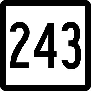
Route 243 is a state highway in Connecticut running for 6.70 miles (10.78 km) from Route 115 at the Ansonia-Derby town line to Route 63 in New Haven. It serves the Westville neighborhood of New Haven and the southern portions of the towns of Woodbridge and Ansonia. The road continues across the Naugatuck River as State Road 853 leading to Route 8.

<span class="mw-page-title-main">Connecticut Route 42</span> State highway in New Haven County, Connecticut, US

Route 42 is an east–west state highway in Connecticut running for 13.66 miles (21.98 km) from Route 67 in Oxford to Route 10 in Cheshire.

<span class="mw-page-title-main">Connecticut Route 110</span> State highway in Fairfield County, Connecticut, US

Route 110 is a state highway in Connecticut running for 15.95 miles (25.67 km) from US 1 in Stratford to Route 111 in Monroe.

<span class="mw-page-title-main">Connecticut Route 114</span> State highway in New Haven County, Connecticut, US

Route 114 is a Connecticut state highway in the western suburbs of New Haven, running from Orange to Woodbridge. Other than at its junction with Route 63, it is signed north and south.

<span class="mw-page-title-main">Connecticut Route 222</span> State highway in Litchfield County, Connecticut, US

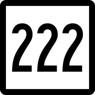
Route 222 is a state highway in west central Connecticut, running in a meandering pattern from Thomaston to Harwinton.

<span class="mw-page-title-main">Connecticut Route 313</span> State highway in New Haven County, Connecticut, US

Route 313 is a Connecticut state highway in the outer northwestern New Haven suburbs, running from Seymour to Woodbridge.

<span class="mw-page-title-main">Connecticut Route 334</span> State highway in New Haven County, Connecticut, US

Route 334 is a Connecticut state highway in the Naugatuck River valley, running from Seymour to Ansonia.

<span class="mw-page-title-main">New Haven and Derby Railroad</span> Former railroad in Connecticut

The New Haven and Derby Railroad (NH&D) was a railroad that connected the city of New Haven, Connecticut, with the town of Derby. The railroad was built between 1868 and 1871, when it began operations. The company was created by the city of New Haven, which owned it until 1889 when it was sold to the Housatonic Railroad. The Housatonic in turn was purchased by the New York, New Haven and Hartford Railroad in 1892. Passenger service existed between New Haven and Derby Junction until 1925 when it was discontinued.

References

  1. 1 2 3 Connecticut State Highway Log Archived 2015-09-05 at the Wayback Machine
  2. 1 2 "Road Conditions in Connecticut". The Hartford Daily Courant . May 27, 1932. p. 14. Retrieved December 24, 2019 via Newspapers.com. Open Access logo PLoS transparent.svg
  3. State Roads and Bridges with Names Commemorating Veterans Organizations or Groups
  4. Connecticut Routes, Route 115
Template:Attached KML/Connecticut Route 115
KML is from Wikidata