Connecticut Route 163

Last updated

Connecticut Highway 163.svg

Route 163

Connecticut Route 163
Map of New London County in southeastern Connecticut with Route 163 highlighted in red
Route information
Maintained by CTDOT
Length12.86 mi [1]  (20.70 km)
Existed1932–present
Major junctions
South endConnecticut Highway 32.svg Route 32 in Montville
Major intersectionsI-395.svg I-395 in Montville
North endConnecticut Highway 2.svg Route 2 in Bozrah
Location
Country United States
State Connecticut
Counties New London
Highway system
  • Connecticut State Highway System
Connecticut Highway 162 wide.svg Route 162 Connecticut Highway 164 wide.svg Route 164

Route 163 is a state highway in southeastern Connecticut running from Montville to Bozrah.

Contents

Route description

Route 163 begins as Oakdale Road at an intersection with Route 32 in the village of Uncasville within the town of Montville. It heads in a northwest direction and soon intersects I-395 (at exit 6) after half a mile. Route 163 then passes through the Palmertown community, passing in front of the Rand-Whitney company headquarters. It soon reaches the village of Oakdale, about 1.5 miles (2.4 km) later, where the road makes a few turns, crosses the Oxoboxo Brook, and continues northwest for another three miles (5 km) to reach Route 82 in northwest Montville. After overlapping Route 82 for 200 yards (180 m), it continues north along Bozrah Road and soon enters the town of Bozrah. In Bozrah, Route 163 veers to the northeast then continues for 4.5 miles (7.2 km) through rural areas before ending at an interchange Route 2 (at exit 23) west of the village of Fitchville. The road continues as unsigned State Road 612 for another 0.14 miles (0.23 km) to end at Fitchville Road, an old alignment of Route 2. [1]

History

The road connecting Uncasville through Oakdale to the Norwich and Salem Turnpike (now Route 82) was designated as a secondary state highway known as Highway 364 in 1922. As part of the 1932 state highway renumbering, old Highway 364 was renumbered to Route 163, running from Route 32 to Route 82. In 1936, it was extended along former SR 655 to its current northern terminus at Route 2 in Bozrah. [2]

Junction list

The entire route is in New London County.

Locationmi [1] kmDestinationsNotes
Montville 0.000.00Connecticut Highway 32.svg Route 32  New London, Quaker Hill, Norwich
0.540.87I-395.svg I-395  New Haven, Norwich Exit 6 on I-395
7.34–
7.46
11.81–
12.01
Connecticut Highway 82.svg Route 82  Norwich, Salem Brief overlap with Route 82
Bozrah 12.8020.60Connecticut Highway 2.svg Route 2  Hartford, Norwich Exit 33 on Route 2
12.8620.70 SSR 612 (Haughton Road)Northern terminus of Route 163
1.000 mi = 1.609 km; 1.000 km = 0.621 mi

Related Research Articles

<span class="mw-page-title-main">Bozrah, Connecticut</span> Town in Connecticut, United States

Bozrah is a town in New London County, Connecticut, United States. The town is part of the Southeastern Connecticut Planning Region. The population was 2,429 at the 2020 census. Bozrah contains three villages: Fitchville, the town center; Leffingwell, a crossroads on Route 82; and Gilman, a mill village along Fitchville Road.

<span class="mw-page-title-main">Interstate 395 (Connecticut–Massachusetts)</span> Highway in Connecticut and Massachusetts

Interstate 395 (I-395) is an auxiliary Interstate Highway in the US states of Connecticut and Massachusetts; it is maintained by the Connecticut Department of Transportation (CTDOT) and the Massachusetts Department of Transportation (MassDOT). Spanning nearly 67 miles (108 km) on a south–north axis, it is the only spur route of I-95 in Connecticut. The 36-mile (58 km) section between its splits from I-95 in East Lyme and Connecticut Route 695 in Plainfield is a component highway of the Connecticut Turnpike. Within that state, the highway is named the American Ex-Prisoner of War Memorial Highway from Plainfield to Thompson.

<span class="mw-page-title-main">Connecticut Route 2</span> State highway in Hartford and New London counties in Connecticut, United States

Route 2 is a 58.03-mile (93.39 km) state highway in Hartford and New London counties in Connecticut. It is a primary state route, with a freeway section connecting Hartford to Norwich and following surface roads to Stonington. The entire freeway section of Route 2 is also known as the Veterans of Foreign Wars Memorial Highway.

<span class="mw-page-title-main">Route 169 (Connecticut–Massachusetts)</span> Highway in Connecticut and Massachusetts

Route 169 is a 47.36-mile-long (76.22 km) state highway in the U.S. states of Connecticut and Massachusetts. It begins in the city of Norwich, Connecticut, and runs 38 miles (61 km) through Northeastern Connecticut, continuing across the state line into Southbridge, Massachusetts. The route ends in Charlton after another nine miles (14 km). A portion of the route in the town center of Pomfret is on the National Register of Historic Places as Pomfret Street Historic District, and 32.10 miles (51.66 km) of the road is designated as the Connecticut State Route 169 National Scenic Byway.

<span class="mw-page-title-main">Connecticut Route 2A</span> State highway in New London County, Connecticut, US

Route 2A is a state highway in the U.S. state of Connecticut. It is a 9.9-mile (15.9 km) mostly freeway alternate route of Route 2 that bypasses the downtown area of the city of Norwich and serves as the main access road to the Mohegan Sun casino.

<span class="mw-page-title-main">Connecticut Route 161</span> State highway in New London County, Connecticut, US

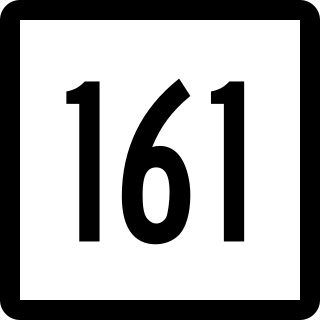
Route 161 is a state highway in southeastern Connecticut, running from the shoreline village of Niantic in East Lyme to the village of Chesterfield in Montville.

<span class="mw-page-title-main">Connecticut Route 45</span> State highway in Litchfield County, Connecticut, US

Route 45 is a Connecticut state highway from US 202 in Washington to US 7 in Cornwall, in the rural northwest of the state. It is 10.29 miles (16.56 km) long and runs north–south.

<span class="mw-page-title-main">Connecticut Route 87</span> State highway in eastern Connecticut, US

Route 87 is a Connecticut state highway running from Franklin to Andover, generally in a southeast–northwest direction. The route is part of the road connecting the towns of Norwich, Lebanon, Columbia, and Andover. Route 87 is a two-lane rural collector road for its entire length.

<span class="mw-page-title-main">Connecticut Route 82</span> State highway in southeastern Connecticut, US

Route 82 is an east–west state highway in Connecticut running for 28.47 miles (45.82 km) from Route 9 in Chester to Route 2 and 32 in Norwich.

<span class="mw-page-title-main">Connecticut Route 151</span> State highway in Middlesex County, Connecticut, US

Route 151 is a Connecticut state highway in the Connecticut River valley running from East Haddam via Moodus to the village of Cobalt in East Hampton.

<span class="mw-page-title-main">Connecticut Route 164</span> State highway in New London County, Connecticut, US

Route 164 is a minor state highway in southeastern Connecticut, United States, running from Route 2 in Preston through the village of Preston City to Route 138 in Griswold just south of the borough of Jewett City.

<span class="mw-page-title-main">Connecticut Route 149</span> State highway in central Connecticut, US

Route 149 is a state highway in east-central Connecticut running from Route 82 in East Haddam center to the Colchester-Hebron town line.

<span class="mw-page-title-main">Connecticut Route 148</span> State highway in southern Connecticut, US

Route 148 is a state highway in southern and southeastern Connecticut running from Route 79 in Killingworth to Route 82 in the village of Hadlyme. Route 148 crosses the Connecticut River using the Chester–Hadlyme Ferry.

<span class="mw-page-title-main">Connecticut Route 124</span> State highway in Fairfield County, Connecticut, US

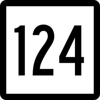
Route 124 is a state highway in southwestern Connecticut running from downtown Darien through the center of New Canaan to the state line in Scotts Corners, New York.

<span class="mw-page-title-main">Connecticut Route 147</span> State highway in Middlesex County, Connecticut, US

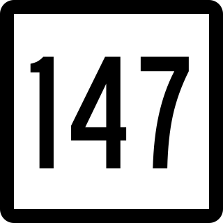
Route 147 is a state highway in central Connecticut running from Durham to Middlefield.

<span class="mw-page-title-main">Connecticut Route 153</span> State highway in Middlesex County, Connecticut, US

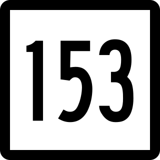
Route 153 is a Connecticut state highway in the Connecticut River valley running from U.S. Route 1 in Westbrook center to Route 154 in Essex Village in the town of Essex.

<span class="mw-page-title-main">Connecticut Route 184</span> State highway in New London County, Connecticut, US

Route 184 is a state highway in southeastern Connecticut, running from Groton to North Stonington.

<span class="mw-page-title-main">Route 197 (Connecticut–Massachusetts)</span> Highway in Connecticut and Massachusetts

Route 197 is a 14.17-mile-long (22.80 km) state highway in northeastern Connecticut and southern Massachusetts, running from Union, Connecticut, to Dudley, Massachusetts. The Connecticut section is signed as an east–west route, while the Massachusetts section is signed north–south.

<span class="mw-page-title-main">Connecticut Route 254</span> State highway in Litchfield County, Connecticut, US

Route 254 is a state highway in northwestern Connecticut running from Thomaston to Litchfield.

<span class="mw-page-title-main">U.S. Route 44</span> Highway in the United States

U.S. Route 44 (US 44) is an east–west United States Numbered Highway that runs for 237 miles (381 km) through four states in the Northeastern United States. The western terminus is at US 209 and New York State Route 55 (NY 55) in Kerhonkson, New York, a hamlet in the Hudson Valley region. The eastern terminus is at Route 3A in Plymouth, Massachusetts.

References

Template:Attached KML/Connecticut Route 163
KML is from Wikidata