
Route 15 is a state highway in the U.S. state of Connecticut that runs 83.53 miles (134.43 km) from a connection with New York's Hutchinson River Parkway in Greenwich, Connecticut to its northern terminus intersecting with Interstate 84 (I-84) in East Hartford, Connecticut. Route 15 consists of four distinct sections: the Merritt Parkway, the Wilbur Cross Parkway, the Berlin Turnpike, and part of the Wilbur Cross Highway. The unified designation was applied to these separate highways in 1948 to provide a continuous through route from New York to Massachusetts. The parkway section of Route 15 is often referred to locally as "The Merritt".

Route 9 is a 40.89-mile (65.81 km), four-lane freeway beginning in Old Saybrook and ending at I-84 near the Farmington–West Hartford town line. It connects the Eastern Coastline of the state along with the Lower Connecticut River Valley to Hartford and the Capital Region.

Route 70 is a 10.92-mile-long (17.57 km) state highway in the U.S. state of Connecticut, connecting the towns of Cheshire and Meriden. The western half of the route is an important link between the Greater New Haven and the Greater Waterbury areas and is part of the state primary highway system. It runs in a “U” Shaped Pattern.

New Hampshire Route 9 is a 109.910-mile-long (176.883 km) state highway located in southern New Hampshire. It runs across the state from west to east and is a multi-state route with Vermont and Maine, part of 1920s-era New England Interstate Route 9.
U.S. Route 301 is a part of the U.S. Highway System that runs from Sarasota, Florida, to Biddles Corner, Delaware. In Virginia, the U.S. Highway runs 142.70 miles (229.65 km) from the North Carolina state line near Skippers north to the Maryland state line at the Potomac River near Dahlgren. US 301 forms the local complement to Interstate 95 (I-95) from Emporia to Petersburg. The U.S. Highway runs concurrently with US 1 between Petersburg and the state capital of Richmond, where the highways form one of the main north–south avenues. US 301 continues north concurrent with Virginia State Route 2 to Bowling Green, forming an eastern alternative to I-95 and US 1 north of Richmond. At Bowling Green, which is connected to I-95 by SR 207, US 301 becomes the primary highway connecting Richmond and the Northern Neck with Southern Maryland. US 301 was constructed in four main segments: as the original SR 24 and then US 17-1 south of Petersburg, as US 1 from Petersburg to Richmond, as SR 2 from Richmond to Bowling Green, and as part of SR 207 toward Dahlgren. US 301 replaced US 17–1 in the early 1930s and was extended from Petersburg north along its current course into Maryland when the Potomac River Bridge was completed in 1940.

Route 142 is a state highway in Connecticut that serves as an alternate route of US 1, passing through the village of Short Beach on the Branford shoreline. It starts at US 1 in East Haven and ends at US 1 in Branford, running for 4.27 miles (6.87 km).

Route 99 is a state highway in Connecticut running for 10.64 miles (17.12 km) from Route 9 in Cromwell, through the town of Rocky Hill, ending in Wethersfield at the Hartford city line. The road continues into Hartford as a local road. It follows the former alignment of Route 9 from prior to that route's upgrade to a freeway.

Route 94 is an east–west state highway in Connecticut running for 9.33 miles (15.02 km) from Route 2 in Glastonbury to Route 85 in Hebron.
Route 73 is an east–west state highway in Connecticut connecting the town center of Watertown to the Route 8 expressway in Waterbury via the village of Oakville. The road is classified as an urban principal arterial road and carries traffic volumes of about 16,400 vehicles per day.

Route 71 is a north–south state highway in Connecticut, running from Wallingford to West Hartford. It is the main north–south road of Meriden, Berlin and New Britain.

U.S. Route 5 (US 5), a north–south U.S. Highway that is generally paralleled by Interstate 91 (I-91), begins at the city of New Haven in Connecticut and heads north through western Massachusetts and eastern Vermont to the international border with Canada. Within Connecticut, US 5 proceeds north from New Haven and passes through Meriden and Hartford towards Springfield, Massachusetts.
Route 108 in the U.S. state of Connecticut, locally called Nichols Avenue and Huntington Turnpike, is a two-lane state highway that runs northerly from US 1, Boston Post Road in Stratford, through Trumbull, to Route 110 in downtown Shelton. Originally called the Farm Highway, it was laid out to the south side of Mischa Hill in Trumbull on December 7, 1696 and is considered to be the third oldest documented highway in Connecticut after the Mohegan Road in Norwich (1670) and the Boston Post Road or US 1 (1673).

U.S. Route 7 (US 7) is a north–south highway extending from southern Connecticut to the northernmost part of Vermont. In Vermont, the route extends for 176 miles (283 km) along the western side of the state as a mostly two-lane rural road, with the exception of an expressway section between Bennington and East Dorset. US 7 is known as the Ethan Allen Highway for its entire length through the state. US 7 ends at an interchange with Interstate 89 (I-89) in the town of Highgate, just south of the Canadian border. I-89 continues to the border crossing.
Route 173 is a Connecticut state highway in the southern and western suburbs of Hartford, running from Newington to West Hartford.

Route 175 is a state highway in central Connecticut, running from New Britain to Wethersfield.
Route 176 is a state highway in central Connecticut, running from the Berlin Turnpike in southern Newington to the Newington-Hartford town line. A section of Route 176 in Newington from its southern terminus to Route 175 is designated the "Newington VFD Memorial Highway".
Route 177 is a state highway in central Connecticut, running from Plainville to Canton.

Route 213 is a state highway in southeastern Connecticut, running in a fishhook pattern from central Waterford to downtown New London via the shoreline.

Route 287 is a Connecticut state highway in the southern Hartford suburbs, running from Newington to Wethersfield. It serves the community of Griswoldville in Wethersfield.
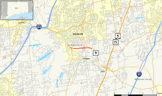
The Willow Brook Connector is a 1.45-mile (2.33 km) unsigned expressway in the town of Berlin, Connecticut. The road is designated but not signed as State Road 571. It gets its name from Willow Brook Park, which begins on the north side of the roadway as one heads into the city of New Britain, or to New Britain Stadium for a baseball game.


