Elmhurst, Illinois

Last updated

Elmhurst, Illinois
Elmhurst City Center.jpg
Flag of Elmhurst, Illinois.png
Elmhurst Seal.png
Mottoes: 
  • "Close to Everything, Unlike Anything"
  • "Ideal for your business, your family, your life"
DuPage County Illinois Incorporated and Unincorporated areas Elmhurst Highlighted.svg
Location of Elmhurst in DuPage County, Illinois.
Coordinates: 41°53′58″N87°56′25″W / 41.89947°N 87.94034°W / 41.89947; -87.94034
CountryUnited States
State Illinois
Counties DuPage, Cook
Townships Addison, York, and Proviso
Incorporated June 5, 1882 (1882-06-05) [1]
Government
[2]
  Type Council–manager
   Mayor Scott M. Levin
Area
[3]
  Total10.28 sq mi (26.62 km2)
  Land10.22 sq mi (26.47 km2)
  Water0.06 sq mi (0.15 km2)  0.58%
Elevation
686 ft (209 m)
Population
 (2020)
  Total45,786
  Density4,480.92/sq mi (1,730.02/km2)
Standard of living (2015-19)
[4]
   Per capita income $57,881
   Median home value $432,600
Time zone UTC-6 (Central)
  Summer (DST) UTC-5 (Central)
ZIP Code
60126, 60127
Area codes 630 and 331
FIPS code 17-23620
GNIS ID 2394673
Website www.elmhurst.org OOjs UI icon edit-ltr-progressive.svg

Elmhurst is a city mostly in DuPage County and overlapping into Cook County in the U.S. state of Illinois, and a western suburb of Chicago.

Contents

History

Elmhurst Station ca. 1890s Elmhurst btwen 1880 and 1899.jpg
Elmhurst Station ca. 1890s

Members of the Potawatomi Native American people, who settled along Salt Creek just south of where the city would develop, are the earliest known settlers of the Elmhurst area. [5] Around 1836, European-American immigrants settled on tracts of land along the same creek. At what would become Elmhurst City Centre, a native of Ohio named Gerry Bates established a community on a tract of "treeless land" in 1842. [5]

The following year, Hill Cottage Tavern opened where St. Charles Road and Cottage Hill Avenue presently intersect. In 1845, the community was officially named Cottage Hill when a post office was established. Four years later, the Galena and Chicago Union Railroad was given right-of-way through the community, giving farmers easier access to Chicago. [5] The first Elmhurst railroad station was built in 1894. The community changed its name to Elmhurst in 1869, and in 1871 Elmhurst University was organized. [1] The land for Elmhurst University was gifted by prominent resident Thomas Barbour Bryan. [6] Bryan (often referred to as the "Father of Elmhurst") [7] played an important role in the development of the town, and has been as the one responsible for renaming the town. [8] [9]

Elmhurst was incorporated as a village in 1882, [1] with a population between 723 and 1,050, and legal boundaries of St. Charles Road to North Avenue, and one half mile west and one quarter mile east of York Street. Elmhurst Memorial Hospital was founded in 1926 as the first hospital in DuPage County. [5]

The Memorial Parade has run every Memorial Day since 1918. The annual Elmhurst St. Patrick's Day Parade continues to be the third largest parade of that sort in the Chicago area, following the more famous parades downtown and on the city's South Side. [5]

Since 1964, it has been home to Elmhurst CRC, one of the largest congregations of the Christian Reformed Church in North America. [10]

The Keebler Company's corporate headquarters was in Elmhurst until 2001, when the Kellogg Company purchased the company. The city is home to the headquarters of Sunshine Biscuits and McMaster-Carr Supply Co.

In 2014, Family Circle magazine ranked Elmhurst as one of the "Ten Best U.S. Towns for Families". [11] [12]

Geography

According to the 2021 census gazetteer files, Elmhurst has a total area of 10.28 square miles (26.63 km2), of which 10.22 square miles (26.47 km2) (or 99.42%) is land and 0.06 square miles (0.16 km2) (or 0.58%) is water. [13]

Due to local topography, the town has had a tendency to flood in the past after large rainfalls; [14] the city is currently undertaking a large effort to mitigate future flooding. [15]

Demographics

Historical population
CensusPop.Note
1870 329
1880 723119.8%
1890 1,05045.2%
1900 1,72864.6%
1910 2,36036.6%
1920 4,59494.7%
1930 14,055205.9%
1940 15,45810.0%
1950 21,27337.6%
1960 36,99173.9%
1970 46,39225.4%
1980 44,276−4.6%
1990 42,029−5.1%
2000 42,7621.7%
2010 44,1213.2%
2020 45,7863.8%
U.S. Census Bureau [16]
Demographics (2010) [17]
DemographicProportion
White 89.5%
Black 1.9%
Asian 5.1%
Islander 0.01%
Native 0.1%
Other3.4%
Hispanic
(any race)
6.6%

As of the 2020 census [18] there were 45,786 people, 16,808 households, and 12,110 families residing in the city. The population density was 4,454.76 inhabitants per square mile (1,719.99/km2). There were 17,260 housing units at an average density of 1,679.32 per square mile (648.39/km2). The racial makeup of the city was 80.47% White, 6.51% Asian, 2.14% African American, 0.26% Native American, 0.02% Pacific Islander, 2.92% from other races, and 7.67% from two or more races. Hispanic or Latino of any race were 9.32% of the population.

There were 16,808 households, out of which 35.8% had children under the age of 18 living with them, 63.37% were married couples living together, 6.49% had a female householder with no husband present, and 27.95% were non-families. 24.44% of all households were made up of individuals, and 13.61% had someone living alone who was 65 years of age or older. The average household size was 3.26 and the average family size was 2.70.

The city's age distribution consisted of 25.1% under the age of 18, 8.6% from 18 to 24, 21.3% from 25 to 44, 28.4% from 45 to 64, and 16.5% who were 65 years of age or older. The median age was 40.7 years. For every 100 females, there were 96.9 males. For every 100 females age 18 and over, there were 94.8 males.

The median income for a household in the city was $123,869, and the median income for a family was $148,663. Males had a median income of $83,584 versus $46,935 for females. The per capita income for the city was $59,911. About 2.1% of families and 3.4% of the population were below the poverty line, including 3.0% of those under age 18 and 4.5% of those age 65 or over.

Economy

Top employers

According to Elmhurst's 2017 Comprehensive Annual Financial Report, [19] the top employers in the city are:

#Employer# of Employees
1 Edward-Elmhurst Hospital 2,758
2 McMaster-Carr Supply Company 800
3 Elmhurst University 600
4 Duchossois Enterprises Group 450
5Altorfer Power Systems (Caterpillar dealer)400
6Semblex Corporation260
7Superior Sound, Inc.250
8 FedEx Freight 200
9Superior Air-Ground Ambulance Service200
10 Safway Services, LLC 180

Arts and culture

Government

The F.B. Henderson House in Elmhurst was designed by Frank Lloyd Wright in 1901. Frank B. Henderson House (Elmhurst, Illinois) 07.JPG
The F.B. Henderson House in Elmhurst was designed by Frank Lloyd Wright in 1901.

Timeline for Elmhurst's leadership: [24]

Education

The Old Main building at Elmhurst University dates to 1878. ElmhurstOldMain.JPG
The Old Main building at Elmhurst University dates to 1878.

Elmhurst University is a local college of the area. It is a four-year private liberal arts college affiliated with the United Church of Christ.

School districts serving Elmhurst include: [25]

Private schools: [25]

Infrastructure

Transportation

Elmhurst is served by Pace buses, and the Metra Union Pacific West Line through the Elmhurst station. The Union Pacific Railroad has freight service on the Metra line and the Canadian National Railway serves the former Illinois Central line south of the Metra line, known as the Freeport Subdivision. O'Hare International Airport is roughly 18 minutes from Elmhurst, and Chicago Midway International Airport is roughly 33 minutes from Elmhurst.

During the summers and December, Elmhurst also has the "Elmhurst Express Trolley", a free weekend trolley that connects downtown Elmhurst to the Spring Road businesses and the Elmhurst Public Library. It runs Friday-Saturday and the $40,000 cost comes out of visiting and tourism fund. [28] [29]

Former services

Elmhurst was previously served by the Chicago Aurora and Elgin Railroad, an electric interurban rail line. The station opened in 1902 as "South Elmhurst" [30] until being renamed to "York St." The station closed in 1959 after the CA&E ceased operations. The Illinois Prairie Path now runs over the former line. [31]

Notable people

Related Research Articles

<span class="mw-page-title-main">DuPage County, Illinois</span> County in Illinois, United States

DuPage County is a county in the U.S. state of Illinois, and one of the collar counties of the Chicago metropolitan area. As of the 2020 census, the population was 932,877, making it Illinois' second-most populous county. Its county seat is Wheaton.

<span class="mw-page-title-main">Bensenville, Illinois</span> Village in Illinois, United States

Bensenville is a village located near O'Hare International Airport in DuPage County, Illinois, with a portion of the town in Cook County. As of the 2020 census, the village population was 18,813.

<span class="mw-page-title-main">Berkeley, Illinois</span> Village in Illinois, United States

Berkeley is a village located in Cook County, Illinois, United States. Incorporated in 1924, the population at the 2020 census was 5,338.

<span class="mw-page-title-main">Brookfield, Illinois</span> Village in Illinois, United States

Brookfield is a village in Cook County, Illinois, United States, located 13 miles (21 km) west of downtown Chicago. Per the 2020 census, the population was 19,476. The city is home to the Brookfield Zoo.

<span class="mw-page-title-main">Dolton, Illinois</span> Village in Illinois, United States

Dolton is a village in Cook County, Illinois, United States. The population was 21,426 at the 2020 census. Dolton is located just west of the expressway Interstate 94 and immediately south of the city limits of Chicago. Its most common ZIP code is 60419.

<span class="mw-page-title-main">Flossmoor, Illinois</span> Village in Illinois, United States

Flossmoor is a village in Cook County, Illinois, United States. The population was 9,704 at the 2020 census. Flossmoor is approximately 24 miles south of The Loop/Downtown Chicago. It is closely tied to neighboring Homewood, sharing a high school and park district.

<span class="mw-page-title-main">Hanover Park, Illinois</span> Village in Illinois, United States

Hanover Park is a village in Cook and DuPage counties in the U.S. state of Illinois, a suburb of Chicago. The population was 37,470 at the 2020 census. Ontarioville is a neighborhood within the village.

<span class="mw-page-title-main">Harvey, Illinois</span> City in Illinois, United States

Harvey is a city in Cook County, Illinois, United States. The population was 20,324 at the 2020 census.

<span class="mw-page-title-main">Homewood, Illinois</span> Village in Illinois, United States

Homewood is a village in Cook County, Illinois, United States. The population was 19,463 at the 2020 census.

<span class="mw-page-title-main">Palos Heights, Illinois</span> City in Illinois, United States

Palos Heights is a city in Cook County, Illinois, United States. It is a southwest suburb of Chicago. Per the 2020 census, the population was 12,068.

<span class="mw-page-title-main">Prospect Heights, Illinois</span> City in Illinois, United States

Prospect Heights is a city in Cook County, Illinois, United States and is a suburb of Chicago. Per the 2020 census, the population was 16,058.

<span class="mw-page-title-main">Riverdale, Illinois</span> Village in Illinois, United States

Riverdale is a village in Cook County, Illinois, United States. The population was 10,663 at the 2020 census. The village shares its name with the bordering Riverdale neighborhood in Chicago.

<span class="mw-page-title-main">Summit, Illinois</span> City in Illinois, United States

Summit is a city in Cook County, Illinois, United States. The population was 11,161 at the 2020 census. The name Summit, in use since 1836, refers to the highest point on the Chicago Portage between the northeast-flowing Chicago River and the southwest-flowing Des Plaines River located just north of the city.

<span class="mw-page-title-main">Western Springs, Illinois</span> Village in Illinois, United States

Western Springs is a village located in Cook County, Illinois, United States, and a suburb of Chicago. As of the 2020 census, the village had a total population of 13,629. It is twinned with Rugeley, Staffordshire, United Kingdom. In July 1962, the towns made telephone history on national television when the chairman of Rugeley Urban District Council made the first telephone call via the new Telstar satellite to the mayor of Western Springs.

<span class="mw-page-title-main">West Chicago, Illinois</span> City in Illinois, United States

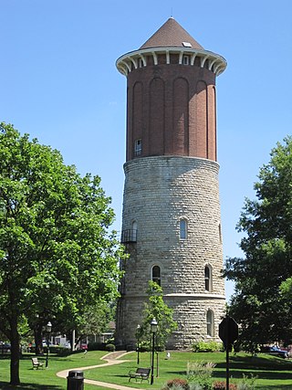
West Chicago is a city in DuPage County, Illinois, United States. The population was 25,614 at the 2020 census. It was formerly named Junction and later Turner, after its founder, John B. Turner, president of the Galena and Chicago Union Railroad (G&CU) in 1855. The city was initially established around the first junction of railroad lines in Illinois, and today is still served by the Union Pacific West Metra service via West Chicago station.

<span class="mw-page-title-main">Wood Dale, Illinois</span> City in Illinois, United States

Wood Dale is a city in Addison Township, DuPage County, Illinois, United States. Per the 2020 census, the population was 14,012.

Grandwood Park is a census-designated place (CDP) in Warren Township, Lake County, Illinois, United States. Per the 2020 census, the population was 5,297.

<span class="mw-page-title-main">Libertyville, Illinois</span> Village in Illinois, United States

Libertyville is a village in Lake County, Illinois, United States, and a northern suburb of Chicago. It is located 5 miles (8 km) west of Lake Michigan along the Des Plaines River. The 2020 census population was 20,579. It is part of Libertyville Township, which includes the village, neighboring Green Oaks, and portions of Vernon Hills, Mundelein, unincorporated Waukegan and Lake Forest, and part of Knollwood CDP. Libertyville neighbors these communities as well as Gurnee to the north and Grayslake to the northwest. Libertyville is about 40 miles north of the Chicago Loop and is part of the United States Census Bureau's Chicago combined statistical area (CSA).

<span class="mw-page-title-main">Crystal Lake, Illinois</span> City in Illinois, United States

Crystal Lake is a city in McHenry County, Illinois, United States. Named after a lake 1.6 miles (2.6 km) southwest of the city's downtown, Crystal Lake is 45 miles (72 km) northwest of Chicago. The population was 40,269 as of the 2020 census. Crystal Lake is the most populous city in McHenry County, part of the Chicago metropolitan area.

<span class="mw-page-title-main">Addison Township, DuPage County, Illinois</span> Township in Illinois, United States

Addison Township is one of nine townships in DuPage County, Illinois, USA. As of the 2020 census, its population was 88,351 and it contained 32,306 housing units.

References

  1. 1 2 3 "Name Index to Illinois Local Governments". Illinois State Archives. Retrieved December 19, 2021.
  2. "Council Members". City of Elmhurst. Retrieved December 19, 2021.
  3. "2020 U.S. Gazetteer Files". United States Census Bureau. Retrieved March 15, 2022.
  4. "QuickFacts Elmhurst city, Illinois". U.S. Census Bureau. April 1, 2020. Retrieved December 19, 2021.
  5. 1 2 3 4 5 "Elmhurst Origins".
  6. "A Spartan Beginning At Elmhurst College". Archived from the original on November 25, 2015. Retrieved August 8, 2015.
  7. "Pick of the Week". Newspapers.com. Chicago Tribune. November 8, 2012. Archived from the original on May 28, 2021. Retrieved January 5, 2021.
  8. Wilson, Nancy (2013). "EHM Historical Highlights Thomas Barbour Bryan (1828–1906)". emhurst.org. Elmhurst History Museum. Archived from the original on June 10, 2020. Retrieved May 8, 2020.
  9. Breslin, Mary (March 9, 1997). "Byrd's Nest Draws Settlers After Chicago Fire". chicagotribune.com. Chicago Tribune. Archived from the original on May 28, 2021. Retrieved May 6, 2020.
  10. Christian Reformed Church in North America. "Elmhurst CRC - Church - Christian Reformed Church" . Retrieved May 26, 2013.
  11. "10 Best Towns for Families: 2014".
  12. Tribune, Chicago. "Elmhurst named one of 10 best places for families". Chicago Tribune .
  13. "Gazetteer Files". Census.gov. Retrieved June 29, 2022.
  14. Earnest, Andrea (May 31, 2018). "Heavy Rain Causes Flooding In Elmhurst". Patch. Retrieved February 15, 2024.
  15. Megan, Graydon (August 22, 2018). "More than $25 million later, how is Elmhurst flood control working?". Chicago Tribune. Archived from the original on March 29, 2019. Retrieved February 15, 2024.
  16. Historical Census Data Retrieved on February 11, 2010
  17. "Profile of General Population and Housing Characteristics: 2010 Demographic Profile Data (DP-1): Elmhurst city, Illinois". U.S. Census Bureau, American Factfinder. Archived from the original on February 12, 2020. Retrieved February 11, 2013.
  18. "Explore Census Data". data.census.gov. Retrieved June 28, 2022.
  19. "City of Elmhurst CAFR".
  20. Pohlen, Jerome (2012). Oddball Illinois: A Guide to 450 Really Strange Places (Second ed.). Chicago Review Press. pp. 104–105. ISBN   978-1613740323.
  21. "Elmhurst Quarry Flood Control Facility | DuPage County Stormwater Management Elmhurst Quarry Flood Control Facility". www.dupageco.org. Retrieved May 1, 2018.
  22. "Art In the Park | Explore Elmhurst, IL". www.elmhursthistory.org. Retrieved February 28, 2018.
  23. "Art in Wilder Park | Annual 2 Day Outdoor Art Show in Elmhurst". www.rglmarketingforthearts.com. Retrieved February 28, 2018.
  24. "Chronology of Elmhurst History".
  25. 1 2 "Education Archived March 21, 2017, at the Wayback Machine ." Elmhurst, Illinois. Retrieved on March 21, 2017.
  26. "Sees Hillside School Wing Built By Fall". Chicago Tribune . August 2, 1953. p. W2.
  27. "School Tries New Mental Health Program". Chicago Tribune . December 16, 1971. p. W9.
  28. "Elmhurst Express Trolley | Explore Elmhurst, IL". www.exploreelmhurst.com. Retrieved February 5, 2018.
  29. Megan, Graydon. "Elmhurst trolley back on track for summer". chicagotribune.com. Retrieved February 5, 2018.
  30. "New Electric Line Opened". Hearst’s Chicago American. August 25, 1902.
  31. "History of the IPP". Illinois Prairie Path. Retrieved January 9, 2024.