McCook, Illinois

Last updated

McCook, Illinois
20150911 01 U S 66 McCook, Illinois (26051009222).jpg
McCook welcome sign, inspired by the Welcome to Fabulous Las Vegas sign
McCook seal.png
Cook County Illinois Incorporated and Unincorporated areas McCook Highlighted.svg
Location of McCook in Cook County, Illinois.
Illinois in United States (US48).svg
Location of Illinois in the United States
Coordinates: 41°47′55″N87°49′57″W / 41.79861°N 87.83250°W / 41.79861; -87.83250
CountryUnited States
StateIllinois
County Cook
Government
  MayorTerrance M. Carr, Jr. (acting mayor)
Area
[1]
  Total2.63 sq mi (6.83 km2)
  Land2.61 sq mi (6.77 km2)
  Water0.02 sq mi (0.05 km2)
Population
 (2020)
  Total249
  Density95.26/sq mi (36.78/km2)
Time zone UTC-6 (CST)
  Summer (DST) UTC-5 (CDT)
ZIP Code(s)
60525
Area code 708
FIPS code 17-45564
Wikimedia CommonsMcCook, Illinois
Website www.villageofmccook.org

McCook is a village in Cook County, Illinois, United States, and is an industrial suburb of Chicago. As of the 2020 census, the village population was 249, which is the lowest population of all municipalities in the county.

Contents

History

McCook was named for John J. McCook, a late 19th-century director of the Santa Fe Railroad and a former Civil War officer. McCook station was served by the railroad in the town. The Outlaws Motorcycle Club was established in McCook in 1935 when Old Route 66 passed through the town. In 1958, six people were killed in an explosion at a Reynolds Metals plant. In 1995, the former Universal Oil Products Riverside Laboratory in McCook was awarded with National Historic Chemical Landmark status.

Geography

McCook is located at 41°47′55″N87°49′57″W / 41.79861°N 87.83250°W / 41.79861; -87.83250 (41.798542, -87.832432). [2]

According to the 2021 census gazetteer files, McCook has a total area of 2.64 square miles (6.84 km2), of which 2.61 square miles (6.76 km2) (or 99.20%) is land and 0.02 square miles (0.05 km2) (or 0.80%) is water. [3]

McCook is home to a small population but a large amount of heavy industry, resulting in a large tax base.

Demographics

Historical population
CensusPop.Note
1930 367
1940 315−14.2%
1950 36114.6%
1960 44122.2%
1970 333−24.5%
1980 303−9.0%
1990 235−22.4%
2000 2548.1%
2010 228−10.2%
2020 2499.2%
U.S. Decennial Census [4]

As of the 2020 census [5] there were 249 people, 107 households, and 87 families residing in the village. The population density was 94.50 inhabitants per square mile (36.49/km2). There were 113 housing units at an average density of 42.88 per square mile (16.56/km2). The racial makeup of the village was 64.26% White, 1.20% Asian, 10.44% from other races, and 24.10% from two or more races. Hispanic or Latino of any race were 36.55% of the population.

There were 107 households, out of which 41.1% had children under the age of 18 living with them, 50.47% were married couples living together, 22.43% had a female householder with no husband present, and 18.69% were non-families. 16.82% of all households were made up of individuals, and 11.21% had someone living alone who was 65 years of age or older. The average household size was 3.18 and the average family size was 2.96.

The village's age distribution consisted of 24.9% under the age of 18, 13.6% from 18 to 24, 21.7% from 25 to 44, 17% from 45 to 64, and 22.7% who were 65 years of age or older. The median age was 31.4 years. For every 100 females, there were 108.6 males. For every 100 females age 18 and over, there were 101.7 males.

The median income for a household in the village was $75,417, and the median income for a family was $65,417. Males had a median income of $50,714 versus $33,750 for females. The per capita income for the village was $28,757. About 3.4% of families and 5.0% of the population were below the poverty line, including 3.8% of those under age 18 and 5.6% of those age 65 or over.

McCook village, Illinois – Demographic Profile
(NH = Non-Hispanic)
Race / EthnicityPop 2010 [6] Pop 2020 [7] % 2010% 2020
White alone (NH)16114170.6%56.6%
Black or African American alone (NH)000.0%0.0%
Native American or Alaska Native alone (NH)000.0%0.0%
Asian alone (NH)030.0%1.2%
Pacific Islander alone (NH)000.0%0.0%
Some Other Race alone (NH)030.0%1.2%
Mixed Race/Multi-Racial (NH)2110.9%4.4%
Hispanic or Latino (any race)659128.5%36.5%
Total228249100.00%100.00%

Government

McCook is in Illinois's 3rd congressional district.

Business

McCook is home to a large amount of heavy industry, including portions of Vulcan Materials Company McCook Quarry, UOP, and the Electro-Motive Diesel (EMD) railroad locomotive plant. Known as the LaGrange plant for its mailing address (McCook does not have its own post office), EMD produced most of their locomotives there from 1935 to 1991, when parent company General Motors moved all final-assembly operations to London, Ontario. The LaGrange plant continues to manufacture locomotive parts and engines, and also serves as the EMD U.S. headquarters.

Education

A part of McCook is served by the Lyons School District 103 and J. Sterling Morton High School District 201's Morton West High School located in Berwyn.

Another part of McCook is served by Lyons Township High School in Western Springs/LaGrange.

Transportation

Pace provides bus service on Route 330 connecting McCook to destinations across the region. [8]

Related Research Articles

<span class="mw-page-title-main">Broadview, Illinois</span> Village in Illinois, United States

Broadview is a village in Cook County, Illinois, 12 miles (19 km) west of downtown Chicago. As of the 2020 census it had a population of 7,998.

<span class="mw-page-title-main">Brookfield, Illinois</span> Village in Illinois, United States

Brookfield is a village in Cook County, Illinois, United States, located 13 miles (21 km) west of downtown Chicago. Per the 2020 census, the population was 19,476. The city is home to the Brookfield Zoo.

<span class="mw-page-title-main">Burnham, Illinois</span> Village in Illinois, United States

Burnham is a village in Cook County, Illinois, United States. The population was 4,046 at the 2020 census. The ZIP code is 60633.

<span class="mw-page-title-main">Burr Ridge, Illinois</span> Village in Illinois, United States

Burr Ridge is a village in Cook and DuPage counties in the U.S. state of Illinois. Per the 2020 census, the population was 11,192.

<span class="mw-page-title-main">Calumet Park, Illinois</span> Village in Illinois, United States

Calumet Park is a village in Cook County, Illinois. The population was 7,025 at the 2020 census.

<span class="mw-page-title-main">Dixmoor, Illinois</span> Village in Illinois, United States

Dixmoor is a village in Cook County, Illinois, United States and a south suburb of Chicago. The population was 2,973 at the 2020 census.

<span class="mw-page-title-main">East Hazel Crest, Illinois</span> Village in Illinois, United States

East Hazel Crest is a village in Cook County, Illinois, in the United States. It is a south suburb of Chicago. As of the 2020 census, the village population was 1,297.

<span class="mw-page-title-main">Forest View, Illinois</span> Village in Illinois, United States

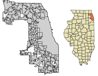
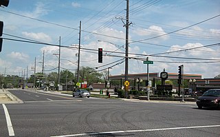
Forest View is a village in Cook County, Illinois, United States. Per the 2020 census, the population was 792. It is primarily an industrial corridor adjacent to the Chicago neighborhood of Garfield Ridge, which is on the village's southern border.

<span class="mw-page-title-main">Glenwood, Illinois</span> Village in Illinois, United States

Glenwood is a village in Cook County, Illinois, United States. The population was 8,662 at the 2020 census.

<span class="mw-page-title-main">Indian Head Park, Illinois</span> Village in Illinois, United States

Indian Head Park is a village in Cook County, Illinois, United States, slightly north of the intersection of Interstate 294 and Interstate 55. The village is south of Western Springs, west of Countryside, north and east of Burr Ridge. Per the 2020 census, the population was 4,065. The village's ZIP code is 60525.

<span class="mw-page-title-main">Justice, Illinois</span> Village in Illinois, United States

Justice is a village in Cook County, Illinois, United States, established in 1911. Per the 2020 census, the population was 12,600.

<span class="mw-page-title-main">La Grange Park, Illinois</span> Village in Illinois, United States

La Grange Park is a village in Cook County, Illinois, United States. According to the 2020 census, the population was 13,475.

<span class="mw-page-title-main">Lynwood, Illinois</span> Village in Illinois, United States

Lynwood is a village in Cook County, Illinois, United States and a suburb of Chicago. The population was 9,116 at the 2020 census.

<span class="mw-page-title-main">Merrionette Park, Illinois</span> Village in Illinois, United States

Merrionette Park is a village in Cook County, Illinois, United States. The population was 1,969 as of the 2020 census.

<span class="mw-page-title-main">Palos Park, Illinois</span> Village in Illinois, United States

Palos Park is a village in southwestern Cook County, Illinois, United States. Per the 2020 census, the population was 4,899.

<span class="mw-page-title-main">Richton Park, Illinois</span> Village in Illinois, United States

Richton Park is a village and a south suburb of Chicago in Cook County, Illinois, United States. The population was 12,775 at the 2020 census.

<span class="mw-page-title-main">South Chicago Heights, Illinois</span> Village in Illinois, United States

South Chicago Heights is a village and a south suburb in Cook County, Illinois, United States. The population was 4,026 at the 2020 census.

<span class="mw-page-title-main">Stickney, Illinois</span> Village in Illinois, United States

Stickney is a village in Cook County, Illinois, United States. The village is named for Alpheus Beede Stickney, a railroad executive who played a central role in establishing the Clearing Industrial District. Per the 2020 census, the population was 7,110. It was well known in the 1920s and early 1930s as the home for several bordellos linked to mobster Al Capone's empire.

<span class="mw-page-title-main">Thornton, Illinois</span> Village in Illinois, United States

Thornton is a village in Cook County, Illinois, United States and a south suburb of Chicago. The population was 2,386 at the 2020 census. Thornton is home to the Thornton Quarry, one of the largest quarries in the world.

<span class="mw-page-title-main">Lyons Township, Cook County, Illinois</span> Township in Illinois, United States

Lyons Township is one of 29 townships in Cook County, Illinois. As of the 2020 census, its population was 115,105, with its most populous municipalities including La Grange, Justice and Summit. Lyons Township was established in 1850. The village of Lyons, almost all of which lies within the township, is often confused with it.

References

  1. "2020 U.S. Gazetteer Files". United States Census Bureau. Retrieved March 15, 2022.
  2. "US Gazetteer files: 2010, 2000, and 1990". United States Census Bureau. February 12, 2011. Retrieved April 23, 2011.
  3. Bureau, US Census. "Gazetteer Files". Census.gov. Retrieved June 29, 2022.
  4. "Census of Population and Housing". Census.gov. Retrieved June 4, 2015.
  5. "Explore Census Data". data.census.gov. Retrieved June 28, 2022.
  6. "P2 HISPANIC OR LATINO, AND NOT HISPANIC OR LATINO BY RACE – 2010: DEC Redistricting Data – McCook village, Illinois". United States Census Bureau .
  7. "P2 HISPANIC OR LATINO, AND NOT HISPANIC OR LATINO BY RACE – 2020: DEC Redistricting Data – McCook village, Illinois". United States Census Bureau .
  8. "RTA System Map" (PDF). Retrieved February 1, 2024.