
Wilson Woodworks
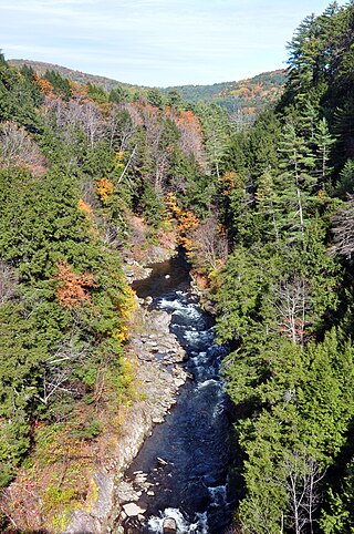
Hydeville is a rural section of the town of Stafford, Connecticut, United States, located on Furnace Creek. Historically, it was also known as Haydenville. [1]
Hydeville is a rural section of the town of Stafford, Connecticut, United States, located on Furnace Creek. Historically, it was also known as Haydenville. [1]
The Lafayette blast furnace, established in Hydeville in 1799 to process bog iron, is reputed to have been the first iron furnace in the state to cast stoves. It operated until 1840, when the local ore supply had been used up. [2]
In the 1890s, Hydeville was described as "consisting of a few houses about a woolen mill" with a population of about 130. Several of the houses in the village were tenement buildings containing several individual dwelling units. [1]
Wilson Woodworks, a producer of wood flooring, was once located in Hydeville, but moved to the town of Windsor, about 30 miles to the southwest. [3]

Tolland County is a county in the northeastern part of the U.S. state of Connecticut. As of the 2020 census, its population was 149,788. It is incorporated into 13 towns and was originally formed on October 13, 1785, from portions of eastern Hartford County and western Windham County.

Estill County is a county located in the U.S. state of Kentucky. As of the 2020 census, the population was 14,163. Its county seat is Irvine. The county was formed in 1808 and named for Captain James Estill, a Kentucky militia officer who was killed in the Battle of Little Mountain during the American Revolutionary War. Estill County is a moist county meaning that the county seat, the city of Irvine, allows the sale of alcohol after the October 9, 2013, vote, but not the rest of Estill County outside the Irvine city limits. Estill County has two adjacent towns, known as the twin cities, Irvine and Ravenna. Both cities sit along the Kentucky River in the central part of the county. Ravenna is home to a former CSX Transportation facility, now owned by Kentucky Steam Heritage Corporation for the restoration of Chesapeake and Ohio 2716. It conducts the Ravenna Railroad Festival annually in late summer, and the historic Fitchburg & Cottage Furnaces are located here. Irvine hosts the annual Mountain Mushroom Festival over the last weekend of April, which celebrates the abundant Morel Mushrooms found in the region.

Southington is a town in Hartford County, Connecticut, United States. The town is part of the Capitol Planning Region. As of the 2020 United States Census, it had a population of 43,501. Southington contains the villages of Marion, Milldale, and Plantsville.

Salisbury is a town situated in Litchfield County, Connecticut, United States. The town is the northwesternmost in the state of Connecticut; the Massachusetts-New York-Connecticut tri-state marker is located at the northwestern corner of the town. The population was 4,194 at the 2020 census. The town is part of the Northwest Hills Planning Region.

Stafford is a town in Tolland County, Connecticut, United States, settled in 1719. The town is part of the Capitol Planning Region. The population was 11,472 at the 2020 United States Census. The community consists of the downtown area of Stafford Springs and the more rural villages of Crystal Lake, Ellithorpe, Hydeville, Orcuttsville, Staffordville, Stafford Hollow, Village Hill, and West Stafford. The town most likely derives its name from Staffordshire, in England.

The Connecticut Colony or Colony of Connecticut, originally known as the Connecticut River Colony or simply the River Colony, was an English colony in New England which later became Connecticut. It was organized on March 3, 1636 as a settlement for a Puritan congregation, and the English permanently gained control of the region in 1637 after struggles with the Dutch. The colony was later the scene of a bloody war between the colonists and Pequots known as the Pequot War. Connecticut Colony played a significant role in the establishment of self-government in the New World with its refusal to surrender local authority to the Dominion of New England, an event known as the Charter Oak incident which occurred at Jeremy Adams' inn and tavern.

The Connecticut College Arboretum is a 300 ha arboretum and botanical gardens, founded in 1931, and located on the campus of Connecticut College and in the towns of New London and Waterford, Connecticut, United States.
Fair Haven Heights, or simply the Heights, is a residential and light industrial neighborhood in the eastern part of the city of New Haven, Connecticut, located east of the Quinnipiac River. Fair Haven Heights is not to be confused with the adjacent Fair Haven neighborhood west of the river. The area is bordered on the west by the Quinnipiac River, on the north by Route 80, on the east by the town of East Haven, and on the south by Ferry Street and Warwick Avenue. The main through routes are Quinnipiac Avenue, East Grand Avenue, and Eastern Street

Fort Griswold is a former American defensive fortification in Groton, Connecticut named after Deputy Governor Matthew Griswold. The fort played a key role in the early stages of the American Revolutionary War, in correspondence with Fort Trumbull on the opposite side of the Thames River. Griswold defended the port of New London, Connecticut, a supply center for the Continental Army and friendly port for Connecticut-based privateers who targeted British shipping. The 17-acre site is maintained as Fort Griswold Battlefield State Park by the Connecticut Department of Energy and Environmental Protection.

Connecticut's 2nd congressional district is a congressional district in the U.S. state of Connecticut. Located in the eastern part of the state, the district includes all of New London County, Tolland County, and Windham County, along with parts of Hartford, Middlesex, and New Haven counties. Principal cities include Enfield, Norwich, New London, and Groton.

Route 19 is a minor Connecticut state route running from Stafford to the Massachusetts state line. It is 6.99 miles (11.25 km) long and runs north–south, entirely within Stafford. The road interconnects the settlements in the eastern part of the town.
Asnuntuck Community College (ACC) is a public community college in Enfield, Connecticut. It offers associate degree and certificate programs as well as healthcare certificate programs and business and industry programming.
The Stewart B. McKinney National Wildlife Refuge is a 950-acre (384.5 ha) National Wildlife Refuge in ten units across the U.S. state of Connecticut. Located in the Atlantic Flyway, the refuge spans 70 miles (110 km) of Connecticut coastline and provides important resting, feeding, and nesting habitat for many species of wading birds, shorebirds, songbirds and terns, including the endangered roseate tern. Adjacent waters serve as wintering habitat for brant, scoters, American black duck, and other waterfowl. Overall, the refuge encompasses over 900 acres (364.2 ha) of barrier beach, intertidal wetland and fragile island habitats.
The Ottauquechee River is a 41.4-mile-long (66.6 km) river in eastern Vermont in the United States. It is a tributary of the Connecticut River, which flows to Long Island Sound.

The Scantic River is a river that flows through the states of Massachusetts and Connecticut. It is a tributary to the Connecticut River.

The Five Mile River is a 10.1-mile-long (16.3 km) river in central Massachusetts, part of the Chicopee River watershed. It rises north of Dean Pond in the Town of Oakham within Rutland State Forest and flows south through Dean Pond to Brooks Pond, 2.5 miles (4.0 km) northeast of North Brookfield, then continues south to its mouth at the north end of Lake Lashaway, also in North Brookfield.

Stafford Hollow, also known as Stafford, Stafford Village, or Furnace Hollow, is a village in the town of Stafford, in Tolland County, Connecticut, United States, located at the junction of Route 19 and Route 319. Stafford Hollow was the town center of Stafford during the 18th and 19th centuries, before the growth of the village of Stafford Springs.

The Richmond Furnace Historical and Archeological District is a historic industrial area located on State, Cone Hill, and Furnace Roads in Richmond, Massachusetts. The industrial history of the site dates to 1763 when the first grist and sawmills were built. In 1829, the first stone furnace was constructed for the production of iron from abundant hematite ore found nearby. It was rebuilt in 1863, and overhauled in 1905 to increase capacity. The area saw industrial iron production until 1923. The historic district also includes several other houses and buildings related to the iron works. It was added to the National Register of Historic Places in 1999.
Old Furnace State Park is a public recreation area adjacent to Ross Pond State Park in the town of Killingly, Connecticut. The state parks covers 367 acres (149 ha), sits at an elevation of 390 feet (120 m), and is open year-round for hiking, hunting, and fishing. It is located east of Interstate 395, south of U.S. Route 6 and north of Connecticut Route 695. The park is the site of a former iron furnace. It was established as a town park in 1909 before being transferred to the state in 1918.
Municipalities and communities of Tolland County, Connecticut, United States | ||
|---|---|---|
| Towns |  | |
| CDPs | ||
| Other communities | ||