Mansfield Center, Connecticut

Last updated

Mansfield Center, Connecticut
CDP
Mansfield Centre General Store, Mansfield Center CT.jpg
Mansfield Center General Store
Tolland County Connecticut Incorporated and Unincorporated areas Mansfield Center Highlighted 2010.svg
Location in Tolland County and the state of Connecticut
Coordinates: 41°45′59″N72°11′41″W / 41.76639°N 72.19472°W / 41.76639; -72.19472
Country United States
State Connecticut
County Tolland
Area
  Total3.4 sq mi (8.8 km2)
  Land3.1 sq mi (7.9 km2)
  Water0.4 sq mi (0.9 km2)
Elevation
256 ft (78 m)
Population
 (2010)
  Total947
  Density318.9/sq mi (123.1/km2)
Time zone UTC-5 (Eastern (EST))
  Summer (DST) UTC-4 (EDT)
ZIP code
06250
Area code 860
FIPS code 09-45120
GNIS feature ID0208699

Mansfield Center is a village [1] within the town of Mansfield in Tolland County, Connecticut, United States. The village is the basis of a census-designated place (CDP) of the same name with a population of 947 at the 2010 census. The CDP includes the original settlement of Mansfield, Mansfield Center or Mansfield Village, as well as the village of Mansfield Hollow. Mansfield Hollow State Park is also located within the boundaries of the CDP.

Contents

Demographics

As of the census [2] of 2000, there were 973 people, 373 households, and 239 families residing in the CDP. The population density was 123.2/km2 (318.9/mi2). There were 382 housing units at an average density of 48.4/km2 (125.2/mi2). The racial makeup of the CDP was 92.19% White, 1.23% African American, 0.21% Native American, 4.01% Asian, 0.10% Pacific Islander, 0.41% from other races, and 1.85% from two or more races. Hispanic or Latino of any race were 1.44% of the population.

There were 373 households, out of which 25.7% had children under the age of 18 living with them, 55.2% were married couples living together, 6.2% had a female householder with no husband present, and 35.9% were non-families. 26.3% of all households were made up of individuals, and 9.7% had someone living alone who was 65 years of age or older. The average household size was 2.38 and the average family size was 2.85.

In the CDP, the population was spread out, with 18.8% under the age of 18, 8.1% from 18 to 24, 23.8% from 25 to 44, 25.9% from 45 to 64, and 23.3% who were 65 years of age or older. The median age was 44 years. For every 100 females, there were 87.5 males. For every 100 females age 18 and over, there were 85.4 males.

The median income for a household in the CDP was $53,125, and the median income for a family was $76,194. Males had a median income of $40,625 versus $29,886 for females. The per capita income for the CDP was $24,401. About 2.9% of families and 7.2% of the population were below the poverty line, including 12.7% of those under age 18 and none of those age 65 or over.

Historic features

Mansfield Center Cemetery, which contains many 18th-century gravestones, is listed on the National Register of Historic Places as a fine example of the rich artistic tradition of funerary stone carving in colonial New England. [3]

Historic buildings in Mansfield Center include the Barrows and Burnham Store, a general store built in 1886. [4]

Geography

According to the United States Census Bureau, the CDP has a total area of 8.8 km2 (3.4 mi2). 7.9 km2 (3.0 mi2) of it is land and 0.9 km2 (0.4 mi2) of it (10.56%) is water.

Climate

MonthJanFebMarAprMayJunJulAugSepOctNovDecYear
Record high °F (°C)68
(20)
69
(21)
83
(28)
91
(33)
93
(34)
95
(35)
101
(38)
97
(36)
97
(36)
89
(32)
82
(28)
73
(23)
101
(38)
Mean maximum °F (°C)56.4
(13.6)
55.2
(12.9)
64.1
(17.8)
77.7
(25.4)
84.1
(28.9)
87.3
(30.7)
89.8
(32.1)
87.8
(31.0)
84.0
(28.9)
76.1
(24.5)
68.2
(20.1)
59.8
(15.4)
91.6
(33.1)
Mean daily maximum °F (°C)35.0
(1.7)
37.2
(2.9)
44.8
(7.1)
57.0
(13.9)
67.6
(19.8)
75.6
(24.2)
80.5
(26.9)
79.1
(26.2)
72.7
(22.6)
61.3
(16.3)
50.3
(10.2)
40.1
(4.5)
58.4
(14.7)
Daily mean °F (°C)26.9
(−2.8)
28.8
(−1.8)
36.3
(2.4)
47.5
(8.6)
57.7
(14.3)
66.3
(19.1)
71.7
(22.1)
70.0
(21.1)
63.4
(17.4)
52.1
(11.2)
42.1
(5.6)
32.7
(0.4)
49.6
(9.8)
Mean daily minimum °F (°C)18.8
(−7.3)
20.4
(−6.4)
27.8
(−2.3)
38.0
(3.3)
47.7
(8.7)
57.0
(13.9)
62.8
(17.1)
60.9
(16.1)
54.1
(12.3)
42.9
(6.1)
34.0
(1.1)
25.3
(−3.7)
40.8
(4.9)
Mean minimum °F (°C)−0.2
(−17.9)
3.2
(−16.0)
11.1
(−11.6)
26.6
(−3.0)
36.4
(2.4)
44.9
(7.2)
53.3
(11.8)
51.2
(10.7)
40.3
(4.6)
29.7
(−1.3)
20.0
(−6.7)
9.9
(−12.3)
−2.1
(−18.9)
Record low °F (°C)−19
(−28)
−20
(−29)
−6
(−21)
10
(−12)
25
(−4)
35
(2)
42
(6)
37
(3)
26
(−3)
16
(−9)
1
(−17)
−17
(−27)
−20
(−29)
Average precipitation inches (mm)3.65
(93)
2.99
(76)
4.38
(111)
4.23
(107)
3.73
(95)
4.52
(115)
4.01
(102)
4.30
(109)
4.48
(114)
4.58
(116)
3.90
(99)
4.50
(114)
49.27
(1,251)
Average snowfall inches (cm)8.3
(21)
14.1
(36)
6.3
(16)
1.7
(4.3)
0.0
(0.0)
0.0
(0.0)
0.0
(0.0)
0.0
(0.0)
0.0
(0.0)
0.3
(0.76)
1.1
(2.8)
7.2
(18)
39
(98.86)
Average precipitation days (≥ 0.01 in)10.29.010.211.312.710.910.59.59.010.69.110.4123.4
Average snowy days (≥ 0.1 in)3.84.02.50.60.00.00.00.00.00.10.42.113.5
Source 1: NOAA [5]
Source 2: National Weather Service [6]

Notable residents

Related Research Articles

<span class="mw-page-title-main">Crystal Lake, Connecticut</span> Census-designated place in Connecticut, United States

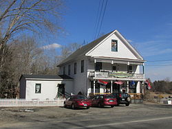
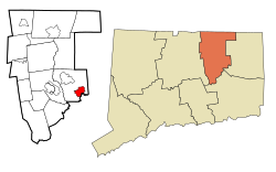
Crystal Lake is a village, census-designated place, and part of the town of Ellington, in Tolland County, Connecticut, United States. The population was 1,945 at the 2010 census. The CDP includes an eponymous lake.

<span class="mw-page-title-main">South Coventry (CDP), Connecticut</span> CDP in Connecticut, United States

South Coventry is a census-designated place and part of the town of Coventry, Connecticut in Tolland County, Connecticut, United States. The population was 1,483 at the 2010 census.

<span class="mw-page-title-main">Harwich Port, Massachusetts</span> Census-designated place in Massachusetts, United States

Harwich Port is a small affluent seaside community and census-designated place (CDP) situated along the Nantucket Sound in the town of Harwich in Barnstable County, Massachusetts, United States. It is named after the port of Harwich in Essex, England. As of the 2010 census, the CDP had a population of 1,644. It is a popular vacation spot on Cape Cod and is home to the Wychmere Beach Club and the Allen Harbor Yacht Club. Also, one of its popular mottos is "Three Harbors, One Port," referencing to Saquatucket, Wychmere, and Allen Harbor, which are all located in Harwich Port. Well known residents include Bill O'Brien, former head coach and general manager of the Houston Texans.

<span class="mw-page-title-main">Acushnet Center, Massachusetts</span> Census-designated place in Massachusetts, United States

Acushnet Center is a census-designated place (CDP) in the town of Acushnet in Bristol County, Massachusetts, United States. The population was 3,030 at the 2020 census, which was 28.7% of the population of the entire town.

<span class="mw-page-title-main">Mansfield Center, Massachusetts</span> Census-designated place in Massachusetts, United States

Mansfield Center is a census-designated place (CDP) in the town of Mansfield in Bristol County, Massachusetts, United States. The population was 7,360 at the 2010 census.

<span class="mw-page-title-main">Three Rivers, Massachusetts</span> Former CDP in Massachusetts, United States

Three Rivers is a village and former census-designated place (CDP) in the city of Palmer in Hampden County, Massachusetts, United States. It is part of the Springfield, Massachusetts Metropolitan Statistical Area. It is named for the confluence of the Ware and Quaboag rivers, which form the Chicopee River.

<span class="mw-page-title-main">Amherst Center, Massachusetts</span> Census-designated place in Massachusetts, United States

Amherst Center is a census-designated place (CDP) in the City of Amherst in Hampshire County, Massachusetts, United States. The CDP covers the primary village in town. The population was 19,065 at the 2010 census, out of a total town population of 37,819. It is part of the Springfield, Massachusetts Metropolitan Statistical Area.

<span class="mw-page-title-main">Marion Center, Massachusetts</span> Census-designated place in Massachusetts, United States

Marion Center is a census-designated place (CDP) in the town of Marion in Plymouth County, Massachusetts, United States. The population was 1,111 at the 2010 census.

<span class="mw-page-title-main">North Lakeville, Massachusetts</span> Census-designated place in Massachusetts, United States

North Lakeville is a census-designated place (CDP) in the town of Lakeville in Plymouth County, Massachusetts, United States. The population was 2,630 at the 2010 census.

<span class="mw-page-title-main">North Pembroke, Massachusetts</span> Census-designated place in Massachusetts, United States

North Pembroke is a census-designated place (CDP) in the town of Pembroke in Plymouth County, Massachusetts, United States. The population was 3,292 at the 2010 census.

<span class="mw-page-title-main">North Plymouth, Massachusetts</span> Census-designated place in Massachusetts, United States

North Plymouth is a census-designated place (CDP) in the town of Plymouth in Plymouth County, Massachusetts, United States. The population was 3,600 at the 2010 census. it is best known as the location of Cordage Park, a small village where the Plymouth Cordage Company was once headquartered. The village is now home to Cordage Commerce Center, a large retail development that consists of offices and stores.

<span class="mw-page-title-main">West Wareham, Massachusetts</span> Census-designated place in Massachusetts, United States

West Wareham is a census-designated place (CDP) in the town of Wareham in Plymouth County, Massachusetts, United States. The population was 2,064 at the 2010 census.

<span class="mw-page-title-main">Harrisville, Rhode Island</span> Census-designated place in Rhode Island, United States

Harrisville is a census-designated place (CDP) and village in the town of Burrillville in Providence County, Rhode Island, United States. The population was 1,605 at the 2010 census. Much of the community composes a historic district listed on the National Register of Historic Places. The village was named after nineteenth century manufacturer Andrew Harris. Previously, the village was named Rhodesville, after Captain William Rhodes, an eighteenth century privateer.

<span class="mw-page-title-main">Sandwich (CDP), Massachusetts</span> Census-designated place in Massachusetts, United States

Sandwich is a village and census-designated place (CDP) in the town of Sandwich in Barnstable County, Massachusetts, United States. The population was 2,962 at the 2010 census, out of a total of 20,675 people in the town of Sandwich.

<span class="mw-page-title-main">Palmer (CDP), Massachusetts</span> Former CDP in Massachusetts, United States

Palmer is former census-designated place (CDP) in Hampden County, Massachusetts, United States. The population was 3,900 at the 2000 census. It is part of the Springfield, Massachusetts Metropolitan Statistical Area. The area is more commonly known as Depot Village, named for the ornate train depot built there by famed architect H.H. Richardson

<span class="mw-page-title-main">Granby (CDP), Massachusetts</span> Census-designated place in Massachusetts, United States

Granby is a census-designated place (CDP) comprising the main village in the town of Granby in Hampshire County, Massachusetts, United States. The population of the CDP was 1,368 at the 2010 census, out of a total town population of 6,240. It is part of the Springfield, Massachusetts Metropolitan Statistical Area.

<span class="mw-page-title-main">Hatfield (CDP), Massachusetts</span> Census-designated place in Massachusetts, United States

Hatfield is a census-designated place (CDP) comprising the main village in the town of Hatfield in Hampshire County, Massachusetts, United States. The population of the CDP was 1,318 at the 2010 census, out of a total town population of 3,279. It is part of the Springfield, Massachusetts Metropolitan Statistical Area.

<span class="mw-page-title-main">Plymouth Center, Massachusetts</span> Census-designated place in Massachusetts, United States

Plymouth is a census-designated place (CDP) in the town of Plymouth in Plymouth County, Massachusetts, United States. It is often referred to as Downtown Plymouth or Plymouth Center. The population was 7,494 at the 2010 census.

<span class="mw-page-title-main">Winchendon (CDP), Massachusetts</span> Census-designated place in Massachusetts, United States

Winchendon is a census-designated place (CDP) in the town of Winchendon in Worcester County, Massachusetts, United States. The population was 4,160 at the 2020 census.

<span class="mw-page-title-main">Winterport (CDP), Maine</span> CDP in Maine, United States

Winterport is a census-designated place (CDP) in the town of Winterport in Waldo County, Maine, United States. The population was 1,307 at the 2000 census.

References

  1. Principal Communities in Connecticut, Dept. of Economic and Community Development
  2. "U.S. Census website". United States Census Bureau . Retrieved January 31, 2008.
  3. Bruce Clouette (February 26, 1992). "NRHP Inventory-Nomination: Mansfield Center Cemetery". National Park Service.
  4. Two Historical Buildings Saved, Mansfield Historical Society website, accessed June 27, 2009, and archived August 21, 2008.
  5. "U.S. Climate Normals Quick Access – Station: Storrs, CT". National Oceanic and Atmospheric Administration. Retrieved February 10, 2023.
  6. "NOAA Online Weather Data – NWS Boston". National Weather Service. Retrieved February 10, 2023.

Further reading

41°45′55″N72°11′53″W / 41.76528°N 72.19806°W / 41.76528; -72.19806