Stafford Springs, Connecticut

Last updated

Stafford Springs
Stafford Springs station postcard.jpg
The Holt Memorial Fountain circa. 1910
Tolland County Connecticut Incorporated and Unincorporated areas Stafford Springs Highlighted 2010.svg
Location in Tolland County and the state of Connecticut
Coordinates: 41°57′12″N72°18′11″W / 41.9534°N 72.3030°W / 41.9534; -72.3030
CountryFlag of the United States.svg  United States
StateFlag of Connecticut.svg  Connecticut
County Tolland
Region Capitol Region
Town Stafford
Area
  Total6.41 sq mi (16.6 km2)
  Land6.37 sq mi (16.5 km2)
  Water0.036 sq mi (0.093 km2)
Elevation
607 ft (185 m)
Population
 (2020)
  Total11,000
  Density1,700/sq mi (660/km2)
Time zone UTC−5 (Eastern (EST))
  Summer (DST) UTC−4 (EDT)
ZIP code
06076
Area code860
FIPS code09-72300
GNIS feature ID2377866 [1]
Website staffordct.org

Stafford Springs is a census-designated place located in Stafford, Connecticut, United States. The population was 4,780 at the 2020 Census. [2] The village was a borough until November 1991, when it was disincorporated. [3]

Contents

Located near the source of the Willimantic River, [4] the mill industry grew in the town due to its location and became the largest industry in the area. [5] The village has the Holt Memorial Fountain and the former railroad station. [6]

In the 18th century, the spring at Stafford Springs was famous for its reputed ability to cure "the gout, sterility, pulmonary, hysterics, etc." [7] In 1771, John Adams, then a young lawyer, visited Stafford Springs for several days after suffering from overwork and anxiety. [7]

Stafford Springs was once the headquarters of Station C of the Connecticut State Police, and subsequently was the site of the Troop C Barracks. [8]

Currently Route 32, Route 190, Route 19, and Route 140 pass through or originate in the village. [9]

Geography

According to the United States Census Bureau, the CDP has a total area of 6.41 mi2 (16.6 km2), of which 6.37 mi2 (16.5 km2) is land and 0.036 mi2 (0.093 km2) (0.56%) is water. [10]

Historical population
CensusPop.Note
1880 2,081
1890 2,35313.1%
1900 2,64012.2%
1910 3,05915.9%
1920 3,38310.6%
1930 3,4923.2%
1940 3,401−2.6%
1950 3,396−0.1%
1960 3,322−2.2%
1970 3,3390.5%
1980 3,3921.6%
1990 4,10020.9%
2010 4,988
2020 4,780−4.2%

Related Research Articles

<span class="mw-page-title-main">Hazardville, Connecticut</span> Census-designated place in Connecticut, United States

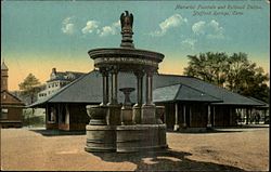
Hazardville is a section of the town of Enfield, Connecticut, United States, in Hartford County. It is a census-designated place (CDP) that had a total population of 4,599 as of the 2010 census.

<span class="mw-page-title-main">Oakville, Connecticut</span> Census-designated place in Connecticut, United States

Oakville is a census-designated place (CDP) and neighborhood section of Watertown, in Litchfield County, Connecticut, United States. The population was 9,047 as of the 2010 census. It is the most populous community in Watertown, with more than twice as many people as the center village of Watertown. The ZIP code for Oakville is 06779.

<span class="mw-page-title-main">Higganum, Connecticut</span> Census-designated place in Connecticut, United States

Higganum is a village and census-designated place (CDP) in the town of Haddam, a part of Middlesex County, Connecticut, United States. The population was 2,089 at the 2020 census.

<span class="mw-page-title-main">Conning Towers Nautilus Park, Connecticut</span> Census-designated place in Connecticut, United States

Conning Towers Nautilus Park is a census-designated place (CDP) in the town of Groton in New London County, Connecticut, United States. The population was 9,828 at the 2010 census. The statistical area consists of the portion of the town in the vicinity of Route 12 and includes Naval Submarine Base New London.

<span class="mw-page-title-main">Crystal Lake, Connecticut</span> Census-designated place in Connecticut, United States

Crystal Lake is a village, census-designated place, and part of the town of Ellington, in Tolland County, Connecticut, United States. The population was 1,945 at the 2010 census. The CDP includes an eponymous lake.

<span class="mw-page-title-main">Storrs, Connecticut</span> Census-designated place in Connecticut, United States

Storrs is a village and census-designated place (CDP) in the town of Mansfield in eastern Tolland County, Connecticut, United States. The village is part of the Capitol Planning Region. The population was 15,979 at the 2020 census. It is dominated economically and demographically by the main campus of the University of Connecticut and the associated Connecticut Repertory Theatre.

<span class="mw-page-title-main">Quinebaug, Connecticut</span> Census-designated place in Connecticut, United States

Quinebaug is a village and census-designated place (CDP) in Thompson, a town in Windham County, Connecticut, United States. The population was 1,133 at the 2010 census.

<span class="mw-page-title-main">South Windham, Connecticut</span> Village in Connecticut, United States

South Windham is a village and census-designated place (CDP) in Windham County, Connecticut, United States. It is located within the town of Windham, Connecticut. The population was 1,421 at the 2010 census.

<span class="mw-page-title-main">Sagamore, Massachusetts</span> Census-designated place in Massachusetts, United States

Sagamore is a census-designated place (CDP) in the town of Bourne in Barnstable County, Massachusetts, United States. The population was 3,623 at the 2010 census. "Sagamore" was one of the words used by northeastern Native Americans to designate an elected chief or leader.

<span class="mw-page-title-main">Millers Falls, Massachusetts</span> Census-designated place in Massachusetts, United States

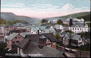
Millers Falls is a census-designated place (CDP) in the towns of Montague and Erving in Franklin County, Massachusetts, United States. The population was 1,139 at the 2010 census. It is part of the Springfield, Massachusetts metropolitan statistical area.

<span class="mw-page-title-main">Shelburne Falls, Massachusetts</span> Census-designated place in Massachusetts, United States

Shelburne Falls is a historic village in the towns of Shelburne and Buckland in Franklin County, Massachusetts, United States. The village is a census-designated place (CDP) with a population of 1,731 at the 2010 census. It is part of the Springfield, Massachusetts, Metropolitan Statistical Area.

<span class="mw-page-title-main">Monson Center, Massachusetts</span> Census-designated place in Massachusetts, United States

Monson Center is a census-designated place (CDP) in the town of Monson in Hampden County, Massachusetts, United States. The population was 2,107 at the 2010 census, out of a total 8,560 people in the town. It is part of the Springfield, Massachusetts Metropolitan Statistical Area.

<span class="mw-page-title-main">Upton (CDP), Massachusetts</span> Census-designated place in Massachusetts, United States

Upton is a census-designated place (CDP) in the town of Upton in Worcester County, Massachusetts, United States. The population was 3,013 at the 2010 census, out of 7,542 in the entire town. The CDP includes the villages of Upton and West Upton.

<span class="mw-page-title-main">Lake Pocotopaug, Connecticut</span> Census-designated place in Connecticut, United States

Lake Pocotopaug is an unincorporated village and census-designated place (CDP) in the town of East Hampton in Middlesex County, Connecticut, United States. As of the 2020 census, it had a population of 4,901, up from 3,436 in 2010.

<span class="mw-page-title-main">Wilder, Vermont</span> Census-designated place in Vermont, United States

Wilder is an unincorporated village and census-designated place (CDP) within the town of Hartford in Windsor County, Vermont, United States. It is the location of the Wilder Dam on the Connecticut River. The population of the CDP was 1,690 at the 2010 census. The village center is an early example of a planned mill community, and was listed on the National Register of Historic Places as the Wilder Village Historic District in 1999.

<span class="mw-page-title-main">Great Barrington (CDP), Massachusetts</span> Census-designated place in Massachusetts, United States

Great Barrington is a census-designated place (CDP) located in the town of Great Barrington in Berkshire County, Massachusetts, United States. The population was 2,231 at the 2010 census, out of 7,104 in the entire town of Great Barrington.

<span class="mw-page-title-main">Williamstown (CDP), Massachusetts</span> Census-designated place in Massachusetts, United States

Williamstown is a census-designated place (CDP) in the town of Williamstown in Berkshire County, Massachusetts, United States. The population of the CDP was 4,325 at the 2010 census, out of 7,754 in the entire town.

<span class="mw-page-title-main">Granby (CDP), Massachusetts</span> Census-designated place in Massachusetts, United States

Granby is a census-designated place (CDP) comprising the main village in the town of Granby in Hampshire County, Massachusetts, United States. The population of the CDP was 1,368 at the 2010 census, out of a total town population of 6,240. It is part of the Springfield, Massachusetts Metropolitan Statistical Area.

<span class="mw-page-title-main">West Brookfield (CDP), Massachusetts</span> Census-designated place in Massachusetts, United States

West Brookfield is a census-designated place (CDP) in the town of West Brookfield in Worcester County, Massachusetts, United States. The population was 1,413 at the 2010 census.

<span class="mw-page-title-main">Canaan (village), Connecticut</span> United States historic place

Canaan is a village and census-designated place (CDP) within the town of North Canaan in Litchfield County, Connecticut, United States. Formerly known as Canaan Depot, the village is more commonly known as Canaan Village to distinguish it from the town of Canaan located to the south of North Canaan. The Canaan Village Historic District is listed on the National Register of Historic Places. As of the 2010 census, the CDP had a population of 1,212, out of a total population of 3,315 in the town of North Canaan.

References

  1. U.S. Geological Survey Geographic Names Information System: Stafford Springs
  2. "Stafford Springs CDP, Connecticut". United States Census Bureau . Retrieved May 13, 2023.
  3. 1992 Census of Wholesale Trade: Geographic Area Series, Connecticut. U.S. Census Bureau. 1994. p. Appendix F: Geographic Notes.
  4. "Stafford". connecticuthistory.org. Connecticut Humanities. October 28, 2011. Retrieved November 25, 2016.
  5. "About Stafford, Connecticut: History". Town of Stafford. Retrieved November 25, 2016.
  6. "Holt Memorial Fountain, Stafford Springs". CTMonuments.net. Retrieved November 25, 2016.
  7. 1 2 Frank Chapelle, Wellsprings: A Natural History of Bottled Spring Waters (Rutgers University Press, 2005), pp. 107-08.
  8. Jerry Longo, Images of America: Connecticut State Police (Arcadia Publishing: 2003), p. 2.
  9. "Highway Log Connecticut State Numbered Routes and Roads" (PDF). ct.gov/dot. Connecticut Department of Transportation. December 31, 2014. Retrieved November 27, 2016.
  10. "US Gazetteer files: 2019". United States Census Bureau . Retrieved November 7, 2020.