Hartland, Connecticut

Last updated

Hartland, Connecticut
Town of Hartland
FallsBrookFalls-Hartland-CT-TunxisSF.JPG
Falls Brook in the Tunxis State Forest
HartlandCTseal.jpg
Hartland CT lg.PNG
Hartland, Connecticut
Coordinates: 42°00′18″N72°56′53″W / 42.00500°N 72.94806°W / 42.00500; -72.94806
CountryFlag of the United States.svg  United States
U.S. state Flag of Connecticut.svg  Connecticut
County Hartford
Region Northwest Hills
Settled1754
Incorporated1761
VillagesEast Hartland
West Hartland
Government
  Type Selectman-town meeting
  First SelectmanMagi Winslow (D)
  SelectmanScott M. Levan (R)
  SelectmanGregory M. Sottile (D)
Area
  Total34.6 sq mi (89.6 km2)
  Land33.1 sq mi (85.7 km2)
  Water1.5 sq mi (3.9 km2)
Elevation
531 ft (162 m)
Population
 (2020) [1]
  Total1,901
  Density55/sq mi (21/km2)
Time zone UTC-5 (Eastern)
  Summer (DST) UTC-4 (Eastern)
ZIP Codes
06027, 06091
Area code(s) 860/959
FIPS code 09-37140
GNIS feature ID0213443 [1]
Website www.hartlandct.org

Hartland is a town in Hartford County, Connecticut, United States. The population was 1,901 at the 2020 census. [2] The rural town is part of the Northwest Hills Planning Region and forms the northwest border of Hartford County. Currently, the town consists of two unincorporated areas, East and West Hartland, entirely separated by the northern portion of the Barkhamsted Reservoir. A third area, Hartland Hollow (also referred to as Hartland Center), was flooded when the reservoir was completed in 1940.

Contents

History

Originally referenced as the "Western Lands," the unsettled area was the subject of a 37-year controversy over competing claims by the Connecticut Colony and the towns of Hartford and Windsor. [3] After the Colony's General Court was petitioned in 1724 to settle the dispute, it divided the lands among the three parties, which was followed by a confirming patent issued by Governor Joseph Talcott in 1729.

After another division agreement, Hartford's proprietors were granted a patent in 1732 for four parcels encompassing the lands now known as Hartland, Winchester, and New Hartford. Land in Hartland was proportionally granted on the basis of Hartford's 1720 Grand List. In 1733, the 67 landowners organized the Proprietors of Hartland association, and received a decree from the General Court for "Hartford land," then shortened to Hartland. [4]

In 1754, Captain/Deacon Thomas Giddings Jr II (1723 -1790) and his wife Mary Coult became the town's first permanent settlers. [3] In 1761, the 44 families of Hartland petitioned the General Court, and Hartland was incorporated as an independent town that same year. [5]

Geography

The town is bisected by the Farmington River's east branch which became the northern section of Barkhamsted Reservoir after construction of the Saville Dam in 1940. [6] The reservoir and surrounding land, owned by the Metropolitan District Commission (MDC) water authority, fills the hollow between East and West mountains.

According to the United States Census Bureau, the town has a total area of 34.6 square miles (89.6 km2), of which 33.1 square miles (85.7 km2) is land and 1.5 square miles (3.9 km2), or 4.39%, is water. [7] Bounded on the north by the Massachusetts border, Hartland is drained by the Farmington River, a tributary of the Connecticut River. The 42nd parallel north and the 73rd meridian west meet in the central western part of town.

Hartland is home to parts of three Connecticut State forests, Peoples State Forest, Tunxis State Forest, and American Legion State Forest [8] The Barkhamsted Reservoir which cuts through the middle of Hartland is 11 miles long and holds approximately 30 billion gallon reservoir, and serves the primary source of drinking water for most of Hartford County. The construction of the reservoir and the Saville Dam required the relocation of over 1,000 people, four cemeteries, and numerous family farms in Hartland and Barkhamsted. [6] In total, over 70% of Hartland's land, or over 15,500 acres, is permanently designated as open space, encompassing state forests and parks, watersheds, and public land conservation trusts. [9]

Demographics

Congregational Church, East Hartland Historic American Buildings Survey (Fed.) Stanley P. Mixon, Photographer, Sept 16, 1940 (A) EXTERIOR, GENERAL VIEW FROM SOUTH EAST - Congregational Church, East Hartland, HABS CONN,2-HARLA,1-3.tif
Congregational Church, East Hartland
Historical population
CensusPop.Note
1800 1,318
1810 1,284−2.6%
1820 1,254−2.3%
1830 1,221−2.6%
1840 1,060−13.2%
1850 848−20.0%
1860 846−0.2%
1870 789−6.7%
1880 643−18.5%
1890 565−12.1%
1900 5924.8%
1910 544−8.1%
1920 448−17.6%
1930 296−33.9%
1940 3001.4%
1950 54983.0%
1960 1,04089.4%
1970 1,30325.3%
1980 1,4168.7%
1990 1,86631.8%
2000 2,0127.8%
2010 2,1145.1%
2020 1,901−10.1%
[10]

As of the U.S. Census Bureau's 2023 American Community Survey, [11] there were 1,971 people and 818 households residing in the town. The population density was 60 people per square mile (23.2/km2). There were 923 housing units, of which 840 (91%) were owner-occupied. The racial makeup of the town was 89% White, less than 1% African American, less than 1% Asian, 10% from other races and two or more races. Hispanic or Latino of any race were less than 1% of the population.

The population distribution in 2023 was 18.82% (397) age 19 and under, 8.22% (162) ages 20 to 29, 9.79% (193) ages 30 to 39, 9.49% (187) ages 40 to 49, 19.13% (377) ages 50 to 59, 22.83% (450) ages 60 to 69, 6.50% (137) ages 70 to 79, and 3.45% (68) who were 80 years of age or older. Median age was 52.

The median household income was $105,921. 2% of the population were below the poverty line. As of 2022, 2.16% (40) of the town qualified for Supplemental Nutritional Assistance Program (SNAP). [12]

Education

Educational data is provided by the Connecticut Economic Resource Center (CERC). Hartland School District consists of one school, Hartland School, Pre-K through grade 8, with an enrollment in 2017 of 162. High school students can attend any of the CREC magnet schools, State of CT vocational schools, State of CT vocational-agricultural schools, the town-designated public high school (Granby High School as of 2019), or receive a voucher to attend another town public high school. Because of the wide variety in high school choice, 4-year cohort graduation rates were not available. From 2013 to 2017, 73.1% of students attended public school, while 26.9% attended private school. By highest education level achieved as of 2017, 32% of the town earned a high school diploma, 12% an associate degree, and 32% bachelor's degree or higher. [13]

Government

Hartland is governed by a three-person, elected Board of Selectman with supporting elected town boards for Finance, Education, and Library. The remaining boards and committees, including Planning & Zoning, Wetlands, and Recreation, are appointed by the Board of Selectman. Total Revenues for 2017 was $7,217,096, with total expenditures of $6,988,601 including $115,495 (1.7% of expenditures) for debt (bond) service. Hartland is rated A1 by Moody's and conveys a mill rate of 25.50 on a net Grand List of $198,192,769. Of the net Grand List, 1.3% is commercial/industrial. [13]

Voter Registration and Party Enrollment as of November 5, 2018 [14]
PartyActive VotersInactive VotersTotal VotersPercentage
Republican 6262965540.89%
Democratic 3321534721.66%
Minor Parties 311322.00%
Unaffiliated 5392956835.46%
Total1,528741,602100%

Politics

Hartland has published results for all presidential elections since 1856. From 1856 to 1876, Hartland supported Democratic candidates for president except for Abraham Lincoln received in the four-way race in 1860. [15] Since 1880, Hartland voters have supported the Republican presidential candidate for 36 consecutive elections. [15] As of 2022, Hartland had the largest share of registered Republican voters in the state, at 40% of the electorate. [16]

Hartland town vote
by party in presidential elections [15]
Year Democratic Republican Third Parties
2020 [17] 35.39% 45763.66%8181.24% 16
2016 [18] 28.19% 34964.94%8046.87% 85
2012 [19] 34.36% 41464.56%7781.08% 13
2008 [20] 38.87% 49659.25%7561.88% 24
2004 [21] 37.15% 43560.46%7082.39% 28
2000 [22] 36.60% 38854.81%5818.59% 91
1996 [23] 32.31% 31750.56%49617.13% 168
1992 [24] 28.42% 30342.96%45828.61% 305*
1988 [25] 35.25% 31863.97%5770.78% 7
1984 [26] 22.97% 18176.40%6020.63% 5
1980 [27] 25.83% 17857.62%39716.55% 114
1976 [28] 33.12% 20666.24%4120.64% 4
1972 [29] 21.31% 13077.71%4740.98% 6
1968 [30] 26.12% 14667.26%3766.62% 37
1964 [31] 43.01% 20356.99%2690.00% 0
1960 [32] 21.03% 9878.70%3620.00% 0
1956 [33] 13.23% 5286.77%3410.00% 0
1952 [34] 17.47% 5882.53%2740.00% 0
1948 [35] 21.27% 4778.28%1730.45% 1
1944 [36] 25.98% 5374.02%1510.00% 0
1940 [37] 31.71% 5268.29%1120.00% 0
1936 [38] 27.88% 4072.22%1040.00% 0
1932 [39] 24.31% 3575.69%1090.00% 0
1928 [40] 17.56% 2382.44%1080.00% 0
1924 [41] 17.89% 2279.67%982.44% 3
1920 [42] 18.87% 2080.19%850.94% 1
1916 [42] 38.00% 3859.00%593.00% 3
1912 [43] 38.00% 3849.00%4913.00% 13
1908 [43] 25.56% 2373.33%661.11% 1
1904 [44] 23.64% 2673.64%812.73% 3
1900 [44] 23.16% 2276.84%730.00% 0
1896 [45] 20.80% 2667.20%8412.00% 15
1892 [45] 35.81% 5362.84%931.35% 2
1888 [46] 42.01% 7156.21%951.78% 3
1884 [46] 45.50% 8652.89%1001.59% 3
1880 [46] 48.57% 8551.43%900.00% 0
1876 [46] 64.71%11035.29% 600.00% 0
1872 [46] 61.97%8838.03% 540.00% 0
1868 [46] 60.22%10939.78% 720.00% 0
1864 [46] 55.50%10644.50% 850.00% 0
1860 [46] 39.49% 6247.13%7413.38% 21
1856 [46] 49.74%9647.67% 922.59% 5

Notable locations

Notable people

Related Research Articles

<span class="mw-page-title-main">Hartford County, Connecticut</span> County in Connecticut, United States

Hartford County is a county located in the north central part of the U.S. state of Connecticut. According to the 2020 census, the population was 899,498, making it the second-most populous county in Connecticut. Hartford County contains the city of Hartford, the state capital of Connecticut and the county's most populous city, with 121,054 residents at the 2020 census. Hartford County is included in the Hartford-East Hartford-Middletown metropolitan statistical area.

<span class="mw-page-title-main">Litchfield County, Connecticut</span> County in Connecticut, United States

Litchfield County is in northwestern Connecticut, United States. As of the 2020 census, the population was 185,186. The county was named after Lichfield, in England. Litchfield County has the lowest population density of any county in Connecticut and is the state's largest county by area.

<span class="mw-page-title-main">Avon, Connecticut</span> Town in Connecticut, United States

Avon is a town in the Farmington Valley region of the Capitol Planning Region, Connecticut, United States. As of the 2020 census, the town had a population of 18,932.

<span class="mw-page-title-main">Bloomfield, Connecticut</span> Town in Connecticut, United States

Bloomfield is a suburb of Hartford in the Capitol Planning Region, Connecticut, United States. The town's population was 21,535 at the 2020 census. Bloomfield is best known as the headquarters of healthcare services company Cigna.

<span class="mw-page-title-main">Burlington, Connecticut</span> Town in Connecticut, United States

Burlington is a town in Hartford County, Connecticut, United States. The town is part of the Northwest Hills Planning Region.

<span class="mw-page-title-main">Canton, Connecticut</span> Town in Connecticut, United States

Canton is a town, incorporated in 1806, located in the Farmington Valley section of the Capitol Planning Region, Connecticut, United States. The population was 10,124 as of the 2020 census. It is bordered by Granby on the north, Simsbury on the east, Avon and Burlington on the south, New Hartford on the west, and Barkhamsted on the northwest. Running through it is the Farmington River. The town includes the villages of North Canton, Canton Center, Canton, and Collinsville. In September 2007, Collinsville was ranked in Budget Travel magazine as one of the "Ten Coolest Small Towns In America".

<span class="mw-page-title-main">Barkhamsted, Connecticut</span> Town in Connecticut, United States

Barkhamsted is a town in Litchfield County, Connecticut, United States. It contains seven villages: West Hill, Mallory, Barkhamsted Center, Center Hill, Washington Hill, Pleasant Valley, and Riverton. The population was 3,647 at the 2020 census, down from 3,799 at the 2010 census. The town is part of the Northwest Hills Planning Region. Barkhamsted was first incorporated in 1779, and named after Berkhamsted, Hertfordshire, England.

<span class="mw-page-title-main">Colebrook, Connecticut</span> Town in Connecticut, United States

Colebrook is a town in Litchfield County, Connecticut, United States. The population was 1,361 at the 2020 census. The town is part of the Northwest Hills Planning Region. Colebrook was named after Colebrooke in the English county of Devon; the reason is now unknown.

<span class="mw-page-title-main">Woodbury, Connecticut</span> Town in Connecticut, United States

Woodbury is a town in Litchfield County, Connecticut, United States. The town is part of the Naugatuck Valley Planning Region. The population was 9,723 at the 2020 census. The town center, comprising the adjacent villages of Woodbury and North Woodbury, is designated by the U.S. Census Bureau as the Woodbury Center census-designated place (CDP). Woodbury was founded in 1673.

<span class="mw-page-title-main">Middlebury, Connecticut</span> Town in Connecticut, United States

Middlebury is a town in New Haven County, Connecticut, United States. The population was 7,574 at the 2020 census. The town is part of the Naugatuck Valley Planning Region.

<span class="mw-page-title-main">Woodbridge, Connecticut</span> Town in Connecticut, United States

Woodbridge is a town in New Haven County, Connecticut, United States. The town is part of the South Central Connecticut Planning Region. The population was 9,087 at the 2020 census. The town center is listed on the National Register of Historic Places as Woodbridge Green Historic District. Woodbridge is part of the Amity Regional School District #5, rated the #1 school district in New Haven County and the 10th best school district in CT by Niche in 2021. As of 2019 Woodbridge has the 7th highest median household income in CT.

<span class="mw-page-title-main">Bolton, Connecticut</span> Town in Connecticut, United States

Bolton is a small suburban town in the Capitol Planning Region, Connecticut, United States. The population was 4,858 as of the 2020 census. Bolton was incorporated in October 1720 and is governed by town meeting, with a first selectman and board of selectman as well as other boards serving specific functions. Bolton was named after a town of the same name in England, also located near Manchester.

<span class="mw-page-title-main">Ashford, Connecticut</span> Town in Connecticut, United States

Ashford is a town in Windham County, Connecticut, United States. The town is part of the Northeastern Connecticut Planning Region. The population was 4,191 at the 2020 census. It was founded in 1714. Eastford was a part of Ashford until 1847, when the former split off to organize its own town. For this reason North Ashford is located in northeast Eastford.

<span class="mw-page-title-main">Eastford, Connecticut</span> Town in Connecticut, United States

Eastford is a town in Windham County, Connecticut, United States. The town is part of the Northeastern Connecticut Planning Region. The population was 1,649 at the 2020 census.

<span class="mw-page-title-main">Farmington River</span> River in the United States of America

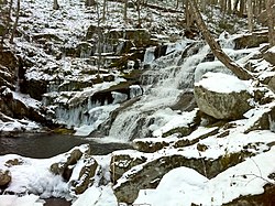
The Farmington River is a river, 46.7 miles (75.2 km) in length along its main stem, located in northwest Connecticut with major tributaries extending into southwest Massachusetts. The longest route of the river, from the origin of its West Branch, is 80.4 miles (129.4 km) long, making it the Connecticut River's longest tributary by 2.3 miles (3.7 km) over the major river directly to its north, the Westfield River. The Farmington River's watershed covers 609 square miles (1,580 km2). Historically, the river played an important role in small-scale manufacturing in towns along its course, but it is now mainly used for recreation and drinking water.

<span class="mw-page-title-main">Connecticut Route 20</span> State highway in Connecticut, US

Route 20 is a 31.56-mile (50.79 km) state highway in the U.S. state of Connecticut. It extends from Route 8 in rural Winchester to Interstate Route 91 in Windsor. Route 20 consists of two distinct sections: a long, winding, scenic rural road, and a section of the freeway linking I-91 to Bradley International Airport.

<span class="mw-page-title-main">Saville Dam</span> Dam in Barkhamsted, Connecticut, United States

Saville Dam is an earthen embankment dam with masonry work on the eastern branch of the Farmington River in southwestern Barkhamsted, Connecticut and central Hartland, Connecticut, dividing the latter into two villages along its hilltops, East and West Hartland. The dam is 135 ft. tall and 1,950 ft. long and has an uncontrolled spillway on its western portion. It creates the Barkhamsted Reservoir which has a volume of 36.8 billion US gallons (139,000,000 m3) and is the primary water source for Hartford, Connecticut. Connecticut Route 318, also known as Saville Dam Road, crosses over the top of the dam.

<span class="mw-page-title-main">Tunxis Trail</span>

The Tunxis Trail is a 79-mile (127 km) Blue-Blazed hiking trail "system" that traverses the western ridge of the central Connecticut Valley. The mainline trail is not completely contiguous, notably there are two gaps of several miles.

<span class="mw-page-title-main">Tunxis State Forest</span> State forest in northern Connecticut, U.S.

Tunxis State Forest is a state forest located in the towns of Hartland, Barkhamsted, and Granby in Connecticut, United States. The forest surrounds Barkhamsted Reservoir and borders the Granville State Forest in Massachusetts. The forest is used for hiking, mountain biking, cross-country skiing, fishing, hunting, and letterboxing. Several trails cross the forest, including the northern end of the blue-blazed Tunxis Trail.

<span class="mw-page-title-main">Metropolitan District Commission of Connecticut</span>

The Metropolitan District Commission of Connecticut (MDC) is a public not-for-profit municipal corporation chartered by the Connecticut General Assembly in 1929 to provide potable water and sewer systems to the Hartford area. The original agreement tied together the water systems of Hartford, Bloomfield, Newington, Wethersfield, and Windsor, later adding West Hartford, Rocky Hill, and East Hartford to its membership. As of 2023, the MDC serves much of the Greater Hartford region, reaching nearly 500,000 residents in its eight member cities and towns as well as parts of East Granby, Farmington, Glastonbury, Windsor Locks, South Windsor, and Portland. The Commission is run by a 29-member board of commissioners; 17 of which are appointed by the member towns, eight by the governor, and four by legislative leaders. The current Chairman of the MDC Board is William A. DiBella.

References

  1. 1 2 U.S. Geological Survey Geographic Names Information System: Hartland, Connecticut
  2. "Census - Geography Profile: Hartland town, Hartford County, Connecticut". United States Census Bureau . Retrieved December 16, 2021.
  3. 1 2 "History of Hartland". Hartland Historical Society. Retrieved December 16, 2023.
  4. "Town of Hartland, Connecticut". Town of Hartland, Connecticut. Retrieved December 16, 2023.
  5. Hartford Courant (July 25, 1996). "Hartland". Hartford Courant. Retrieved September 15, 2019.
  6. 1 2 "Barkhamsted Reservoir Construction Washes Away a Community". December 21, 2020. Retrieved June 19, 2021.
  7. "Geographic Identifiers: 2010 Demographic Profile Data (G001): Hartland town, Hartford County, Connecticut". U.S. Census Bureau, American Factfinder. Archived from the original on February 12, 2020. Retrieved November 28, 2012.
  8. "Department of Energy & Environmental Protection Property" (PDF). January 2014.
  9. "MAP: How Much of Your Town Is Open Space?". Brookfield, CT Patch. April 13, 2014. Retrieved June 19, 2021.
  10. "Annual Town and County Population for Connecticut". ct.gov. CT State Department of Public Health. Retrieved December 22, 2023.
  11. "2023 Town Profile Hartland, Connecticut" (PDF). profiles.ctdata.org. CTData Collaborative. Retrieved December 22, 2023.
  12. "SNAP Enrollment by Town" (PDF). cga.ct.gov. February 16, 2022. Retrieved December 22, 2023.
  13. 1 2 "Connecticut Economic Resource Center 2019 Town Profile for Hartland CT" (PDF). Retrieved November 1, 2019.
  14. "Registration and Party Enrollment Statistics as of November 5, 2018" (PDF). Connecticut Secretary of State. Retrieved November 1, 2019.
  15. 1 2 3 "General Election Statements of Vote, 1922 – Current". CT Secretary of State. Retrieved December 16, 2023.
  16. "MAPS: How has political affiliation in CT's towns changed from 2012-2022?". CT Mirror. February 2, 2023. Retrieved December 16, 2023.
  17. "State of Connecticut 2020 Statement of Vote" (PDF). 2020.
  18. "State of Connecticut 2016 Statement of Vote" (PDF). 2016.
  19. "State of Connecticut 2012 Statement of Vote" (PDF). 2012.
  20. "State of Connecticut 2008 Statement of Vote" (PDF). 2008.
  21. "State of Connecticut 2004 Statement of Vote" (PDF). 2004.
  22. "State of Connecticut 2000 Statement of Vote" (PDF). 2000.
  23. "State of Connecticut 1996 Statement of Vote" (PDF). 1996.
  24. "State of Connecticut 1992 Statement of Vote" (PDF). 1992.
  25. "State of Connecticut 1988 Statement of Vote" (PDF). 1988.
  26. "State of Connecticut 1984 Statement of Vote" (PDF). 1984.
  27. "State of Connecticut 1980 Statement of Vote" (PDF). 1980.
  28. "State of Connecticut 1976 Statement of Vote" (PDF). 1976.
  29. "State of Connecticut 1972 Statement of Vote" (PDF). 1972.
  30. "State of Connecticut 1968 Statement of Vote" (PDF). 1968.
  31. "State of Connecticut 1964 Statement of Vote" (PDF). 1964.
  32. "State of Connecticut 1960 Statement of Vote" (PDF). 1960.
  33. "State of Connecticut 1956 Statement of Vote" (PDF). 1956.
  34. "State of Connecticut 1952 Statement of Vote" (PDF). 1952.
  35. "State of Connecticut 1948 Statement of Vote" (PDF). 1948.
  36. "State of Connecticut 1944 Statement of Vote" (PDF). 1944.
  37. "State of Connecticut 1940 Statement of Vote" (PDF). 1940.
  38. "State of Connecticut 1936 Statement of Vote" (PDF). 1936.
  39. "State of Connecticut 1932 Statement of Vote" (PDF). 1932.
  40. "State of Connecticut 1928 Statement of Vote" (PDF). 1928.
  41. "State of Connecticut 1924 Statement of Vote" (PDF). 1924.
  42. 1 2 "State of Connecticut register and manual". Register and Manual. 1921.
  43. 1 2 "State of Connecticut register and manual". Register and Manual. 1913.
  44. 1 2 "State of Connecticut register and manual". Register and Manual. 1907.
  45. 1 2 "State of Connecticut register and manual". Register and Manual. 1897.
  46. 1 2 3 4 5 6 7 8 9 "State of Connecticut register and manual". Register and Manual. 1889.

Further reading