
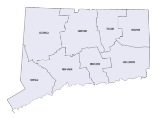
Southington is a town in Hartford County, Connecticut, United States. The town is part of the Capitol Planning Region. As of the 2020 United States Census, it had a population of 43,501. Southington contains the villages of Marion, Milldale, and Plantsville.

Plantsville is a neighborhood in the town of Southington, Hartford County, Connecticut. It is centered at the merger between South Main Street and West Main Street. As of the 2000 Census there were 10,387 people living in the Zip Code Tabulation Area for zip code 06479, which is assigned the postal city name Plantsville. The Zip Code Tabulation Area includes the entire southwestern corner of the town of Southington, including Marion and Milldale. Beginning in 2015 Plantsville was listed as a census-designated place.
This is a list of properties and districts listed on the National Register of Historic Places in Connecticut. There are more than 1,500 listed sites in Connecticut. All 8 counties in Connecticut have listings on the National Register.
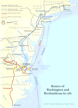
The Washington–Rochambeau Revolutionary Route is a 680-mile (1,090 km) series of roads used in 1781 by the Continental Army under the command of George Washington and the Expédition Particulière under the command of Jean-Baptiste de Rochambeau during their 14-week march from Newport, Rhode Island, to Yorktown, Virginia.
The Sterling Hill Historic District encompasses a well-preserved early 19th-century rural village center on western edge of the town of Sterling, Connecticut. Centered at the junction of Plainfield Pike and Sterling Hill Road, it consists of a cluster of 19th and early 19th-century houses, and a church. Unlike other period villages, it has largely been unaffected by later development. It was listed on the National Register of Historic Places in 1986.

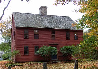
The Levi B Frost House, also known as the Asa Barns’ Tavern, is a historic building in the Marion village of Southington, Connecticut. The home represents over two centuries of Southington history. It appears twice on the National Register of Historic Places, as an individual structure and as a part of the Marion Historic District. It is significant both architecturally and historically for its connection to United States and New England history.

The Hillside Historic District in Waterbury, Connecticut is a 106-acre (43 ha) historic district that was listed on the National Register of Historic Places (NRHP) in 1987. It encompasses a residential area north of the city's central business district, and is bounded on the south by West Main Street, the west by Willow Avenue and Cliff and Frederick Streets, on the north by Buckingham Street and Woodland Terrace, and on the east by Cooke Street. Developed principally over an 80-year period between 1840 and 1920, it includes a cross-section of architectural styles of the 19th and early 20th centuries. The area was a desirable neighborhood of the city for much of this time, and was home to a number of the city's elite. In 1987, it included 395 buildings deemed to contribute to the historic character of the area, and one other contributing structure. It includes the Wilby High School and the Benedict-Miller House, which are both separately listed. 32 Hillside Road, a several acre property that includes the Benedict Miller House, was the original site of The University of Connecticut's Waterbury Branch until 2003.
Whitney Avenue is a principal arterial connecting Downtown New Haven with the town center of Hamden in the U.S. state of Connecticut. Most of the road within the city of New Haven is included in the Whitney Avenue Historic District, which is listed on the National Register of Historic Places. The designation begins at Grove Street in the northern part of Downtown New Haven and extends through the town of Hamden up to the Cheshire town line. North of Dixwell Avenue in Hamden Center, the road is a state highway and designated as part of Route 10. From the New Haven town line to Dixwell Avenue, the road is state-maintained with an unsigned designation of State Road 707. Within New Haven, Whitney Avenue is a town road. The J route of Connecticut Transit New Haven, which connects New Haven to Waterbury, runs along Whitney Avenue.

The Josiah Bronson House is a historic house on Breakneck Hill Road in Middlebury, Connecticut, built about 1738. It is one of the town's few surviving 18th-century houses, and a good example of residential architecture from that period. It was listed on the National Register of Historic Places in 1982.
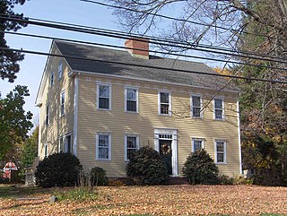
The Barnes-Frost House is a historic house at 1177 Marion Avenue in the Marion section of Southington, Connecticut. Built about 1795, it is a high quality local example of late Colonial architecture, with a history of ownership by members of prominent local families. It was listed on the National Register of Historic Places in 1989.
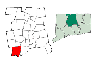
This is a list of the National Register of Historic Places listings in Southington, Connecticut.
The Oliver White Tavern is a historic former tavern at 2 Brandy Street in Bolton, Connecticut. Built approximately 1750 as a residence, it is a good example of Georgian architecture. The tavern is historically significant because of its association with the march of Rochambeau's army during the American Revolutionary War, on their way to the Battle of Yorktown. The building, now a private residence, was listed on the National Register of Historic Places in 2002.
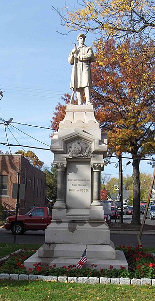
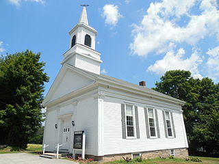
The Southington Center Historic District is a National Register of Historic Places district covering a major portion of the center of Southington, Connecticut. The area includes a considerable number of resources, many of which are buildings, commercial, governmental, religious and residential, but the list also includes monuments, and the town green. The district was added to the National Register in 1989.

The Selah Barnes House is a historic house at 282 Prospect Street Southington, Connecticut. Built about 1778 for a local merchant, it is a good local example of vernacular Georgian architecture. It was listed on the National Register of Historic Places in 1989.

The Dr. J. Porter House is a historic house at 391 Belleview Avenue in Southington, Connecticut. Estimated to have been built about 1728, it is one of the town's few surviving 18th-century houses. It was home from 1754 home to one of the town's largest landowners. It was listed on the National Register of Historic Places in 1989.

West Street School is a historic one-room school house at 1432 West Street in Southington, Connecticut. Built about 1760, it is the oldest surviving school building in the town. It served the town as a school until 1946, and is now preserved by the Southington Historical Society. It was added to the National Register of Historic Places in 1988.
The Charlotte Center Historic District encompasses the historic 19th-century town center of Charlotte, Vermont. Settled c. 1790 and developed mainly in the mid-19th century, the village, stretched along Church Hill Road west of Hinesburg Road, retains a well-preserved 19th-century atmosphere of residential, civic, and commercial buildings. The district was listed on the National Register of Historic Places in 1984.

The Hastings Hill Historic District encompasses a rural crossroads settlement of the early 19th century at the junction of Spruce Street, Hill Street, and Russell Avenue in Suffield, Connecticut. The area includes well-preserved examples of 18th and 18th-century domestic architecture, as well as the 1842 First Baptist Church and a district schoolhouse. It was listed on the National Register of Historic Places in 1979.

The Cheshire Historic District encompasses the historic town center of Cheshire, Connecticut. Centered on the junction of Main Street and Academy Road, the district's architecture is reflective of the town's development over two centuries, and includes many of its civic buildings. It was listed on the National Register of Historic Places in 1986.


