Paul Chaplinsky Jr. (R), Chair James Morelli Jr. (R), Vice Chair Michael DelSanto (R) William Dziedzic (R) Jennifer Clock (R) Tony Morrison (R) Christopher Palmieri (D) Valerie DePaolo (D) Jack Perry (D)
Although Southington was formally established as a town in 1779, its roots go back to a much earlier time. Samuel Woodruff, Southington's first white settler, moved from Farmington to the area then known as "Panthorne" that was settled in 1698. The land was formerly occupied by the Tunxis or Sepores Indians.[2] The settlement grew, prospered, and came to be known as "South Farmington" and then later, the shortened version, Southington.
The town's most important early visitor was General George Washington, who passed through the town in 1770 on his way to Wethersfield.
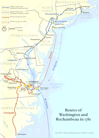
The Marion section of Southington is one of the most historic places in the town. It is the site of an encampment by the great French general, Jean-Baptiste Donatien de Vimeur, comte de Rochambeau, and his troops during the American Revolutionary War. In June 1781, the French troops under Rochambeau's command left Farmington and marched 13 miles (21km) to their eighth camp through Connecticut, near Asa Barnes Tavern in the Marion section of Southington, now the Marion Historic District.
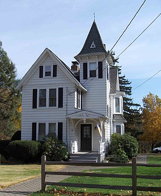
They camped there for four days. Rochambeau and his officers took shelter in the tavern, and the troops set up camp on a hill on the other side of the road. The area of the encampment has since become known as French Hill, and a marker on the east side of Marion Avenue commemorates the French campsite. According to Rev. Timlow's Sketches of Southington (1875), "Landlord Barnes gave a ball at his tavern, at which a large number of the young women of the vicinity were present; and they esteemed it something of an honor to have had a 'cotillion' with the polite foreigner." The celebrations-infused with spirits provided by Landlord Barnes-spanned the four nights they were in Southington. Rochambeau revisited Barnes's Tavern on the return march on October 27, 1782. According to Timlow, coins, buttons and other things were picked up in the vicinity many years after the two encampments. The Asa Barnes Tavern is now a private residence very near the camp site at 1089 Marion Avenue.
Southington originally was a small, rural farming community. In the early 1900s, Southington developed as a manufacturing center, but still maintained a very small population of a few thousand residents. Some of the products invented there include the first cement that was able to harden under water, the first carriage bolt cutting machine, the break-neck rat trap, and a new tinware process.
With the overall decline of industry in New England, and the construction of Interstate 84 in the mid 1960s, Southington developed into a bedroom community in which the town saw explosive growth and a population that has surged to over 42,000 today. 28% of the workers in Southington are still employed in manufacturing, most of them in the production of fabricated metals and aircraft.
In May 1942, during World War II, the town was selected by the War Department to be highlighted in a defense booklet called Southington, CT—Microcosm of America. Photographers roamed the community taking photos of residents at work, at play and in their homes and churches. The final publication was intended to show friends and foes alike in Europe the typical American citizens and families, their traditions and values. Thousands of copies were dropped from military airplanes over Europe during the Nazi German Occupation. Also in 1942 the mural, Romance of Southington, was painted in the town post office by Ann Hunt Spence. Murals were produced from 1934 to 1943 in the United States through the Section of Painting and Sculpture, later called the Section of Fine Arts, of the Treasury Department. The WPA was the largest and most ambitious American New Deal agency, employing individuals to carry out public works projects.[3]
Each year, Southington is home to the Apple Harvest Festival, an effort to bring together local businesses and denizens from the area and surrounding cities. This has been a tradition of the town since 1969, generally spanning six weekdays and two weekends. Its highlights include a town parade, carnival rides and games, musical performances, and a wide selection of unique recipes and foods served by community cornerstones including the Boy Scouts of America, local churches, the Southington Fire Department and Police Department, the Southington Rotary Chapter, and the Southington Jaycees. Southington is home to several farms and apple orchards, including Rogers Orchards, the largest in the state.
On May24, 1962, the town was heavily damaged by a high-end F3tornado. The tornado, which was "near-F4" intensity at the time, damaged or destroyed numerous buildings, homes, businesses, and vehicles throughout the area before it dissipated northeast of town. Overall, the storm left one dead and 50injured.[4][5][6][7][8][9][10]
Two of Southington's main state roads are ceremonially named for notable residents. Southington's portion of Route 10 is named the Louis G. Tolles Memorial Highway for the late state Grange leader and legislator (1885–1956). The road was dedicated on Aug. 6, 1960, and rededicated with new signs on Oct. 6, 2007. A section of Route 364 (Oakland Road and Berlin Street) was dedicated as the Officer Timothy Foley Memorial Highway on Sept. 11, 2009, in honor of the first (and to date the only) Southington police officer killed in the line of duty. He died six days after being struck by a vehicle on Dec. 30, 1937.
In January 2011, John Weichsel retired as town manager after 44 years. He was hired by the first Town Council when the council/manager form of government was established in town in 1966. His tenure as a town manager in the same community is one of the longest in the United States. Weichsel died in 2013. The municipal center at 196–200 North Main St. is named in his honor.
Southington ranked second nationally on an August 2023 Realtor.com list of hottest zip codes in the country, based on views of listings, how fast houses are selling and at what price.
Photos
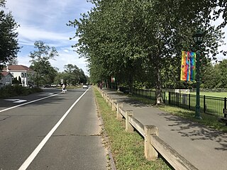
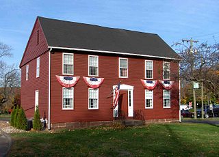
The Plantsville Green
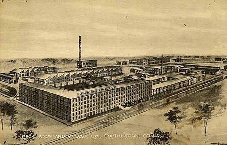
The Wilcox Factory located in Southington, in 1910.
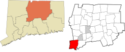
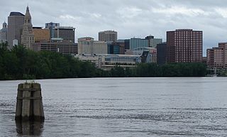
Southington is situated about 20 miles (32km) southwest of Hartford, about 80 miles (130km) northeast of New York City, 105 miles (169km) southwest of Boston and 77 miles (124km) west of Providence. It includes the areas of Plantsville, Marion and Milldale, each of which has its own post office and distinct architecture. The town rests in a valley, with two mountains on its east and west sides. The town is located along exits 28 through 32 of Interstate 84, exit 4 of Interstate 691, and bisected by Connecticut Route 10. Southington has the nickname of "The Apple Valley", due to the many orchards that still dot its landscape. The Quinnipiac River flows through the town. It is home to Mount Southington ski area, which has drawn visitors since the 1960s.
Southington is located at geographical coordinates 41° 35′ 48" North, 72° 52′ 40" West (41.596588, −72.87767). According to the United States Census Bureau, the town has a total area of 36.6 square miles (94.9km2), of which 35.9 square miles (93.0km2) are land and 0.73 square miles (1.9km2), or 1.99%, is water.[11]
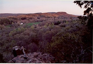
Southington's west ridge is rich with many geological formations. These include North Hamlin Brook, Roaring Brook, and Soltys Pond.[12] Soltys Pond was named after Alexander Soltys, who settled in the area in 1713. The most well-known geological formation in the area is one of several in the world known as the Great Unconformity.[citation needed]
Located less than one mile northwest of the Great Unconformity on Southington Mountain is Hushak Rock, which has been known informally for decades as White Rock. The overlook has expansive views of the region and can be seen from much of Route 229 and area neighborhoods. The state of Connecticut officially named Hushak Rock in 2017 for longtime Southington civic leader and World War II pilot Walter J. Hushak (b. 1923).
As of the 2020 census,[14] there were 43,501 people and 17,149 households in the town. The population density was 1,212 inhabitants per square mile (468/km2). There were 18,154 housing units at an average density of 506 per square mile (195/km2). The racial makeup of the town was 89.6% White, 2.4% Black or African American, 0.0% Native American, 2.9% Asian, 0.0% Pacific Islander, and 3.7% from two or more races. Hispanic or Latino of any race were 5.1% of the population.
As of 2010, there were 16,814 households, out of which 31.8% had children under the age of 18 living with them, 58.2% were married couples living together, 9.4% had a female householder with no husband present, and 28.8% were non-families. 24% of all households were made up of individuals, and 11.8% had someone living alone who was 65 years of age or older. The average household size was 2.54 and the average family size was 3.01.
In the town, the population was spread out, with 23.8% under the age of 18, 5.9% from 18 to 24, 29.3% from 25 to 44, 26.3% from 45 to 64, and 14.7% who were 65 years of age or older. The median age was 43.3 years. For every 100 females, there were 94.1 males. For every 100 females age 18 and over, there were 90.1 males.
As of 2015, the median income for a household in the town was $82,704, and the median income for a family was $102,775. Households in Southington were relatively affluent, with 41.9% of its households earning above $100,000.[15] The per capita income for the town was $36,682 according to the 2010 census. Males had a median income of $68,378 versus $50,599 for females. About 2.2% of families and 3.5% of the population were below the poverty line, including 3.0% of those under age 18 and 5.6% of those age 65 or over.
Economy
Top employers
Top employers in Southington according to the town's 2019 Comprehensive Annual Financial Report[16]
As industry in the area declined, many old factories and buildings were left vacant. The latest to close was Ideal Forging, which filed for bankruptcy in 2001 and vacated its building in the town center. In 2005, Meridian Development Partners of New York City purchased the land with plans to transform the former factory site into homes and retail space.[17] Demolition of the factory began in October 2014, but the project was later abandoned because of the high cost necessary to decontaminate the soil. As of 2023, preparations have begun for a new attempt at developing the space. The soil decontamination for the most recent plan has been subsidised by the EPA, the state, and the town.[18]
Southington has taken the initiative to spur its own revitalization. In 2002, the town completed the downtown renaissance project. This project replaced the sidewalks on Main Street and Center Street with granite curbing and brick paving stones. Lifelong resident and philanthropist Robert Petroske donated $50,000 to the revitalization effort which led to the installation of decorative iron lamp posts, benches, and garbage cans. Flowering trees were planted, and a former fountain and light fixture was restored and relocated from Recreation Park (where it had been moved in 1961) to the town center. A renaissance zone was created where private business owners in the zone could apply to the town to continue the project of granite, brick pavers, and lamp posts, of which the town would pay the difference of replacement concrete sidewalks versus the more expensive brick. The extension of brick pavers from Center Street to a section on the east side of Liberty Street was completed in July 2008 to connect with the pavers installed outside the new Liberty Square office building.
The town water department, which built a new facility on West Queen Street in 2002, demolished its former facility located between Mill and High streets in June 2008 and developed the land into a landscaped park, along with a continuation of the sidewalks, iron fences and decorative lamp posts. The old water facility abuts the linear walking trail.
Southington boasts a fair share of large parks and open land, each serving several outdoor activities, and as a whole, a vast array of them.
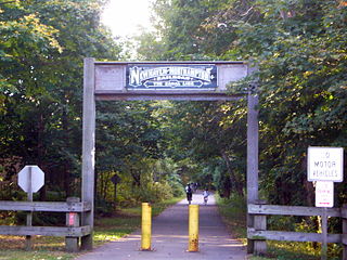
Linear walking trail
The linear trail opened to the public in the summer of 2003. This trail was built over the town's old rail line which had ceased operation several years earlier. Dubbed the Farmington Canal Greenway, when completed it will stretch from New Haven, Connecticut, to Northampton, Massachusetts, following the route of the historical Farmington Canal. The second phase of construction on the trail, which officially opened in 2011, redeveloped the old train line from Plantsville center to the Cheshire town line. The project has brought landscaping, iron benches, and intersections of brick pavers where the trail crosses roads. This is seen as a major link for the further revitalization of downtown Southington and Plantsville. Eventually the trail will connect with the Cheshire-to-New Haven route.
Lake Compounce
Lake Compounce is partly in Southington, and Bristol. Founded in 1846, it is the oldest amusement park in the US.
Locally, the Town of Southington has a form of government known as Council-Manager Government. It consists of a nine-member Town Council, elected every odd year through an at-large popular vote.[20] Due to state minority representation laws, a maximum of six nominees from each party can run. The nine candidates who receive the most votes become councillors.[21] The council appoints a nonpartisan full-time administrator, known as the Town Manager.
Voters also elect a municipal Planning and Zoning Commission (four year terms), Board of Education (two year terms), Board of Finance (two year terms), Water Commission (two year terms), Town Clerk (six year term) and Registrar of Voters (four term term).[20]
Education
Southington has eight public elementary schools, two middle schools and one high school.[22] It also has an alternative school for children in grades 8–12 called the Karen Smith Academy. Approximately 6,500 students are enrolled in Southington public schools, making it one of the larger districts in the state of Connecticut. Southington High School has a growing enrollment exceeding 2,200 students, of which 90% of graduates attend post-secondary education.
Due to Southington's popularity as a family suburb, the town has undertaken plans to expand all schools to accommodate the growing enrollment. Three elementary schools have been completed, and a new building and second cafeteria has been added to the high school campus. In 2012, voters approved expansion and renovations to two other elementary schools (with one to be demolished and rebuilt), as well as to the two middle schools.
Southington also has two parochial schools; Southington Catholic is pre-kindergarten through eighth and the other, Central Christian Academy is pre-kindergarten through twelfth.
Elementary schools
Walter A. Derynoski
Flanders
William H. Hatton
Urbin T. Kelley
Zaya A. Oshana (renamed June 2019; formerly Plantsville School)
On March 28, 2015, CTfastrak, Connecticut's first bus rapid transit corridor, opened. It provides a separated right-of-way between Hartford and New Britain; Express bus services travel between downtown Hartford and Waterbury, with service to Southington, with its free park-and-ride located at the corner of South Main and Mulberry streets. Following its creation, public transportation can now connect Southington residents to Waterbury station and the Metro-North Railroad, providing service to Bridgeport and ultimately Stamford and New York City.
Highways
Southington is home to several highways, including Interstate 84, also known as The Yankee Expressway, and Interstate 691.
Berlin is a town in the Capitol Planning Region, Connecticut, United States. The population was 20,175 at the 2020 census. It was incorporated in 1785. The geographic center of Connecticut is located in the town. Berlin is residential and industrial, and is served by the Amtrak station of the same name. Berlin also has two hamlets: Kensington and East Berlin.
Farmington is a town in Hartford County in the Farmington Valley area of central Connecticut in the United States. The town is part of the Capitol Planning Region. The population was 26,712 at the 2020 census. It sits 10 miles west of Hartford at the hub of major I-84 interchanges, 20 miles south of Bradley International Airport and two hours by car from New York City and Boston. It has been home to the world headquarters of several large corporations including Otis Elevator Company, United Technologies, and Carvel. The northwestern section of Farmington is a suburban neighborhood called Unionville.
Simsbury is a town in Hartford County, Connecticut, United States, incorporated as Connecticut's 21st town in May 1670. The town is part of the Capitol Planning Region. The population was 24,517 in the 2020 census.
Wolcott is a town in New Haven County, Connecticut, United States. The town is part of the Naugatuck Valley Planning Region. It is primarily residential, with a population of 16,142 as of the 2020 United States Census.
Bristol is a suburban city located in Hartford County, Connecticut, United States, 20 miles (32 km) southwest-west of Hartford. The city is also 120 miles southwest from Boston, and approximately 100 miles northeast of New York City. The city is part of the Naugatuck Valley Planning Region. As of the 2020 census, the population of the city was 60,833.
West Hartford is a town in Hartford County, Connecticut, United States, 5 miles (8.0 km) west of downtown Hartford. The town is part of the Capitol Planning Region. The population was 64,083 at the 2020 census.
Greater Hartford is a region located in the U.S. state of Connecticut, centered on the state's capital of Hartford. It represents the only combined statistical area in Connecticut defined by a city within the state, being bordered by the Greater Boston region to the northeast and New York metropolitan area to the south and west. Sitting at the southern end of the Metacomet Ridge, its geology is characterized by land of a level grade along the shores of Connecticut River Valley, with loamy, finer-grained soil than other regions in the state. Greater Hartford, had a total population of 1,213,531 at the 2020 United States census.
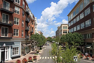
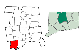
Plantsville is a neighborhood in the town of Southington, Hartford County, Connecticut. It is centered at the merger between South Main Street and West Main Street. As of the 2000 Census there were 10,387 people living in the Zip Code Tabulation Area for zip code 06479, which is assigned the postal city name Plantsville. The Zip Code Tabulation Area includes the entire southwestern corner of the town of Southington, including Marion and Milldale. Beginning in 2015 Plantsville was listed as a census-designated place.
This is a list of properties and districts listed on the National Register of Historic Places in Connecticut. There are more than 1,500 listed sites in Connecticut. All 8 counties in Connecticut have listings on the National Register.
The Farmington Canal, also known as the New Haven and Northampton Canal, was a major private canal built in the early 19th century to provide water transportation from New Haven into the interior of Connecticut, Massachusetts and beyond. Its Massachusetts segment was known as the Hampshire and Hampden Canal. With the advent of railroads, it was quickly converted to a railroad in the mid-19th century and in recent years has been converted to a multi-use trail after being abandoned for years.
The Washington–Rochambeau Revolutionary Route is a 680-mile (1,090 km) series of roads used in 1781 by the Continental Army under the command of George Washington and the Expédition Particulière under the command of Jean-Baptiste de Rochambeau during their 14-week march from Newport, Rhode Island, to Yorktown, Virginia.
The Farmington Canal Heritage Trail is an 81.2-mile (130.7 km) multi-use rail trail located in Connecticut and Massachusetts.
Marion is a neighborhood in the town of Southington, Connecticut. It is generally the area in the vicinity of the intersection of Route 322 and Marion Avenue just north of the Cheshire town line.
The Levi B Frost House, also known as the Asa Barns’ Tavern, is a historic building in the Marion village of Southington, Connecticut. The home represents over two centuries of Southington history. It appears twice on the National Register of Historic Places, as an individual structure and as a part of the Marion Historic District. It is significant both architecturally and historically for its connection to United States and New England history.
The Tunxis Trail is a 79-mile (127 km) Blue-Blazed hiking trail "system" that traverses the western ridge of the central Connecticut Valley. The mainline trail is not completely contiguous, notably there are two gaps of several miles.
This is a list of the National Register of Historic Places listings in Southington, Connecticut.
The Jonathan Root House is a historic house at 140–142 North Main Street in Southington, Connecticut. Built about 1720, it is believed to be the oldest surviving colonial building in the town. It was listed on the National Register of Historic Places in 1989, and now houses professional offices.
The Selah Barnes House is a historic house at 282 Prospect Street Southington, Connecticut. Built about 1778 for a local merchant, it is a good local example of vernacular Georgian architecture. It was listed on the National Register of Historic Places in 1989.
This page is based on this Wikipedia article Text is available under the CC BY-SA 4.0 license; additional terms may apply. Images, videos and audio are available under their respective licenses.