Winchester, Connecticut

Last updated

Winchester, Connecticut
Town of Winchester
WinchesterCTseal.JPG
Litchfield County Connecticut Incorporated and Unincorporated areas Winchester Highlighted 2010.svg
Winchester, Connecticut
Coordinates: 41°55′30″N73°06′11″W / 41.92500°N 73.10306°W / 41.92500; -73.10306
CountryFlag of the United States.svg  United States
U.S. state Flag of Connecticut.svg  Connecticut
County Litchfield
Region Northwest Hills
Incorporated1771
Government
  Type Board of Selectmen - Town Manager
  Town Manager/CEOJoshua Steele Kelly
  Board of SelectmenTodd Arcelaschi (R), Mayor
Althea C. Perez (D)
Steven Sedlack (D)
Jack Bourque (D)
Linda Groppo (D)
Candace Bouchard (R)
Jonathan W. Morhardt (R)
Area
  Total33.8 sq mi (87.6 km2)
  Land32.5 sq mi (84.2 km2)
  Water1.3 sq mi (3.4 km2)
Elevation
1,017 ft (310 m)
Population
 (2020)
  Total10,224
  Density314/sq mi (121.4/km2)
Time zone UTC-5 (Eastern)
  Summer (DST) UTC-4 (Eastern)
ZIP codes
06094, 06098
Area code(s) 860/959
FIPS code 09-86440
GNIS feature ID0213536
Website www.townofwinchester.org

Winchester is a town in Litchfield County, Connecticut, United States. The population was 10,224 at the 2020 census. [1] The city of Winsted is located in Winchester. The town is part of the Northwest Hills Planning Region.

Contents

History

Winchester was incorporated on May 21, 1771, and named after Winchester in England. [2]

Geography

The town is in northeastern Litchfield County and is bordered to the south by the city of Torrington. It is 28 miles (45 km) northwest of Hartford, the state capital, and 27 miles (43 km) north of Waterbury. Winsted, with a population of 7,321 by far the largest community in Winchester, is in the eastern part of the town.

According to the United States Census Bureau, the town has a total area of 33.8 square miles (87.6 km2), of which 32.5 square miles (84.2 km2) are land and 1.3 square miles (3.4 km2), or 3.87%, are water. [3] Highland Lake, Crystal Lake, and Winchester Lake are three of the larger water bodies in the town. The Still River, a tributary of the Farmington River, flows from south to north through the eastern side of the town.

Principal communities

Demographics

Historical population
CensusPop.Note
1820 1,601
1850 2,179
1860 3,51361.2%
1870 4,09616.6%
1880 5,14225.5%
1890 6,18320.2%
1900 7,76325.6%
1910 8,67911.8%
1920 9,0193.9%
1930 8,674−3.8%
1940 8,482−2.2%
1950 10,53524.2%
1960 10,496−0.4%
1970 11,1065.8%
1980 10,841−2.4%
1990 11,5246.3%
2000 10,664−7.5%
2010 11,2425.4%
2020 10,224−9.1%
U.S. Decennial Census [4]

At the 2000 census there were 10,664 people, 4,371 households, and 2,849 families living in the town. The population density was 330.4 inhabitants per square mile (127.6/km2). There were 4,922 housing units at an average density of 152.5 per square mile (58.9/km2). The racial makeup of the town was 94.44% White, 1.24% African American, 0.23% Native American, 0.93% Asian, 0.01% Pacific Islander, 1.69% from other races, and 1.46% from two or more races. Hispanic or Latino people of any race were 3.17%. [5]

Of the 4,371 households 28.3% had children under the age of 18 living with them, 50.3% were married couples living together, 10.2% had a female householder with no husband present, and 34.8% were non-families. 28.0% of households were one person and 11.9% were one person aged 65 or older. The average household size was 2.42 and the average family size was 2.97.

The age distribution was 23.3% under the age of 18, 7.1% from 18 to 24, 29.4% from 25 to 44, 25.0% from 45 to 64, and 15.2% 65 or older. The median age was 40 years. For every 100 females, there were 94.0 males. For every 100 females age 18 and over, there were 90.5 males.

The median household income was $46,671 and the median family income was $57,866. Males had a median income of $41,076 versus $28,058 for females. The per capita income for the town was $22,589. About 4.3% of families and 6.7% of the population were below the poverty line, including 9.9% of those under age 18 and 7.4% of those age 65 or over.

Transportation

Highland Lake, c. 1905 PostcardWinstedCTHighlandLakeBirdsEyeViewCirca1901To1907.jpg
Highland Lake, c.1905

The town is served by buses of the Northwestern Connecticut Transit District.

The city of Winsted is located at the junction of Connecticut Route 8 and U.S. Route 44. Route 263 connects Winchester Center and Winsted.

Education

Winchester Public Schools is the public school district for grades K-6, while The Gilbert School serves as the public school for grades 7-12. Prior to 2011, middle school students went to schools operated by the Winchester district. [6]

Northwestern Regional School District No. 7 maintains Northwestern Regional High School, which is partly in Winsted. [7] However, the school does not act as the public school for Winsted. [8] Students who live in Winchester can attend Northwestern Regional High School through their Agricultural Education Program.

Also located in the town, is Explorations Charter School. Created to serve a diverse body of students, the school was designed to accommodate the unique educational, social, and emotional needs of its students. [9]

Prior to closing in 2020, [10] the town also had a parochial Catholic school called St. Anthony School, of the Roman Catholic Diocese of Hartford. The school opened in 1865, [11] and maintained a class of around 200 students. Experiencing a large decrease in enrollment, the school dropped from serving around 200 students, to just 90. When in operation, it was the oldest school continually operated by the archdiocese. [12]

Northwestern Connecticut Community College is in Winsted.

Notable people

Related Research Articles

<span class="mw-page-title-main">Hartford County, Connecticut</span> County in Connecticut, United States

Hartford County is a county located in the north central part of the U.S. state of Connecticut. According to the 2020 census, the population was 899,498, making it the second-most populous county in Connecticut. Hartford County contains the city of Hartford, the state capital of Connecticut and the county's most populous city, with 121,054 residents at the 2020 census. Hartford County is included in the Hartford-East Hartford-Middletown metropolitan statistical area.

<span class="mw-page-title-main">Litchfield County, Connecticut</span> County in Connecticut, United States

Litchfield County is in northwestern Connecticut, United States. As of the 2020 census, the population was 185,186. The county was named after Lichfield, in England. Litchfield County has the lowest population density of any county in Connecticut and is the state's largest county by area.

<span class="mw-page-title-main">New Haven County, Connecticut</span> County in Connecticut, United States

New Haven County is a county in the south central part of the U.S. state of Connecticut. As of the 2020 census, the population was 864,835, making it the third-most populous county in Connecticut. Two of the state's top 5 largest cities, New Haven (3rd) and Waterbury (5th), are part of New Haven County.

<span class="mw-page-title-main">Barkhamsted, Connecticut</span> Town in Connecticut, United States

Barkhamsted is a town in Litchfield County, Connecticut, United States. It contains seven villages: West Hill, Mallory, Barkhamsted Center, Center Hill, Washington Hill, Pleasant Valley, and Riverton. The population was 3,647 at the 2020 census, down from 3,799 at the 2010 census. The town is part of the Northwest Hills Planning Region. Barkhamsted was first incorporated in 1779, and named after Berkhamsted, Hertfordshire, England.

<span class="mw-page-title-main">Colebrook, Connecticut</span> Town in Connecticut, United States

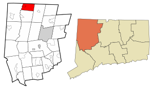
Colebrook is a town in Litchfield County, Connecticut, United States. The population was 1,361 at the 2020 census. The town is part of the Northwest Hills Planning Region. Colebrook was named after Colebrooke in the English county of Devon; the reason is now unknown.

<span class="mw-page-title-main">Harwinton, Connecticut</span> Town in Connecticut, United States

Harwinton is a town in Litchfield County, Connecticut, United States. The population was 5,484 at the 2020 census. The town is part of the Northwest Hills Planning Region. The high school is Lewis S. Mills.

<span class="mw-page-title-main">New Hartford, Connecticut</span> Town in Connecticut, United States

New Hartford is a town in Litchfield County, Connecticut, United States. The population was 6,658 at the 2020 census. The town is part of the Northwest Hills Planning Region. The town center is defined by the U.S. Census Bureau as the New Hartford Center census-designated place (CDP). The town is mainly a rural community consisting of farms, homes, and parks. Brodie Park and Ski Sundown are located in New Hartford.

<span class="mw-page-title-main">Norfolk, Connecticut</span> Town in Connecticut, United States

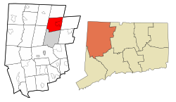
Norfolk is a town in Litchfield County, Connecticut, United States. The population was 1,588 at the 2020 census. The town is part of the Northwest Hills Planning Region. The urban center of the town is the Norfolk census-designated place, with a population of 553 at the 2010 census.

<span class="mw-page-title-main">North Canaan, Connecticut</span> Town in Connecticut, United States

North Canaan is a town in Litchfield County, Connecticut, United States. The population was 3,211 at the 2020 census. The town is part of the Northwest Hills Planning Region. The town center is still called "Canaan", being the main town center of the old town of Canaan prior to North Canaan splitting off as its own town.

<span class="mw-page-title-main">Northwest Harwinton, Connecticut</span> Census-designated place in Connecticut, United States

Northwest Harwinton is a census-designated place (CDP) in the town of Harwinton in Litchfield County, Connecticut, United States. The population was 3,158 at the 2020 census, out of 5,484 in the entire town. The CDP contains the town center.

<span class="mw-page-title-main">Plymouth, Connecticut</span> Town in Connecticut, United States

Plymouth is a town in Litchfield County, Connecticut, United States. It is named after Plymouth, Devon, England. The population was 11,671 at the 2020 census, down from 12,243 at the 2010 census. The town of Plymouth includes the villages of Plymouth Center, Terryville and Pequabuck.

<span class="mw-page-title-main">Roxbury, Connecticut</span> Town in Connecticut, United States

Roxbury is a town in Litchfield County, Connecticut, United States. The population was 2,260 at the 2020 census. The town is located 65 miles (105 km) northeast of New York City, and is part of the Northwest Hills Planning Region.

<span class="mw-page-title-main">Sharon, Connecticut</span> Town in Connecticut, United States

Sharon is a town in Litchfield County, Connecticut, United States, in the northwest corner of the state. At the time of the 2020 census, the town had a total population of 2,680. The town is part of the Northwest Hills Planning Region. The ZIP code for Sharon is 06069. The urban center of the town is the Sharon census-designated place, with a population of 729 at the 2010 census.

<span class="mw-page-title-main">Warren, Connecticut</span> Town in Connecticut, United States

Warren is a town in Litchfield County, Connecticut, United States. The population was 1,351 at the 2020 census. The town is part of the Northwest Hills Planning Region. The town was named for Revolutionary War General Joseph Warren.

<span class="mw-page-title-main">Winsted, Connecticut</span> CDP in Connecticut, United States

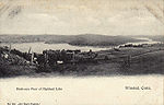
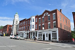
Winsted is a census-designated place and an incorporated city in Litchfield County, Connecticut, United States. It is part of the town of Winchester. The population of Winsted was 7,712 at the 2010 census, out of 11,242 in the entire town of Winchester. Winsted is part of the Northwest Hills Planning Region.

<span class="mw-page-title-main">Middlebury, Connecticut</span> Town in Connecticut, United States

Middlebury is a town in New Haven County, Connecticut, United States. The population was 7,574 at the 2020 census. The town is part of the Naugatuck Valley Planning Region.

<span class="mw-page-title-main">Litchfield, Connecticut</span> Town in Connecticut, United States

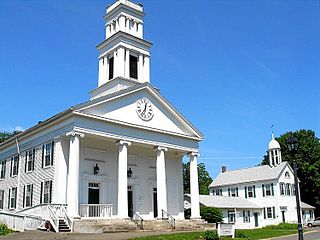
Litchfield is a town in and former county seat of Litchfield County, Connecticut, United States. The population was 8,192 at the 2020 census. The town is part of the Northwest Hills Planning Region. The boroughs of Bantam and Litchfield are located within the town. There are also three unincorporated villages: East Litchfield, Milton, and Northfield. Northfield, located in the southeastern corner of Litchfield, is home to a high percentage of the Litchfield population.

<span class="mw-page-title-main">New Hartford Center, Connecticut</span> Census-designated place in Connecticut, United States

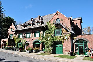
New Hartford Center is a census-designated place (CDP) in Litchfield County, Connecticut, United States. It comprises the village of New Hartford, the adjacent Pine Meadow Historic District, and some surrounding forest land, all within the town of New Hartford. As of the 2010 census, the population of New Hartford Center was 1,385, out of 6,970 in the entire town of New Hartford.

<span class="mw-page-title-main">Canaan, Connecticut</span> Town in Connecticut, United States

Canaan is a town in Litchfield County, Connecticut, United States. The population was 1,080 at the 2020 census, down from 1,234 at the 2010 census. The town is part of the Northwest Hills Planning Region. The town of Canaan is often referred to locally by the name of its principal settlement, Falls Village.

<span class="mw-page-title-main">Norfolk (CDP), Connecticut</span> Census-designated place in Connecticut, United States

Norfolk is a census-designated place (CDP) in Litchfield County, Connecticut, United States. It is the central village within the town of Norfolk. As of the 2010 census, the population of the CDP was 553, out of 1,709 in the entire town.

References

  1. "Census - Geography Profile: Winchester town, Litchfield County, Connecticut". United States Census Bureau . Retrieved December 23, 2021.
  2. The Connecticut Magazine: An Illustrated Monthly. Connecticut Magazine Company. 1903. p. 335.
  3. "Geographic Identifiers: 2010 Census Summary File 1 (G001), Winchester town, Litchfield County, Connecticut". American FactFinder. U.S. Census Bureau. Archived from the original on February 13, 2020. Retrieved October 17, 2019.
  4. "Census of Population and Housing". Census.gov. Retrieved June 4, 2015.
  5. "U.S. Census website". United States Census Bureau . Retrieved January 31, 2008.
  6. "History". Gilbert School . Retrieved May 19, 2021.
  7. "Winsted Zoning Map" (PDF). Town of Winchester. Retrieved May 19, 2021.
  8. "About Us". Northwestern Regional School District No. 7 . Retrieved May 19, 2021. Regional School District No. 7 is composed of four rural-suburban towns: Barkhamsted, Colebrook, New Hartford and Norfolk.[...]
  9. "Schools". Town of Winchester. Retrieved May 19, 2021.
  10. "Home". St. Anthony School. Retrieved May 19, 2021.
  11. "150th Anniversary Celebration". St. Anthony School. August 7, 2018. Archived from the original on August 7, 2018. Retrieved May 19, 2021.
  12. Gugliotti, Elio (March 17, 2020). "St. Anthony School in Winsted to close". Republican American . Retrieved May 19, 2021.