Griswold, Connecticut

Last updated

Griswold, Connecticut
Town of Griswold
First Congregational Church of Griswold CT.JPG
First Congregational Church
GriswoldSeal.gif
New London County Connecticut Incorporated and Unincorporated areas Griswold Highlighted 2010.svg
Griswold, Connecticut
Coordinates: 41°35′04″N71°55′16″W / 41.58444°N 71.92111°W / 41.58444; -71.92111
CountryFlag of the United States.svg  United States
U.S. state Flag of Connecticut.svg  Connecticut
County New London
Region Southeastern CT
Incorporated1815
Government
  Type Selectman-town meeting
  First selectmanDana Bennett
Area
  Total37.1 sq mi (96.0 km2)
  Land34.7 sq mi (89.9 km2)
  Water2.4 sq mi (6.1 km2)
Elevation
210 ft (64 m)
Population
 (2020)
  Total11,402
  Density310/sq mi (120/km2)
Time zone UTC-5 (Eastern)
  Summer (DST) UTC-4 (Eastern)
ZIP Code
06351
Area code(s) 860/959
FIPS code 09-33900
GNIS feature ID0213436
Website www.griswold-ct.org

Griswold is a town in New London County, Connecticut, United States. The town is part of the Southeastern Connecticut Planning Region. The population was 11,402 at the 2020 census. [1] Griswold contains the borough of Jewett City and the villages of Doaneville, Kaalmanville, Rixtown, Glasgo, Hopeville, Nathanieltown, and Pachaug.

Contents

History

Long a fishing ground for the Mohegan people, the waterways attracted settlers who established ironworks, saw and corn mills, and other businesses.[ citation needed ]

The town of Griswold was originally the northern part of the town of Preston. The North Society was established in 1716 at the request of residents who had been travelling to Preston to attend church. [2] [3]

In the late 1700s, Eliezer Jewett opened several mills and an irrigation plant. His success led the area to be called Jewett City. [4] The town of Griswold incorporated in 1815, naming itself after Governor Roger Griswold. [5] [6] In 1895, Jewett City incorporated as a borough of the town.

Griswold contains Hopeville Pond State Park, former site of a woolen mill. [4]

Geography

The Pachaug and Quinebaug rivers flow through the town of Griswold, which is located at the northeastern edge of New London County. [4] According to the United States Census Bureau, the town has a total area of 37.1 square miles (96.0 km2), of which 34.7 square miles (89.9 km2) is land and 2.4 square miles (6.1 km2), or 6.37%, is water. [7]

Demographics

Historical population
CensusPop.Note
1820 1,859
1850 2,065
1860 2,2177.4%
1870 2,57516.1%
1880 2,7456.6%
1890 3,11313.4%
1900 3,49012.1%
1910 4,23321.3%
1920 4,220−0.3%
1930 6,01042.4%
1940 5,343−11.1%
1950 5,7287.2%
1960 6,47213.0%
1970 7,76319.9%
1980 8,96715.5%
1990 10,38415.8%
2000 10,8074.1%
2010 11,95110.6%
2020 11,402−4.6%
[8] [9]

As of the census [10] of 2010, there were 11,951 people, 4,646 households, and 3,225 families living in the town. The population density was 344.4 inhabitants per square mile (133.0/km2). There were 5,118 housing units at an average density of 147.5 per square mile (57.0/km2). The racial makeup of the town was 91.6% White, 1.8% African American, 0.9% Native American, 2.2% Asian, 0.03% Pacific Islander, 0.6% some other race, and 2.8% from two or more races. Hispanic or Latino people of any race were 3.3% of the population. [8]

There were 4,646 households, out of which 31.3% had children under the age of 18 living with them, 50.3% were headed by married couples living together, 12.5% had a female householder with no husband present, and 30.6% were non-families. 23.3% of all households were made up of individuals, and 7.4% were someone living alone who was 65 years of age or older. The average household size was 2.57 and the average family size was 3.00. [8]

In the town, the population was spread out, with 22.9% under the age of 18, 8.4% from 18 to 24, 27.2% from 25 to 44, 30.8% from 45 to 64, and 10.7% who were 65 years of age or older. The median age was 39.6 years. For every 100 females, there were 99.8 males. For every 100 females age 18 and over, there were 97.8 males. [8]

At the 2000 census, the median income for a household in the town was $40,156, and the median income for a family was $48,852. Males had a median income of $57,869 versus $17,441 for females. The per capita income for the town was $21,196. About 6.1% of families and 9.2% of the population were below the poverty line, including 6.1% of those under age 18 and 7.6% of those age 65 or over.

Voter registration and party enrollment as of October 30, 2014 [11]
PartyActive votersInactive votersTotal votersPercentage
Democratic 2,1611162,27733.1%
Republican 1,314331,34719.6%
Unaffiliated 2,9461973,14345.6%
Minor parties11551201.7%
Total6,5363516,887100%

Notable locations

Notable people

Related Research Articles

<span class="mw-page-title-main">New London County, Connecticut</span> County in Connecticut, United States

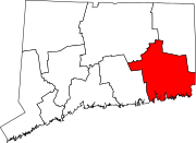
New London County is in the southeastern corner of Connecticut and comprises the Norwich-New London, Connecticut Metropolitan Statistical Area, which is also included in the Hartford-East Hartford, Connecticut Combined Statistical Area. There is no county government and no county seat, as is the case with all eight of Connecticut's counties; towns are responsible for all local government activities, including fire and rescue, snow removal, and schools.

<span class="mw-page-title-main">Georgetown, Connecticut</span> Census-designated place in Connecticut, United States

Georgetown is a census-designated place in Fairfield County, Connecticut, United States. It is located in the area where the towns of Wilton, Redding, Weston, and Ridgefield meet.

<span class="mw-page-title-main">Jewett City, Connecticut</span> Borough in Connecticut, United States

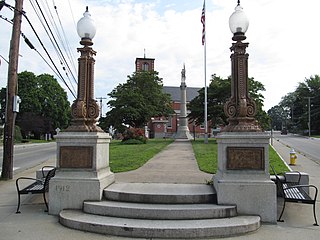
Jewett City is a borough in New London County, Connecticut, in the town of Griswold. The borough is part of the Southeastern Connecticut Planning Region. The population was 3,487 at the 2010 census. The borough was named for Eliezer Jewett, who founded a settlement there in 1771.

<span class="mw-page-title-main">Lisbon, Connecticut</span> Town in Connecticut, United States

Lisbon is a town in New London County, Connecticut, United States, 7.3 miles (11.7 km) by road northeast of Norwich. The town is part of the Southeastern Connecticut Planning Region. The population was 4,195 at the 2020 census. The town center is also known as the village of Newent. The town school is Lisbon Central School. Its only postal code, 06351, is Jewett City, Connecticut, which is a village of the town of Griswold, Connecticut and encompasses all of Lisbon and Griswold.

<span class="mw-page-title-main">Preston, Connecticut</span> Town in Connecticut, United States

Preston is a town in New London County, Connecticut, United States. The town is part of the Southeastern Connecticut Planning Region. The population was 4,788 at the 2020 census. The town includes the villages of Long Society, Preston City, and Poquetanuck.

<span class="mw-page-title-main">Sprague, Connecticut</span> Town in Connecticut, United States

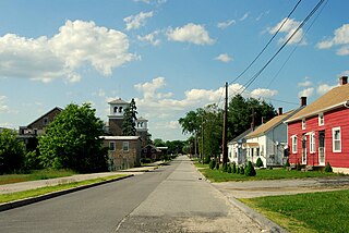
Sprague is a town in New London County, Connecticut, United States. The town is part of the Southeastern Connecticut Planning Region. The town was named after William Sprague III, who laid out the industrial section. The population was 2,967 at the 2020 census. Sprague includes three villages: Baltic, Hanover, and Versailles.

<span class="mw-page-title-main">Voluntown, Connecticut</span> Town in Connecticut, United States

Voluntown is a town in New London County, Connecticut, United States. The town is part of the Northeastern Connecticut Planning Region. The population was 2,570 at the 2020 census. Voluntown was part of Windham County from 1726 to 1881.

<span class="mw-page-title-main">Brooklyn, Connecticut</span> Town in Connecticut, United States

Brooklyn is a town in Windham County, Connecticut, United States. The town is part of the Northeastern Connecticut Planning Region. The population was 8,450 at the 2020 census. The town center village is listed by the U.S. Census Bureau as a census-designated place. The district of East Brooklyn is listed as a separate census-designated place.

<span class="mw-page-title-main">Canterbury, Connecticut</span> Town in Connecticut, United States

Canterbury is a town in Windham County, Connecticut, United States. The town is part of the Northeastern Connecticut Planning Region. The population was 5,045 at the 2020 census.

<span class="mw-page-title-main">East Brooklyn, Connecticut</span> Census-designated place in Connecticut, United States

East Brooklyn is a census-designated place located within the town of Brooklyn in Windham County, Connecticut. It is the portion of the Danielson urban cluster within the town of Brooklyn. The population was 1,638 at the 2010 census. US 6 runs through the town and severs the town.

<span class="mw-page-title-main">Killingly, Connecticut</span> Town in Connecticut, United States

Killingly is a town in Windham County, Connecticut, United States. Killingly is the largest town by population in the Northeastern Connecticut Planning Region. The population was 17,752 at the 2020 census. It consists of the borough of Danielson and the villages of Attawaugan, Ballouville, Dayville, East Killingly, Rogers, and South Killingly.

<span class="mw-page-title-main">Plainfield, Connecticut</span> Town in Connecticut, United States

Plainfield is a town in Windham County, Connecticut, United States. The town is part of the Northeastern Connecticut Planning Region. The population was 14,973 at the 2020 census. The town comprises four villages: Plainfield, Moosup, Wauregan, and Central Village. Each village has their own respective United States Post Office and fire department. The entire town is serviced by the 860 area code.

<span class="mw-page-title-main">Putnam, Connecticut</span> Town in Connecticut, United States

Putnam is a town in Windham County, Connecticut, United States. The town is part of the Northeastern Connecticut Planning Region. The population was 9,224 at the 2020 census.

<span class="mw-page-title-main">Sterling, Connecticut</span> Town in Connecticut, United States

Sterling is a town in Windham County, Connecticut, United States. The town is part of the Northeastern Connecticut Planning Region. The population was 3,578 at the 2020 census.

<span class="mw-page-title-main">Thompson, Connecticut</span> Town in Connecticut, United States

Thompson is a town in Windham County, Connecticut, United States. The town is part of the Northeastern Connecticut Planning Region. The town was named after Sir Robert Thompson, an English landholder. The population was 9,189 at the 2020 census. Thompson is located in the northeastern corner of the state and is bordered on the north by Webster, Massachusetts and Dudley, Massachusetts, on the east by Douglas, Massachusetts and Burrillville, Rhode Island, on the west by Woodstock, Connecticut, and on the south by Putnam, Connecticut.

<span class="mw-page-title-main">Wauregan, Connecticut</span> United States historic place

Wauregan is a village located in the northwestern corner of the town of Plainfield, Connecticut in the United States. Originally a mill village, Wauregan was established around a cotton mill powered by the Quinebaug River. Wauregan and West Wauregan, across the Quinebaug in the town of Brooklyn, together comprise the Wauregan census-designated place, with a population of 1,205 at the 2010 census.

<span class="mw-page-title-main">Durham, Connecticut</span> Town in Connecticut, United States

Durham is a town in Middlesex County, Connecticut, United States. Durham is a former farming village on the Coginchaug River in central Connecticut. The town is part of the Lower Connecticut River Valley Planning Region. The population was 7,152 at the 2020 census. Every autumn, the town hosts the Durham Fair, the largest volunteer agricultural fair in New England.

<span class="mw-page-title-main">Southbridge, Massachusetts</span> Town in Massachusetts, United States

Southbridge is a city in Worcester County, Massachusetts, United States. The population was 17,740 at the 2020 census. Although Southbridge has a city form of government, it is legally known as the Town of Southbridge.

<span class="mw-page-title-main">Hopeville Pond State Park</span> Park in Griswold, Connecticut, US

Hopeville Pond State Park is a public recreation area located on Hopeville Pond, an impoundment of the Pachaug River, in the town of Griswold, Connecticut. A portion of the 554-acre (224 ha) state park occupies the site of the lost village of Hopeville. The park manager's house occupies Avery House, which is listed on the National Register of Historic Places. The park offers fishing, swimming, camping, and trails for hiking and biking. It is managed by the Connecticut Department of Energy and Environmental Protection.

References

  1. "Census - Geography Profile: Griswold town, New London County, Connecticut". United States Census Bureau . Retrieved December 16, 2021.
  2. Connecticut Colony Public Records, Vol. IV
  3. Preston. First Congregational Church. The Bicentennial Celebration
  4. 1 2 3 Connecticut History: Griswold, accessed 5 Nov 2017.
  5. The Connecticut Magazine: An Illustrated Monthly. Connecticut Magazine Company. 1903. p. 332.
  6. Gannett, Henry (1905). The Origin of Certain Place Names in the United States. Govt. Print. Off. pp.  145.
  7. "Geographic Identifiers: 2010 Demographic Profile Data (G001): Griswold town, New London County, Connecticut". United States Census Bureau . Retrieved October 24, 2012.
  8. 1 2 3 4 "Profile of General Population and Housing Characteristics: 2010 Demographic Profile Data (DP-1): Griswold town, New London County, Connecticut". United States Census Bureau . Retrieved October 25, 2012.
  9. U.S. Census Bureau [ permanent dead link ]. Accessed October 14, 2009.
  10. "U.S. Census website". United States Census Bureau . Retrieved January 31, 2008.
  11. "Registration and Party Enrollment Statistics as of October 30, 2014" (PDF). Connecticut Secretary of State. Archived from the original (PDF) on September 23, 2006. Retrieved May 8, 2015.