Voluntown, Connecticut

Last updated

Voluntown, Connecticut
Town of Voluntown
Voluntown Baptist Church, Voluntown CT.jpg
Voluntown Baptist Church
VoluntownCTseal.JPG
New London County Connecticut Incorporated and Unincorporated areas Voluntown Highlighted 2010.svg
Voluntown, Connecticut
Coordinates: 41°35′N71°50′W / 41.583°N 71.833°W / 41.583; -71.833
CountryFlag of the United States.svg  United States
U.S. state Flag of Connecticut.svg  Connecticut
County New London
Region Northeastern CT
Incorporated1721
Government
  Type Selectman-town meeting
  First SelectmanTracey Hanson
Area
  Total39.8 sq mi (103.1 km2)
  Land38.9 sq mi (100.8 km2)
  Water0.8 sq mi (2.2 km2)
Elevation
381 ft (116 m)
Population
 (2020)
  Total2,570
  Density65/sq mi (25/km2)
Time zone UTC-5 (Eastern)
  Summer (DST) UTC-4 (Eastern)
ZIP code
06384
Area code(s) 860/959
FIPS code 09-78600
GNIS feature ID0213521
Website www.voluntown.gov

Voluntown is a town in New London County, Connecticut, United States. The town is part of the Northeastern Connecticut Planning Region. The population was 2,570 at the 2020 census. [1] Voluntown was part of Windham County from 1726 to 1881, after which it became part of New London County.

Contents

The town was named for the English volunteers in the 1675 Indian wars (King Philip's War) who stayed to fight "and went not away". One of the original founders of Voluntown was Lieutenant Thomas Leffingwell, who secured the town's approval in the colonial legislature and surveyed its original layout. [2] Maj. General Benedict Arnold, the infamous Revolutionary War turncoat, was a landholder.[ citation needed ]

Geography

According to the United States Census Bureau, the town has a total area of 39.8 square miles (103 km2). 38.9 square miles (101 km2) of it is land and 0.9 square miles (2.3 km2) of it (2.14%) is covered by surface water.

Demographics

Historical population
CensusPop.Note
1820 1,116
1850 1,064
1860 1,055−0.8%
1870 1,052−0.3%
1880 1,18612.7%
1890 1,060−10.6%
1900 872−17.7%
1910 779−10.7%
1920 656−15.8%
1930 651−0.8%
1940 72311.1%
1950 82514.1%
1960 1,02824.6%
1970 1,45241.2%
1980 1,63712.7%
1990 2,11329.1%
2000 2,52819.6%
2010 2,6033.0%
2020 2,570−1.3%
U.S. Decennial Census [3]

At the 2000 census there were 2,528 people, 952 households, and 702 families living in the town. The population density was 65.0 inhabitants per square mile (25.1/km2). There were 1,091 housing units at an average density of 28.0 per square mile (10.8/km2). The racial makeup of the town was 96.64% White, 0.55% African American, 0.99% Native American, 0.28% Asian, 0.40% from other races, and 1.15% from two or more races. Hispanic or Latino of any race were 1.19%. [4] 13.2% were of English, 12.5% French Canadian, 11.5% Irish, 9.2% American, 8.9% French, 8.0% Polish, 7.6% Italian, 7.3% German and 5.6% Finnish ancestry according to Census 2000.

Of the 952 households 37.4% had children under the age of 18 living with them, 61.9% were married couples living together, 7.0% had a female householder with no husband present, and 26.2% were non-families. 19.0% of households were one person and 6.3% were one person aged 65 or older. The average household size was 2.66 and the average family size was 3.05.

The age distribution was 26.5% under the age of 18, 5.3% from 18 to 24, 36.9% from 25 to 44, 21.7% from 45 to 64, and 9.5% 65 or older. The median age was 36 years. For every 100 females, there were 104.2 males. For every 100 females age 18 and over, there were 105.6 males.

The median household income was $56,802 and the median family income was $61,618. Males had a median income of $42,647 versus $27,368 for females. The per capita income for the town was $23,707. About 3.0% of families and 4.9% of the population were below the poverty line, including 4.7% of those under age 18 and 10.3% of those age 65 or over.

Education

There is only one school in the school district. Voluntown Elementary School offers grades pre-k through 8th and has offered full-day kindergarten since the 2008–2009 school year. The school also offers a program for three-year-old children. In-town high school students are given the option of attending one of two public schools: Griswold High School or Norwich Free Academy. They are also given the choice of selecting a technical school: Norwich Tech or Ellis Tech. Students can also attend Quinebaug Middle College at Q.V.C.C. in Danielson, CT, and Marine Science Magnet High School in Groton, CT.

Institutions

Voluntown is the home of the Voluntown Peace Trust, successor [5] to the New England Committee for Non-Violent Action, which opposed nuclear weapons testing and the launch of nuclear submarines from nearby Groton during the 1950s and 1960s.

Related Research Articles

<span class="mw-page-title-main">New London County, Connecticut</span> County in Connecticut, United States

New London County is in the southeastern corner of Connecticut and comprises the Norwich-New London, Connecticut Metropolitan Statistical Area, which is also included in the Hartford-East Hartford, Connecticut Combined Statistical Area. There is no county government and no county seat, as is the case with all eight of Connecticut's counties; towns are responsible for all local government activities, including fire and rescue, snow removal, and schools.

<span class="mw-page-title-main">Westbrook, Connecticut</span> Town in Connecticut, United States

Westbrook is a town in Middlesex County, Connecticut, United States. The town is part of the Lower Connecticut River Valley Planning Region. The population was 6,769 at the 2020 census. The town center is classified by the U.S. Census Bureau as a census-designated place (CDP).

<span class="mw-page-title-main">Bozrah, Connecticut</span> Town in Connecticut, United States

Bozrah is a town in New London County, Connecticut, United States. The town is part of the Southeastern Connecticut Planning Region. The population was 2,429 at the 2020 census. Bozrah contains three villages: Fitchville, the town center; Leffingwell, a crossroads on Route 82; and Gilman, a mill village along Fitchville Road.

<span class="mw-page-title-main">Franklin, Connecticut</span> Town in Connecticut, United States

Franklin is a town in New London County, Connecticut, United States. The town is part of the Southeastern Connecticut Planning Region. The population was 1,863 at the 2020 census. The town includes the village of North Franklin.

<span class="mw-page-title-main">Groton Long Point</span> Borough in Connecticut, United States

Groton Long Point (GLP) is located within the town of Groton, on Fishers Island Sound, in New London County, Connecticut, United States. The year-round population was 518 at the 2010 census.

<span class="mw-page-title-main">Ledyard, Connecticut</span> Town in Connecticut, United States

Ledyard is a Town in New London County, Connecticut, United States, located along the Thames River. The town is named after Colonel William Ledyard, a Revolutionary War officer who was killed at the Battle of Groton Heights. The town is part of the Southeastern Connecticut Planning Region. The population was 15,413 at the 2020 census. The Foxwoods Resort Casino, owned and operated by the Mashantucket Pequot Tribe, is located in the northeastern section of Ledyard, on the reservation owned by the tribe.

<span class="mw-page-title-main">Lisbon, Connecticut</span> Town in Connecticut, United States

Lisbon is a town in New London County, Connecticut, United States, 7.3 miles (11.7 km) by road northeast of Norwich. The town is part of the Southeastern Connecticut Planning Region. The population was 4,195 at the 2020 census. The town center is also known as the village of Newent. The town school is Lisbon Central School. Its only postal code, 06351, is Jewett City, Connecticut, which is a village of the town of Griswold, Connecticut and encompasses all of Lisbon and Griswold.

<span class="mw-page-title-main">Long Hill, Groton, Connecticut</span> Census-designated place in Connecticut, United States

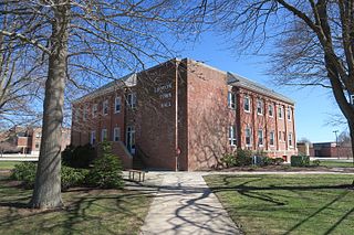
Long Hill is a census-designated place (CDP) in the town of Groton in New London County, Connecticut, United States. The population was 4,205 at the 2010 census.

<span class="mw-page-title-main">Old Mystic, Connecticut</span> Census-designated place in Connecticut, United States

Old Mystic is a village and census-designated place (CDP) located in the town of Groton, Connecticut. The population was 3,554 at the 2010 census.

<span class="mw-page-title-main">Poquonock Bridge, Connecticut</span> Census-designated place in Connecticut, United States

Poquonock Bridge is a village and census-designated place (CDP) in the town of Groton in New London County, Connecticut, United States. The population was 1,686 at the 2020 census.

<span class="mw-page-title-main">Sterling, Connecticut</span> Town in Connecticut, United States

Sterling is a town in Windham County, Connecticut, United States. The town is part of the Northeastern Connecticut Planning Region. The population was 3,578 at the 2020 census. The rural town is home to two villages: Oneco and Sterling village. Each contains a post office, a church, and a fire station. The town hall and public library are located in Oneco, and the town's one public school is in Sterling village.

<span class="mw-page-title-main">Norwich, Kansas</span> City in Kingman County, Kansas

Norwich is a city in Kingman County, Kansas, United States. As of the 2020 census, the population of the city was 444.

<span class="mw-page-title-main">Groton, New Hampshire</span> Town in New Hampshire, United States

Groton is a town in Grafton County, New Hampshire, United States. The population was 569 at the 2020 census.

<span class="mw-page-title-main">Orange, New Hampshire</span> Town in New Hampshire, United States

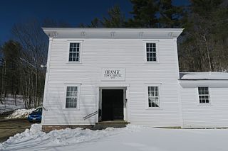
Orange is a town in Grafton County, New Hampshire, United States. The population was 277 at the 2020 census, down from 331 at the 2010 census.

<span class="mw-page-title-main">Groton, South Dakota</span> City in South Dakota, United States

Groton is a city in southeastern Brown County, South Dakota, United States. The population was 1,380 at the 2020 census.

<span class="mw-page-title-main">Groton, Vermont</span> Town in Vermont, United States

Groton is a town in Caledonia County, Vermont, United States. The population was 984 at the 2020 census. It contains the places Groton Pond, Rickers Mills, Rickers and West Groton. The unincorporated village of Groton in the southeast corner of town is recorded as the Groton census-designated place (CDP), with a population of 419 at the 2020 census.

<span class="mw-page-title-main">Ryegate, Vermont</span> Town in Vermont, United States

Ryegate is a town in Caledonia County, Vermont, United States. The population was 1,165 at the 2020 census. The town contains the villages of South Ryegate, East Ryegate, and Ryegate Corner.

<span class="mw-page-title-main">Groton (CDP), Massachusetts</span> Census-designated place in Massachusetts, United States

Groton is a census-designated place (CDP) comprising the main village in the town of Groton in Middlesex County, Massachusetts, United States. The population of the CDP was 1,353 at the 2020 census, out of 11,315 in the entire town of Groton.

Groton is a town in Tompkins County, New York, United States. The population was 5,950 at the 2010 census. The name is taken from Groton, Massachusetts.

<span class="mw-page-title-main">Groton (city), Connecticut</span> City in Connecticut

The City of Groton is a dependent political subdivision of the town of Groton, Connecticut. The city was settled in 1655 as Groton Bank, and the area developed into the principal village of the town of Groton. The village of Groton incorporated as a borough in 1903, and the residents of the borough of Groton reincorporated as the city of Groton in 1964. It is the only remaining city in the state of Connecticut that is not governmentally consolidated with its parent town. The city is part of the Southeastern Connecticut Planning Region. The population was 10,389 at the 2010 census.

References

  1. "Census - Geography Profile: Voluntown town, New London County, Connecticut". United States Census Bureau . Retrieved December 22, 2021.
  2. Mahan, Russell, Thomas Leffingwell: The Connecticut Pioneer Who Rescued Chief Uncas and the Mohegans; Historical Enterprises, Santa Clara, Utah, 2018, pp. 83-84.
  3. "Census of Population and Housing". Census.gov. Retrieved June 4, 2015.
  4. "U.S. Census website". United States Census Bureau . Retrieved January 31, 2008.
  5. Voluntown Peace Trust History