New Hartford, Connecticut

Last updated

New Hartford, Connecticut
Town of New Hartford
NewHartfordCT TownHall.jpg
New Hartford Town Hall
NewHartfordCTseal.jpg
Litchfield County Connecticut Incorporated and Unincorporated areas New Hartford Highlighted 2010.svg
New Hartford, Connecticut
Coordinates: 41°50′29″N73°00′15″W / 41.84139°N 73.00417°W / 41.84139; -73.00417
CountryFlag of the United States.svg  United States
U.S. state Flag of Connecticut.svg  Connecticut
County Litchfield
Region Northwest Hills
Incorporated1738
Government
  Type Selectman-town meeting
  First selectmanDaniel V. Jerram (R)
  SelectmanAlesia R. Kennerson (R)
  SelectmanLaura Garay (D)
Area
  Total38.2 sq mi (98.9 km2)
  Land37.0 sq mi (95.9 km2)
  Water1.1 sq mi (2.9 km2)
Elevation
873 ft (266 m)
Population
 (2020) [1]
  Total6,658
  Density180/sq mi (69.4/km2)
Time zone UTC-5 (Eastern)
  Summer (DST) UTC-4 (Eastern)
ZIP code
06057
Area code(s) 860/959
FIPS code 09-51350
GNIS feature ID0213470
Major highways US 44.svg US 202.svg
Website newhartfordct.gov

New Hartford is a town in Litchfield County, Connecticut, United States. The population was 6,658 at the 2020 census. [2] The town is part of the Northwest Hills Planning Region. The town center is defined by the U.S. Census Bureau as the New Hartford Center census-designated place (CDP). The town is mainly a rural community consisting of farms, homes, and parks. Brodie Park and Ski Sundown are located in New Hartford.

Contents

Geography

"Central Avenue, New Hartford", a 1910 postcard CentralAveNewHartford1910.jpg
"Central Avenue, New Hartford", a 1910 postcard

New Hartford is in eastern Litchfield County and is bordered by the city of Torrington to the west and Hartford County to the east and south. It is 19 miles (31 km) northwest of Hartford, the state capital. According to the United States Census Bureau, New Hartford has a total area of 38.2 square miles (98.9 km2), of which 37.0 square miles (95.9 km2) are land and 1.1 square miles (2.9 km2), or 2.97%, are water. [3] The CDP has a total area of 3.4 square miles (8.8 km2), of which 6.09% is water. [4]

Principal communities

Demographics

Historical population
CensusPop.Note
1820 1,685
1850 2,643
1860 2,7584.4%
1870 3,07811.6%
1880 3,3027.3%
1890 3,160−4.3%
1900 3,4248.4%
1910 2,144−37.4%
1920 1,781−16.9%
1930 1,8343.0%
1940 1,8360.1%
1950 2,39530.4%
1960 3,03326.6%
1970 3,97030.9%
1980 4,88423.0%
1990 5,76918.1%
2000 6,0885.5%
2010 6,97014.5%
2020 6,658−4.5%
U.S. Decennial Census [5]

As of the census [6] of 2000, there were 6,088 people, 2,228 households, and 1,748 families residing in the town. The population density was 164.4 inhabitants per square mile (63.5/km2). There were 2,368 housing units at an average density of 64.0 per square mile (24.7/km2). The racial makeup of the town was 97.67% White, 0.64% African American, 0.05% Native American, 0.74% Asian, 0.07% Pacific Islander, 0.20% from other races, and 0.64% from two or more races. Hispanic or Latino of any race were 1.35% of the population.

There were 2,228 households, out of which 38.3% had children under the age of 18 living with them, 68.9% were married couples living together, 6.6% had a female householder with no husband present, and 21.5% were non-families. 16.4% of all households were made up of individuals, and 4.7% had someone living alone who was 65 years of age or older. The average household size was 2.72 and the average family size was 3.07.

In the town, the population was spread out, with 26.9% under the age of 18, 4.4% from 18 to 24, 31.0% from 25 to 44, 28.7% from 45 to 64, and 8.9% who were 65 years of age or older. The median age was 39 years. For every 100 females, there were 100.1 males. For every 100 females age 18 and over, there were 97.6 males.

The median income for a household in the town was $69,321, and the median income for a family was $78,065. Males had a median income of $52,077 versus $36,946 for females. The per capita income for the town was $30,429. About 1.5% of families and 1.6% of the population were below the poverty line, including none of those under age 18 and 3.1% of those age 65 or over.

Education

The town of New Hartford has three elementary schools: the New Hartford Elementary and Bakerville School have grades Kindergarten through Second Grade. The New Hartford Elementary School includes preschool classes, with most children, attending whichever school they're closest to. All children from grades three through six attend the Ann Antolini School.

Resident middle and high school students attend the Northwestern Regional District 7, located in Winsted, Connecticut. It operates Northwestern Regional Middle School and Northwestern Regional High School. [7]

Community and recreation

New Hartford is home to Ski Sundown, a locally popular ski mountain that attracts many skiers and snowboarders in Litchfield County. It hosts several Slopestyle Competitions and winter events every year. Many other community events are held at Brodie Park, which lies on the edge of West Hill Lake, where a small beach and swimming area is welcome for New Hartford Residents. Several of the events held at Brodie Park are The Race Around The Lake, on Memorial Day weekend, several camps and concerts during the summer, a community picnic in July, and an annual children's Christmas Party held in Berkshire Hall. All other events are held in New Hartford Center, primarily the annual Light New Hartford held in early December. New Hartford is the largest town in the local area and therefore has many of the regional sports teams. Most games for baseball, softball, soccer and football are held at Brown's Corner, which is off Route 202.

Places of worship

There are six churches in New Hartford: two Congregational churches (the oldest church in the town, at New Hartford Center, and another in the village of Nepaug), an Episcopal church (at Pine Meadow), Saint Paul's Lutheran Church, a Methodist church (in the village of Bakerville), a Baptist church (Harvest Baptist) and Immaculate Conception Roman Catholic Church. There is also a Buddhist temple, at Bakerville.

Transportation

Girder bridge, "Satan's Kingdom", c. 1910s PostcardNewHartfordCTBridgeSatansKingdomCirca1910to1920.jpg
Girder bridge, "Satan's Kingdom", c.1910s

The town's main thoroughfares are U.S. Route 202 and U.S. Route 44. US 202 leads west to Torrington and east to Avon, while US 44 leads northwest to Winsted and southeast to Hartford. Connecticut Route 219 has its southern terminus at US 202 between Bakerville and Nepaug, and leads north through New Hartford Center into Barkhamsted.

Being a primarily rural town, New Hartford does not have any public transit services.

On the National Register of Historic Places

Gillette's Grist Mill Gillette's Grist Mill.JPG
Gillette's Grist Mill

Notable locations

New Hartford House, built in 1888. The building was destroyed in 2021 by a fire. New Hartford House, New Hartford, CT.jpg
New Hartford House, built in 1888. The building was destroyed in 2021 by a fire.

Notable people

Related Research Articles

<span class="mw-page-title-main">Hartford County, Connecticut</span> County in Connecticut, United States

Hartford County is a county located in the north central part of the U.S. state of Connecticut. According to the 2020 census, the population was 899,498, making it the second-most populous county in Connecticut. Hartford County contains the city of Hartford, the state capital of Connecticut and the county's most populous city, with 121,054 residents at the 2020 census. Hartford County is included in the Hartford-East Hartford-Middletown metropolitan statistical area.

<span class="mw-page-title-main">Litchfield County, Connecticut</span> County in Connecticut, United States

Litchfield County is in northwestern Connecticut, United States. As of the 2020 census, the population was 185,186. The county was named after Lichfield, in England. Litchfield County has the lowest population density of any county in Connecticut and is the state's largest county by area.

<span class="mw-page-title-main">Weatogue, Connecticut</span> Census-designated place in Connecticut, United States

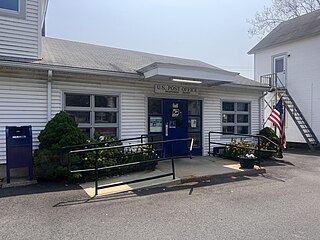
Weatogue is a village and census-designated place in Simsbury, Hartford County, Connecticut. The population was 2,776 at the 2010 census.

<span class="mw-page-title-main">Bantam, Connecticut</span> Borough in Connecticut, United States

Bantam is a borough in Litchfield County, Connecticut, United States. The population was 720 at the 2020 census. It is part of the town of Litchfield, and is the 2nd least populous borough in Connecticut, only beaten by Fenwick.

<span class="mw-page-title-main">Barkhamsted, Connecticut</span> Town in Connecticut, United States

Barkhamsted is a town in Litchfield County, Connecticut, United States. It contains seven villages: West Hill, Mallory, Barkhamsted Center, Center Hill, Washington Hill, Pleasant Valley, and Riverton. The population was 3,647 at the 2020 census, down from 3,799 at the 2010 census. The town is part of the Northwest Hills Planning Region. Barkhamsted was first incorporated in 1779, and named after Berkhamsted, Hertfordshire, England.

<span class="mw-page-title-main">Bethlehem, Connecticut</span> Town in Connecticut, United States

Bethlehem is a town in Litchfield County, Connecticut, United States. The population was 3,385 at the 2020 census, down from 3,607 at the 2010 census. The town is part of the Naugatuck Valley Planning Region. The town center is a historic district and a census-designated place (CDP).

<span class="mw-page-title-main">Colebrook, Connecticut</span> Town in Connecticut, United States

Colebrook is a town in Litchfield County, Connecticut, United States. The population was 1,361 at the 2020 census. The town is part of the Northwest Hills Planning Region. Colebrook was named after Colebrooke in the English county of Devon; the reason is now unknown.

<span class="mw-page-title-main">Cornwall, Connecticut</span> Town in Connecticut, United States

Cornwall is a town in Litchfield County, Connecticut, United States. The population was 1,567 at the 2020 census. The town is part of the Northwest Hills Planning Region.

<span class="mw-page-title-main">Harwinton, Connecticut</span> Town in Connecticut, United States

Harwinton is a town in Litchfield County, Connecticut, United States. The population was 5,484 at the 2020 census. The town is part of the Northwest Hills Planning Region. The high school is Lewis S. Mills.

<span class="mw-page-title-main">Norfolk, Connecticut</span> Town in Connecticut, United States

Norfolk is a town in Litchfield County, Connecticut, United States. The population was 1,588 at the 2020 census. The town is part of the Northwest Hills Planning Region. The urban center of the town is the Norfolk census-designated place, with a population of 553 at the 2010 census.

<span class="mw-page-title-main">Northwest Harwinton, Connecticut</span> Census-designated place in Connecticut, United States

Northwest Harwinton is a census-designated place (CDP) in the town of Harwinton in Litchfield County, Connecticut, United States. The population was 3,158 at the 2020 census, out of 5,484 in the entire town. The CDP contains the town center.

<span class="mw-page-title-main">Salisbury, Connecticut</span> Town in Connecticut, United States

Salisbury is a town situated in Litchfield County, Connecticut, United States. The town is the northwesternmost in the state of Connecticut; the Massachusetts-New York-Connecticut tri-state marker is located at the northwest corner of the town. The population was 4,194 at the 2020 census. The town is part of the Northwest Hills Planning Region.

<span class="mw-page-title-main">Sharon, Connecticut</span> Town in Connecticut, United States

Sharon is a town in Litchfield County, Connecticut, United States, in the northwest corner of the state. At the time of the 2020 census, the town had a total population of 2,680. The town is part of the Northwest Hills Planning Region. The ZIP code for Sharon is 06069. The urban center of the town is the Sharon census-designated place, with a population of 729 at the 2010 census.

<span class="mw-page-title-main">Warren, Connecticut</span> Town in Connecticut, United States

Warren is a town in Litchfield County, Connecticut, United States. The population was 1,351 at the 2020 census. The town is part of the Northwest Hills Planning Region. The town was named for Revolutionary War General Joseph Warren.

<span class="mw-page-title-main">Watertown, Connecticut</span> Town in Connecticut, United States

Watertown is a town in Litchfield County, Connecticut, United States. The town is part of the Naugatuck Valley Planning Region. The population was 22,105 at the 2020 census. The ZIP Codes for Watertown are 06795 and 06779. It is a suburb of Waterbury. The urban center of the town is the Watertown census-designated place, with a population of 3,938 at the 2020 census.

<span class="mw-page-title-main">Winchester, Connecticut</span> Town in Connecticut, United States

Winchester is a town in Litchfield County, Connecticut, United States. The population was 10,224 at the 2020 census. The city of Winsted is located in Winchester. The town is part of the Northwest Hills Planning Region.

<span class="mw-page-title-main">Woodbury, Connecticut</span> Town in Connecticut, United States

Woodbury is a town in Litchfield County, Connecticut, United States. The town is part of the Naugatuck Valley Planning Region. The population was 9,723 at the 2020 census. The town center, comprising the adjacent villages of Woodbury and North Woodbury, is designated by the U.S. Census Bureau as the Woodbury Center census-designated place (CDP). Woodbury was founded in 1673.

<span class="mw-page-title-main">Litchfield, Connecticut</span> Town in Connecticut, United States

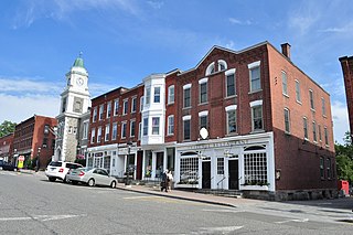
Litchfield is a town in and former county seat of Litchfield County, Connecticut, United States. The population was 8,192 at the 2020 census. The town is part of the Northwest Hills Planning Region. The boroughs of Bantam and Litchfield are located within the town. There are also three unincorporated villages: East Litchfield, Milton, and Northfield. Northfield, located in the southeastern corner of Litchfield, is home to a high percentage of the Litchfield population.

<span class="mw-page-title-main">Canton Valley, Connecticut</span> Census-designated place in Connecticut, United States

Canton Valley is a village and census-designated place (CDP) in the town of Canton in Hartford County, Connecticut, United States. The population was 1,580 at the 2010 census. As of the 2017 census the population was 1,489.

<span class="mw-page-title-main">New Hartford Center, Connecticut</span> Census-designated place in Connecticut, United States

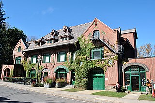
New Hartford Center is a census-designated place (CDP) in Litchfield County, Connecticut, United States. It comprises the village of New Hartford, the adjacent Pine Meadow Historic District, and some surrounding forest land, all within the town of New Hartford. As of the 2010 census, the population of New Hartford Center was 1,385, out of 6,970 in the entire town of New Hartford.

References

  1. U.S. Census website, Census.gov
  2. "Census - Geography Profile: New Hartford town, Litchfield County, Connecticut". United States Census Bureau . Retrieved December 18, 2021.
  3. "Geographic Identifiers: 2010 Census Summary File 1 (G001), New Hartford town, Litchfield County, Connecticut". American FactFinder. U.S. Census Bureau. Archived from the original on February 13, 2020. Retrieved October 8, 2019.
  4. "Geographic Identifiers: 2010 Census Summary File 1 (G001), New Hartford Center CDP, Connecticut". American FactFinder. U.S. Census Bureau. Archived from the original on February 13, 2020. Retrieved October 8, 2019.
  5. "Census of Population and Housing". Census.gov. Retrieved June 4, 2015.
  6. "U.S. Census website". United States Census Bureau . Retrieved January 31, 2008.
  7. "About Us". Northwestern Regional School District No. 7 . Retrieved May 19, 2021.