Monroe, New York

Last updated

Monroe, New York
Town of Monroe
Monroe, NY, town hall.jpg
Town hall
Orange County New York incorporated and unincorporated areas Monroe highlighted.svg
Location in Orange County and the state of New York; map shown does not reflect separation of Palm Tree from Monroe.
Country United States
State New York
County Orange
Area
[1]
  Total21.3 sq mi (55.1 km2)
  Land20.1 sq mi (52.0 km2)
  Water1.2 sq mi (3.1 km2)
Elevation
554 ft (169 m)
Population
 (2020)
  Total21,387
Time zone UTC-5 (Eastern (EST))
  Summer (DST) UTC-4 (EDT)
ZIP code
10950 [2]
Area code 845
Website monroeny.org

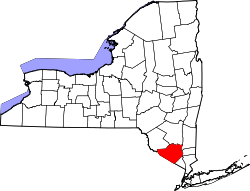
Monroe is a town in Orange County, New York, United States. The population was 21,387 at the 2020 census, [3] compared to 39,912 at the 2010 census; the significant fall in census population was due to the secession of the town of Palm Tree in 2019. The town is named after President James Monroe.

Contents

History

The first settlers to this land were American Indians from the Leni-Lenape Indian nation. The Leni-Lenape nation consisted of three tribes: the Unulactus, the turkey tribe; Minsis, the wolf tribe; and the Unamis, the turtle tribe. As white settlers started to move north, the Leni-Lenape were forced to move west, out of New York and New Jersey into Pennsylvania and later into central North America, under the treaty of Easton, a colonial agreement signed in October 1758. The British colonial government of the province of Pennsylvania and the Native American tribes in the Ohio country signed this document stating they would be allies in the French and Indian War.

In the early 1700s the lower Hudson Valley region was being mapped out to be divided up under the crown. On March 25, 1707, the "Chessecocks Patent was granted by Queen Anne". [4] The patent confirmed deeds that had been previously acquired by purchase directly from the Leni-Lenape nation. The patent was given to seven people, six men and one woman. Cheesecocks as a precinct included all of present-day Monroe, Woodbury, Tuxedo, and Stony Point. Many of the patentees never saw the land they bought or were given. [4] Many of the new settlers to come with the Cheesecocks patent were Dutch and English. Both groups of settlers came from Long Island for the rich natural resources.

The original name for the area on the Ramapo River, surveyed by General Washington's geographer and surveyor Robert Erskine, was Smith's Mill, described by Erskine as being "on a sudden bend of the Ramapo." This site still contains the ruins of the grist mill built in 1741 by David Smith, the first settler (Map of Orange and Rockland Counties Area laid down by R. Erskine 1778–1779). The Clove Road, which led from Haverstraw, home of Sir William Smith, up through Tuxedo and the rocky defile known by the Dutch word "kloof", for Clove, was vital to the American cause during the Revolutionary War. It was unknown to the British patrolling the Hudson and gave Washington his escape route from New York to his New Windsor headquarters. The area was called Southfields prior to April 6, 1808, when it took its present name of Monroe (Belcher, pp. 68–9).

Quoting from Gen George Washington's daily journal:

July 15, [1777]. To Sovereign (Suffern's or Suffren's) Tavern, near the entrance to Smith's Clove.On Sunday, July 20, 1777, Washington has moved on northward into the Ramapo Valley and to the place then known as Galloway's, which is now the village of Southfields (Belcher, p. 81).

David Smith, a prosperous miller of Smithtown, Long Island, bought land from one of the original patentees, Philip Livingston. Smith "purchased lot 43, consisting of 276 acres. He built the first home." Smith built a dam and a grist mill on the Ramapo River, which created the Mill Pond of today, as well as homes for himself and his four sons.

In 1889, a further division of the town resulted in a loss of territory to the towns of Woodbury and Tuxedo. In 1894, the community of Monroe set itself apart from the town by incorporating as a village.

The explosive growth of the Hasidic Jewish village of Kiryas Joel from its establishment in the 1970s, which led to a majority of the town's population being in the village by 2017, resulting in political conflicts, mostly over zoning. Negotiations led to an agreement that Kiryas Joel would split from Monroe and become its own town, subject to voter approval in a November 2017 referendum. With the initiative receiving overwhelming approval, Kiryas Joel became the new town of Palm Tree. The new town was originally set to be created in 2020, [5] but a bill was passed by the New York state legislature and signed into law by Governor Andrew Cuomo that officially established Palm Tree on January 1, 2019. [6]

Seven Springs proposal

About 600 Hasidic landowners and residents left outside Palm Tree's boundaries by the compromise accepted in the 2017 referendum proposed the following year to create another village, Seven Springs, on 2 square miles (5.2 km2) in the town between Palm Tree and the village of Monroe. Other residents were opposed to the plan, as well as the government of Palm Tree, which filed its own annexation petition for some of the same land along Route 17. The Seven Springs incorporation petition was also rejected by the town. A county Supreme Court judge ruled in 2019 that the Seven Springs petition had preceded the Palm Tree one; a year later she further held that Monroe had improperly rejected it. Both decisions were upheld in 2023. [7]

At the end of 2023 Governor Kathy Hochul signed a bill written by state senator James Skoufis, formerly a town councilman in neighboring Woodbury, who had been active in that town's incorporation as a village to prevent any annexations by Kiryas Joel. The new law tripled the state's requirements for incorporating villages from 500 potential residents to 1,500, and required a study to be done on the financial and governmental impacts of creating a village on the surrounding town, provisions that were seen as fatal to Seven Springs. The attorney for the residents seeking to create the village said he would challenge the new law in court as a violation of the federal and state constitutions. [7]

Cheeses

The town is the birthplace of Velveeta and Liederkranz cheese. Each year, a cheese festival is held to honor the former and the noble history (and unfortunate death) of the latter. [8] It also was the original home of the Orange and Rockland Electric Company, founded by Roscoe W. Smith, a descendant of David Smith.

Fire of 1895

On the night of March 17, 1895, the village of Monroe had one of the most disastrous fires in its history, in which the center of the village was nearly wiped out. "The total losses of real estate were three large business places, three barns, a storehouse, several sheds and smaller buildings valued altogether at $25,000. Personal property, goods-in stock and furniture destroyed were valued at $15,000". [9] It was said that people from all over took the Erie Railroad to come see the remains of the "Big Fire". A short time after the fire the Village decided to install a water works system which would be owned by the Village. "On July 24, 1895 the Mombasha Fire Company was organized. The Hook and Ladder Company was organized on October 4, 1895. In 1898 the two Companies consolidated as the Mombasha Fire Company". [9]

Harness racing

In the early 1900s the Monroe Race Track was established to "increase the towns popularity as both local residents and visitors flocked to the track to watch the horse races and place bets on the trotters". The first race was held on August 8, 1908, there was 22,000 people estimated at the race. [10] The track became a part of the Orange County Harness Racing Circuit which included Endicott, Middletown, Goshen, and Monroe. "The first grandstand was located on the long side of the track, while the second grandstand wasn't completed until 1910. It was seventy-five feet long and could hold one thousand people." [10] The track was in operation 19 years. "On August 13, 1913 the race track record was set with a time of 2:04¼ minutes for the mile pace on a half mile track. At this time this was also a world record for a pacer." [10] In 1927 Monroe was dropped by the circuit and was replaced by one in Elmira, New York, where construction of a new 5,000 seat grandstand had been completed. [10] The last purse offered at Monroe Track in 1927 was for $31,000. In 1964 the grandstands of the track were torn down.

Geography

According to the United States Census Bureau, the town has a total area of 21.3 square miles (55 km2), of which 20.1 square miles (52 km2) is land and 1.2 square miles (3.1 km2) (5.55%) is water.

The town is located in the southern region of the county, bordered on the northwest by the town of Chester, on the north by the town of Blooming Grove, on the northeast by the town of Palm Tree, on the east by the town of Woodbury, on the south by the town of Tuxedo, and on the southwest by the town of Warwick.

NY-17 (future I-86), combined with U.S. Highway 6 NY-17M, passes through Monroe village.

Lakes
Walton Lake Waltonlakemonroe.JPG
Walton Lake
Communities

Communities within the town of Monroe:

Demographics

Historical population
CensusPop.Note
1820 2,969
1830 3,67123.6%
1840 3,9146.6%
1850 4,2809.4%
1860 3,975−7.1%
1870 4,66617.4%
1880 5,0969.2%
1890 1,694−66.8%
1900 1,7845.3%
1910 2,28528.1%
1920 2,63015.1%
1930 3,00014.1%
1940 3,30210.1%
1950 3,71412.5%
1960 5,96560.6%
1970 9,16953.7%
1980 14,94863.0%
1990 23,03554.1%
2000 31,41136.4%
2010 39,91227.1%
2020 21,387−46.4%
U.S. Decennial Census [11] [12]

As of the census [13] of 2000, there were 31,407 people, 8,228 households, and 6,878 families residing in the town. The population density was 1,563.5 people per square mile (603.7 people/km2). There were 8,517 housing units at an average density of 424.0 per square mile (163.7/km2). The racial makeup of the town was 94.91% white, 1.22% Black or African American, 0.25% Native American, 1.36% Asian, 1.15% from other races, and 1.10% from two or more races. Hispanic or Latino of any race were 4.91% of the population. 12.6% were of Italian, 12.4% Irish, 9.2% Hungarian, 6.0% American and 5.6% German ancestry according to Census 2000.

There were 8,228 households, out of which 53.6% had children under the age of 18 living with them, 74.3% were married couples living together, 6.3% had a female householder with no husband present, and 16.4% were non-families. 13.2% of all households were made up of individuals, and 5.2% had someone living alone who was 65 years of age or older. The average household size was 3.72 and the average family size was 4.14.

In the town, the population was spread out, with 41.5% under the age of 18, 11.6% from 18 to 24, 24.8% from 25 to 44, 16.2% from 45 to 64, and 5.8% who were 65 years of age or older. The median age was 22 years. For every 100 females, there were 107.9 males. For every 100 females age 18 and over, there were 103.3 males.

The median income for a household in the town was $50,889, and the median income for a family was $54,315. Males had a median income of $51,125 versus $34,547 for females. The per capita income for the town was $16,569. About 22.3% of families and 29.1% of the population were below the poverty line, including 39.6% of those under age 18 and 10.9% of those age 65 or over.

Notable people

Related Research Articles

<span class="mw-page-title-main">Orange County, New York</span> County in New York, United States

Orange County is a county located in the U.S. state of New York. As of the 2020 census, the population was 401,310. The county seat is Goshen. This county was first created in 1683 and reorganized with its present boundaries in 1798. The county is part of the Hudson Valley region of the state.

<span class="mw-page-title-main">Harriman, New York</span> Village in New York, United States

Harriman is a village in Orange County, New York, United States. It is in the southeastern section of the town of Monroe, with a small portion in the town of Woodbury. The population was 2,714 at the 2020 census. It is part of the Kiryas Joel–Poughkeepsie–Newburgh, NY Metropolitan Statistical Area as well as the larger New York–Newark–Bridgeport, NY-NJ-CT-PA Combined Statistical Area.

<span class="mw-page-title-main">Kiryas Joel, New York</span> Village in New York, United States

Kiryas Joel is a village coterminous with the Town of Palm Tree in Orange County, New York, United States. The village shares one government with the Town. The vast majority of its residents are Yiddish-speaking Hasidic Jews who belong to the worldwide Satmar sect of Hasidism.

<span class="mw-page-title-main">Tuxedo, New York</span> Town in New York, United States

Tuxedo is a town located in Orange County, New York, United States, along the Ramapo River. As of the 2020 census, the town had a total population of 3,811. The town is in the southeastern part of the county in the Ramapo Mountains. New York State Route 17 and the New York State Thruway pass through the town. The name is derived from a Lenape word tucseto, which has several known meanings.

<span class="mw-page-title-main">Tuxedo Park, New York</span> Village in New York, United States

Tuxedo Park is a village in Orange County, New York, United States. Its population was 645 at the 2020 census. It is part of the Poughkeepsie–Newburgh–Middletown metropolitan area as well as the larger New York metropolitan area. Its name is derived from an indigenous Lenape word of the Munsee language, tucsedo or p'tuxseepu, which is said to mean 'crooked water' or 'crooked river'.

<span class="mw-page-title-main">Woodbury, Orange County, New York</span> Town and village in New York, United States

Woodbury is a town and village in Orange County, New York, United States. The town population was 12,197 at the 2020 census. The village was incorporated in 2006 and comprises all of the town that is not part of the village of Harriman. The region was once called Woodbury Clove. It is part of the Kiryas Joel–Poughkeepsie–Newburgh, NY Metropolitan Statistical Area as well as the larger New York–Newark–Bridgeport, NY-NJ-CT-PA Combined Statistical Area. Woodbury is in the southeastern part of Orange County. The town also has four schools, which are part of the Monroe-Woodbury Central school District.

<span class="mw-page-title-main">Hillburn, New York</span> Village in New York, United States

Hillburn, originally called "Woodburn" and incorporated in 1893, is a village in the town of Ramapo, Rockland County, New York, United States. It is located north of Suffern, east of Orange County, south of Viola, and west of Montebello. It is considered to be one of the more rural communities in Rockland County. The population was 930 at the 2020 census.

<span class="mw-page-title-main">Kaser, New York</span> Village in New York, United States

Kaser is a village in the town of Ramapo, Rockland County, New York, United States. The village is completely surrounded by the hamlet of Monsey. As of the 2020 United States census, the village population was 5,491.

<span class="mw-page-title-main">Ramapo, New York</span> Town in New York, United States

Ramapo is a town in Rockland County, New York, United States. It was originally formed as New Hampstead, in 1791, and became Ramapo in 1828. It shares its name with the Ramapo River. As of the 2020 census, Ramapo had a total population of 148,919, making it the most populous town in New York outside of Long Island. If all towns in New York were cities, Ramapo would be the 12th-largest city in the state of New York.

<span class="mw-page-title-main">Sloatsburg, New York</span> Village in Ramapo, New York, US

Sloatsburg is a village in the town of Ramapo in Rockland County, New York, United States. Located east of Orange County, it is at the southern entrance to Harriman State Park. The population was 3,036 at the 2020 census. The village is named after Stephen Sloat, an early European landowner.

<span class="mw-page-title-main">Suffern, New York</span> Village in New York, United States

Suffern is a village that was incorporated in 1796 in the town of Ramapo in Rockland County, New York. Sitting adjacent to the town of Mahwah, New Jersey, Suffern is located 31 miles northwest of Manhattan. As of the 2020 census, Suffern's population was 11,402.

<span class="mw-page-title-main">Chester, Orange County, New York</span> Town in New York, United States

Chester is a town in Orange County, New York, United States. The population was 12,646 at the 2020 census. Chester contains a village, also called Chester.

<span class="mw-page-title-main">Monroe (village), New York</span> Village in New York, United States

Monroe is a village in Orange County, New York, United States. The population was 9,343 at the 2020 census. It is part of the Poughkeepsie–Newburgh–Middletown, NY Metropolitan Statistical Area as well as the larger New York–Newark–Bridgeport, NY-NJ-CT-PA Combined Statistical Area. The community is not named after President James Monroe, but rather after an early 19th-century New York state senator.

<span class="mw-page-title-main">Ramapo River</span>

The Ramapo River is a tributary of the Pompton River, approximately 30 mi (48 km) long, in southern New York and northern New Jersey in the United States.

Seven Lakes Drive is a north–south parkway located in the Hudson Valley region of New York in the United States. It extends for just under 18 miles (29 km) on a northeast–southwest alignment from an intersection with New York State Route 17 (NY 17) in the village of Sloatsburg to a junction with U.S. Route 9W (US 9W) and US 202 south of the Bear Mountain Bridge in the town of Stony Point. Most of the parkway is located in either Harriman or Bear Mountain state parks, except for a small stretch near its western end. Ownership of Seven Lakes Drive is split between three entities, two of which are also responsible for maintenance of the road.

<span class="mw-page-title-main">Monroe–Woodbury Central School District</span> School district in the U.S. state of New York

The Monroe–Woodbury Central School District (MWCSD) is a school district in Orange County, New York. Most students in the school district live in the towns of Monroe or Woodbury, hence the name. However, there are some students in the district that live in either Harriman, Highland Mills, Central Valley, Chester, Blooming Grove, or Tuxedo.

<span class="mw-page-title-main">Kiryas Joel-Poughkeepsie-Newburgh metropolitan area</span> Metropolitan statistical area in New York, United States

The Kiryas Joel-Poughkeepsie-Newburgh, NY Metropolitan Statistical Area, as defined by the United States Office of Management and Budget, is an area consisting of two counties in New York's Hudson Valley, with the municipalities of Kiryas Joel, Poughkeepsie, and Newburgh as its principal cities. As of the 2020 census, the MSA had a population of 679,221. The area was centered on the urban area of Poughkeepsie-Newburgh. Prior to July 2023, it was known as the Poughkeepsie-Newburgh-Middletown, NY Metropolitan Statistical Area; whereupon it was renamed to its current name, to reflect population changes among its largest municipalities.

<span class="mw-page-title-main">Village of Monroe Historic District</span> Historic district in New York, United States

The Village of Monroe Historic District, also known as the Smith's Mill Historic District, is located in Monroe, New York, United States. It is an irregularly shaped 81-acre (33 ha) area containing 36 properties, primarily residential but with some churches and commercial buildings, in the center of the village, just east of its downtown. In 1998 it was listed on the National Register of Historic Places.

A coterminous municipality, sometimes also known as a coterminous city or a coterminous town-village, is a form of local government in some U.S. states in which a municipality and one or more civil townships have partial or complete consolidation of their government functions. A term used for the formation of such a local government is "township and municipal consolidation." This form of local government is distinct from a municipality coterminous with a higher level of government, which is called a consolidated city-county or a variation of that term.

<span class="mw-page-title-main">Palm Tree, New York</span> Town in New York, United States

Palm Tree is a Ashkenazi town coterminous with the village of Kiryas Joel in Orange County, New York, United States. New York's first new town in 38 years, it came into being on New Year's Day 2019 as the result of a referendum that came about due to zoning and other conflicts between residents of the village of Kiryas Joel, inhabited by the Satmar Hasidic community, and the municipality to which it belonged, Monroe. The population of Palm Tree was 32,954 at the 2020 census.

References

  1. "2016 U.S. Gazetteer Files". United States Census Bureau. Archived from the original on August 24, 2017. Retrieved July 5, 2017.
  2. "Monroe ZIP Code". ZipDataMaps. 2023. Retrieved January 12, 2023.
  3. US Census Bureau, 2020 Census Report Monroe town, Orange County, New York QuickFacts https://www.census.gov/quickfacts/monroetownorangecountynewyork
  4. 1 2 The Village of Monroe, pg13
  5. Foderaro, Lisa W. (November 19, 2017). "Call It Splitsville, N.Y.: Hasidic Enclave to Get Its Own Town". The New York Times . Archived from the original on November 20, 2017. Retrieved September 19, 2018.
  6. McKenna, Chris (July 2, 2018). "Cuomo signs bill to start Town of Palm Tree in 2019". Times Herald-Record . Middletown, NY. Archived from the original on July 2, 2018. Retrieved September 19, 2018.
  7. 1 2 Bellamy, Lara (December 29, 2023). "Seven Springs petitioner to challenge state's new village formation laws". Albany Times Union . Retrieved January 4, 2024.
  8. http://www.monroecheesefestival.com/index.shtml [ bare URL ]
  9. 1 2 Armstrong, Harry, Monroe New York: Bicentennial Showcase 1775–1976, Monroe: 1976.
  10. 1 2 3 4 Carnelia Bush, Paul Ellis-Graham, James A Nelson, Charles King, The Village of Monroe: the Celebration of a Century, Unionville, NY: Royal Fireworks Press, 1994.
  11. "Census of Population and Housing". Census.gov. Retrieved June 4, 2015.
  12. "U.S. Census Bureau QuickFacts: Monroe town, Orange County, New York". www.census.gov. Retrieved January 22, 2022.
  13. "U.S. Census website". United States Census Bureau . Retrieved January 31, 2008.
  14. "Malcolm Bricklin's next bright idea". AutoNews.com. May 12, 2017. Retrieved June 2, 2021.

41°19′26″N74°11′13″W / 41.324°N 74.187°W / 41.324; -74.187