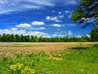
In the late 20th and early 21st centuries, Monroe County was one of the fastest-growing counties in Pennsylvania, largely due to Pocono Mountain-related tourism and partly due to an influx residents from New York City and its metropolitan area who sought a lower cost of living while still being close enough to commute to the city.[5] The population increased by over 70% from 1990 to 2010, and the commercial and retail sectors expanded significantly, although population growth has since slowed.
According to the U.S. Census Bureau, the county has a total area of 617 square miles (1,600km2), of which 608 square miles (1,570km2) is land and 9.0 square miles (23km2) (1.5%) is water.[6] It has a humid continental climate (Dfb except for some Dfa in the southern and SE tiers) and the hardiness zone ranges from 5a to 6b. The area code is 570, except in the southwest where the Kunkletown exchange uses 610.
U.S. Decennial Census[7] 1790–1960[8] 1900–1990[9] 1990–2000[10] 2010–2019[11]
As of the census[12] of 2010, there were 169,842 people, 49,454 households, and 36,447 families residing in the county. The population density was 228 inhabitants per square mile (88/km2). There were 67,581 housing units at an average density of 111 unitsper square mile (43/km2). The racial makeup of the county was 70.5% White Non-Hispanic, 13.2% Black or African American, 0.3% Native American, 2.1% Asian, 0.03% Pacific Islander, 4.3% from other races, and 2.9% from two or more races. 13.1% of the population were Hispanic or Latino of any race. 19.9% were of German, 16.8% Irish, 14.5% Italian, 8.8% Pennsylvania German, 5.4% Polish, 5.1% American and 5.1% English ancestry.
There were 49,454 households, out of which 36.20% had children under the age of 18 living with them, 60.70% were married couples living together, 8.80% had a female householder with no husband present, and 26.30% were non-families. 20.20% of all households were made up of individuals, and 7.80% had someone living alone who was 65 years of age or older. The average household size was 2.73 and the average family size was 3.16.
As of the end of 2021, the median value of all homes in Monroe County was $210,972, an increase of 13% since the prior year.[13]
In the county, the population was spread out, with 26.80% under the age of 18, 8.60% from 18 to 24, 28.80% from 25 to 44, 23.50% from 45 to 64, and 12.30% who were 65 years of age or older. The median age was 37 years. For every 100 females there were 97.60 males. For every 100 females age 18 and over, there were 94.40 males.
The U.S. Office of Management and Budget has designated Monroe County as the East Stroudsburg, PA Micropolitan Statistical Area.[15] Prior to 2023, the area was designated as a metropolitan area.[16] As of the 2010 census the Metro area had a population of 169,842. The area ranks 12th most populous in the state of Pennsylvania and ranks 244th most populous in the United States.
The U.S. Office of Management and Budget has also designated Monroe County as part of the larger Allentown-Bethlehem-East Stroudsburg, PA-NJ Combined Statistical Area.[16] As of the 2020 US Census, the population of the CSA was 1,030,216, making it the third most populous Combined Statistical Area in Pennsylvania, and the 59th most populous in the United States. Monroe County was once part of the New York CSA, but as of 2023, Pike County is the only county in Pennsylvania grouped with New York's CSA.
For much of the second half of the 20th century, Monroe County was a Republican stronghold. However, in recent years, party registration has leaned toward the Democratic Party, a result of continued migration to the county by former New York City residents, many of whom are Democrats. While in the 2004 U.S. presidential election the county was carried by Republican George W. Bush by a margin of four votes, beginning with the first campaign (2008) of Barack Obama, Democratic candidates carried Monroe County. In that election Obama carried the county by a 17-point margin, 58% to 41%–the first Democrat to win the county since 1964, and only the second since 1940. The other three 2008 statewide Democratic candidates also carried the county handily. Additionally, the Democratic presidential candidates carried the county in 2012 (Obama), 2016 (Hillary Clinton), and 2020 (Joe Biden).
United States presidential election results for Monroe County, Pennsylvania[17]
Public transportation throughout the county is provided by the Monroe County Transit Authority (MCTA), known as the "Pocono Pony".[20] MCTA operates a fixed route bus system[21] and a paratransit curb to curb service for eligible populations.[22]
The Tobyhanna Army Depot, the U.S. Department of Defense's largest center for the repair and fabrication of electronic systems, is located in Monroe County.[24] It was identified in 2004 as the largest employer in northeastern Pennsylvania.[25]
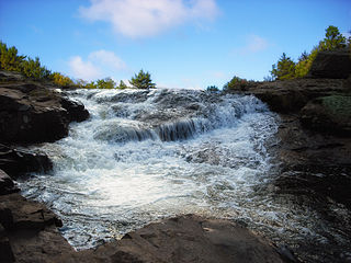
The Appalachian Trail passes through Monroe County. David Pierce wrote in the Pocono Record, "The 2,184-mile [3,515km] public footpath—from Georgia to Maine—has a particularly scenic but rugged section that straddles Monroe County’s southern border..." He stated that "trail hiking has long been an integral part of Monroe County's identity..."[28]
The Long Pond Conservation Easement has over 10,000 acres (40km2) of public access land with numerous trail systems. It's one of the most extensive public access trail systems in Monroe County.[32]
Dixon Miller State Forest – this is an extensive trail system in Long Pond, PA.[33]
Jonas Mountain Nature Preserve is over 300 acres (120ha) of Trail system that encompasses an old mountain ridge, and Jonas Creek.[34]
Cherry Valley National Wildlife Refuge has elaborate Trail systems, and public access.[35]
Mount Wismer is a scenic hike in Monroe County.[36]
Nothstein Preserve is an elaborate wooded trail system in the Poconos [37]
Chestnut mountain nature preserve is a many acre preserve atop the Plateau.[38]
Two of the earliest Pocono resorts, founded by rival factions of the Philadelphia Quaker community, were located in Monroe County: Inn at Buck Hill Falls (1901) and Pocono Manor (1902).[39][40][41] These resorts did not allow liquor or dancing, and evening dress was discouraged.[42] The Quakers "brought a quiet, unostentatious style to the region,"[42] but their hotels later developed from religious retreats into "luxurious mountain resorts."[43] Buck Hill's stone facade became a model for close to 300 stately stone-and-shingle homes in the region.[42] Pocono Manor offers sweeping vistas of the eastern and western Pocono region and has been referred to as the "Grand Lady of the Mountains."[44] Buck Hill closed in 1990 and the Inn at Pocono Manor was mostly destroyed by fire in 2019.[42][45]
Skytop Lodge, built in 1928, is also located in Monroe County and has been described as a "Dutch Colonial-style manor house."[41][46] Designed in reaction to the Quaker resorts, it had a dance floor and served liquor in a basement bar.[42] Skytop offers thirty miles of hiking trails, and the main building "is surrounded by 5,000 acres (20km2) of wood, glacial bogs, hemlock gorges, beaver marshes, and cascading waterfalls."[44]
The Buckwood Inn opened in Monroe County in 1911 and included the first golf course to be designed by renowned golf architect A. W. Tillinghast.[47][48][49] Bandleader Fred Waring purchased the resort in 1943, renamed it the Shawnee Inn, and broadcast his radio shows from there.[50] The Shawnee Inn is a Spanish colonial revival building with white-Moorish architecture and Spanish tiled roofs,[42] and it was identified in the 1990s as the only resort on the banks of the Delaware River.[51][52]
Mount Airy Lodge, which expanded from an eight-room inn into the largest Pocono resort, was located in Monroe County.[53][54] It heavily advertised in the New York media market with the catchy jingle, "Beautiful Mount Airy Lodge."[55] Headliners, such as Bob Hope, Milton Berle, and Connie Francis, performed in the Crystal Room, Mount Airy's 2,000-seat theater. Comedian Mickey Freeman said, "The food was lousy, but it was a legalized orgy." The 1,200 acres (490ha) resort's heyday was in the 1960s and 1970s before closing in 2001.[54] In October 2007 the Mount Airy Casino Resort opened on the site.[53]
Map of Monroe County, Pennsylvania with Municipal Labels showing Boroughs (red), Townships (white), and Census-designated places (blue).
Under Pennsylvania law, there are four types of incorporated municipalities: cities, boroughs, townships, and, in at most two cases, towns. The following cities, boroughs and townships are located in Monroe County:
Census-designated places are geographical areas designated by the U.S. Census Bureau for the purposes of compiling demographic data. They are not actual jurisdictions under Pennsylvania law.
Monroe County has three major watersheds, all of which are part of the Delaware River Watershed.[58]
The Brodhead Watershed,[59] the Aquashicola Pohopoco Watershed,[60] and the Tobyhanna Tunkhannock Watershed.[61]
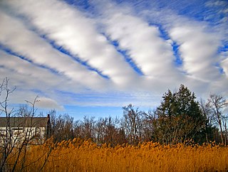
Climate
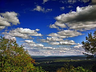
Pocono Plateau Region
According to the Trewartha climate classification system, the higher elevation Pocono Plateau Region of Monroe County has a Temperate Continental climate (Dc) with warm summers (b), cold winters (o) and year-around precipitation (Dcbo). Dcbo climates are characterized by at least one month having an average mean temperature ≤ 32.0°F (0.0°C), four to seven months with an average mean temperature ≥ 50.0°F (10.0°C), all months with an average mean temperature < 72.0°F (22.2°C) and no significant precipitation difference between seasons. Although most summer days are comfortably humid on the Pocono Plateau, episodes of heat and high humidity can occur with heat index values > 92°F (33°C). Since 1981, the highest air temperature was 93.0°F (33.9°C) on July 15, 1995, and the highest daily average mean dew point was 70.8°F (21.6°C) on January 8, 2006. July is the peak month for thunderstorm activity which correlates with the average warmest month of the year. Since 1981, the wettest calendar day was 6.43 inches (163mm) on September 30, 2010. During the winter months, the plant hardiness zone is 5b with an average annual extreme minimum air temperature of −11.2°F (−24.0°C).[62] Since 1981, the coldest air temperature was −22.9°F (−30.5°C) on January 21, 1994. Episodes of extreme cold and wind can occur with wind chill values < −24°F (−31°C). The average snowiest month is January which correlates with the average coldest month of the year. Ice storms and large snowstorms depositing ≥ 12 inches (30cm) of snow occur nearly every year, particularly during nor’easters from December through March.
Climate data for 4 NE Tobyhanna, Elevation 2,087ft (636m), 1981–2010 normals, extremes 1981–2018
According to the Trewartha climate classification system, the lower elevation Ridge and Valley section of Monroe County has a Temperate Continental climate (Dc) with hot summers (a), cold winters (o) and year-around precipitation (Dcao). Dcao climates are characterized by at least one month having an average mean temperature ≤ 32.0°F (0.0°C), four to seven months with an average mean temperature ≥ 50.0°F (10.0°C), at least one month with an average mean temperature ≥ 72.0°F (22.2°C) and no significant precipitation difference between seasons. Although most summer days are slightly humid in the Ridge and Valley, episodes of heat and high humidity can occur with heat index values > 102°F (39°C). Since 1981, the highest air temperature was 100.3°F (37.9°C) on July 22, 2011, and the highest daily average mean dew point was 72.7°F (22.6°C) on January 8, 2006. July is the peak month for thunderstorm activity which correlates with the average warmest month of the year. The average wettest month is September which correlates with tropical storm remnants during the peak of the Atlantic hurricane season. Since 1981, the wettest calendar day was 6.36 inches (162mm) on August 10, 2005. During the winter months, the plant hardiness zone is 6a with an average annual extreme minimum air temperature of −5.4°F (−20.8°C).[62] Since 1981, the coldest air temperature was −18.0°F (−27.8°C) on January 21, 1994. Episodes of extreme cold and wind can occur with wind chill values < −17°F (−27°C). The average snowiest month is January which correlates with the average coldest month of the year. Ice storms and large snowstorms depositing ≥ 12 inches (30cm) of snow occur once every couple of years, particularly during nor’easters from December through March.
Climate data for East Stroudsburg, Elevation 531ft (162m), 1981–2010 normals, extremes 1981–2018
The Nature Conservancy's Hauser Nature Center is a destination for hiking and ecological tourism in Long Pond.[66]
Pocono Plateau Region
According to the A. W. Kuchler U.S. potential natural vegetation types, the higher elevation Pocono Plateau Region of Monroe County would have a dominant vegetation type of Northern Hardwood (106) with a dominant vegetation form of Northern hardwood forest (26).[67] The peak spring bloom typically occurs in early-May and peak fall color usually occurs in early-October. The plant hardiness zone is 5b with an average annual extreme minimum air temperature of −11.2°F (−24.0°C).[62]
Ridge and Valley Region
According to the A. W. Kuchler U.S. potential natural vegetation types, the lower elevation Ridge and Valley section of Monroe County would have a dominant vegetation type of Appalachian Oak (104) with a dominant vegetation form of Eastern Hardwood Forest (25).[67] The peak spring bloom typically occurs in late-April and peak fall color usually occurs in mid-October. The plant hardiness zone is 6a with an average annual extreme minimum air temperature of −5.4°F (−20.8°C).[62]
Glacial Till Barrens
Located in the vicinity of Big Pocono State Park, Blakeslee, and Long pond. The Glacial Till Barrens are best exeplified by the Long Pond Conservation Easement. Which has public access trail systems. Glacial Till Barrens are found in Dixon Miller State Forest,[33] and within the Bethlehem Authority property. One of the only such ecosystems in the entire state of Pennsylvania. The Glacial till barrens are mesic (meaning moist), and yet have species that are more typical of far northern climates.[66][68]
Pike County is a county in the Commonwealth of Pennsylvania. As of the 2020 census, the population was 58,535. Its county seat is Milford. The county is part of the Northeast Pennsylvania region of the state.
Lehigh County is a county in the Commonwealth of Pennsylvania. As of the 2020 census, the county's population was 374,557. Its county seat is Allentown, the state's third-largest city after Philadelphia and Pittsburgh. The county is part of the Southeast Pennsylvania region of the state.
Carbon County is a county in the Commonwealth of Pennsylvania. As of the 2020 census, the population was 64,749. The county is part of the Northeast Pennsylvania region of the state.
Kidder Township is a township in Carbon County, Pennsylvania. It is part of Northeastern Pennsylvania. The population was 1,935 at the 2010 census, up from 1,185 at the 2000 census.
Coolbaugh Township is a township in Monroe County, Pennsylvania, United States. The population was 20,805 at the 2020 census. Tobyhanna State Park is in Coolbaugh Township. Tobyhanna, an unincorporated community, is also located in Coolbaugh Township rather than Tobyhanna Township.
East Stroudsburg is a borough in Monroe County, Pennsylvania, and part of the Pocono Mountains region of the state. Originally known as Dansbury, East Stroudsburg was renamed for geographic reasons when the Delaware, Lackawanna, and Western Railroad opened a station in East Stroudsburg. Despite its name being derivative of its bordering borough, Stroudsburg, it has almost twice the population.
Mount Pocono is a borough in Monroe County, Pennsylvania. It is located nearly centered in the southernmost county of five in the northeastern corner that are part of the Pocono Mountains. The borough serves as a local highway nexus, and sees a lot of tourist traffic making use of resources in the region. As of the 2020 census, the borough population was 3,083 residents.
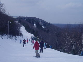
Pocono Township is a township in Monroe County, Pennsylvania. The township's government is located in the village of Tannersville, Pennsylvania, near the site of Camelback Mountain Resort, which is located in the Pocono Mountains and the adjacent Jackson Township. The top of the ski area is within Big Pocono State Park, which is maintained by resort staff. The population was 10,868 at the 2020 census.
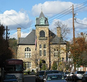
Stroudsburg is a borough and county seat of Monroe County, Pennsylvania, United States. It lies within the Poconos region approximately five miles (8 km) from the Delaware Water Gap at the confluence of Brodhead Creek, McMichaels, and Pocono Creeks in Northeastern Pennsylvania. Stroudsburg is part of the East Stroudsburg, PA Metropolitan Statistical Area, which in turn is part of the New York combined statistical area. The population was 5,927 at the 2020 census.
Tobyhanna Township is a township in Monroe County, Pennsylvania, United States. The population was 8,290 at the 2020 census. Tobyhanna Township has Tobyhanna Elementary Center and Locust Lake Village.
Tunkhannock Township is a township in Monroe County, Pennsylvania, United States. The population was 7,037 at the 2020 census. Tunkhannock Township comprises the communities of Blakeslee and Long Pond. The most noteworthy feature of this township is the Tunkhannock creek, which forms "Long Pond", and is designated by the PA DEP as an Exceptional Value Waters (EV). The Bethlehem Authority, Nature Conservancy, Wildlands Conservancy County of Monroe Open Space Program, and PA Department of Forest and Waters have protected thousands of acres. Tunkhannock Township, PA is home to many species of globally rare, threatened, and endangered plants and animals and has been described as one of the last "great places".
Long Pond is an unincorporated community in Monroe County in the Pocono Mountains region of Pennsylvania, a part of the Appalachian Mountains. Long Pond is located within the Tunkhannock Creek Watershed. Its ZIP code is 18334.
The Pocono Mountains, commonly referred to as the Poconos, are a geographical, geological, and cultural region in Northeastern Pennsylvania. They overlook the Delaware River and Delaware Water Gap to the east, Lake Wallenpaupack to the north, Wyoming Valley and the Coal Region to the west, and the Lehigh Valley to the south. The name Pocono is derived from the Munsee word Pokawachne, which means "Creek Between Two Hills".
Interstate 380 (I-380) is an auxiliary Interstate Highway in Northeastern Pennsylvania that connects I-80 with I-81 and I-84. The southern terminus is in Tunkhannock Township at the junction with I-80; the northern terminus of I-380 is at I-81 and U.S. Route 6 (US 6) in Dunmore. The entire length of the highway is 28.45 miles (45.79 km).
Northeastern Pennsylvania is a region of the U.S. state of Pennsylvania that includes the Pocono Mountains, the Endless Mountains, and the industrial cities of Scranton, Wilkes-Barre, Pittston, Hazleton, Nanticoke, and Carbondale. A portion of this region is located in the New York City metropolitan area. Recently, Pennsylvania tourism boards have described Northeastern Pennsylvania as Upstate Pennsylvania.
Pennsylvania Route 611 is a state highway in eastern Pennsylvania running 109.7 mi (176.5 km) from Interstate 95 (I-95) in the southern part of Philadelphia north to I-380 in Coolbaugh Township in the Pocono Mountains.
Tobyhanna State Park is a Pennsylvania state park on 5,440 acres (2,201 ha) mostly in Coolbaugh Township, Monroe County, with a small portion of the park in Dreher and Lehigh townships in Wayne County, all in Pennsylvania in the United States. The park includes the 170-acre (69 ha) Tobyhanna Lake and a portion of Tobyhanna Creek. It is located 2.1 miles (3.4 km) north of the town of Tobyhanna, with the main park entrance on Pennsylvania Route 423, and a portion that borders on Pennsylvania Route 196. The park lies immediately adjacent to Gouldsboro State Park, Pennsylvania State Game Lands 312, and State Game Land 127.
Big Pocono State Park is a 1,305.6-acre (528.4 ha) Pennsylvania state park in Jackson and Pocono townships in Monroe County, Pennsylvania in Northeastern Pennsylvania. The park is located on Camelback Mountain and is maintained jointly by the Pennsylvania Department of Conservation and Natural Resources and Camelback Ski Corporation.
Gouldsboro State Park is a 2,880-acre (1,165 ha) Pennsylvania state park in Coolbaugh Township, Monroe County and Lehigh Township, Wayne County, Pennsylvania in the United States. The park includes the 250-acre (100 ha) Gouldsboro Lake. Gouldsboro State Park is located very close to Tobyhanna State Park and Pennsylvania State Game Lands 127 and 312. It is on Pennsylvania Route 507 near the small village of Gouldsboro.
The Monroe County Transit Authority (MCTA), also known as the Pocono Pony, is a public transportation service located in Monroe County, Pennsylvania. It provides rural and inter-city fixed route bus and paratransit service within the county. MCTA is funded in part by PennDOT, the Federal Transit Administration, local match and farebox revenue.
References
↑ Includes Luzerne, Lackawanna, Monroe, Schuylkill, Carbon, Pike, Bradford, Wayne, Susquehanna, Wyoming and Sullivan Counties
↑ "County Median Home Price". National Association of Realtors. January 4, 2019. Archived from the original on April 20, 2022. Retrieved April 14, 2022.{{cite web}}: CS1 maint: bot: original URL status unknown (link)
↑ Center, Legislativate Data Processing. "Find Your Legislator". The official website for the Pennsylvania General Assembly. Retrieved April 25, 2017.
↑ Center, Legislativate Data Processing. "Find Your Legislator". The official website for the Pennsylvania General Assembly. Retrieved November 27, 2018.
↑ Squeri, Lawrence (2002). Better in the Poconos: The Story of Pennsylvania's Vacationland. University Park, PA: Pennsylvania State University Press. pp.71–73. ISBN0271021578.
↑ "Skytop Lodge". Historic Hotels of America. National Trust For Historic Preservation. Retrieved October 3, 2015.
↑ Goodwin, Stephen; Wolffe, Rick. "The Creator of Golf Courses". The Tillinghast Association. Archived from the original on September 29, 2018. Retrieved September 19, 2018.
This page is based on this Wikipedia article Text is available under the CC BY-SA 4.0 license; additional terms may apply. Images, videos and audio are available under their respective licenses.