Hamilton Township, Monroe County, Pennsylvania

Last updated

Hamilton Township
Hamilton Township vista.jpg
A Hamilton Township vista
Monroe County Pennsylvania Incorporated Hamilton Township Highlighted.svg
Pennsylvania in United States (US48).svg
Location of Pennsylvania in the United States
Coordinates: 40°52′29″N75°16′59″W / 40.87472°N 75.28306°W / 40.87472; -75.28306
CountryUnited States
StatePennsylvania
County Monroe
Area
[1]
  Total38.50 sq mi (99.72 km2)
  Land38.32 sq mi (99.25 km2)
  Water0.18 sq mi (0.47 km2)
Elevation
1,286 ft (392 m)
Population
 (2020) [2]
  Total8,635 Decrease2.svg
  Estimate 
(2021) [2]
8,678
  Density229.09/sq mi (88.45/km2)
Time zone UTC-5 (EST)
  Summer (DST) UTC-4 (EDT)
Area code 570
FIPS code 42-089-32176
Website www.hamiltontwp.org

Hamilton Township is a township in Monroe County, Pennsylvania, United States. The population was 8,635 at the 2020 census. [2]

Contents

History

The Christ Hamilton United Lutheran Church and Cemetery, Fenner–Snyder Mill, and Quiet Valley Farm are listed on the National Register of Historic Places. [3]

Geography

According to the United States Census Bureau, the township has a total area of 38.5 square miles (100 km2), of which 38.3 square miles (99 km2) is land and 0.2 square miles (0.52 km2) (0.42%) is water. The township contains the unincorporated communities of Blue Mountain Pines, Bossardsville, Hamilton Square, Kellersville, Kemmererville, Sandhill, Sciota, Snydersville, and Stormville, plus a portion of Saylorsburg.

Demographics

Historical population
CensusPop.Note
2000 8,235
2010 9,08310.3%
2020 8,635−4.9%
2021 (est.)8,678 [2] 0.5%
U.S. Decennial Census [4]

As of the census [5] of 2000, there were 8,235 people, 2,947 households, and 2,207 families residing in the township. The population density was 215.0 inhabitants per square mile (83.0/km2). There were 3,299 housing units at an average density of 86.1 per square mile (33.2/km2). The racial makeup of the township was 94.92% White, 2.43% African American, 0.10% Native American, 1.00% Asian, 0.05% Pacific Islander, 0.67% from other races, and 0.84% from two or more races. Hispanic or Latino of any race were 2.78% of the population.

There were 2,947 households, out of which 33.6% had children under the age of 18 living with them, 63.9% were married couples living together, 7.3% had a female householder with no husband present, and 25.1% were non-families. 19.5% of all households were made up of individuals, and 7.4% had someone living alone who was 65 years of age or older. The average household size was 2.64 and the average family size was 3.05.

In the township the population was spread out, with 23.8% under the age of 18, 6.3% from 18 to 24, 29.6% from 25 to 44, 26.8% from 45 to 64, and 13.4% who were 65 years of age or older. The median age was 40 years. For every 100 females, there were 102.0 males. For every 100 females age 18 and over, there were 100.9 males.

The median income for a household in the township was $47,327, and the median income for a family was $54,955. Males had a median income of $42,847 versus $26,141 for females. The per capita income for the township was $22,153. About 5.1% of families and 6.4% of the population were below the poverty line, including 7.7% of those under age 18 and 8.8% of those age 65 or over.

Climate

According to the Trewartha climate classification system, Hamilton Township has a Temperate Continental climate (Dc) with hot summers (a), cold winters (o) and year-around precipitation (Dcao). Dcao climates are characterized by at least one month having an average mean temperature ≤ 32.0 °F (0 °C), four to seven months with an average mean temperature ≥ 50.0 °F (10 °C), at least one month with an average mean temperature ≥ 72.0 °F (22 °C) and no significant precipitation difference between seasons. Although most summer days are slightly humid in Hamilton Township, episodes of heat and high humidity can occur with heat index values > 101 °F (38 °C). Since 1981, the highest air temperature has been 99.8 °F (38 °C), on July 22, 2011, and the highest daily average mean dew point was 72.5 °F (23 °C) on August 28, 2018. July is the peak month for thunderstorm activity, which correlates with the average warmest month of the year. The average wettest month is September, which correlates with tropical storm remnants during the peak of the Atlantic hurricane season. Since 1981, the wettest calendar day has been 6.22 inches, (158 mm) on October 8, 2005. During the winter months, the plant hardiness zone is 6a, with an average annual extreme minimum air temperature of −6.8 °F (−22 °C). [6] Since 1981, the coldest air temperature has been−18.2 °F (−28 °C) on January 21, 1994. Episodes of extreme cold and wind can occur, with wind chill values < −19 °F (−28 °C). The average snowiest month is January, which correlates with the average coldest month of the year. Ice storms and large snowstorms depositing ≥ 12 inches (30 cm) of snow occur once every couple of years, particularly during nor’easters from December through March.

Climate data for Hamilton Twp, Elevation 676 ft (206 m), 1981-2010 normals, extremes 1981-2018
MonthJanFebMarAprMayJunJulAugSepOctNovDecYear
Record high °F (°C)67.6
(19.8)
76.6
(24.8)
85.6
(29.8)
93.1
(33.9)
93.7
(34.3)
94.2
(34.6)
99.8
(37.7)
98.1
(36.7)
95.7
(35.4)
87.7
(30.9)
78.4
(25.8)
70.5
(21.4)
99.8
(37.7)
Mean daily maximum °F (°C)35.6
(2.0)
39.3
(4.1)
48.3
(9.1)
60.8
(16.0)
71.2
(21.8)
79.3
(26.3)
83.4
(28.6)
81.8
(27.7)
74.7
(23.7)
63.1
(17.3)
51.9
(11.1)
39.9
(4.4)
60.9
(16.1)
Daily mean °F (°C)26.9
(−2.8)
29.7
(−1.3)
37.8
(3.2)
48.9
(9.4)
58.9
(14.9)
67.7
(19.8)
72.1
(22.3)
70.5
(21.4)
63.2
(17.3)
51.6
(10.9)
42.1
(5.6)
31.7
(−0.2)
50.2
(10.1)
Mean daily minimum °F (°C)18.2
(−7.7)
20.1
(−6.6)
27.2
(−2.7)
36.9
(2.7)
46.6
(8.1)
56.0
(13.3)
60.7
(15.9)
59.2
(15.1)
51.7
(10.9)
40.2
(4.6)
32.3
(0.2)
23.4
(−4.8)
39.5
(4.2)
Record low °F (°C)−18.2
(−27.9)
−8.2
(−22.3)
0.3
(−17.6)
14.5
(−9.7)
29.4
(−1.4)
36.6
(2.6)
42.4
(5.8)
37.9
(3.3)
30.6
(−0.8)
19.7
(−6.8)
6.1
(−14.4)
−6.6
(−21.4)
−18.2
(−27.9)
Average precipitation inches (mm)3.43
(87)
2.94
(75)
3.67
(93)
4.13
(105)
4.37
(111)
4.61
(117)
4.49
(114)
4.26
(108)
4.88
(124)
4.62
(117)
3.92
(100)
4.05
(103)
49.37
(1,254)
Average snowfall inches (cm)12.7
(32)
9.0
(23)
9.4
(24)
2.3
(5.8)
0.0
(0.0)
0.0
(0.0)
0.0
(0.0)
0.0
(0.0)
0.0
(0.0)
0.1
(0.25)
2.4
(6.1)
7.6
(19)
45.2
(115)
Average relative humidity (%)69.964.859.957.862.569.169.172.273.371.569.971.167.6
Average dew point °F (°C)18.4
(−7.6)
19.3
(−7.1)
25.1
(−3.8)
34.7
(1.5)
46.1
(7.8)
57.2
(14.0)
61.4
(16.3)
61.1
(16.2)
54.5
(12.5)
42.7
(5.9)
33.0
(0.6)
23.4
(−4.8)
39.8
(4.3)
Source: PRISM [7]

Transportation

I-80 westbound in Hamilton Township 2022-08-15 10 59 57 View west along Interstate 80 (Keystone Shortway) from the overpass for Pennsylvania State Route 33 in Hamilton Township, Monroe County, Pennsylvania.jpg
I-80 westbound in Hamilton Township

As of 2013, there were 140.03 miles (225.36 km) of public roads in Hamilton Township, of which 58.93 miles (94.84 km) were maintained by the Pennsylvania Department of Transportation (PennDOT) and 81.10 miles (130.52 km) were maintained by the township. [8]

Multiple highways serve Hamilton Township. The most prominent of these is Interstate 80, which follows the Keystone Shortway along a northwest-southeast alignment across the northern corner of the township. U.S. Route 209 follows a southwest-northeast alignment across the middle of the township. U.S. Route 209 Business starts at US 209 in the western section of the township and heads northeastward just northwest of US 209. Pennsylvania Route 33 follows a north-south alignment through the middle of the township, including a concurrency with US 209. Finally, Pennsylvania Route 611 follows a northwest-southeast alignment across the northern tip of the township, just north of I-80.

Tornado

On Wednesday, July 29, 2009, an EF2 tornado touched down in Hamilton Township and tore through the landscape for five miles across Hamilton Township and neighboring Stroud Township. Three minor injuries, five homes damaged, and multiple farm buildings were destroyed because of the tornado.

Ecology

According to the A. W. Kuchler U.S. potential natural vegetation types, Hamilton Township would have a dominant vegetation type of Appalachian Oak (104) with a dominant vegetation form of Eastern Hardwood Forest (25). [9] The peak spring bloom typically occurs in late-April and peak fall color usually occurs in mid-October. The plant hardiness zone is 6a with an average annual extreme minimum air temperature of −6.8 °F (−22 °C). [6]

Notable person

Related Research Articles

<span class="mw-page-title-main">Durham Township, Pennsylvania</span> Township in Pennsylvania, United States

Durham Township is a township in Bucks County, Pennsylvania, United States. The population was 1,144 at the 2010 census.

<span class="mw-page-title-main">East Rockhill Township, Pennsylvania</span> Township in Pennsylvania, United States

East Rockhill Township is a township in Bucks County, Pennsylvania, United States. The original Rockhill Township was established in 1740 and was divided into East and West Rockhill Townships in 1890. The population was 5,706 at the 2010 Census. East Rockhill is part of Pennridge School District. Pennridge Airport is located in East Rockhill Township.

<span class="mw-page-title-main">Hilltown Township, Pennsylvania</span> Township in Pennsylvania, United States

Hilltown Township is a township in Bucks County, Pennsylvania, United States. The population was 15,029 at the 2010 census. Most of Hilltown is part of Pennridge School District, while a small portion in Line Lexington is part of North Penn School District.

<span class="mw-page-title-main">New Britain Township, Pennsylvania</span> Township in Pennsylvania, United States

New Britain Township is a township in Bucks County, Pennsylvania, United States. The population was 11,070 at the 2010 census.

<span class="mw-page-title-main">Newtown Township, Bucks County, Pennsylvania</span> Township in Pennsylvania, United States

Newtown Township is a township in Bucks County, Pennsylvania, United States. The population was 19,299 at the 2010 census.

<span class="mw-page-title-main">Richland Township, Bucks County, Pennsylvania</span> Township in Pennsylvania, United States

Richland Township is a township in Bucks County, Pennsylvania, United States. The population was 11,100 at the 2010 census.

<span class="mw-page-title-main">Upper Makefield Township, Pennsylvania</span> Township in Pennsylvania, United States

Upper Makefield Township is a township in Bucks County, Pennsylvania. The population was 8,190 at the 2010 census. It has the eighth-highest per capita income among all townships in Pennsylvania.

<span class="mw-page-title-main">Barrett Township, Pennsylvania</span> Place in Pennsylvania, United States

Barrett Township is a township in Monroe County, Pennsylvania, United States. The population was 4,053 at the 2020 census. Two Poconos resort communities, Buck Hill Falls and Skytop, are located within the township. It is located 38 miles from Scranton and 48 miles from Wilkes-Barre. There is one privately owned, public-use airport in Barrett Township, called the Flying Dollar Airport.

<span class="mw-page-title-main">Chestnuthill Township, Pennsylvania</span> Place in Pennsylvania, United States

Chestnuthill Township is a township in Monroe County, Pennsylvania, United States. The population was 16,708 at the 2020 census.

<span class="mw-page-title-main">Coolbaugh Township, Pennsylvania</span> Place in Pennsylvania, United States

Coolbaugh Township is a township in Monroe County, Pennsylvania, United States. The population was 20,805 at the 2020 census. Tobyhanna State Park is in Coolbaugh Township. Tobyhanna, an unincorporated community, is also located in Coolbaugh Township rather than Tobyhanna Township.

<span class="mw-page-title-main">Delaware Water Gap, Pennsylvania</span> Borough in Pennsylvania, United States

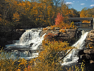
Delaware Water Gap is a borough in Monroe County, Pennsylvania, United States. It is located adjacent to the Delaware Water Gap, the pass through which the Lackawanna Corridor and Interstate 80 run across the Pennsylvania-New Jersey border along the Delaware River.

<span class="mw-page-title-main">Jackson Township, Monroe County, Pennsylvania</span> Township in Pennsylvania, United States

Jackson Township is a township in Monroe County, Pennsylvania, United States. The population was 6,578 at the 2020 census. A portion of Big Pocono State Park, a Pennsylvania state park, is on Camelback Mountain in Jackson Township.

<span class="mw-page-title-main">Middle Smithfield Township, Pennsylvania</span> Place in Pennsylvania, United States

Middle Smithfield Township is a township in Monroe County, Pennsylvania, United States. The population was 16,014 at the 2020 census.

<span class="mw-page-title-main">Paradise Township, Monroe County, Pennsylvania</span> Place in Pennsylvania, United States

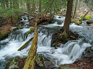
Paradise Township is a township in Monroe County, Pennsylvania in the Pocono Mountains. The population was 2,898 at the 2020 census.

<span class="mw-page-title-main">Pocono Township, Pennsylvania</span> Place in Pennsylvania, United States

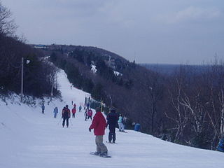
Pocono Township is a township in Monroe County, Pennsylvania. The township's government is located in the village of Tannersville, Pennsylvania, near the site of Camelback Mountain Resort, which is located in the Pocono Mountains and the adjacent Jackson Township. The top of the ski area is within Big Pocono State Park, which is maintained by resort staff. The population was 10,868 at the 2020 census.

<span class="mw-page-title-main">Polk Township, Monroe County, Pennsylvania</span> Place in Pennsylvania, United States

Polk Township is a township in Monroe County, Pennsylvania, United States. The population was 7,473 at the 2020 census.

<span class="mw-page-title-main">Price Township, Pennsylvania</span> Place in Pennsylvania, United States

Price Township is a township in Monroe County, Pennsylvania, United States. The population was 3,675 at the 2020 census.

<span class="mw-page-title-main">Ross Township, Monroe County, Pennsylvania</span> Township in Pennsylvania, United States

Ross Township is a township in Monroe County, Pennsylvania, United States. The population was 5,464 at the 2020 census. Ross Township is one of 16 townships in Monroe County.

<span class="mw-page-title-main">Smithfield Township, Monroe County, Pennsylvania</span> Place in Pennsylvania, United States

Smithfield Township is a township in Monroe County, Pennsylvania, United States. The population was 8,001 at the 2020 census.

<span class="mw-page-title-main">Stroud Township, Pennsylvania</span> Place in Pennsylvania, United States

Stroud Township is a township in Monroe County, Pennsylvania, United States. As of 2020, the township had an estimated population of 19,812.

References

  1. "2016 U.S. Gazetteer Files". United States Census Bureau. Retrieved August 14, 2017.
  2. 1 2 3 4 Bureau, US Census. "City and Town Population Totals: 2020—2021". Census.gov. US Census Bureau. Retrieved August 6, 2022.
  3. "National Register Information System". National Register of Historic Places . National Park Service. July 9, 2010.
  4. "Census of Population and Housing". Census.gov. Retrieved June 4, 2016.
  5. "U.S. Census website". United States Census Bureau . Retrieved January 31, 2008.
  6. 1 2 "USDA Interactive Plant Hardiness Map". United States Department of Agriculture . Retrieved September 4, 2019.
  7. "PRISM Climate Group, Oregon State University" . Retrieved September 4, 2019.
  8. "Hamilton Township map" (PDF). PennDOT. Retrieved March 15, 2023.
  9. "U.S. Potential Natural Vegetation, Original Kuchler Types, v2.0 (Spatially Adjusted to Correct Geometric Distortions)" . Retrieved September 3, 2019.
  10. Gerard C. Wertkin (August 2, 2004). Encyclopedia of American Folk Art . Routledge. ISBN   978-1-135-95614-1.