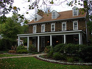
Berwyn is a census-designated place (CDP) in Chester County, Pennsylvania, United States. Berwyn is located within Tredyffrin and Easttown Townships. The area is part of the Philadelphia Main Line suburbs.
Skytop is an unincorporated community in Barrett Township, Monroe County, Pennsylvania, United States. Located north of Mountainhome, it is accessible by local roads off Route 390. Its elevation is 1,562 feet (476 m), and it is located at 41°13′40″N75°14′18″W. Although Skytop is unincorporated, it has a post office, with the ZIP code of 18357; the ZCTA for ZIP Code 18357 had a population of 87 at the 2000 census.
Fogelsville is a village in Lehigh County, Pennsylvania. It is a suburb of Allentown, in Upper Macungie Township, and is part of the Lehigh Valley, which has a population of 861,899 and was the 68th-most populous metropolitan area in the U.S. as of the 2020 census.
Graterford is an unincorporated community in Perkiomen Township, Montgomery County, Pennsylvania, United States.

Scenery Hill, which was known as Hillsborough prior to April 10, 1867, is an unincorporated community which is located in North Bethlehem Township in Washington County, Pennsylvania, United States. It serves as the postal address for most North Bethlehem Township residents. The ZIP code is 15360.

Sterling is an unincorporated, census-designated place in northwestern Milton Township, Wayne County, Ohio, United States with the ZIP code of 44276.
Zieglerville is an unincorporated community in Lower Frederick Township in Montgomery County, Pennsylvania, United States. Its ZIP Code is 19492 and it is located on the west side of the Perkiomen Creek where PA Route 29 and PA Route 73 split at a roundabout, just north of Schwenksville.
Scarlets Mill is an unincorporated community in Robeson Township, Berks County, Pennsylvania, United States. The Twin Valley School District serves the village, whose zip code is 19508. Scarlets Mill is also located up Haycreek Road from the nearby village of Geigertown.
Seisholtzville is a village that is primarily located in Hereford Township, Berks County, Pennsylvania, United States, with a portion of it situated in Longswamp Township.
Landis Store is a village in District Township, Berks County, Pennsylvania, United States. It is drained by the West Branch Perkiomen Creek into the Perkiomen Creek in the Green Lane Reservoir. It is split between the Alburtis zip code of 18011, the Barto zip code of 19504, and the Boyertown zip code of 19512.

Geryville is a village located mainly in Milford Township, Bucks County but also in Upper Hanover Township, Montgomery County, Pennsylvania, United States. The first letter of the name is pronounced as a hard "g." It is located just north of Route 663 and is split between the East Greenville zip code of 18041 and the Pennsburg zip code of 18073. Originally known as Aurora, the village received its name from the postmaster Jesse Gery in 1865. The Publick House on the corner of Sleepy Hollow Road and Geryville Pike played a prominent role in Fries's Rebellion of 1799. It is drained via the Macoby Creek southward into the Perkiomen Creek and Schuylkill River.
Finland is a village and an unincorporated community on the Unami Creek in southern Milford Township, Bucks County, Pennsylvania, United States. It is split between the Green Lane Zip Code of 18054 and the Pennsburg zip code of 18073. The immediate area was known in the 1920s as the "Poconos of Philadelphia" and as "The Fineland," and it is from this latter name that the US post office had put it on the map as Finland in 1886. Multiple summer camps have been located in this area and one of them is still in use. The Unami Creek flows southward to the Perkiomen Creek. The village was established by Finnish immigrants to New Sweden.

Spinnerstown is a census-designated place in Milford Township, Bucks County, Pennsylvania, United States. It is located just northwest of the Quakertown interchange of I-476 with Route 663. As of the 2010 census, the population was 1,826 residents.

Schoenersville is a suburban village split between Hanover Township in Lehigh County and Hanover Township in Northampton County, Pennsylvania. It is pronounced "SHOO-nerz-vil" and is part of the Lehigh Valley metropolitan area, which has a population of 861,899 and is the 68th-most populous metropolitan area in the U.S. as of the 2020 census.
Hensingersville, also known as New Hensingersville, is an unincorporated community located mostly in southwestern Lower Macungie Township in Lehigh County, Pennsylvania. It also extends into Longswamp Township in Berks Township near the intersections of Pennsylvania Route 201, Pennsylvania Route 3001, Chestnut Road, and Reservoir Hill Road.
Shelly is an unincorporated community in northwestern Richland Township, Bucks County, Pennsylvania, United States. The community is located on the Tohickon Creek and Pennsylvania Route 309. It uses the Quakertown ZIP Code of 18951.
The elevation is 169 meters (554 ft.).

Gauff Hill is an unincorporated community in extreme eastern Salisbury Township in Lehigh County, Pennsylvania. It is part of the Lehigh Valley, which has a population of 861,899 and was the 68th-most populous metropolitan area in the U.S. as of the 2020 census.
Unionville is a suburban community in the Delaware Valley located on Pennsylvania Route 309. It is mainly in Hatfield Township, Montgomery County but also in Hilltown Township, Bucks County, Pennsylvania, United States.
Lickdale, previously known as Union Forge, is an unincorporated community in northern Lebanon County, Pennsylvania, United States. It is a village approximately three miles west of Fredericksburg, Pennsylvania, and was named for James Lick. Lickdale was a prominent 19th century canal port along a branch of the Union Canal and contained a large commercial ice house. It is on the Swatara Creek and serves as a southern gateway to Swatara State Park. It is located in Union Township and Route 72 has an interchange with Interstate 81 via Fisher Avenue. It is served by the Jonestown post office with the zip code of 17038.
Amity is an unincorporated community located in Springfield Township, Bucks County, Pennsylvania, United States.


